
Gaim
|
Gaim
|
||
 Muddy forest path in the Gaim |
||
| location | 1 km northeast of Wülferode | |
| surface | 91 ha | |
| Identifier | NSG HA 165 | |
| WDPA ID | 163184 | |
| Geographical location | 52 ° 20 ' N , 9 ° 52' E | |
|
||
| Sea level | from 90.3 m to 72.5 m | |
| Setup date | 03/03/1994 | |
| administration | NLWKN | |
| particularities | repealed in January 2019 | |

The Gaim is a 91 hectare protected forest area in the Wülferode district of Hanover and in the Höver district of the city of Sehnde . In January 2019, the Gaim nature reserve was merged into the new Bockmerholz nature reserve , Gaim .
location

The Gaim borders directly on the Mergelhalde nature reserve and is located about 1 km northeast of Wülferode and about 2 km northeast of the Bockmerholz , with which it belonged to a formerly extensive forest area on the southeastern edge of Hanover. Since the forest lies in a depression of varying moisture, it could not be used as arable land and was therefore never cleared. Around a quarter of its area is not used today and remains as a natural forest . Forest paths and individual paths lead through the Gaim.
The A 7 runs through the Gaim, and the Hannover-Wülferode motorway service station was built in the forest. The Mittelland Canal cuts the Gaim in the northeast .
vegetation
Characteristic is a species-rich oak - hornbeam forest with a distinct species-rich herb layer. There are numerous endangered plant and animal species in the forest. It is characterized by its high number of spring flowers.
Established in 1994 the nature reserve was part of the FFH - nature reserve 108 Bockmerholz, Gaim . The under-protection position also serves natural forest research in order to be able to examine the uninfluenced development of forest communities and ecosystems.

Conservation sign in the forest

Mittelland Canal in the Gaim
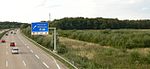
Sign on the A 7 to the Wülferode rest area in the Gaim


literature
- Eva Benz-Rababah : Gaim. In: Klaus Mlynek, Waldemar R. Röhrbein (eds.) U. a .: City Lexicon Hanover . From the beginning to the present. Schlütersche, Hannover 2009, ISBN 978-3-89993-662-9 , p. 200.
Web links
- Description of the Gaim on hannover.de
- Nature reserve "Gaim" in the database of the Lower Saxony State Office for Water Management, Coastal and Nature Conservation (NLWKN)
- Photos of the Gaim in spring with flowering plants at myheimat
- Nature conservation ordinance of 1994 by the Hanover region
- Ordinance on the nature reserve "Bockmerholz, Gaim" in the cities of Sehnde and Laatzen as well as in the state capital Hanover, Region Hanover (nature reserve ordinance "Bockmerholz, Gaim" - NSG-HA 217)
Individual evidence
- ↑ The southeastern foothills - outside the nature reserve - belongs to Höver, cf. City map .
- ↑ "Gaim" nature reserve in the database of the Lower Saxony State Office for Water Management, Coastal and Nature Conservation (NLWKN)


Old leash | Altwarmbüchener Moor | Bieförthmoor | Bissendorfer Moor | Bissendorfer Moor II | Blank Flat | Bockmerholz, Gaim | Fire | Brandmoorwiesen | Düvels Kamp | Evenser Moor | Hagenburger Moor | Hahnenkamp | Hallerbruch | Hämeler Forest and Sohrwiesen | Helstorfer Altwasser | Helstorfer Moor | Cave area in the Little Deister | Hubbelsche | In the kingdom of heaven | In the seven parts of the mountain | Kananohe | Kienmoor | Köllnischfeld | Deciduous forests south of Seelze | Leineaue between Ruthe and Koldingen | Linderter and Stamstorfer wood | Sea break | Seabreak Meadows | Marl pit near Hanover (HPC I) | Otternhagener Moor | Spring forest near Bennemühlen | Ricklinger Duck Pool | Saupark | Reed break | Black moor near Resse | Quarry wood mill | Sundern | Dead moor | Trunnenmoor | Calf fracture | Gypsy grove