Grünenthal (Gummersbach)
|
Grünenthal
City of Gummersbach
Coordinates: 51 ° 3 ′ 59 ″ N , 7 ° 39 ′ 11 ″ E
|
||
|---|---|---|
| Height : | 300 m above sea level NN | |
| Residents : | 23 (Dec. 31, 2019) | |
| Postal code : | 51645 | |
| Area code : | 02261 | |
|
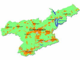
Location of Grünenthal in Gummersbach |
||
Grünenthal is a district of Gummersbach in the Oberbergisches Kreis in southern North Rhine-Westphalia , Germany .
geography
The place is about 10.9 km from the city center on the L323 road . It extends at the eastern foot of the Aggerhomert in the Aggertal .
history
Grünenthal is only mentioned in a document after 1800 and until then was only used as a field name (“In the green valley”). The operation of a paper mill has been secured here from 1821 , which, however, very likely arose from an old hammer mill belonging to Koverstein Castle .
traffic
The place is only indirectly connected to public transport . It can be reached with the 318 bus (Gummersbach - ( Niedernhagen -) Lieberhausen / Piene / Pernze ) via the Koverstein stop , from there about 250 m on foot.
Individual evidence
- ^ Jürgen Woelke: Alt-Gummersbach. In contemporary images and views. Volume 2: A foray through the city and its 70 villages. Gronenberg, Gummersbach 1980, ISBN 3-88265-024-9 .

