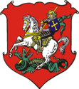
Vysoké Mýto
| Vysoké Mýto | ||||
|---|---|---|---|---|
|
||||
| Basic data | ||||
| State : |
|
|||
| Region : | Pardubický kraj | |||
| District : | Ústí nad Orlicí | |||
| Area : | 4207 ha | |||
| Geographic location : | 49 ° 57 ' N , 16 ° 10' E | |||
| Height: | 284 m nm | |||
| Residents : | 12,335 (Jan 1, 2019) | |||
| Postal code : | 565 41 - 566 01 | |||
| structure | ||||
| Status: | city | |||
| Districts: | 10 | |||
| administration | ||||
| Mayor : | Ing.Fantišek Jiraský (as of 2017) | |||
| Address: | B. Smetany 92 566 32 Vysoké Mýto |
|||
| Municipality number: | 581186 | |||
| Website : | www.vysoke-myto.cz | |||
Vysoké Mýto (German Hohenmaut , also Hohenmauth ) is a town in the Okres Ústí nad Orlicí in the Czech Republic .
geography
Vysoké Mýto is located about 18 km west of Wildenschwert ( Ústí nad Orlicí ) at an altitude of 289 m. The city is bounded in the northwest by the Vrchů hills , in the southeast are the heights of Bučkova Kopce and Vinice .
The place is at the mouth of the Mühlenbach ( Mlýnský potok ) in the Lautschna ( Loučná ) and in the east touches the city of the Nejzbach ( Blahovský potok ).
history
The area around the Lautschna river was inhabited as early as the Stone Age. Celts and Teutons have lived here since the 4th century, followed by Slavs in the 9th century .
In the 11th century, Duke Vratislav II had Vraclav Castle built, which became the administrative seat for two centuries. In 1108 the last Vršovci are said to have been exterminated at the castle . The Hrutov fortress protected the Trstenická stezka trade route from Bohemia to Moravia .
The city was founded in 1262 by Přemysl Ottokar II as a royal city and fortified three years later. She took over the tasks of military administration, which until then had been done at Vraclav Castle . The city flourished economically in the 14th century. After the smashing of the Hussites , Hohenmaut sided with Emperor Sigismund of Luxembourg and received numerous privileges in return.
During the Thirty Years' War , the city experienced an economic decline. Since there was a military base here, it was repeatedly attacked. The population fell sharply due to fires and the plague, but increased again due to the economic boom from the 18th century.
At the end of the 19th century, Hohenmauth was the seat of a district administration and a district court. The town was garrison of the kuk Infantry Regiment No. 98 (also Bohemian Infantry Regiment "von Rummer" No. 98 since 1883), the 51st Landwehr Infantry Brigade (with the kk Landwehr Infantry Regiment No. 30 since 1899) and the kk Landwehr-Uhlan Regiment No. . 2 (since 1883).
After the First World War , the city belonged to the newly founded Czechoslovakia . Before the start of the Second World War , the place was from March 1939 in the Protectorate of Bohemia and Moravia . The State Rifle Battalion 983 was set up here in 1941. After the end of the war, the resident German population was expelled .
Economy and Transport
In the 19th century Hohenmauth was a center for cloth weaving. Today the bus manufacturer Iveco Czech Republic (formerly Karosa ) is located here . The railway line from Chotzen to Leitomischl and the Silnice I / 35 ( European route 442 ) run through the town .
Attractions
- Church of St. Lawrence from 1349 ( Kostel sv. Vavřince )
- Church of the Holy Trinity from 1543 ( Kostel Nejsvětější Trojice )
- Plague column (1714) on the central square
- Old Town Hall
- Bell tower (16th century)
- District Museum (1871)
- City fortifications
- Preserved parts of the city wall (1265) with monastery bastion and water bastion
- Chotzen Gate (13th century)
- Prague Gate (13th century) ( Pražská brána )
- Litomyšl Gate ( Litomyšlská brána )
City structure
The districts of Vysoké Mýto belong to:
- Brteč ( Bertsch )
- Choceňské Předměstí ( Chotzen suburb )
- Domoradice ( Domoraditz )
- Knířov ( Knirau )
- Lhůta ( Lhuta )
- Litomyšlské Předměstí ( Litomyšl suburb )
- Pražské Předměstí ( Prague Suburbs )
- Svařeň ( Swarschen )
- Vanice ( Wanitz )
- Vysoké Mýto - Město ( Old Town )
sons and daughters of the town
- Johannes von Hohenmauth († around 1402), important theologian; Rector of Charles University in Prague
- Friedrich Briedel (1619–1680), Jesuit and religious writer
- Dismas Hataš (1724–1777), Bohemian composer
- Jan Václav Hataš (1727– after 1752), composer
- Jindřich Kristof Hataš (1739– after 1808), composer
- Josef Lipavský (1772–1810), Bohemian composer
- Alois Vojtěch Šembera (1807–1882), Bohemian historian and translator
- Josef Jireček (1825–1888), Bohemian literary historian, linguist and politician
- Karel Škorpil (1859–1944), Czech-Bulgarian archaeologist
- František Ventura (1894–1969), show jumper
- Pravoslav Sovak (* 1926), Czech painter and graphic artist
- Zdeněk Mlynář (1930–1997), Czech politician
- Tomáš Jirsák (* 1984), Czech football player


