Hronovce
| Hronovce | ||
|---|---|---|
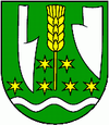
| coat of arms | map | |

|
|
|
| Basic data | ||
| State : | Slovakia | |
| Kraj : | Nitriansky kraj | |
| Okres : | Levice | |
| Region : | Nitra | |
| Area : | 30.96 km² | |
| Residents : | 1,476 (Dec. 31, 2019) | |
| Population density : | 48 inhabitants per km² | |
| Height : | 131 m nm | |
| Postal code : | 935 61 | |
| Telephone code : | 0 36 | |
| Geographic location : | 48 ° 0 ' N , 18 ° 39' E | |
| License plate : | LV | |
| Kód obce : | 502324 | |
| structure | ||
| Community type : | local community | |
| Structure of the municipality: | 3 parts of the community | |
| Administration (as of November 2018) | ||
| Mayor : | Róbert Csudai | |
| Address: | Obecný úrad Hronovce Levická 3 93561 Hronovce |
|
| Website: | www.hronovce.sk | |
| Statistics information on statistics.sk | ||
Hronovce is a municipality in southern central Slovakia.
It was created on July 1, 1968 through the merger of the towns of Čajakovo (German Lecker ), Domaša and Vozokany nad Hronom . The place is located south of the town of Želiezovce at the mouth of the Malianka brook in the Gran . The place name is also derived from the Slovak name Hron for the river Gran.
48% of the population belong to the Hungarian-speaking population group in Slovakia, 45% to the Slovak language group and around 6% to the Roma .
The Roman Catholic Church from 1220 is a historical monument in the town.
Web links
Commons : Hronovce - collection of images, videos and audio files
