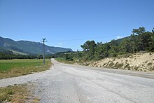
Jonchères
| Jonchères | ||
|---|---|---|
|
|
||
| region | Auvergne-Rhône-Alpes | |
| Department | Drôme | |
| Arrondissement | The | |
| Canton | Le Diois | |
| Community association | Diois | |
| Coordinates | 44 ° 34 ' N , 5 ° 24' E | |
| height | 719-1,560 m | |
| surface | 16.68 km 2 | |
| Residents | 28 (January 1, 2017) | |
| Population density | 2 inhabitants / km 2 | |
| Post Code | 26310 | |
| INSEE code | 26152 | |
 Mairie Jonchères |
||
Jonchères is a French municipality with 28 inhabitants (at January 1, 2017) in the Drome region, in the region of Auvergne Rhône-Alpes . It belongs to the Arrondissement of Die and the canton of Le Diois .
Geography, infrastructure
Neighboring municipalities are Aucelon in the northwest, Poyols in the north, Beaumont-en-Diois in the northeast, Bellegarde-en-Diois in the southeast, La Motte-Chalancon and Chalancon in the southwest and Volvent in the west. Jonchères is on the Cevennes Railway . The nearest serviced stations are in Chapeauroux and Langogne .
Population development
| year | 1962 | 1968 | 1975 | 1982 | 1990 | 1999 | 2008 | 2016 |
|---|---|---|---|---|---|---|---|---|
| Residents | 54 | 39 | 50 | 37 | 50 | 35 | 37 | 29 |
Web links
Commons : Jonchères - Collection of images, videos and audio files

