Jonen
| Jonen | |
|---|---|
| State : |
|
| Canton : |
|
| District : | Bremgarten |
| BFS no. : | 4071 |
| Postal code : | 8916 |
| UN / LOCODE : | CH JNE |
| Coordinates : | 672 369 / 238802 |
| Height : | 400 m above sea level M. |
| Height range : | 377-562 m above sea level M. |
| Area : | 5.70 km² |
| Residents: | 2181 (December 31, 2019) |
| Population density : | 383 inhabitants per km² |
|
Proportion of foreigners : (residents without citizenship ) |
15.1% (December 31, 2019) |
| Website: | www.jonen.ch |
|
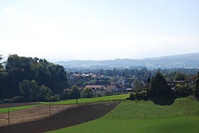
Jonen, panoramic view |
|
| Location of the municipality | |
Jonen ( Swiss German : ˈjoːnə ) is a municipality in the Swiss canton of Aargau . It belongs to the Bremgarten district and is located in the Reuss valley on the border with the canton of Zurich .
geography
The village center is on the edge of the fertile Reuss plain, around half a kilometer east of the river. Along the river bank there are alluvial forests and small swamp areas . The Jonental extends from east to west . The eastern part of Jonen Bach passes through a narrow, up to 30 meters deep ravine between the Birriwald the north and the south Goomwald. After leaving the gorge, the brook flows through the center of the village and finally flows into the Reuss. A little more than half a kilometer east of the village lies the hamlet of Obschlag ( 412 m above sea level ) in the Jonental valley . The hamlets of Litzi ( 467 m above sea level ) and Mörgeln ( 497 m above sea level ) are located on terraces on the foothills of the Holzbirrliberg in the immediate vicinity of Obschlag .
The area of the municipality is 570 hectares , of which 171 hectares are covered with forest and 76 hectares are built over. The highest point is at 559 m above sea level. M. am Hallenberg in the very east of the municipality, the deepest at 380 m above sea level. M. on the Reuss. Neighboring communities are Oberlunkhofen in the north, Arni in the northeast, Affoltern am Albis in the southeast, Ottenbach in the south, Aristau in the west and Rottenschwil in the northwest.
history
Grave finds near the hamlet of Litzi indicate settlement during the Hallstatt period. There was once a Roman villa on the border with Oberlunkhofen . Further grave finds document the settlement by the Alemanni in the 7th century. Jonun was first mentioned in writing in 1243 in a Habsburg document. The place name goes back to the old European river name Jouna ("the moving"), which Helvetii , Romans and Alamanni later adopted. The Old High German (ze) Jonun , which means "on the Jona", developed from this.
The village was part of the Kelnhof Lunkhofen, which had been donated to the St. Leodegar monastery in Lucerne in 694 and, in addition to Jonen, also included Arni , Islisberg , Oberlunkhofen and Unterlunkhofen . In 1291 Rudolf I bought the Kelnhof, and the city of Lucerne and 15 other villages came into the possession of the Habsburgs for 2000 silver marks. This transaction was one of the reasons that the three original cantons founded the Old Confederation . After the Kelnhof initially belonged to the Freiamt Affoltern for administrative purposes , twenty years later it formed its own office, the so-called cellar office .
In 1415 the city of Zurich took over the cellar office. While the people of Zurich took on blood jurisdiction , the lower jurisdiction had been owned by the city of Bremgarten since 1410 . In 1529 the population of Jonen was reformed , but had to convert to Catholicism again in 1531 after the Second Kappel War . In 1797, a year before the old rule structure collapsed, Bremgarten sold its rights to the village communities.
After the conquest of Switzerland by the French and the proclamation of the Helvetic Republic in March 1798, the cellar office was dissolved and the four municipalities of Ober- and Unterlunkhofen, Jonen and Arni-Islisberg were created . These initially belonged to the short-lived Canton of Baden and in 1803 came to the Canton of Aargau; however, the residents initially preferred a connection to Zug or Zurich . On September 1, 1811, a devastating village fire raged, which destroyed two thirds of all houses and made 266 residents homeless. Until the establishment of its own parish in 1866, Jonen belonged to the parish of Lunkhofen. The population declined slightly during the first half of the 20th century. Aided by the proximity to the cities of Zurich and Zug , there was brisk construction activity from the mid-1970s, which more than doubled the population.
Attractions
The Jonental pilgrimage chapel , built in 1735 and first mentioned in 1521, is the most important Marian pilgrimage site in the canton of Aargau.
The Catholic parish church Franz Xaver , built from 1804 to 1808, replaced the small village chapel, first mentioned in 1598. In the village fire of 1811, the church suffered severe damage, which could be removed by 1813. In 1910 the church tower and the choir were rebuilt. The Jon parish church is modeled on that of Oberlunkhofen. It is a flat-roofed hall church with a rectangular choir and baroque altars.
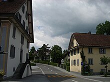
In the tavern "Zur Muttergottes", which was rebuilt in 1815 after the village fire, the civil court of the cellar office met four times a year with a self-elected subordinate as president and four advocates as judges. In the Middle Ages it was the only inn between Ziegelbach bei Geisshof Unterlunkhofen and Cham and had the sole baking and butcher rights. The “Alte Post” opposite the tavern was first mentioned in 1510 and served as a forge from the early 17th century to 1806, as a new building from 1808 as Jonen's first schoolhouse and from 1907 until after the Second World War as a post office. In the hamlet of Litzi, building 158 is one of the oldest parts of Switzerland, which was dendrochronologically dated to 1228 and 1318.
coat of arms
The blazon of the municipal coat of arms reads: "By a white wave pole split by blue with three six-pointed white stars placed on each pole and red with a white key turned to the left." The Joner coat of arms, which has existed in this form since 1805, combines motifs from the coat of arms of the canton of Aargau (three stars) and the cellar office (key). The wave pole symbolizes the Reuss or the Jonenbach.
population
The population developed as follows:
| year | 1850 | 1900 | 1930 | 1950 | 1960 | 1970 | 1980 | 1990 | 2000 | 2010 |
| Residents | 788 | 630 | 573 | 570 | 652 | 698 | 800 | 1102 | 1569 | 1866 |
On December 31, 2019, 2181 people lived in Jonen, the proportion of foreigners was 15.1%. In the 2015 census, 45.4% described themselves as Roman Catholic and 23.1% as Reformed ; 31.5% were non-denominational or of other faiths. 94.9% stated German as their main language in the 2000 census , 0.9% each Italian and Serbo-Croatian and 0.7% each French and English .
Politics and law
The assembly of those entitled to vote, the municipal assembly , exercises legislative power. The executing authority is the five-member municipal council . He is elected by the people in the majority procedure, his term of office is four years. The parish council leads and represents the parish. To this end, it implements the resolutions of the municipal assembly and the tasks assigned to it by the canton. The Bremgarten District Court is primarily responsible for legal disputes . Jonen belongs to the Friedensrichterkreis VII (Bremgarten).
economy
According to the company structure statistics (STATENT) collected in 2015, there are around 800 jobs in Jonen, 8% of them in agriculture, 40% in industry and 52% in the service sector. By far the largest employer is the pharmaceutical company Similasan, which produces homeopathic medicines. Many workers are commuters and work either in the Bremgarten region or in the agglomerations of Zurich and Zug .
traffic
Jonen is located on Kantonsstrasse 262 between Bremgarten and Affoltern am Albis ; in the center of the village, Kantonsstrasse 405 branches off to Hedingen . The A4 motorway near Affoltern was opened in November 2009 , which has made accessibility significantly better. Jonen is the terminus of a post bus line to Bremgarten, another runs from Zurich-Wiedikon via Jonen to Affoltern. In Bremgarten there is a connection to the Bremgarten-Dietikon-Bahn , in Affoltern to the S-Bahn Zurich . On weekends there is a night bus from Birmensdorf via Jonen to Obfelden .
education
There is a kindergarten and a primary school in Jonen . The community is the location of the Kelleramt district school with secondary school and secondary school , which is also available to school children from the surrounding communities. The district school can be attended in Bremgarten . The closest grammar school is the Cantonal School in Wohlen .
Personalities
- Jakob Huber (1883–1953), Chief of Staff
- Albert Rüttimann (1925–2009), politician
- Johann Heinrich Werdmüller (1742–1814), painter and writer
literature
- Anton Wohler: Jonen. In: Historical Lexicon of Switzerland .
- Peter Felder: The art monuments of the canton of Aargau . Ed .: Society for Swiss Art History . Volume IV: Bremgarten district. Birkhäuser Verlag, Basel 1967, ISBN 3-906131-07-6 .
- Walter Bürgisser: Jonen: From the past of the village and parish . Ed .: Municipality of Jonen. 2nd Edition. Casimir Meyer, Wohlen 1991.
- Max Widler (Ed.): It bsonders Volk: Litzi, Mörgeln, Obschlag - the outer courtyards of Jonen . Jonen 1998.
Web links
Individual evidence
- ↑ Cantonal population statistics 2019. Department of Finance and Resources, Statistics Aargau, March 30, 2020, accessed on April 2, 2019 .
- ↑ Cantonal population statistics 2019. Department of Finance and Resources, Statistics Aargau, March 30, 2020, accessed on April 2, 2019 .
- ↑ a b Beat Zehnder: The community names of the canton of Aargau . In: Historical Society of the Canton of Aargau (Ed.): Argovia . tape 100 . Verlag Sauerländer, Aarau 1991, ISBN 3-7941-3122-3 , p. 211-213 .
- ^ National map of Switzerland, sheets 1110 and 1111, Swisstopo.
- ↑ Standard area statistics - municipalities according to 4 main areas. Federal Statistical Office , November 26, 2018, accessed on May 14, 2019 .
- ↑ Fields: The Art Monuments of the Canton of Aargau, Volume IV: Bremgarten District. Pp. 285-290.
- ^ Joseph Galliker, Marcel Giger: Municipal coat of arms of the Canton of Aargau . Lehrmittelverlag des Kantons Aargau, book 2004, ISBN 3-906738-07-8 , p. 185 .
- ↑ Population development in the municipalities of the Canton of Aargau since 1850. (Excel) In: Eidg. Volkszählung 2000. Statistics Aargau, 2001, archived from the original on October 8, 2018 ; accessed on May 14, 2019 .
- ↑ Resident population by religious affiliation, 2015. (Excel) In: Population and Households, Community Tables 2015. Statistics Aargau, accessed on May 14, 2019 .
- ↑ Swiss Federal Census 2000: Economic resident population by main language as well as by districts and municipalities. (Excel) Statistics Aargau, archived from the original on August 10, 2018 ; accessed on May 14, 2019 .
- ↑ circles of justice of the peace. Canton of Aargau, accessed on June 20, 2019 .
- ↑ Statistics of the corporate structure (STATENT). (Excel, 157 kB) Statistics Aargau, 2016, accessed on May 14, 2019 .


