
Dottikon
| Dottikon | |
|---|---|
 |
|
| State : |
|
| Canton : |
|
| District : | Bremgarten |
| BFS no. : | 4065 |
| Postal code : | 5605 |
| UN / LOCODE : | CH DTO |
| Coordinates : | 660 558 / 248461 |
| Height : | 417 m above sea level M. |
| Height range : | 401-548 m above sea level M. |
| Area : | 3.88 km² |
| Residents: | 3885 (December 31, 2019) |
| Population density : | 1001 inhabitants per km² |
|
Proportion of foreigners : (residents without citizenship ) |
37.0% (December 31, 2019) |
| Website: | www.dottikon.ch |
 View of Dottikon |
|
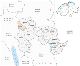
| Location of the municipality | |
  |
|
Dottikon ( Swiss German : ˈtɔtːikχə ) is a municipality in the canton of Aargau in Switzerland . It is the westernmost municipality in the Bremgarten district .
geography
The community is located in the lower Bünztal . The village center is located between the western slope of the Wagenrain and the canalised Bünz, which crosses the village from southeast to northwest. The southern half of the village and the extensive industrial area are located in the Bünz plane, which was partly swampy until the mid-1920s and was then drained. In the far south-east there is a wooded hill called "Berg" ( 525 m above sea level ), one of the heights of the Wagenrain chain.
The area of the municipality is 388 hectares , 92 hectares of which are forested and 125 hectares are built over. The highest point is at 549 m above sea level. M. in the Dreihägen area, the deepest point is 406 m above sea level. M. at the deep-grain mill. Neighboring communities are Hägglingen in the northeast, Wohlen in the southeast, Villmergen in the south, Hendschiken in the west and Othmarsingen in the northwest.
history
Dottikon emerged as an Alemannic settlement in the 7th century . The first written mention as Totinchon was in 1179 in a letter of protection from Pope Alexander III. to the Muri monastery . The place name comes from the Old High German Tottinghofun and means "at the farms of the Totto clan". The Lords of Tottikon emigrated to Lucerne and Küssnacht am Rigi in the 13th century and sold their property to the Habsburgs . In 1351 the Königsfelden monastery acquired lower jurisdiction from the Muri monastery .
In 1415 the Swiss conquered Aargau and Dottikon formed a judicial district of the Free Offices , a common rule . Between 1611 and 1613 plague epidemics decimated the village population. Before the first battle of Villmergen on January 24, 1656, Bernese troops largely destroyed the village. In March 1798, the French invaded Switzerland and proclaimed the Helvetic Republic . Dottikon became a municipality in the short-lived canton of Baden , since 1803 it has belonged to the canton of Aargau.

A mess chapel is first mentioned in 1436, a branch of the Staufberg parish on the hill of the same name . Until 1531 church membership was divided; the part of the village south of the Bünz belonged to Staufberg, the northern part to Ammerswil . The Reformation was introduced in 1529, but this was reversed after the Second Kappel War . In 1531 the village was assigned in its entirety to the parish of Hägglingen , and since 1867 it has been an independent parish.
The opening of the Rupperswil - Wohlen line of the Aargau Southern Railway on June 23, 1874 brought the connection to the railway network. After the farming village stagnated in the second half of the 19th century, Dottikon developed into a typical industrial village at the beginning of the 20th century, aided by the (now defunct) straw industry , the Swiss explosives factory founded in 1913 and the one in the municipality of Bally shoe factory located in Villmergen (closed 1987). In the early morning of April 8, 1969, a serious explosion occurred in the Swiss explosives factory, the "Pulveri", in which 18 people were killed and numerous others were injured, some seriously.
Attractions

In 1862 the construction of the parish church began under the direction of the architect Robert Moser from Baden . The hall church in neo-Romanesque style was consecrated in 1865 in honor of St. John the Baptist. The old Agatha Chapel, first mentioned in 1436, was torn down in the same year. The church was completely rebuilt and modernized between 1962 and 1964 under the direction of the architect P. Deucher from Baden, the neo-Romanesque furnishings were lost.
coat of arms
The blazon of the municipal coat of arms reads: "In yellow on a green three-mountain growing red horse." The coat of arms first appeared on the municipal seal in 1872. The representation is said to go back to a legend from the 13th century, according to which a knight died on the way and the horse carried him back to Dottikon. The color of the horse was originally white instead of red, which contradicts the heraldic color rules. In 1950 the community assembly approved a proposed change.
population
The population developed as follows:
| year | 1850 | 1900 | 1930 | 1950 | 1960 | 1970 | 1980 | 1990 | 2000 | 2010 |
| Residents | 713 | 722 | 1224 | 1321 | 1753 | 2462 | 2645 | 2955 | 2969 | 3273 |
On December 31, 2019, 3885 people lived in Dottikon, the proportion of foreigners was 37%. In the 2015 census, 40.5% described themselves as Roman Catholic and 14.3% as Reformed ; 45.2% were non-denominational or of other faiths. In the 2000 census, 78.1% stated German as their main language, 9.3% Italian , 2.9% Turkish , 2.5% each of Albanian and Serbo-Croatian , 0.8% Spanish and 0.7% Portuguese .
Politics and law
The assembly of those entitled to vote, the municipal assembly , exercises legislative power. The executing authority is the five-member municipal council . He is elected by the people in the majority procedure, his term of office is four years. The parish council leads and represents the parish. To this end, it implements the resolutions of the municipal assembly and the tasks assigned to it by the canton. The Bremgarten District Court is primarily responsible for legal disputes . Dottikon belongs to the Friedensrichterkreis VI (Wohlen).
economy
According to the company structure statistics (STATENT) collected in 2015, there are around 1,100 jobs in Dottikon, 3% of them in agriculture, 57% in industry and 40% in the service sector. Most companies are small and medium-sized companies. By far the largest employer with over 400 employees is Dottikon ES Holding , which specializes in fine chemicals and emerged in 2005 from the Swiss Explosives Factory. The Richard Huber AG tree and rose school , which specializes in rose growing, is also well known across the region.
traffic
The main road 1 , one of the main national road links Switzerland, some runs, one kilometer southwest of the village center. The Lenzburg and Mägenwil connections to the A1 motorway are both around five minutes' drive away. Kantonsstrasse 280 runs through the village itself between Brugg and Wohlen . The station Dottikon-Dintikon on the SBB railway line Aarau - Arth-Goldau ( Aargauische Südbahn ) is curiously located in neither of the two eponymous municipalities, but in the municipality of Villmergen . Two post bus lines connect Hägglingen with Dottikon and Wohlen station , either via Anglikon or Villmergen. On weekends there is a night bus from Lenzburg via Villmergen and Wohlen to Dottikon.
education
The community has five kindergartens and two schoolhouses in which all levels of compulsory elementary school are taught ( primary school , secondary school , secondary school and district school ). The closest grammar school is the Cantonal School in Wohlen .
Oddities
In the book “ Der deeper Sinn des Labenz ” by Sven Böttcher , the place-derived term Dottikon is defined as: An apostrophe that is not one. Dottikons in word structures such as “Dieter's bar”, “Susi's sewing room” and “Wednesdays closed” are particularly common.
literature
- Anton Wohler: Dottikon. In: Historical Lexicon of Switzerland .
- Peter Felder: The art monuments of the canton of Aargau . Ed .: Society for Swiss Art History . Volume IV: Bremgarten district. Birkhäuser Verlag, Basel 1967, ISBN 3-906131-07-6 .
Web links
Individual evidence
- ↑ Cantonal population statistics 2019. Department of Finance and Resources, Statistics Aargau, March 30, 2020, accessed on April 2, 2019 .
- ↑ Cantonal population statistics 2019. Department of Finance and Resources, Statistics Aargau, March 30, 2020, accessed on April 2, 2019 .
- ↑ a b Beat Zehnder: The community names of the canton of Aargau . In: Historical Society of the Canton of Aargau (Ed.): Argovia . tape 100 . Verlag Sauerländer, Aarau 1991, ISBN 3-7941-3122-3 , p. 130-131 .
- ^ National map of Switzerland, sheet 1090, Swisstopo.
- ↑ Standard area statistics - municipalities according to 4 main areas. Federal Statistical Office , November 26, 2018, accessed on May 14, 2019 .
- ^ K. Lütolf, History of the Parish Hägglingen, Baden 1918, pp. 87–89.
- ↑ Peter Felder: The art monuments of the canton Aargau . Ed .: Society for Swiss Art History. Volume IV: Bremgarten district. Birkhäuser Verlag, Basel 1967, ISBN 3-906131-07-6 , p. 184-188 .
- ^ Joseph Galliker, Marcel Giger: Municipal coat of arms of the Canton of Aargau . Lehrmittelverlag des Kantons Aargau, book 2004, ISBN 3-906738-07-8 , p. 142 .
- ↑ Population development in the municipalities of the Canton of Aargau since 1850. (Excel) In: Eidg. Volkszählung 2000. Statistics Aargau, 2001, archived from the original on October 8, 2018 ; accessed on May 14, 2019 .
- ↑ Resident population by religious affiliation, 2015. (Excel) In: Population and Households, Community Tables 2015. Statistics Aargau, accessed on May 14, 2019 .
- ↑ Swiss Federal Census 2000: Economic resident population by main language as well as by districts and municipalities. (Excel) Statistics Aargau, archived from the original on August 10, 2018 ; accessed on May 14, 2019 .
- ↑ circles of justice of the peace. Canton of Aargau, accessed on June 20, 2019 .
- ↑ Statistics of the corporate structure (STATENT). (Excel, 157 kB) Statistics Aargau, 2016, accessed on May 14, 2019 .
- ↑ Schweizerische Sprengstofffabrik AG. VAMUS, Association of Aargau Museums and Collections, accessed on January 13, 2010 .
Arni | Berikon | Bremgarten | Büttikon | Dottikon | Eggenwil | Fischbach-Göslikon | Hagglingen | Islisberg | Jonen | Niederwil | Oberlunkhofen | Oberwil-Lieli | Rudolfstetten-Friedlisberg | Sarmenstorf | Daily | Uezwil | Unterlunkhofen | Villmergen | Widen | Wohlen | Zufikon
Former municipality: Anglikon | Arni-Islisberg | Hermetschwil squadrons | Hilfikon | Lieli | Nesselnbach
Canton of Aargau | Districts of the Canton of Aargau | Municipalities in the Canton of Aargau