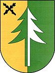
Kojetín u Havlíčkova Brodu
| Kojetín | ||||
|---|---|---|---|---|
|
||||
| Basic data | ||||
| State : |
|
|||
| Region : | Kraj Vysočina | |||
| District : | Havlíčkův Brod | |||
| Area : | 799 ha | |||
| Geographic location : | 49 ° 39 ' N , 15 ° 39' E | |||
| Height: | 523 m nm | |||
| Residents : | 157 (Jan 1, 2019) | |||
| Postal code : | 580 01 | |||
| License plate : | J | |||
| traffic | ||||
| Street: | Dolní Krupá - Česká Bělá | |||
| structure | ||||
| Status: | local community | |||
| Districts: | 1 | |||
| administration | ||||
| Mayor : | Ladislav Venc (as of 2019) | |||
| Address: | Kojetín 36 580 01 Havlíčkův Brod |
|||
| Municipality number: | 568881 | |||
| Website : | www.kojetin-hb.cz | |||
Kojetín (German Kojetein ) is a municipality in the Czech Republic . It is located eight kilometers northeast of the city center of Havlíčkův Brod and belongs to the Okres Havlíčkův Brod .
geography
Kojetín is located on the upper reaches of the Bělsko brook in the Hornosázavská pahorkatina ( hill country on the upper Sázava ). In the north rises the Kopec (582 m nm), northwest of the Pouchovské (554 m nm). The Ronovecký les ( summer forest ) extends to the west .
Neighboring places are Jahodov and Nemojov in the north, Počátky, Vlachov and U Hajného in the northeast, Jitkov and Oudoleň in the east, Samotín, Česká Bělá and Krátká Ves in the southeast, Jilemník and Ždírec in the south, Ronovec, Kyjov and Chrastevnice in the south Žlabě and Dolní Krupá in the west and Horní Krupá , Údolí, Rozsochatec , Nové Dvory and Pouch in the northwest.
history
The first written mention of Kojetín was in 1351 under the possession of the summer castle . The town of Deutschbrod later acquired the village. In 1787 there were 34 houses in Kogetin .
In 1840 the village of Kojetain or Kogetin , located in the Caslau district , consisted of 46 houses in which 385 people lived. There was a branch school in the village. Apart from that, in the summer forest, there was an official forester's house and a hunter's house. The parish was Biela . Kojetain remained subordinate to the royal city of Teutschbrod until the middle of the 19th century .
After the abolition of patrimonial Kojetín formed from 1849 a municipality in the judicial district Deutschbrod . From 1868 the village belonged to the Deutschbrod district . In 1869 Kojetín had 448 inhabitants and consisted of 47 houses. In 1900 there were 410 people in Kojetín, compared to 384 in 1910. In 1930 Kojetín had 401 inhabitants and consisted of 71 houses. In the 2001 census, 163 people lived in the 64 houses of the community.
Community structure
No districts are shown for the municipality of Kojetín. The Pouch and Ronovec ( summer forest ) settlements belong to Kojetín .
The municipality forms the cadastral district Kojetín u Havlíčkova Brodu.
Attractions
- Chapel on the road from Ronovec to Břevnice
- Burgruine Ronovec ( Sommerburg Potok), west of the village above the valley of Břevnický. It was built in the middle of the 13th century for Smil von Lichtenburg and abandoned in 1544.
- Prdlavka spring well, west of the village
literature
- Historický lexikon obcí České republiky 1869–2005 , part 1, p. 554
Web links
Individual evidence
- ↑ http://www.uir.cz/obec/568881/Kojetin
- ↑ Český statistický úřad - The population of the Czech municipalities as of January 1, 2019 (PDF; 7.4 MiB)
- ↑ Jaroslaus Schaller : Topography of the Kingdom of Bohemia. Sixth part. Czaslauer Kreis Prague and Vienna 1787, p. 158
- ^ Johann Gottfried Sommer : The Kingdom of Bohemia; Represented statistically and topographically. Volume 11: Caslauer Kreis. Ehrlich, Prague 1843, p. 191.
- ↑ http://www.uir.cz/katastralni-uzemi/667871/Kojetin-u-Havlickova-Brodu


