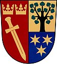
Kraborovice
| Kraborovice | ||||
|---|---|---|---|---|
|
||||
| Basic data | ||||
| State : |
|
|||
| Region : | Kraj Vysočina | |||
| District : | Havlíčkův Brod | |||
| Area : | 527 ha | |||
| Geographic location : | 49 ° 48 ' N , 15 ° 34' E | |||
| Height: | 390 m nm | |||
| Residents : | 96 (Jan. 1, 2019) | |||
| Postal code : | 582 82 | |||
| License plate : | J | |||
| traffic | ||||
| Street: | Chotěboř - Vilémov | |||
| structure | ||||
| Status: | local community | |||
| Districts: | 2 | |||
| administration | ||||
| Mayor : | František Sojka (as of 2019) | |||
| Address: | Kraborovice 21 582 82 Golčův Jeníkov |
|||
| Municipality number: | 548618 | |||
| Website : | www.kraborovice.eu | |||
Kraborovice (German Kraborowitz ) is a municipality in the Czech Republic . It is located seven kilometers east of Golčův Jeníkov and belongs to the Okres Havlíčkův Brod .
geography
Kraborovice is located at the brook Doubravka ( Borekbach ) in the Hornosázavská pahorkatina ( hill country on the upper Sázava ). State road II / 345 between Chotěboř and Vilémov runs through the village . In the northeast rises the Výrovka (422 m nm).
Neighboring towns are Úhrov , Na Pilce and Úhrovský Mlyn in the north, Spačice, Rostejn and Ostružno in the Northeast, Lomy and Vestecká Lhotka in the east, Heřmaň and Borek in the southeast, Uhelná Příbram and Dálčice in the south, Košťany and Ždánice in the southwest, Sychrov and Cerna Pila in the west and Točice and Vilémov in the northwest.
history
The first written mention of Kraborovice was made in 1556 in the country table . Most of the time the village belonged to the Auhrow estate , which was owned by the Dobrženský von Dobrženitz family from 1752 to 1888 .
In 1840 the village of Kraborowitz , located in the Caslauer Kreis on the Brünner Chaussee, consisted of 17 houses in which 124 people lived. There was an inn in the village. Was vicarage Wilimow , the official residence in Auhrow. Until the middle of the 19th century, Kraborowitz remained subordinate to the Auhrow estate, including Přibram and Negepin .
After the abolition of patrimonial Kraborovice formed from 1849 a district of the municipality Úhrov in the judicial district Chotěboř . From 1868 the place belonged to the district Chotěboř . In 1869 Kraborovice had 119 inhabitants and consisted of 18 houses. To the south of the old village, new houses were built in the second half of the 19th century on Brünner Chaussee, where until then only the inn had stood. In 1876 the village school was built there, which the children from Úhrov also attended. In 1900 there were 112 people living in Kraborovice, in 1910 there were 127. In 1919 Kraborovice broke away from Úhrov and formed a separate municipality with the districts Košťany and Dálčice . In 1930 Kraborovice had 116 inhabitants and consisted of 26 houses. Since the territorial reform of 1960, the municipality has belonged to Okres Havlíčkův Brod . In 1961 Úhrov was incorporated. The school closed in 1972. The school building was given a new use by the district archive, which later abandoned the building due to its dilapidation. On January 1, 1976, the village was incorporated into Vilémov . Kraborovice and Úhrov broke away from Vilémov on November 24, 1990 and formed the municipality of Kraborovice. In the years 1995–1996 the schoolhouse was renovated and since 1996 it has served as a municipal office. At the 2001 census, 102 people lived in the 70 houses of the municipality, 53 of them in Kraborovice (28 houses) and 49 in Úhrov (42 houses).
Community structure
The municipality Kraborovice consists of the districts Kraborovice ( Kraborowitz ) and Úhrov ( Auhrow ), which also form cadastral districts. The layers Na Pilce, Na Sklepích and Úhrovský Mlýn also belong to Kraborovice.
Attractions
- Baroque palace Úhrov, built at the beginning of the 18th century for Franz Wenzel Wltawsky von Mannswerth. The tower with the castle chapel of St. Elevation of the cross was added in 1745.
- Chapel of St. Anthony of Padua in Úhrov
- Wooden bell trees in Kraborovice and Úhrov
- Atonement cross on the road to Borek
- Cast iron cross on the Kraborovice village square
literature
- Historický lexikon obcí České republiky 1869–2005 , part 1, p. 554
Web links
Individual evidence
- ↑ http://www.uir.cz/obec/548618/Kraborovice
- ↑ Český statistický úřad - The population of the Czech municipalities as of January 1, 2019 (PDF; 7.4 MiB)
- ^ Johann Gottfried Sommer : The Kingdom of Bohemia; Represented statistically and topographically. Volume 11: Caslauer Kreis. Ehrlich, Prague 1843, p. 284.
- ↑ http://www.uir.cz/casti-obce-obec/548618/Obec-Kraborovice
- ↑ http://www.uir.cz/katastralni-uzemi-obec/548618/Obec-Kraborovice


