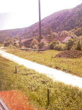
La today
| La today | ||
|---|---|---|
| State : |
|
|
| Canton : |
|
|
| Administrative district : | Bernese Jura | |
| Residential municipality : | Péry-La Heutte | |
| Postal code : | 2604 | |
| former BFS no. : | 0436 | |
| Coordinates : | 584 022 / 226 768 | |
| Height : | 615 m above sea level M. | |
| Area : | 8.0 km² | |
| Residents: | 485 (December 31, 2013) | |
| Population density : | 61 inhabitants per km² | |
| Website: | www.pery-laheutte.ch | |
|
La today |
||
| map | ||
|
|
||
La Heutte is a place in the municipality of Péry-La Heutte , which is in the Bernese Jura administrative district in the canton of Bern in Switzerland . The former German name hut is no longer used today.
Until December 31, 2014, La Heutte was an independent political municipality . On January 1, 2015, La Heutte merged with the municipality of Péry to form the new municipality of Péry-La Heutte .
geography
La Heutte is 615 m above sea level. M. , six kilometers north of Biel (as the crow flies). The village extends in the valley of the Schüss ( French Suze ) between two anticlines of the Jura .
The area of the eight square kilometer former municipal area includes a section of the lower Schüsstal with a valley floor that is around 500 m wide. In the north, the area extends to the ridge of the Montoz chain, on which at 1285 m above sea level. M. the highest point of La Heutte is reached. To the south, the former municipality extends to the easternmost foothills of the Chasseral chain (up to 1193 m above sea level ). In this chain, a half-cycle was created by erosion . Part of the rock material that has been removed over millions of years forms an alluvial cone in the area of the Métairie de Nidau south of the Schüss. In 1997, 9% of the former municipal area was in settlements, 67% in forests and woodlands, 23% in agriculture and a little less than 1% was unproductive land.
La Heutte has numerous individual farms that are widely scattered in the valley and on the Jura heights. Neighboring communities of La Heutte were Sonceboz-Sombeval , Orvin , Péry, Reconvilier and Tavannes .
population
With 485 inhabitants (as of December 31, 2013), La Heutte was one of the smaller communities in the Bernese Jura . 75.2% of the residents are French-speaking, 20.1% German-speaking and 2.8% Spanish-speaking (as of 2000). The population of La Heutte was 271 in 1850 and 400 in 1900. Since 1950 (344 inhabitants) there has been a significant increase in population.
politics
The voting shares of the parties on the occasion of the National Council elections in 2011 were: SVP 32.7%, SP 28.5%, BDP 9.3%, GPS 6.0%, FDP 5.9%, CVP 4.3%, Les Rauraques 3, 7%, AL 1.8%, pirates 1.7%, EVP 1.4%, glp 1.3%, SLB 1.3%, EDU 0.6%.
economy
La Heutte was an agricultural village until the 20th century . Outside the primary sector there were jobs in watchmaking , in a sawmill and in local small businesses. In the last few decades a horticultural company has established itself in La Heutte that secures many jobs. Two small hydroelectric power plants, the history of which can be traced back to 1622, have been restored. The power plants are located on the site of the former mill of Abraham Bendicht des Junge von Hütten, (today La Heutte, the glassworks). The venerable restaurant de la Croix Fédérale opens in 2018. The restaurant has been restored in the style of the 19th century with the help of monument preservation.
A large number of employees are commuters and mainly work in nearby Biel.
traffic
The former community is well developed in terms of traffic. It is located on the main road from Biel to La Chaux-de-Fonds . With the opening of the A16 motorway from La Heutte to Tavannes in 1997, the town was relieved of through traffic. On April 30, 1874, the railway line from Biel to Convers was opened with a train station in La Heutte.
history
La Heutte was first mentioned in writing in 1370 under the German name Zur Hütte . There is evidence of a glassworks in the village since the beginning of the 15th century. The current French place name does not appear until 1727. Until 1797 the village belonged to the Erguel lordship , which was subordinate to the Duchy of Basel , whereby the city of Biel also exerted greater influence at times and introduced the Reformation in 1530 . From 1797 to 1815 La Heutte belonged to France and was initially part of the Mont-Terrible department , which was connected to the Haut-Rhin department in 1800 . As a result of the decision of the Congress of Vienna , the place came to the canton of Bern in the Courtelary district in 1815 .
Until December 31, 2014, La Heutte was an independent municipality .
Attractions
In the old town center there are some typical farmhouses from the 18th and 19th centuries. The former school with a bell tower dates from 1839. You can see the footprints of dinosaurs on a small rock wall in the Forêt de l'Envers, south of La Heutte . Two small hydroelectric power plants with a small museum can be visited. The La Suze (Schüss) invites you to linger, there are also many other hikes from the train station. close. In "Paradis", a park with all levels of difficulty, popular with climbers, can be reached in 5 minutes from the train station.
Web links
- Official website of the municipality of La Heutte (French)
- Anne Beuchat-Bessire: Heutte, La. In: Historical Lexicon of Switzerland .


