Lamboing
| Lamboing | ||
|---|---|---|
| State : |
|
|
| Canton : |
|
|
| Administrative district : | Bernese Jura | |
| Residential municipality : | Plateau de Diesse | |
| Postal code : | 2516 | |
| former BFS no. : | 0722 | |
| UN / LOCODE : | CH LBN | |
| Coordinates : | 577 043 / 218607 | |
| Height : | 820 m above sea level M. | |
| Area : | 9.1 km² | |
| Residents: | 696 (December 31, 2013) | |
| Population density : | 76 inhabitants per km² | |
| Website: | www.lamboing.ch | |
|
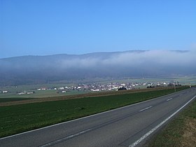
View of the village of Lamboing |
||
| map | ||
|
|
||
Until December 31, 2013, Lamboing was a political municipality in the Bernese Jura administrative district in the canton of Bern in Switzerland . The former German name Lamlingen is no longer used today. On January 1, 2014 Lamboing merged with the two other former municipalities of Diesse and Prêles to form the new municipality of Plateau de Diesse .
geography
Lamboing is 820 m above sea level. M. , nine kilometers west of Biel (as the crow flies). The village extends on the northern edge of the Montagne de Diesse (German Tessenberg ) plateau above Lake Biel , in the southern Jura at the foot of Mont Sujet .
The area of the 9.1 km² former municipal area comprises the easternmost section of the plateau de Diesse. South of the village, the Douanne (German Twannbach ) drains the plateau through the Twannbach Gorge to Lake Biel. To the north, the municipality extends to the crest of the anticlines of the Mont Sujet, on which at 1382 m above sea level. M. the highest point of Lamboing is reached. The northern boundary runs temporarily in the synclines Les Prés Vaillons , the Mont subject of the Chasseral separates chain. In the east, Lamboing extends to the height of the Magglingerberg ( 1092 m above sea level ). On the wide ridges of Mont Sujet and Magglingerberg ( Prés de Macolin-Derrière ) there are extensive Jura high pastures with the typical mighty spruce trees , which either stand individually or in groups. In 1997, 7% of the municipal area was accounted for by settlements, 55% for forests and trees and 38% for agriculture.
Lamboing includes the hamlets of Les Moulins ( 770 m above sea level ) in the Douanne valley and Derrière la Chaux ( 800 m above sea level ), the holiday homes and weekend houses on Les Prés de Macolin-Derrière and some individual farms. Until December 31, 2013 , neighboring communities of Lamboing were Nods , Diesse , Prêles , Twann-Tüscherz , Evilard and Orvin .
population
With 696 inhabitants (as of December 31, 2013) Lamboing was one of the medium-sized communities in the Bernese Jura . 84.2% of the residents are French-speaking, 12.4% German-speaking and 0.9% Portuguese-speaking (as of 2000). The population of Lamboing was 569 in 1850 and 521 in 1900. In the course of the 20th century the population fluctuated between 440 and 530 people. Since 1980 (445 inhabitants) there has been a clearly increasing trend.
politics
The voting shares of the parties on the occasion of the National Council elections in 2011 were: SP 26.4%, SVP 26.2%, FDP 15.5%, EPP 6.7%, GPS 6.6%, BDP 3.7%, glp 3.6 %, EDU 2.4%, pirates 2.2%, CVP 1.6%, AL 1.4%, Les Rauraques 1.2%.
economy
Lamboing was mainly dominated by agriculture until the middle of the 20th century . Since around 1970 the village has gradually developed into a residential community. There was a watch factory in Lamboing until 1981 . Today there are jobs in mechanics and local trades. However, many workers are commuters and work in Biel or in the La Neuveville region .
traffic
The village is located off the major thoroughfares on the cantonal road from Frinvillier to Nods . Lamboing is connected to La Neuveville by a post bus course, which also serves the other municipalities of the Montagne de Diesse.
history

The first written mention was made in 1178 when Pope Alexander III. confirmed to the chapter Saint-Imier goods in Lamboens . In 1248 the spelling Lambuoons appears and in 1304 the German name Lamblingen . The place name is probably due to the proper name Landebod . In the 13th century the nobles of Lamboing are attested, whose lineage expired at the beginning of the 14th century. From 1423 to 1509, the place belonged to the von Vaumarcus family as a fief, after which it came to the Principality of Basel . The Reformation was also introduced on the Montagne de Diesse around the middle of the 16th century . From 1798 to 1815 Lamboing belonged to France and was initially part of the Mont-Terrible department , which was connected to the Haut-Rhin department in 1800 . As a result of the decision of the Congress of Vienna , the place came to the canton of Bern to the district of Erlach in 1815 and to the new district of La Neuveville in 1846 . At Easter 1817 almost all houses in Lamboing were destroyed by a fire. The place is mentioned by name as the residence of the criminal Gastmann in Dürrenmatt's novel The Judge and His Executioner , published in 1950 .
Until December 31, 2013, Lamboing was an independent municipality .
Attractions
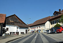
In the town center there are some farmhouses that date from the time after the village fire. There are still several mills on the Douanne, the oldest was built in 1636. Ecclesiastically, Lamboing belongs to the parish of Diesse .
After Hurricane Lothar , the Lothurm was built, which was so badly damaged by a storm in 2013 that it had to be dismantled in 2014.
Web links
- Official website of the municipality of Lamboing (French)
- Frédy Dubois: Lamboing. In: Historical Lexicon of Switzerland .


