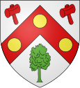
Le Boulay-Morin
| Le Boulay-Morin | ||
|---|---|---|

|
|
|
| region | Normandy | |
| Department | Your | |
| Arrondissement | Evreux | |
| Canton | Evreux-2 | |
| Community association | Evreux Portes de Normandie | |
| Coordinates | 49 ° 5 ' N , 1 ° 11' E | |
| height | 84-147 m | |
| surface | 5.55 km 2 | |
| Residents | 777 (January 1, 2017) | |
| Population density | 140 inhabitants / km 2 | |
| Post Code | 27930 | |
| INSEE code | 27099 | |
| Website | http://www.leboulaymorin.fr | |
Le Boulay-Morin is a French municipality with 777 inhabitants (at January 1, 2017) in the department of Eure in the region Normandy (before 2016 Haute-Normandie ). It belongs to the arrondissement of Évreux and the canton of Évreux-2 (until 2015 Évreux-Nord ) as well as to the municipal association of Évreux Portes de Normandie . The inhabitants are called Boulay-Morinois .
geography
Le Boulay-Morin is located about seven kilometers north-northeast of Évreux . Le Boulay-Morin is surrounded by the neighboring communities of La Chapelle-du-Bois-des-Faulx and Irreville in the north, Dardez in the east and north-east, Reuilly in the east and south-east, Normanville in the south and west and Émalleville in the north-west.
Population development
| year | 1962 | 1968 | 1975 | 1982 | 1990 | 1999 | 2006 | 2013 |
| Residents | 188 | 151 | 400 | 457 | 516 | 558 | 641 | 740 |
Source: INSEE
Attractions
- Saint-André church from the 18th century
- Castle and park from the 18th century
Web links
Commons : Le Boulay-Morin - Collection of images, videos and audio files

