List of architectural monuments in Klausen (South Tyrol)
The list of architectural monuments in Klausen ( Italian: Chiusa ) contains the 87 objects in the area of the municipality of Klausen that have been designated as architectural monuments .
The basis is the official directory of the monuments in South Tyrol, which can be viewed on the Internet. These can be, for example, sacred buildings , residential houses, farms and aristocratic residences. The order in this list is based on the designation, alternatively it can also be sorted according to the address or the date on which it was placed under protection.
list
| photo | designation | Location | registration | description | Metadata |
|---|---|---|---|---|---|

|
Old forge ID: 15405 |
Gerbergasse 2, 8 46 ° 38 ′ 22 ″ N, 11 ° 33 ′ 54 ″ E |
July 25, 1951 (MD) |
Urban residential building |
KG: Klausen building plot: 89, 90
|

|
Old Town Hall ID: 15421 |
Oberstadt 29 46 ° 38 ′ 26 ″ N, 11 ° 33 ′ 59 ″ E |
July 25, 1951 (MD) |
Urban residential building |
KG: Klausen building plot: 113
|

|
Old Hospital ID: 15400 |
Färbergasse 10 46 ° 38 ′ 22 ″ N, 11 ° 33 ′ 58 ″ E |
July 6, 1951 (MD) |
hospital |
KG: Klausen building plot: 44
|
| Anger ID: 15377 |
46 ° 38 ′ 41 ″ N, 11 ° 34 ′ 59 ″ E |
Feb 20, 1951 (MD) |
Raised hide |
KG: Gries near Klausen building plot: 36, 37
|
|
| Ansheim ID: 15445 |
46 ° 38 '22 "N, 11 ° 33' 46" E |
Nov. 13, 1978 (BLR-LAB 7795) |
Raised hide |
KG: Ask building plot: 10
|
|

|
Apostle Church ID: 15427 |
46 ° 38 ′ 30 "N, 11 ° 34 ′ 6" E |
Nov. 13, 1978 (BLR-LAB 7795) |
church |
KG: Klausen building plot: 124
|

|
On the Frag 21 ID: 15366 |
On Frag 21 46 ° 38 ′ 17 ″ N, 11 ° 33 ′ 46 ″ E |
Nov. 13, 1978 (BLR-LAB 7795) |
Rural house / farm |
KG: Ask building plot: 19
|
|
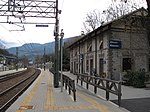
Klausen train station ID: 50102 |
46 ° 38 ′ 34 "N, 11 ° 34 ′ 22" E |
April 5, 2004 (BLR-LAB 1083) |
Train station / Remise |
KG: Gries near Klausen Building plot: 497
|

|
Säben Benedictine Abbey with St. Mary's Church ID: 15430 |
46 ° 38 ′ 40 "N, 11 ° 34 ′ 5" E |
June 14, 1982 (BLR-LAB 3604) |
monastery |
KG: Latzfons building plot: 18, 19, 20
|
| Benefit house ID: 15380 |
46 ° 38 ′ 55 ″ N, 11 ° 36 ′ 9 ″ E |
June 14, 1982 (BLR-LAB 3604) |
Rural house / farm |
KG: Gufidaun building plot: 8
|
|
| Benefit house ID: 15390 |
Oberstadt 64 46 ° 38 ′ 28 ″ N, 11 ° 34 ′ 3 ″ E |
Nov. 13, 1978 (BLR-LAB 7795) |
Urban residential building |
KG: Klausen building plot: 6 basic plot: 9/2
|
|

|
Image stock ID: 15385 |
46 ° 38 ′ 45 "N, 11 ° 35 ′ 53" E |
June 14, 1982 (BLR-LAB 3604) |
Wayside shrine |
KG: Gufidaun basic parcel: 270/1
|

|
Branzoll ID: 15413 |
46 ° 38 '25 "N, 11 ° 33' 55" E |
July 25, 1951 (MD) |
Castle |
KG: Klausen building plot: 105/1, 105/2, 105/3
|
| Eichbichler ID: 50601 |
46 ° 38 ′ 22 "N, 11 ° 33 ′ 57" E |
April 11, 2017 (BLR-LAB 427) |
four-story, three-axis building |
KG: Klausen building plot: 49
|
|
|
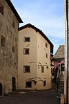
Färbergasse 16 ID: 15399 |
Färbergasse 16 46 ° 38 ′ 22 ″ N, 11 ° 33 ′ 59 ″ E |
July 25, 1951 (MD) |
Urban residential building |
KG: Klausen building plot: 40
|

|
Fragburg ID: 15370 |
46 ° 38 ′ 16 "N, 11 ° 33 ′ 39" E |
Dec 14, 1950 (MD) |
Raised hide |
KG: Ask building plot: 37
|

|
Garnstein ID: 15442 |
46 ° 39 ′ 52 "N, 11 ° 32 ′ 28" E |
16 Sep 1986 (BLR-LAB 5108) |
Castle |
KG: Latzfons building plot: 182
|
| Gasthaus zum Bären ID: 15396 |
Lower town 3 46 ° 38 ′ 23 ″ N, 11 ° 33 ′ 58 ″ E |
July 6, 1951 (MD) |
Inn |
KG: Klausen building plot: 36
|
|

|
Gasthaus zum Hirschen ID: 15402 |
Tinneplatz 7 46 ° 38 ′ 21 ″ N, 11 ° 33 ′ 54 ″ E |
July 6, 1951 (MD) |
Inn |
KG: Klausen building plot: 63
|

|
Gasthaus zur Post ID: 15401 |
Tinneplatz 3 46 ° 38 ′ 21 ″ N, 11 ° 33 ′ 57 ″ E |
Oct 15, 1951 (MD) |
Inn |
KG: Klausen building plot: 51/1, 51/2
|
| Gasthaus zur Rose ID: 15409 |
Lower town 16 46 ° 38 ′ 23 ″ N, 11 ° 33 ′ 56 ″ E |
July 6, 1951 (MD) |
Inn |
KG: Klausen building plot: 100
|
|
| Gasthof Weißes Keuz ID: 15412 |
Lower City 4 46 ° 38 ′ 24 ″ N, 11 ° 33 ′ 57 ″ E |
July 25, 1951 (MD) |
Inn |
KG: Klausen building plot: 103
|
|

|
Griesbruck ID: 15372 |
46 ° 38 ′ 23 "N, 11 ° 34 ′ 5" E |
Oct. 27, 1948 (MD) |
Raised hide |
KG: Gries near Klausen Building plot: 1
|

|
Holy Cross Chapel ID: 15369 |
46 ° 38 ′ 17 "N, 11 ° 33 ′ 39" E |
Dec 14, 1950 (MD) |
church |
KG: Ask building plot: 36
|

|
Holy Cross Church on Säben ID: 15429 |
46 ° 38 ′ 41 ″ N, 11 ° 34 ′ 6 ″ E |
June 14, 1982 (BLR-LAB 3604) |
church |
KG: Latzfons building plot: 17
|

|
Holy Cross on Ritzlar ID: 15441 |
46 ° 42 ′ 6 ″ N, 11 ° 29 ′ 59 ″ E |
June 14, 1982 (BLR-LAB 3604) |
church |
KG: Latzfons building plot: 157
|
|
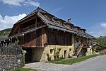
Hintner in Verdings ID: 15435 |
46 ° 39 ′ 22 "N, 11 ° 34 ′ 21" E |
June 14, 1982 (BLR-LAB 3604) |
Rural house / farm |
KG: Latzfons building plot: 44
|
| Hulz ID: 15383 |
46 ° 38 ′ 29 "N, 11 ° 34 ′ 5" E |
June 7, 1951 (MD) |
Rural house / farm |
KG: Gufidaun building plot: 45
|
|
|
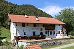
Johannser ID: 15365 |
46 ° 38 ′ 33 "N, 11 ° 33 ′ 27" E |
Dec 14, 1950 (MD) |
Rural house / farm |
KG: Ask building plot: 4
|

|
Chapel of the Sorrowful in Runggalten ID: 15444 |
46 ° 40 ′ 5 ″ N, 11 ° 31 ′ 9 ″ E |
June 7, 1951 (MD) |
chapel |
KG: Latzfons building plot: 251
|
|
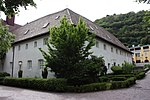
Capuchin monastery, Church of St. Felix of Cantalicio and Loreto Chapel ID: 18060 |
46 ° 38 ′ 20 "N, 11 ° 33 ′ 48" E |
Nov. 5, 2012 (BLR-LAB 1642) |
Monastery with attached church; the Loretokapelle is located a few meters southwest to 46 ° 38 '17.9 " N , 11 ° 33' 47.1" O . |
KG: Ask building plot: 14, 15, 17, 720
|

|
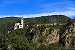
Koburg ID: 15382 |
46 ° 38 ′ 56 "N, 11 ° 36 ′ 0" E |
June 7, 1951 (MD) |
Raised hide |
KG: Gufidaun building plot: 29
|
|
Church of Our Lady with Lady Chapel on Säben ID: 15431 |
46 ° 38 ′ 35 "N, 11 ° 34 ′ 1" E |
June 14, 1982 (BLR-LAB 3604) |
church |
KG: Latzfons building plot: 21
|

|
Mair in the village ID: 15438 |
46 ° 40 '12 "N, 11 ° 32' 57" E |
June 7, 1951 (MD) |
Rural house / farm |
KG: Latzfons building plot: 101/1
|

|
Mairheim ID: 15367 |
46 ° 38 '15 "N, 11 ° 33' 43" E |
Dec 14, 1950 (MD) |
Raised hide |
KG: Ask building plot: 26/1, 770
|

|
Lady Chapel in Pardell ID: 15443 |
46 ° 39 ′ 3 ″ N, 11 ° 34 ′ 18 ″ E |
16 Sep 1986 (BLR-LAB 5108) |
chapel |
KG: Latzfons building plot: 207
|

|
Marketplace 1 ID: 15428 |
Marktplatz 1 46 ° 38 ′ 31 ″ N, 11 ° 34 ′ 6 ″ E |
Nov. 13, 1978 (BLR-LAB 7795) |
Urban residential building |
KG: Klausen building plot: 125/1
|

|
Menhir at the Mair in Ums ID: 15371 |
46 ° 38 ′ 46 ″ N, 11 ° 33 ′ 15 ″ E |
16 Sep 1986 (BLR-LAB 5108) |
monument |
KG: Ask land parcel: 41
|

|
Mesnerturm ID: 15394 |
46 ° 38 ′ 22 "N, 11 ° 34 ′ 0" E |
Nov. 13, 1978 (BLR-LAB 7795) |
bridge |
KG: Klausen building plot: 34
|

|
Neidegg ID: 15376 |
46 ° 38 ′ 34 "N, 11 ° 35 ′ 1" E |
June 14, 1982 (BLR-LAB 3604) |
Raised hide |
KG: Gries near Klausen Building plot: 35/2, 35/3
|
| Oberstadt 1 ID: 15415 |
Oberstadt 1 46 ° 38 ′ 24 ″ N, 11 ° 33 ′ 58 ″ E |
July 6, 1951 (MD) |
Urban residential building |
KG: Klausen building plot: 107
|
|
| Oberstadt 3 ID: 15416 |
Oberstadt 3 46 ° 38 ′ 25 ″ N, 11 ° 33 ′ 58 ″ E |
July 6, 1951 (MD) |
Urban residential building |
KG: Klausen building plot: 108
|
|
| Oberstadt 9 ID: 15417 |
Oberstadt 9 46 ° 38 ′ 25 ″ N, 11 ° 33 ′ 59 ″ E |
July 6, 1951 (MD) |
Inn |
KG: Klausen building plot: 109
|
|

|
Oberstadt 13 ID: 15418 |
Oberstadt 13 46 ° 38 ′ 25 ″ N, 11 ° 33 ′ 59 ″ E |
Nov. 13, 1978 (BLR-LAB 7795) |
Urban residential building |
KG: Klausen building plot: 110
|
| Oberstadt 14 ID: 15392 |
Oberstadt 14 46 ° 38 ′ 25 ″ N, 11 ° 34 ′ 0 ″ E |
July 6, 1951 (MD) |
Urban residential building |
KG: Klausen building plot: 23
|
|
| Oberstadt 14 ID: 50529 |
Oberstadt 14 46 ° 38 ′ 25 ″ N, 11 ° 34 ′ 0 ″ E |
Jan. 20, 1997 (BLR-LAB 137) |
Urban residential building |
KG: Klausen building plot: 22
|
|
| Oberstadt 17 ID: 15419 |
Oberstadt 17 46 ° 38 ′ 26 ″ N, 11 ° 33 ′ 59 ″ E |
Nov. 13, 1978 (BLR-LAB 7795) |
Urban residential building |
KG: Klausen building plot: 111
|
|
| Oberstadt 21 ID: 15420 |
Oberstadt 21 46 ° 38 ′ 26 ″ N, 11 ° 33 ′ 59 ″ E |
July 25, 1951 (MD) |
Urban residential building |
KG: Klausen building plot: 112
|
|
| Oberstadt 39 ID: 15422 |
Oberstadt 39 46 ° 38 ′ 27 ″ N, 11 ° 34 ′ 1 ″ E |
Nov. 13, 1978 (BLR-LAB 7795) |
Urban residential building |
KG: Klausen building plot: 115
|
|

|
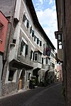
Oberstadt 41 ID: 15423 |
Oberstadt 41 46 ° 38 ′ 27 ″ N, 11 ° 34 ′ 1 ″ E |
July 6, 1951 (MD) |
Urban residential building |
KG: Klausen building plot: 116
|
|
Oberstadt 57 ID: 15424 |
Oberstadt 57 46 ° 38 ′ 29 ″ N, 11 ° 34 ′ 2 ″ E |
July 6, 1951 (MD) |
Inn |
KG: Klausen building plot: 120
|
| Oberstadt 62, court offices ID: 15391 |
Oberstadt 62 46 ° 38 ′ 28 ″ N, 11 ° 34 ′ 2 ″ E |
Nov. 13, 1978 (BLR-LAB 7795) |
Urban residential building |
KG: Klausen building plot: 7, 8
|
|

|
Oberstadt 65 ID: 15425 |
Oberstadt 65 46 ° 38 ′ 29 ″ N, 11 ° 34 ′ 3 ″ E |
July 6, 1951 (MD) |
Urban residential building |
KG: Klausen building plot: 121
|

|
Oberstadt 66 ID: 15389 |
Oberstadt 66 46 ° 38 ′ 28 ″ N, 11 ° 34 ′ 4 ″ E |
July 6, 1951 (MD) |
Urban residential building |
KG: Klausen building plot: 5
|

|
Oberstadt 67 ID: 15426 |
Oberstadt 67 46 ° 38 ′ 29 ″ N, 11 ° 34 ′ 4 ″ E |
Nov. 13, 1978 (BLR-LAB 7795) |
Customs House |
KG: Klausen building plot: 122
|

|
Oberstadt 68-70 ID: 15388 |
Oberstadt 68-70 46 ° 38 ′ 29 ″ N, 11 ° 34 ′ 4 ″ E |
July 6, 1951 (MD) |
Urban residential building |
KG: Klausen building plot: 4
|
| Upper town 72 ID: 15387 |
Oberstadt 72 46 ° 38 ′ 29 ″ N, 11 ° 34 ′ 5 ″ E |
Oct 15, 1951 (MD) |
Urban residential building |
KG: Klausen building plot: 3
|
|

|
Parish church St. Jakob with cemetery ID: 15440 |
46 ° 40 ′ 9 ″ N, 11 ° 32 ′ 58 ″ E |
June 14, 1982 (BLR-LAB 3604) |
church |
KG: Latzfons building plot: 113 Base plot: 1151
|

|
Parish church of St. Martin with cemetery chapel and cemetery ID: 15378 |
46 ° 38 ′ 56 "N, 11 ° 36 ′ 8" E |
June 14, 1982 (BLR-LAB 3604) |
church |
KG: Gufidaun building plot: 1, 2 basic plot: 1
|

|
Pfarrplatz 4 ID: 15414 |
Pfarrplatz 4 46 ° 38 ′ 24 ″ N, 11 ° 33 ′ 58 ″ E |
July 6, 1951 (MD) |
Urban residential building |
KG: Klausen building plot: 106
|

|
Pfarrplatz 10 ID: 15395 |
Pfarrplatz 10 46 ° 38 ′ 23 ″ N, 11 ° 33 ′ 58 ″ E |
July 6, 1951 (MD) |
Urban residential building |
KG: Klausen building plot: 35
|

|
Town Hall ID: 15386 |
Oberstadt 74 46 ° 38 ′ 29 ″ N, 11 ° 34 ′ 6 ″ E |
Nov. 13, 1978 (BLR-LAB 7795) |
hospital |
KG: Klausen building plot: 2/1
|
| Rechegg with wayside shrine ID: 15368 |
On Frag 17 46 ° 38 ′ 19 ″ N, 11 ° 33 ′ 44 ″ E |
Dec 14, 1950 (MD) |
Rural house / farm; Stock of the image is located on 46 ° 38 '17.7 " N , 11 ° 33' 45.8" O . |
KG: Ask building plot: 34
|
|
| Säbener Aufgang 2 ID: 15404 |
Säbener Aufgang 2 46 ° 38 ′ 23 ″ N, 11 ° 33 ′ 55 ″ E |
Nov. 13, 1978 (BLR-LAB 7795) |
Urban residential building, assembled in the basement with the customs wall house |
KG: Klausen building plot: 88
|
|
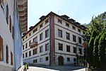
| Säbener Aufgang 2 ID: 15407 |
Säbener Aufgang 2 46 ° 38 ′ 23 ″ N, 11 ° 33 ′ 56 ″ E |
July 6, 1951 (MD) |
Urban residential building |
KG: Klausen building plot: 98
|
|
|
Seebegg ID: 15374 |
46 ° 38 ′ 19 ″ N, 11 ° 34 ′ 8 ″ E |
Oct 16, 1948 (MD) |
Raised hide |
KG: Gries near Klausen Building plot: 13
|

|
St. Katharina in Viers ID: 15433 |
46 ° 39 ′ 10 "N, 11 ° 34 ′ 41" E |
June 7, 1951 (MD) |
church |
KG: Latzfons building plot: 35
|

|
St. Peter in the forest in Latzfons ID: 15437 |
46 ° 40 ′ 30 ″ N, 11 ° 32 ′ 24 ″ E |
June 14, 1982 (BLR-LAB 3604) |
church |
KG: Latzfons building plot: 98
|

|
St. Sebastian ID: 50103 |
46 ° 38 ′ 47 "N, 11 ° 34 ′ 48" E |
Dec 11, 1937 (MD) |
church |
KG: Latzfons building plot: 1 basic plot: 1/5, 8/2, 9/1, 9/10
|

|
St. Theobald in Bad Froi ID: 15384 |
46 ° 37 ′ 48 "N, 11 ° 38 ′ 4" E |
June 14, 1982 (BLR-LAB 3604) |
church |
KG: Gufidaun building plot: 78
|

|
St. Valentin with cemetery chapel and cemetery in Verdings ID: 15434 |
46 ° 39 ′ 18 ″ N, 11 ° 34 ′ 16 ″ E |
June 14, 1982 (BLR-LAB 3604) |
church |
KG: Latzfons building plot: 309, 38 basic plot: 482
|

|
City parish church St. Andreas with cemetery chapel ID: 15393 |
46 ° 38 ′ 23 "N, 11 ° 34 ′ 0" E |
Nov. 13, 1978 (BLR-LAB 7795) |
church |
KG: Klausen building plot: 31, 33
|

|
Summersberg ID: 15379 |
46 ° 38 ′ 55 "N, 11 ° 36 ′ 12" E |
June 7, 1951 (MD) |
Castle |
KG: Gufidaun building plot: 3, 5
|

|
Telfner in Verdings ID: 15436 |
46 ° 39 '48 "N, 11 ° 33' 56" E |
June 14, 1982 (BLR-LAB 3604) |
Rural house / farm |
KG: Latzfons building plot: 57
|

|
Tinneplatz 15 ID: 15406 |
Tinneplatz 15 46 ° 38 ′ 22 ″ N, 11 ° 33 ′ 55 ″ E |
July 6, 1951 (MD) |
Urban residential building |
KG: Klausen building plot: 96
|
|
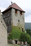
Gate tower and curtain wall by Säben ID: 15432 |
46 ° 38 ′ 36 "N, 11 ° 33 ′ 58" E |
June 14, 1982 (BLR-LAB 3604) |
Fortifications |
KG: Latzfons building plot: 22
|

|
Turmwirt ID: 15381 |
Gufidaun 50 46 ° 38 ′ 55 ″ N, 11 ° 36 ′ 9 ″ E |
June 14, 1982 (BLR-LAB 3604) |
Inn |
KG: Gufidaun building plot: 9
|

|
Our Lady of the Village ID: 15439 |
46 ° 40 ′ 13 "N, 11 ° 32 ′ 59" E |
June 14, 1982 (BLR-LAB 3602) |
church |
KG: Latzfons building plot: 102
|
| Lower town 5 ID: 15397 |
Lower City 5 46 ° 38 ′ 23 ″ N, 11 ° 33 ′ 57 ″ E |
July 6, 1951 (MD) |
Urban residential building |
KG: Klausen building plot: 37
|
|
| Lower town 6 ID: 15411 |
Lower City 6 46 ° 38 ′ 23 ″ N, 11 ° 33 ′ 57 ″ E |
July 25, 1951 (MD) |
Urban residential building |
KG: Klausen building plot: 102
|
|
| Lower town 9 ID: 15398 |
Lower town 9 46 ° 38 ′ 23 ″ N, 11 ° 33 ′ 57 ″ E |
Nov. 13, 1978 (BLR-LAB 7795) |
Urban residential building |
KG: Klausen building plot: 38
|
|
| Lower town 12 ID: 15410 |
Lower City 12 46 ° 38 ′ 23 ″ N, 11 ° 33 ′ 57 ″ E |
July 25, 1951 (MD) |
Urban residential building |
KG: Klausen building plot: 101
|
|

|
Lower town 20 ID: 15408 |
Lower City 20 46 ° 38 ′ 23 ″ N, 11 ° 33 ′ 56 ″ E |
July 6, 1951 (MD) |
Urban residential building |
KG: Klausen building plot: 99
|

|
Viaduct of the Val Gardena Railway ID: 50605 |
46 ° 38 ′ 36 "N, 11 ° 34 ′ 31" E |
5th Sep 2017 (BLR-LAB 971) |
102.85 m long stone viaduct |
KG: Griesbruck Land parcel: 5225/21
|

|
Villa Köster with outbuilding and park ID: 15375 |
46 ° 38 ′ 22 "N, 11 ° 34 ′ 13" E |
23 Aug 1988 (BLR-LAB 5419) |
Villa / summer cottage |
KG: Gries near Klausen Building plot : 28, 29 Basic plot: 121/1, 121/2, 121/3, 122, 123
|

|
Widum (Bärburg) ID: 15373 |
46 ° 38 ′ 21 ″ N, 11 ° 34 ′ 2 ″ E |
Nov. 13, 1978 (BLR-LAB 7795) |
Raised hide |
KG: Gries near Klausen Building plot: 6
|

|
Zollmauerhaus Säbener Aufgang 13 ID: 15403 |
Säbener Aufgang 13 46 ° 38 ′ 23 ″ N, 11 ° 33 ′ 54 ″ E |
July 25, 1951 (MD) |
Urban residential building |
KG: Klausen building plot: 86 |
If no coordinates are known for a monument, the cadastral data at the time it was placed under protection are given as a substitute. These are neither official nor necessarily up-to-date.
The addresses taken from the State Monuments Office may be out of date.
| Photo: | Photograph of the monument. Click the photo generates an enlarged view. There are also two symbols: |
| ID | Identifier at the South Tyrolean Monuments Office |
| KG | Cadastral parish |
| MD | Ministerial Decree |
| BLR-LAB | Decision of the state government - state committee decision |
Web links
- Monument browser of the South Tyrolean Monuments Office
- Monuments at the Klausen cultural property association
Individual evidence
- ^ Franz Caramelle : Anger . In: Oswald Trapp (ed.), Tiroler Burgenbuch. IV. Volume: Eisacktal . Publishing house Athesia, Bozen 1977, pp. 102-113.