
Losse (river)
| Losse | ||
 |
||
| Data | ||
| Water code | EN : 4296 | |
| location | Werra-Meißner district , Kassel district , Kassel , Hesse ( Germany ) | |
| River system | Weser | |
| Drain over | Fulda → Weser → North Sea | |
| source | on the Walberg near Hessisch Lichtenau 51 ° 11 ′ 34 ″ N , 9 ° 45 ′ 2 ″ E |
|
| Source height | approx. 402 m above sea level NHN | |
| muzzle | between Bettenhausen and Sandershausen in the Fulda coordinates: 51 ° 19 ′ 18 ″ N , 9 ° 32 ′ 14 ″ E 51 ° 19 ′ 18 ″ N , 9 ° 32 ′ 14 ″ E |
|
| Mouth height | approx. 135 m above sea level NHN | |
| Height difference | approx. 267 m | |
| Bottom slope | approx. 9.2 ‰ | |
| length | 28.9 km | |
| Catchment area | 120.58 km² | |
| Drain |
MQ |
1.418 m³ / s |
| Left tributaries | see below | |
| Right tributaries | see below | |
| Big cities | kassel | |
| Small towns | Hessian Lichtenau | |
| Communities | Helsa , Kaufungen , Niestetal | |

.JPG)
The Losse is a 28.9 km long, eastern and right tributary of the Fulda . It flows in the Werra-Meißner district , in the district of Kassel and in the independent city of Kassel in northern Hesse ( Germany ).
geography
course
The Losse rises in the Werra-Meißner district near Hessisch Lichtenau . Your source is in the Geo-Natural Park Mother Hulda country (Werratal.Meißner.Kaufunger Forest) on the western slope of the eastern the main town Walberg ( 429.3 m above sea level. NHN ), a gently sloping woodless survey with the former training area of the former Blücher barracks . Around 550 m southwest of its highest point, it lies on the edge of a grove at an altitude of around 402 m .
Initially, the Losse flows north-west in the geo-nature park into the core town of Hessisch Lichtenau, through which it first runs west and then north-west along federal road 7 and the Kassel – Waldkappel railway (Lossetalbahn) . Shortly afterwards it runs, continuing along both traffic arteries, to the confluence of the Saubach, northwest through the Hessisch Lichtenau district of Fürstenhagen , where the Börnchenbach flows into it.
The Losse then flows between the Kaufunger Wald on the right bank and the Söhre on the left bank in a north-westerly direction into the Kassel district, where it passes the Helsa village of Eschenstruth to the east , where the Fingergraben and the Männerwasser flow into it. Shortly after the men’s water confluence, the river crosses under the B 7 and the Lossetalbahn , and a little below it crosses the Hirschhagen tunnel . A little further north, after the Rohrgraben coming from the east towards the remote Eschenstruther housing estate Waldhof , it flows through again under the railway line. Then the Rohrberg ( 535.6 m ) rises to the east-southeast and the Bielstein ( 527.8 m ) to the west-northwest .
Then the Losse, continuing to the north along the B 7 and Lossetalbahn and crossing the railway line again before the confluence of the Hergesbach , reaches the Helsa core town, where the Wedemann brook comes from the east and the Ibach flows from the northeast. After the Ibach estuary, it again crosses under the railway line and flows north-west to Oberkaufungen , where it is first fed by the Lempersbach a little to the north opposite the Lossetalstadion and shortly afterwards again bridged by the railway line. The Losse then runs a little south past the Steinertsee and westwards to Niederkaufungen , where the Setzebach flows into it. After that, the flowing water strives to the northwest, after having crossed the B 7 twice and then flowing into the Diebach ditch coming from Mühlenberg ( 351.8 m ) to the north past the Kaufungen district of Papierfabrik .
When crossing under the federal motorway 7 (200 m long bridge), where it leaves the geo-nature park, the Losse flows into the independent city of Kassel . In this large city it flows through the Bettenhausen district , where it initially passes the Eichwald forest to the north and gradually moves away from the B 7 and Lossetalbahn . Later it forms the border between Bettenhausen and the Untereustadt district .
Finally , the Losse flows into the city limits of Sandershausen (part of the municipality of Niestetal ) within the artificially created Lossedeltas located in the Kassel area (see section History - 21st Century ) at about 135 m above sea level in the western Weser source river Fulda ; Opposite the estuary, across the Fulda, is the Kassel district of Wolfsanger .
Natural allocation
The Losse arises in the natural spatial main unit group Osthessisches Bergland (No. 35), in the main unit Fulda-Werra-Bergland (357) and in the subunit Witzenhausen-Altmorschener Talung (357.5) in the Hessisch Lichtenau Basin (357.51). In this natural area it flows to below Fürstenhagen. There the river changes into the natural area Söhre (357.70) belonging to the subunit Kaufunger Wald und Söhre (357.7) .
After that, the Losse flows from Oberkaufungen to below Niederkaufungen in the subunit Kassel Basin (343.3), and the lower reaches the natural area Kasseler Fuldaaue (343.30); Both belong in the main unit group West Hessian Mountains (34) to the main unit West Hessian Depression (343).
Catchment area and tributaries
The catchment area of the Losse is 120.58 km². Their tributaries include, viewed downstream (data - if not otherwise stated - according to the individual records mentioned in the table header):
| Surname | page | Length (km) |
Source | Muzzle | Estuarine location ( Location ) |
Mu stat. ( km ) |
EZG (km²) |
GKZ |
|---|---|---|---|---|---|---|---|---|
| height (m above sea level ) | ||||||||
| Bach at the train station | right | 0.4 | 386 | 378 | Hessisch Lichtenau (i) | 26.95 | 4296-112 | |
| Bach in Hessisch Lichtenau | Left | 1.1 | 402 | 370 | Hessisch Lichtenau (i) | 26.45 | 4296-114 | |
| Bach from Eisenberg | right | 1.1 | 419 | 364 | Hessisch Lichtenau (i) | 25.95 | 4296-116 | |
| Canal from Steinbach near Hessisch Lichtenau |
right | 1.7 | 395 | 361 | Hessisch Lichtenau (i) | 25.7 | 4296-118 | |
| Steinbach near Hessisch Lichtenau | right | 2.5 | 445 | 348 | Hessisch Lichtenau (u) | 25.05 | 6.12 | 4296-12 |
| Saubach | Left | 2.8 | 443 | 336 | Fürstenhagen (o) | 23.9 | 4296-194 | |
| Börnchenbach | Left | 2.8 | 379 | 332 | Fürstenhagen (i) | 23.55 | 5.97 | 4296-2 |
| Finger ditch | Left | 2 | 373 | 308 | Eschenstruth (o) | 21.05 | 4296-312 | |
| Men's water | Left | 3.9 | 458 | 306 | Eschenstruth (b) | 20.9 | 5.97 | 4296-32 |
| Steinbach near Eschenstruth | Left | 3.3 | 425 | 302 | Eschenstruth (u) | 20.35 | 4296-332 | |
| Pipe trench | right | 1.8 | 440 | 294 | Helsa - Waldhof (b) | 19.6 | 4296-334 | |
| Hergesbach | right | 4.3 | 430 | 274 | Helsa (o) | 17.25 | 6.49 | 4296-34 |
| Wedemann | right | 5.1 | 525 | 250 | Helsa (i) | 15.9 | 14.51 | 4296-4 |
| Ibach | right | 2.7 | 455 | 245 | Helsa (u) | 15.35 | 3.01 | 4296-52 |
| Bach from the Kuhplatz | right | 1.3 | 382 | 240 | Helsa (u) | 14.1 | 4296-5912 | |
| Brook from the Lewenbruch | right | 0.8 | 345 | 233 | Acquisitions (o) | 13.4 | 4296-5916 | |
| Bach from the hospital | right | 0.5 | 345 | 214 | Acquisitions (o) | 12.05 | 4296-5992 | |
| Bach from the Eduard-Dilling-Hütte |
Left | 1.8 | 335 | 210 | Acquisitions (i) | 11.35 | 4296-5996 | |
| Lempersbach | right | 3.4 | 344 | 195 | Acquisitions (u) | 10.35 | 6.79 | 4296-6 |
| Bach on Auestrasse | Left | 1.7 | 262 | 189 | Low purchases (o) | 9.05 | 4296-72 | |
| Setzebach (Setzelbach) | Left | 5.3 | 407 | 176 | Low purchases (u) | 7.45 | 8.21 | 4296-8 |
| Brook from the Birkengrund | Left | 1.9 | 235 | 174 | Low purchases (u) | 7.1 | 4296-912 | |
| Diebachsgraben | right | 5.1 | 306 | 169 | Paper mill (g) | 6.35 | 4296-916 | |
| Olebach | right | 2.7 | 169 | 150 | Bettenhausen (i) | 3.8 | 4296-992 | |
| Abbreviations: o = above, i = im, u = below from, b = at, g = opposite the point of the mouth | ||||||||
Localities
The villages on or not far from the Losse include - viewed downstream:
|
|
|
Protected areas
The source of the Losse and its upper course near the source are located in the fauna-flora-habitat area Glimmerode and Hambach near Hessisch Lichtenau (FFH No. 4824-308; 7.8271 km² in size). Between Fürstenhagen and Eschenstruth the flow passes through the conservation area (LSG) Lossetal at Fürstenhagen ( CDDA -No 378524;. Expelled 1956 17.32 ha ) and by the FFH area Lossetal at Fürstenhagen (FFH No. 4724-306;. 2 , 7198 km²). At Kaufungen-Papierfabrik it flows through the LSG Lossewiesen bei Niederkaufungen (CDDA no. 378525; 1996; 29 ha) and through the FFH area Lossewiesen bei Niederkaufungen (FFH no. 4723-304; 16.61 ha). In Kassel the Losse runs through the LSG Stadt Kassel (CDDA no. 378517; 1995; 19.8386 km²). The final section of the lower reaches and the mouth is in the bird sanctuary Fuldaaue near Kassel (VSG no. 4722-401; 8.2893 km²).
gallery

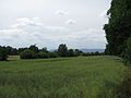
Lossetal in Kassel- Bettenhausen ; right the oak forest
Lossetal in Bettenhausen; with Hohem Habichtswald on the western horizon

The Losse in Bettenhausen above and ...

... below the bridge on Miramstrasse


history
.jpg)
Middle Ages to World War II
As early as the Middle Ages , the water power of the fast flowing Losse was used to drive numerous mills . In the course of time 34 mills established themselves, in Bettenhausen alone there were 12 on the mill canal of the Losse. The mills were only partly grinding mills, many of them were also or exclusively industrial mills that were used to drive machines. Many street names in the Kassel districts of Bettenhausen and Forstfeld still recall these mills. The mills include:
- the Agathof , first mentioned in 1377 under the name Lachenmühle , with changing functions as a grinding mill, gemstone cutting (the name Agat is probably derived from agate ) and later a chemical factory;
- the iron hammer , partly built in 1685, first a paper mill, then a sawmill and later the Rocholl stick factory ;
- the Herwigsmühle ( wire mill , Unterer Messinghof ), mentioned for the first time in 1410, which served mainly as a grinding mill and in which the brass yard's wire drawing shop was temporarily housed;
- the copper hammer ( supreme wire mill ), founded in 1680 and located above the brass yard , where part of the copper processing of the brass yard took place;
- the forest mill , first mentioned in 1407 , the later brass yard and brass works since the middle of the 16th century.
Second World War to the end of the 20th century
After the Second World War , the Losse was straightened in order to protect adjacent arable and pasture areas from flooding and erosion of the banks. This increased the flow rate of the water. Floods cause damage time and again, especially in the flat lower reaches and thus in the Kassel districts (cellars, for example, were full).
21st century
At the beginning of the 21st century, extensive renaturation work was carried out in almost the entire course of the Losse , which is based on a concept started in 1998 by the University of Kassel and serves to improve the ecological situation and also to protect against floods ; some of the measures continue.
Between the aforementioned crossing under the A 7 and the confluence of the Losse with the Fulda - and thus in Kassel - in 2004 (August 30 to December 21), among other things, the canal-like course of the Losse, enclosed in concrete walls, became a natural one River bed converted and retreat areas for animals and plants established.
It was also to February 2006, the former channel-straightened mouth of the Losse of the end of August 2005 - east of Kassel port located - by including previous arable and meadow areas for emerging estuary Losse Delta widened. For this purpose, nutrient-rich arable land was removed from around 60,000 m². The resulting hollow with a capacity of around 63,000 m³ serves not only as a delta but also as a flood protection area. From now on , the approximately 400 m long estuary is defined by river bends, branches and islands as well as small still waters . At the same time trees and bushes were planted. In the delta, amphibians , fish , insects and birds like the development of the landscape are left to their own devices. The processes in this artificially created nature reserve can be observed from a specially built observation hill, which, along with information boards, is located below the "Stadtreiniger depot" near the foot and cycle bridge over the Losse.
etymology
The origin of the name Losse is controversial, but there is a beautiful story that is still passed down today: Because the river was previously nameless, all the mayors of the neighboring towns came together a long time ago to choose a name for the river. However, despite the long consultation time, one could not agree. One of the advisors is said to have exclaimed wearily of the waiting time: “Losse doh be called as it will” (High German: “Let it be called what it wants”) - and this is how the Losse should have got its name.
Traffic and walking

By Lossetal extending between the Kaufunger forest and the Söhre of Hessian Lichtenau by Helsa and Kaufungen to Kassel Federal Highway 7 , which the Bundesautobahn 7 (200 m-long bridge) on the border of Kaufungen and Kassel crosses under. From the A 7, the part of the federal motorway 44 , which is partly still in the planning stage , partly under construction or completed in sections and leading to the southeast , will branch off . It should then run past Kaufungen and Helsa to Hessisch Lichtenau - partly through the river valley, on the mountain flanks or in tunnels near Helsa , Hirschhagen , Schulberg , Walberg . Through the valley also passing railway Kassel-Waldkappel (also Losse Talbahn or Kassel Forest Kappeler railway called) connecting the villages above each other along the Losse. The hiking trails that run along or cross the Losse include: Brüder-Grimm-Weg , Eder-Gelster-Weg , Franzosenstraße , Grimmsteig , Herkulesweg , Kassel-Steig , Lossetalradweg , Märchenlandweg and Riedforstweg .
Individual evidence
- ↑ a b c d Map services of the Federal Agency for Nature Conservation ( information )
- ↑ a b c d e f g Water map service of the Hessian Ministry for the Environment, Climate Protection, Agriculture and Consumer Protection ( information )
- ^ Hans-Jürgen Klink: Geographical land survey: The natural space units on sheet 112 Kassel. Federal Institute for Regional Studies, Bad Godesberg 1969. → Online map (PDF; 6.9 MB)
- ↑ Position of the mouth of the tributaries at / near the river kilometer of the Losse according to the kilometer (water station; stat.) In the water map service of the Hessian Ministry for the Environment, Climate Protection, Agriculture and Consumer Protection ( information )
- ↑ For a better overview and sorting downstream, a hyphen has been inserted for each river in the water body code (GKZ) after the number “4296”, which stands for the lot .
- ↑ Olebach: connecting channel between the mouth region of Diebachsgrabens and Losse
- ↑ a b c d Article: Inauguration of the new Losse Delta ( Memento from January 6, 2013 in the web archive archive.today ), on archive.is
- ↑ Photo: Lossedelta ( Memento from February 6, 2013 in the web archive archive.today ) from a bird's eye view with the Fulda in the background (2006), on archive.is
Web links
Website of KasselWasser (formerly Kassel Drainage Company; KEB) about the Losse:
- Inauguration of the new Losse Delta ( Memento from January 6, 2013 in the web archive archive.today ), on archive.is
- Kassel Förderschule takes on Bach sponsorship for the Losse ( memento from February 11, 2013 in the web archive archive.today ), on archive.is