
Mertendorf (Saxony-Anhalt)
| coat of arms | Germany map | |
|---|---|---|

|
Coordinates: 51 ° 7 ' N , 11 ° 51' E |
|
| Basic data | ||
| State : | Saxony-Anhalt | |
| County : | Burgenland district | |
| Association municipality : | Wethautal | |
| Height : | 165 m above sea level NHN | |
| Area : | 32.51 km 2 | |
| Residents: | 1639 (Dec. 31, 2019) | |
| Population density : | 50 inhabitants per km 2 | |
| Postal code : | 06618 | |
| Primaries : | 03445, 034422 | |
| License plate : | BLK, HHM, NEB, NMB, WSF, ZZ | |
| Community key : | 15 0 84 335 | |
| Community structure: | 13 districts | |
| Association administration address: | Corseburger Weg 11 06721 Osterfeld |
|
| Website : | ||
| Mayor : | Armin Kunze | |
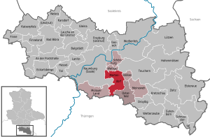
| Location of the municipality of Mertendorf in the Burgenland district | ||
  |
||

Mertendorf is a member municipality of the Wethautal association and is located in the Burgenland district in Saxony-Anhalt (Germany).

geography
Mertendorf is about 6 km southeast of Naumburg (Saale) an der Wethau . The following are identified as districts of the municipality:
|
history
The community was first mentioned in 1030 as Martindorf . In 1178 the abbot of the Pforta monastery bought 18 hoof goods from the place with all accessories. Later, the monastery also acquired the manorial lordship over the remaining goods in the place. In 1353 Heinrich von Busleben sold his possessions at Mertendorf and Punkewitz with all jurisdiction to the Pforta monastery . After the secularization of the Pforta monastery in 1540, Mertendorf and the neighboring town of Punkewitz belonged to the Pforta educational authority as an exclave from 1543 to 1815 . However, the two exclave locations had to pay their tax shock to the administrative office of Weißenfels . In the 18th century, lignite was discovered in the area around Mertendorf.
By the resolutions of the Vienna Congress Mertendorf came to Prussia and in 1816 the county Naumburg in the administrative district of Merseburg of the Province of Saxony assigned to the part of the site to the 1944th The exact dates of incorporation from Punkewitz and Wetterscheidt to Mertendorf are unknown, but they happened before 1950.
On July 1, 1950, the previously independent community Scheiplitz was incorporated. The place was reclassified to Görschen on January 1, 1963.
On January 1, 2010, the previously independent communities of Mertendorf (with the districts of Punkewitz and Wetterscheidt), Löbitz (with the districts of Utenbach , Cauerwitz and Seiselitz ) and Görschen (with the districts of Droitzen, Rathewitz and Scheiplitz) merged to form the new municipality of Mertendorf.
politics
Municipal council
The municipal council of Mertendorf consists of ten council members.
mayor
The honorary mayor Armin Kunze was elected on September 25, 2016.
traffic
To the federal highway 180 , which runs north of the community from Naumburg (Saale) to Zeitz , it is approx. 2 km. Mertendorf has been a stop on the Naumburg – Teuchern railway line since 1900 . However, passenger traffic was discontinued in December 2011.
Monuments
- War memorial at the intersection of Wettaburger Strasse and Strasse des Friedens
- The Protestant Church of St. Martin
Personalities
- Johann Karl von der Becke (1756–1830), lawyer and minister in the Duchy of Saxony-Gotha-Altenburg
literature
- Louis Naumann : Mertendorf and Punkewitz: From hereditary interest registers d. Cathedral chapter , Heuneburg 1937
Web links
Individual evidence
- ↑ State Statistical Office Saxony-Anhalt, population of the municipalities - as of December 31, 2019 (PDF) (update) ( help ).
- ↑ Small stories on Saxon-Thuringian history, Volume 2, pp. 143f.
- ^ Karlheinz Blaschke , Uwe Ulrich Jäschke : Kursächsischer Ämteratlas , Leipzig 2009, ISBN 978-3-937386-14-0 ; P. 34f.
- ↑ Earth description of the Electoral and Ducal Saxon Lands, p. 164
- ^ Locations of the Prussian district of Naumburg in the municipal directory 1900
- ^ Punkewitz on www.genealogy.net
- ↑ Wetterscheidt on www.genealogy.net
- ↑ StBA: Area changes from January 01 to December 31, 2010
Cities: Bad Bibra | Eckartsberga | Freyburg (Unstrut) | Laucha on the Unstrut | Lützen | Naumburg (Saale) | Nebra (Unstrut) | Osterfeld | Weißenfels | Zeitz . Municipalities: An der Poststraße | Balgstädt | Droyziger | Elsteraue | Fin | Finneland | Gleina | Goseck | Gutenborn | Hohenmölsen | Imperial Palace | Karsdorf | Kretzschau | Lanitz-Hassel Valley | My pain | Mertendorf | Molau Country | Schnaudertal | Schönburg | Bumps | Teuchern | Wethau | Weather cap .