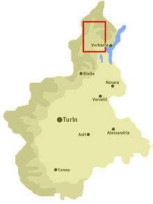
Pallanzeno
| Pallanzeno | ||
|---|---|---|

|
|
|
| Country | Italy | |
| region | Piedmont | |
| province | Verbano-Cusio-Ossola (VB) | |
| Coordinates | 46 ° 3 ' N , 8 ° 16' E | |
| height | 230 m slm | |
| surface | 4 km² | |
| Residents | 1,138 (Dec. 31, 2019) | |
| Population density | 285 inhabitants / km² | |
| Post Code | 28020 | |
| prefix | 0324 | |
| ISTAT number | 103052 | |
| Popular name | pallanzenesi | |
| Patron saint | Simon Petrus ( June 29 ) | |
| Website | Pallanzeno | |
Pallanzeno is a municipality in the Italian province of Verbano-Cusio-Ossola (VB) in the Piedmont region .
geography
The municipality covers an area of 4 km² . The neighboring municipalities are Beura-Cardezza , Calasca-Castiglione , Piedimulera , Borgomezzavalle , Villadossola and Vogogna .
history
In the Middle Ages, Pallanzeno was a small village associated with Vogogna, but over the years it grew, including in population. During the years of the Second World War, the parish was small and strongly linked to the industrial activities of Villadossola, and almost entirely covered by fields of vine and wheat. Wet from the Toce River , at the point where it flows by, you can still see what the area around the river was like of wild rabbits, foxes and various species of birds.
population
| Population development | |||||||||||||||
|---|---|---|---|---|---|---|---|---|---|---|---|---|---|---|---|
| year | 1861 | 1871 | 1881 | 1901 | 1921 | 1931 | 1951 | 1971 | 1991 | 2001 | 2011 | 2017 | 2018 | ||
| Residents | 480 | 490 | 513 | 580 | 724 | 787 | 1002 | 1127 | 1230 | 1210 | 1176 | 1136 | 1136 | ||
literature
- Various authors: Comuni della Provincia del Verbano-Cusio-Ossola. Consiglio Regionale del Piemonte, Chieri 2012, ISBN 9788896074503 .
- Various authors: Il Piemonte paese per paese. Bonechi Editore, Firenze 1996, ISBN 88-8029-156-4 .
Web links
- Pallanzeno (Italian) on tuttitalia.it/piemonte
- Pallanzeno (Italian) on comuni-italiani.it
- Pallanzeno (Italian) on piemonte.indettaglio.it/ita/comuni
- Public transport timetable of the Verbano-Cusio-Ossola Province (Italian)
- Pallanzeno on the ETHorama platform
Individual evidence
- ↑ Statistiche demografiche ISTAT. Monthly population statistics of the Istituto Nazionale di Statistica , as of December 31 of 2019.


