
Pflausach
|
Pflausach ( Rotte ) village |
|||
|---|---|---|---|
|
|||
| Basic data | |||
| Pole. District , state | Sankt Veit an der Glan (SV), Carinthia | ||
| Judicial district | Sankt Veit an der Glan | ||
| Pole. local community | Liebenfels ( KG Pflausach ) | ||
| Coordinates | 46 ° 45 '47 " N , 14 ° 15' 48" E | ||
| height | 820 m above sea level A. | ||
| Residents of the village | 56 (January 1, 2020) | ||
| Building status | 16 (January 1, 2011 ) | ||
| Statistical identification | |||
| Locality code | 01687 | ||
 Pflausach, house number 2 and 3 |
|||
| Source: STAT : index of places ; BEV : GEONAM ; KAGIS | |||

Pflausach is a village in the municipality of Liebenfels in the Sankt Veit an der Glan district in Carinthia . The village has 56 inhabitants (as of January 1, 2020). It lies entirely in the area of the cadastral municipality of Pflausach .
location
The village is located in the southwest of the Sankt Veit an der Glan district, west of Sörg . The farms and houses between the Höllwald in the west and the Harter Bach in the east belong to it ; are adjacent to the center of the location (houses No. 2 to 5.) inter alia the farms Steiner (no. 8) in the south on the way to Gradenegg , Rosenberger (no. 1) in the south on the way to Glantschach , the only hard from reachable Riesinger (No. 6) in the north, as well as two dilapidated houses (No. 9) in the southeast, above the Harter Bach.
history
The place is first mentioned in 1285 as Plauzah , which is derived from the Slovenian Pluzah (= "with the plowers"; compare the neighboring village of Pflugern on the other side of the Harter Bach ).
Belonging to the tax municipality Pflausach, the place was part of the tax district Gradenegg in the first half of the 19th century . When the local congregations were formed in the course of the reforms after the revolution of 1848/49, the place first came to the municipality of Glantschach and in 1875 to the municipality of Sörg . Since the merger of the municipalities of Sörg and Liebenfels in 1973, Pflausach has belonged to the municipality of Liebenfels.
In recent decades, more and more buildings in the center of the village have been acquired or built by Camphill Liebenfels, who is committed to anthroposophic social therapy .
Population development
The following population figures were counted for the village:
- 1800: 10 houses
- 1869: 9 houses, 89 inhabitants
- 1880: 8 houses, 79 inhabitants
- 1890: 9 houses, 83 inhabitants
- 1900: 8 houses, 54 inhabitants
- 1910: 8 houses, 76 inhabitants
- 1923: 8 houses, 62 inhabitants
- 1934: 46 inhabitants
- 1961: 9 houses, 51 inhabitants
- 2001: 14 buildings (14 of them with main residence) with 15 apartments and 15 households; 61 residents and 4 cases of secondary residence
- 2011: 16 buildings, 51 inhabitants
There is 1 workplace in the village (as of 2011; 2001: 2) and 7 agricultural and forestry operations (as of 2001).
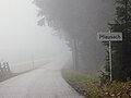
Place name sign Pflausach, on the street from Hart

Center of Pflausach, from left to right houses No. 2 to 5 with outbuildings. Left above house number 7.

Pflausach house no.7

Pflausach village sign, at house number 2


Individual evidence
- ↑ Statistics Austria: Population on January 1st, 2020 by locality (area status on January 1st, 2020) , ( CSV )
- ^ Community Liebenfels (ed.): Community chronicle Liebenfels. 1998. p. 396.
- ^ Christian Crusius: Topographical Post-Lexicon of all localities of the kk hereditary countries. Volume 2. Vienna 1800. p. 237.
- ^ Central Statistical Commission: Local Repertory of the Duchy of Carinthia. Based on the census of December 31, 1869. Carl Gerold's Sohn, Vienna 1872. P. 72.
- ^ KK Statistische Central-Commission (Ed.): Complete list of localities of the kingdoms and countries represented in the Reichsrathe according to the results of the census of December 31, 1880. Alfred Hölder, Vienna 1882. S. 60.
- ↑ KK Statistische Central-Commission (Hrsg.): Local repertories of the kingdoms and countries represented in the Austrian Reichsrathe. Revised based on the results of the census of December 31, 1890. V. Carinthia. Alfred Hölder, Vienna 1894. p. 61.
- ↑ KK Central Statistical Commission (ed.): Community encyclopedia of the kingdoms and countries represented in the Reichsrat. Revised based on the results of the census of December 31, 1900. V. Carinthia. KK Hof- und Staatsdruckerei, Vienna 1905. p. 82.
- ^ Central Statistical Commission (ed.): Special locations repertory of the Austrian countries. Edited on the basis of the results of the census of December 31, 1910. V. Carinthia. Verlag der Staatsdruckerei, Vienna 1918. p. 43.
- ^ Federal Statistical Office (ed.): Directory of Austria. Edited on the basis of the results of the census of March 7, 1923. Österreichische Staatsdruckerei, Vienna 1930. Section Carinthia, p. 18.
- ↑ Handwritten addendum to the 1923 local directory (Federal Statistical Office (Hrsg.): Local directory of Austria. Edited on the basis of the results of the census of March 7, 1923. Österreichische Staatsdruckerei, Vienna 1930.) with the signature II 28238 of the Klagenfurt University Library. Section Carinthia, p. 18.
- ^ Austrian Central Statistical Office: Directory of Austria. Edited on the basis of the results of the census of March 21, 1961. Österreichische Staatsdruckerei, 1965. p. 257.
- ↑ a b c Statistics Austria (Ed.): Local directory 2001 Carinthia. Vienna 2004. 112.
- ^ A b Office of the Carinthian regional government, regional statistical office: Carinthian local directory. Territorial status January 1, 2014. Klagenfurt, 2014.

Cadastral communities: friendly | Glantschach | Gradenegg | Hardegg | Liebenfels | Liemberg | Pflausach | Rosenbichl | Rottschaft Feistritz | Sörg | Soergerberg
Locations: Bärndorf | Beißendorf | Harrows I | Harrows II | Friendly | Gasmai | Glantschach | Gßeberg | Dig | Gradenegg | Grassendorf | Reason | Hardegg | Hard | Hoch-Liebenfels | Hohenstein | Kraindorf | Kulm | Ladein | Lebmach | Liebenfels | Liemberg | Lorberhof | Mailsberg | Metschach | Miedling | Moss | Pflausach | Plowing | Pulse | Puppitsch | Radelsdorf | Rasting | Reidenau | Rohnsdorf | Rosenbichl | Sörg | Sörgerberg | St. Leonhard | Chadam | Waggendorf | Wasai | Weitensfeld | Woitsch | Zmuln | Zojach | Zwattendorf | Two churches
(Former) parts of the village: Grientschach | Undergrowth | Schoberhof | Seidelhof | Divorce
Counting district: Liebenfels-Nord | Liebenfels-Süd | Sörg
Former communities: Community of Glantschach 1850–1875 | Hardegg municipality 1850–1958 | Liemberg municipality 1850–1958 | Municipality of Pulst 1850–1958 (of which 1850–1875 as municipality of Feistritz ) | Municipality of Sörg 1875–1973