
Liebenfels (municipality of Liebenfels)
|
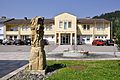
Liebenfels ( village ) locality ( capital of the municipality ) |
|||
|---|---|---|---|
|
|||
| Basic data | |||
| Pole. District , state | Sankt Veit an der Glan (SV), Carinthia | ||
| Judicial district | Sankt Veit an der Glan | ||
| Pole. local community | Liebenfels ( KG Liebenfels , Rottschaft Feistritz ) | ||
| Coordinates | 46 ° 44 '14 " N , 14 ° 17' 22" E | ||
| height | 487 m above sea level A. | ||
| Residents of the village | 765 (January 1, 2020) | ||
| Building status | 171 (January 1, 2011 ) | ||
| Statistical identification | |||
| Locality code | 01470 | ||
 Liebenfels, view from the south |
|||
| Source: STAT : index of places ; BEV : GEONAM ; KAGIS | |||

Liebenfels (before 1958: Feistritz ) is a village in the municipality of Liebenfels in the Sankt Veit an der Glan district in Carinthia . The village has 765 inhabitants (as of January 1, 2020). It lies in the area of the cadastral communities of Liebenfels , Rottschaft Feistritz and Rosenbichl .
location
The village is located in the southwest of the Sankt Veit an der Glan district. The center was where the Feistritzbach coming from the Wimitz mountains reaches the plain of the Glantalboden with the St. Veit - Villach road; In the last decades the place has grown strongly and on the left side of the Glan it has expanded far over the Glantalboden.
history
The place was named Veustritz in 1285 , which is derived from the Slovenian Bistrica (= wild stream ). At first it was a small farming village, from the 16th century it became the center of the iron industry in the Upper Glantal and there were several mills and saws, mainly on Feistritzbach , in the village. The place was on the road connection from Sankt Veit an der Glan to Villach and thus on Triester Straße . There has been a train station in town since 1871. But in addition to the decline of the iron industry, there was also a flood disaster in 1874, which destroyed the mills and saws.
The place lies at the intersection of three cadastral communities, and in the early 19th century it was also at the intersection of three tax districts: The houses on the area of the former tax community Feistritz (today Liebenfels ) belonged to the tax district Karlsberg in the first half of the 19th century , the houses in the area of the tax community Rottschaft Feistritz belonged to the tax district Kraig and Nussberg , and the few houses which were in the area of the tax community Rosenbichl belonged to the tax district Rosenbichl . When the local congregations were founded in the course of the reforms after the revolution of 1848/49, the houses in the area of the cadastral municipality of Rottschaft Feistritz came first to the municipality of Glantschach , while the houses in the cadastral municipalities of Feistritz (today Liebenfels ) and Rosenbichl to the municipality of Feistritz . Feistritz was conveniently located on the main road and railroad, but the most important facilities of the community and also the parish church were in Pulst , north of the Glantal , so that the community was renamed Pulst in 1865 . In 1875 the cadastral community of Rottschaft Feistritz was attached to the community of Pulst; since then the entire place has belonged to one community.
In 1958, Feistritz became the capital of the large community created at the time by the merger of the communities Pulst , Liemberg and Hardegg . Since there were already several communities called Feistritz in Carinthia, the new community was named Liebenfels after the Liebenfels castle ruins , and the place Feistritz was also renamed Liebenfels . Since the 1960s, the place has grown strongly due to brisk construction activity, the municipal office was also moved from Pulst to Liebenfels in 1963 and gained in importance through the merger with the municipality of Sörg in 1973. A Catholic pastoral care center was also established in Liebenfels; the two branch churches St. Johann and St. Thomas , which are documented for the place , had long since gone.
Population development
The following population figures were counted for the village, including the Seidelhof:
- 1869: 24 houses, 139 inhabitants
- 1880: 25 houses, 154 inhabitants
- 1890: 24 houses, 164 inhabitants
- 1900: 22 houses, 154 inhabitants
- 1910: 24 houses, 172 inhabitants
- 1923: 25 houses, 200 inhabitants
- 1934: 212 inhabitants
- 1961: 65 houses, 483 inhabitants
- 2001: 146 buildings (including 146 with main residence) with 293 apartments and 283 households; 712 residents and 16 secondary residence cases
- 2011: 171 buildings, 723 inhabitants
There are 47 workplaces in the village (as of 2011; 2001: 40) and 14 agricultural and forestry operations (as of 2001).
Part of the Seidelhof village
The Seidelhof, just under a kilometer east of the center of the village, is part of the village and was included in censuses for a while as part of the village :
- 1900: 1 house, 4 inhabitants
- 1910: 1 house, 12 inhabitants
- 1923: 1 house, 15 inhabitants
- 1961: 1 house, 17 inhabitants
The Seidelhof is mentioned in a document even before 1570. In 1610 it was a noble seat of Balthasar Kulmer von Hohenstein.
Liebenfels municipal office

Catholic pastoral care center Liebenfels

Liebenfels cultural center

Liebenfels primary school


Individual evidence
- ↑ Statistics Austria: Population on January 1st, 2020 by locality (area status on January 1st, 2020) , ( CSV )
- ↑ a b Community Liebenfels (ed.): Community chronicle Liebenfels. 1998, p. 388.
- ^ Central Statistical Commission: Local Repertory of the Duchy of Carinthia. Based on the census of December 31, 1869. Carl Gerold's Sohn, Vienna 1872. p. 76.
- ^ KK Statistische Central-Commission (Ed.): Complete list of localities of the kingdoms and countries represented in the Reichsrathe according to the results of the census of December 31, 1880. Alfred Hölder, Vienna 1882. S. 59.
- ↑ KK Statistische Central-Commission (Hrsg.): Local repertories of the kingdoms and countries represented in the Austrian Reichsrathe. Revised based on the results of the census of December 31, 1890. V. Carinthia. Alfred Hölder, Vienna 1894. p. 60.
- ↑ a b K. K. Central Statistical Commission (ed.): Community encyclopedia of the kingdoms and countries represented in the Reichsrat. Revised based on the results of the census of December 31, 1900. V. Carinthia. KK Hof- und Staatsdruckerei, Vienna 1905. p. 80.
- ↑ a b Statistical Central Commission (Ed.): Special locations repertory of the Austrian countries. Edited on the basis of the results of the census of December 31, 1910. V. Carinthia. Verlag der Staatsdruckerei, Vienna 1918. p. 41.
- ↑ a b Federal Statistical Office (ed.): Local directory of Austria. Edited on the basis of the results of the census of March 7, 1923. Österreichische Staatsdruckerei, Vienna 1930. Section Carinthia, p. 17.
- ↑ Handwritten addendum to the 1923 local directory (Federal Statistical Office (Hrsg.): Local directory of Austria. Edited on the basis of the results of the census of March 7, 1923. Österreichische Staatsdruckerei, Vienna 1930.) with the signature II 28238 of the Klagenfurt University Library. Section Carinthia, p. 17.
- ^ A b Austrian Central Statistical Office: Directory of Austria. Edited on the basis of the results of the census of March 21, 1961. Österreichische Staatsdruckerei, 1965. p. 256.
- ↑ a b c Statistics Austria (Ed.): Local directory 2001 Carinthia. Vienna 2004. 112.
- ^ A b Office of the Carinthian regional government, regional statistical office: Carinthian local directory. Territorial status January 1, 2014. Klagenfurt, 2014.
- ^ Community Liebenfels (ed.): Community chronicle Liebenfels. 1998, p. 390.

Cadastral communities: friendly | Glantschach | Gradenegg | Hardegg | Liebenfels | Liemberg | Pflausach | Rosenbichl | Rottschaft Feistritz | Sörg | Soergerberg
Locations: Bärndorf | Beißendorf | Harrows I | Harrows II | Friendly | Gasmai | Glantschach | Gßeberg | Dig | Gradenegg | Grassendorf | Reason | Hardegg | Hard | Hoch-Liebenfels | Hohenstein | Kraindorf | Kulm | Ladein | Lebmach | Liebenfels | Liemberg | Lorberhof | Mailsberg | Metschach | Miedling | Moss | Pflausach | Plowing | Pulse | Puppitsch | Radelsdorf | Rasting | Reidenau | Rohnsdorf | Rosenbichl | Sörg | Sörgerberg | St. Leonhard | Chadam | Waggendorf | Wasai | Weitensfeld | Woitsch | Zmuln | Zojach | Zwattendorf | Two churches
(Former) parts of the village: Grientschach | Undergrowth | Schoberhof | Seidelhof | Divorce
Counting district: Liebenfels-Nord | Liebenfels-Süd | Sörg
Former communities: Community of Glantschach 1850–1875 | Hardegg municipality 1850–1958 | Liemberg municipality 1850–1958 | Municipality of Pulst 1850–1958 (of which 1850–1875 as municipality of Feistritz ) | Municipality of Sörg 1875–1973