Pont-de-Buis-lès-Quimerch
| Pont-de-Buis-lès-Quimerch | ||
|---|---|---|

|
|
|
| region | Brittany | |
| Department | Finistère | |
| Arrondissement | Chateaulin | |
| Canton | Pont-de-Buis-lès-Quimerch | |
| Community association | Presqu'île de Crozon-Aulne maritime | |
| Coordinates | 48 ° 15 ′ N , 4 ° 5 ′ W | |
| height | 0-278 m | |
| surface | 41.39 km 2 | |
| Residents | 3,792 (January 1, 2017) | |
| Population density | 92 inhabitants / km 2 | |
| Post Code | 29590 | |
| INSEE code | 29302 | |
| Website | pontdebuislesquimerch.fr | |
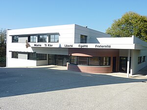
 Mairie Pont-de-Buis-lès-Quimerch |
||
Pont-de-Buis-lès-Quimerch ( Breton Pont-ar-Veuzenn ) is a French commune with 3792 inhabitants (as of January 1, 2017) in the Bretagne region in the Finistère department .
geography
The village is traversed by the Douffine River, which reaches the Aulne around two kilometers further . In this section, the douffine forms a funnel mouth .
Quimper is 28 kilometers south, Brest 32 kilometers northwest and Paris about 480 kilometers east.
The municipality has an exit on the expressway E 60 ( Nantes -Brest) and a regional station on the almost parallel railway line Savenay-Landerneau .
history
Pont-de-Buis-lès-Quimerch is the youngest commune in the Finistère department. In 1949 the Quimerch transmitter was built, and the new municipality of Pont-de-Buis was founded from parts of the municipalities of Saint-Ségal and Quimerch . This was merged with the municipalities of Quimerch and Logonna-Quimerch in 1965 and has been called Pont-de-Buis-lès-Quimerch ever since.
Population development
| year | 1962 | 1968 | 1975 | 1982 | 1990 | 1999 | 2009 | 2017 |
| Residents | 3060 | 3999 | 3916 | 3710 | 3373 | 3385 | 3821 | 3792 |
| Sources: Cassini and INSEE | ||||||||
literature
- Le Patrimoine des Communes du Finistère. Flohic Editions, Volume 1, Paris 1998, ISBN 2-84234-039-6 , pp. 446-449.

