
St. Veit in Defereggen
|
St. Veit in Defereggen
|
||
|---|---|---|
| coat of arms | Austria map | |
 |
|
|
| Basic data | ||
| Country: | Austria | |
| State : | Tyrol | |
| Political District : | Lienz | |
| License plate : | LZ | |
| Surface: | 61.45 km² | |
| Coordinates : | 46 ° 56 ' N , 12 ° 26' E | |
| Height : | 1495 m above sea level A. | |
| Residents : | 639 (January 1, 2020) | |
| Postal code : | 9962 | |
| Area code : | 04879 | |
| Community code : | 7 07 26 | |
| NUTS region | AT333 | |
| Address of the municipal administration: |
Gsaritzen 28 9962 St. Veit in Defereggen |
|
| Website: | ||
| politics | ||
| Mayor : | Vitus Monitzer | |
|
Municipal Council : (2016) (11 members) |
||
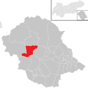
| Location of St. Veit in Defereggen in the Lienz district | ||
  |
||
| Source: Municipal data from Statistics Austria | ||

St. Veit in Defereggen is a municipality with 639 inhabitants (as of January 1, 2020) in the Austrian state of Tyrol , district of Lienz (East Tyrol). The municipal area includes the central Defereggental and some side valleys. Almost a quarter of the municipality belongs to the Hohe Tauern National Park .
The settlement took place from around 200 AD by farmers from the Virgental , who initially used the sunny slopes as summer pastures for their cattle. Until the 15th century the population lived mainly from agriculture and cattle breeding, after which mining was dominant for a long time. Today tourism is the main source of income for the population. Politically, St. Veit belonged to Salzburg. This affiliation began at the beginning of the 13th century and did not end until 1803. St. Veit was first mentioned in a document in 1313.
geography
location
St. Veit is located in the middle Defereggental on a southern slope at an altitude of 1,495 m above sea level. A. and is the highest municipality in East Tyrol. Due to the location on the “sunny side” of the valley, even grain and potatoes could be grown in the past. However, it also happens in the summer months that snow falls. The Schwarzach flows through the Defereggental . The community extends over several hamlets and farms in the valley and on the slopes. Place names such as Gsaritzen, Gritzen or Görtschach are of Slavic origin.
Community structure
|
structure
|
||||||
|
Legend for the breakdown table
|
| Population distribution 2001 | |
|---|---|
| Bruggen | 269 |
| Goertschach | 155 |
| Alleys | 9 |
| Grits | 127 |
| Gsaritzen | 132 |
| moss | 99 |

The municipality of St. Veit is divided into the six fractions Bruggen, Görtschach, Gassen, Gritzen, Gsaritzen and Moos. The largest fraction is Bruggen. It is entirely in the valley. The districts of Rauth, Bruggen, Feld, Schnall, Abersboden and Mentlerboden belong to it. This is where the Gritzen parliamentary group joins. The districts of Osing and Zotten are still in the valley. Egg and Obergritzen are on the slope. Also in the valley, in the district of Zotten, is the Görtschach fraction. Görtschach is also partly on the slope. The hamlets Ausserzotten, Scheibelrauth, Kurzthal, Unteregg, Auseregg, Ratschitsch and Linden belong to Görtschach. The center of St. Veit itself belongs to the Gsaritzen fraction. This fraction is already at an altitude of 1500 to 1650 m. This is where the percent and Oberholz farms are located. Out of the valley, in the east of the municipality, lies the Moos fraction. The hamlets of Mellitz, Bergl, Unterbergl, Gampele, Moos, Köfele and Birk belong to it. The smallest fraction is Gassen. Gassen was only opened with a street in 2007. Two houses belong to it. The life on the steep slope nature and culture trail, set up by the Hohe Tauern National Park , leads through alleys .
In the center at an altitude of 1500 m is the parish church, which is dedicated to St. Vitus and has been occupied since 1313, the rectory, the municipal office, a two-class elementary school and an inn. Years ago the post office and the grocery store were closed.
Neighboring communities
Neighboring communities in Defereggental are St. Jakob in Defereggen in the west and Hopfgarten in Defereggen in the east . In the north, St. Veit borders on Virgen and Matrei in East Tyrol, and in the south on Ausservillgraten and Innervillgraten in Pustertal . There are no road connections to the communities in the north and south.
Land use
A large part of the municipal area is used for agriculture or forestry. However, there are only a few full-time or part-time businesses. Already in 1999, 84% of the area was cultivated by legal entities, 5% of the area by full-time businesses and 11% by part-time businesses. 22% of the municipality is in the Hohe Tauern National Park.
history

colonization
The first traces of settlement are finds of Roman ceramics and a bone pin that was found during excavations in the Church of St. Vitus. In addition, a spindle whorl, presumably from the Roman era, was found in Feld. These finds are exhibited today in the Defereggental Time Travel Museum in St. Jakob. St. Vitus was settled by immigrating Slavs in the Middle Ages. First of all, starting from the Virgental, they used the sunny slopes above St. Veit as summer pasture for their cattle. Field names still preserved today indicate this settlement. Later, due to the Christianization of the Alpine region, settlers from Bavarian regions increasingly immigrated . Since more settlement space was needed, the Defereggental valley area was also increasingly populated.
First mention

A pastor of St. Veit and thus the place is mentioned for the first time in 1313. At that time the parish belonged to the Archdiocese of Salzburg both ecclesiastically and politically . Affiliation did not end until 1803. However, St. Veit was not independent, but as a curate with its own priest financially and legally dependent on Windisch-Matrei . The parish church of St. Vitus was built at the beginning of the 15th century and is therefore the oldest preserved building in the community. However, some very old wooden houses are still preserved, such as an old bird feeder in Gassen with the year 1502 on a wooden beam.
Mining and peddlers
Mining also reached St. Vitus in the late Middle Ages. Because of him, the population rose to 2,000 at the end of the 15th century. Numerous tunnels were created in the municipality. There are still two trial tunnels near the Rotte Osing.
The rapidly growing population could no longer be fed by agriculture and livestock farming alone, especially since with increasing depletion of the deposits, mining also no longer brought the necessary income. More and more valley dwellers got into the peddler business , which has been mentioned since the 17th century. Most of the time in the winter months, many men left the valley to go on a journey. This trade eventually stretched from Hamburg to Egypt and from Paris to Moscow. These undertakings were carried out in companies, called companies, and the profit made was distributed according to the amount of the investment, the knowledge and skills of the shareholders.
Around 1820 the peddler trade experienced a significant expansion with the addition of Krainer straw hats. These cheap goods were replaced around 1850 by finer Italian products from Bassano and Marostica in Veneto , the so-called "Venetian hats". The turmoil during the revolution of 1848 led to a serious crisis in the peddler trade in the pre- March period. The companies were therefore forced to change the previous form of trade and to set up permanent shops in various cities.
An economically very important and well-known good was the Deferegger straw hat, which was later increasingly produced in factories outside the Defereggental throughout Austria-Hungary . Well-known Defereggen company was P. Ladstätter & Sons , which even became a purveyor to the court .
Expulsion of the Deferegg Protestants
The teachings of Martin Luther found their way into the Defereggental around 1600 probably through the miners or through the journeys of the peddlers . After Salzburg Archbishop Max Gandolf von Kuenburg learned of the presence of the Protestants in 1666 , questioning and interrogation followed. In 1684 a Protestant leader was arrested. As a result, 70 farmers moved to Matrei and, in accordance with the provisions of the Peace of Westphalia, applied to be able to hold onto their doctrine or to be allowed to leave the country. The archbishop then asked them to return to the Catholic faith or to prepare for deportation. Contrary to the provisions of the Peace of Westphalia, they were given only 36 or 50 days instead of three years to prepare for deportation and to sell their belongings. In December 1684 the first Defereggers had to leave the valley. Children under the age of 15 were not allowed to accompany their parents. These should stay in the valley and be brought up in the Catholic faith. Almost 620 adults were forced to leave the country, 290 children had to stay behind. However, many of them were later kidnapped from the valley by their parents. However, Protestantism did not finally die out in the valley at the beginning of the 18th century.
St. Vitus in the 20th century
The establishment of factories for the production of the Deferegger straw hat and also of watch factories led to an increased emigration of the population in the 19th century. However, the increased contacts also brought new influences into the valley. At the end of the 19th century, the Defereggental was opened up from Huben with a road. As a result, tourism also experienced an initial boom. In the meantime, tourism has become the most important industry in the valley. The community got its first post office in 1870 in the hamlet of Zotten. In 1987 it was moved to St. Veit and closed in 2002. The road to St. Veit was not completed until World War II. Construction had already started in the 1930s.
Flood disaster in 1965
After it had rained heavily for several days at the beginning of September, a mudslide broke out in the hamlet of Gassen on the night of September 3rd. This hit a semi-detached house in which 16 residents had gathered due to its location, which was previously considered safe. Six people died, three had left the house beforehand, seven were rescued. As a result of this event, the surviving residents moved away except for one pair of siblings. In the valley too, houses near the Schwarzach had to be evacuated, courtyards were no longer accessible because the floods flooded the paths. Several houses and the St. John's Chapel in Bruggen were destroyed. In the documentary "Unterwegs nach ... Heimat" from 2004, the disaster was dealt with on film. The documentary was awarded the Romy 2005 .
politics
Municipal council
The municipal council consists of eleven members who are elected every six years in the course of the Tyrolean municipal council elections. Since the 2016 municipal council election, it has consisted of mandates from the following groups of voters:
The group of voters “Together for our St. Veit with Mayor Vitus Monitzer” won 5 seats. The group of voters “With us in St. Veit” won 2 seats, the group of voters “List 3 For St. Veit” won 4 seats. Vitus Monitzer has been the directly elected mayor of St. Veit since 1998.
coat of arms
In 1975 the municipality was given a coat of arms by the Tyrolean provincial government. It shows St. Vitus, the namesake of the community. According to his legend, he is in an oil kettle over red flames, carrying the martyr's palm in his left hand, his right hand is raised. The coat of arms shows him in black on a gold shield. The municipal flag also shows the color combination black and yellow.
Community partnerships
Culture and sights
Personalities
- Reimmichl Sebastian Rieger, a Roman Catholic priest and poet.
literature
- Matthias Hofmann: Chronicle St. Veit in Defereggen. From the beginning until 1889. Ed. v. M. Hafele, M. Huber, St. Veit 1997
- Heinz Kröll, Gert Stemberger: Defereggen - a landscape in Tyrol. Dr. A.Schendl Verlag, Vienna 1985
Web links
- 70726 - St. Veit in Defereggen. Community data, Statistics Austria .
Individual evidence
- ↑ History of the National Park in Tyrol ( page no longer available , search in web archives ) Info: The link was automatically marked as defective. Please check the link according to the instructions and then remove this notice.
- ↑ a b municipality data St. Veit in Defereggen VZ 2001 (Statistics Austria)
- ↑ Zwanowetz: Ladstätter, Peter sen .. In: Austrian Biographical Lexicon 1815-1950 (ÖBL). Volume 4, Verlag der Österreichischen Akademie der Wissenschaften, Vienna 1969, p. 398 f. (Direct links on p. 398 , p. 399 ).
- ↑ On the way to home ( Memento of the original from September 29, 2007 in the Internet Archive ) Info: The archive link was inserted automatically and has not yet been checked. Please check the original and archive link according to the instructions and then remove this notice.
Abfaltersbach | Ainet | Amlach | Anras | Assling | Ausservillgraten | Dölsach | Gaimberg | Heinfels | Hopfgarten in Defereggen | Innervillgraten | Iselsberg-Stronach | Kals am Großglockner | Kartitsch | Lavant | Leisach | Lienz | Matrei i. O. | Nikolsdorf | Nussdorf-Debant | Oberlienz | Obertilliach | Prägraten am Großvenediger | St. Jakob in Defereggen | St. Johann im Walde | St. Veit in Defereggen | Schlaiten | Sillian | Streets | Thurn | Tristach | Untertilliach | Virgen
Salzburg:
Krimml |
Wald im Pinzgau |
Neukirchen am Großvenediger |
Bramberg am Wildkogel |
Hollersbach im Pinzgau |
Mittersill |
Uttendorf |
Kaprun |
Fusch an der Großglocknerstrasse |
Rauris |
Bad Gastein |
Hüttschlag |
Muhr |
Carinthia:
Malta |
Mallnitz |
Obervellach |
Heiligenblut am Großglockner |
Großkirchheim |
Mörtschach |
Winklern |
Tyrol:
Iselsberg-Stronach |
Dölsach |
Nussdorf-Debant |
Kals am Großglockner |
Matrei in East Tyrol |
Virgen |
Prägraten am Großvenediger |
Hopfgarten in Defereggen |
St. Veit in Defereggen |
St. Jakob in Defereggen
(clockwise)