Ses Salines (Mallorca)
| Ses Salines municipality | ||
|---|---|---|
| coat of arms | Map of Spain | |

|
|
|
| Basic data | ||
| Autonomous Community : | Balearic Islands | |
| Island: | Mallorca | |
| Comarca : | Migjorn | |
| Coordinates | 39 ° 20 ' N , 3 ° 3' E | |
| Height : | 53 msnm | |
| Area : | 39.01 km² | |
| Residents : | 4,960 (Jan 1, 2019) | |
| Population density : | 127.15 inhabitants / km² | |
| Postal code : | 07638, 07640 | |
| Municipality number ( INE ): | 07059 | |
| Nearest airport : | Palma ( Son Sant Joan / Palma de Mallorca , 36 km ) | |
| administration | ||
| Official language : | Catalan , Castilian | |
| Mayor : | Bernat Roig ( Endavant ) | |
| Address of the municipal administration: | C / Major, 1 07640 Ses Salines |
|
| Website : | www.ajsessalines.net | |
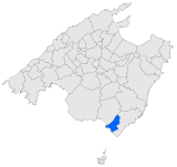
| Location of the municipality | ||
Mallorca
|
||
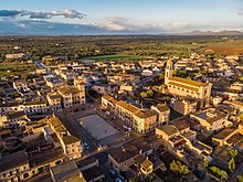
Ses Salines ( Castilian Las Salinas ) is a municipality on the Spanish Balearic island of Mallorca . It has 4960 inhabitants (as of January 1, 2019). In 2006 the proportion of foreigners in the municipality was 24.6% (1,108), the proportion of German residents was 6.8% (308). The main town of the same name, Ses Salines, seven kilometers inland, has 2350 inhabitants (2009), but the largest settlement with 2920 inhabitants (2009) is Colonia de Sant Jordi , a tourist town on the coast. The name of the community is derived from the large salt pans that are still used today for salt production .
geography
Flora and fauna
The flora is conditioned by the salinity of the earth; the native periwinkle, the Spanish cane and salt plants predominate. Sead trees, pine forests and rosemary and rockrose bushes are at home on the hills with lower salinity .
Over the years, a very specialized flora and fauna has developed on the edges of the salt basins. Only a few plants are able to live in permanently moist salt areas. These include the chloride-tolerant , mostly thick-fleshed succulents such as the bush samphire ; the sulfate halophytes , which include the tamarisk and the shrubby salt herb include reducing their metabolism through small leaf surfaces.
Because of the occurrence of Halobacterium , which contains red to orange-colored carotenoids , the salt ponds turn red. The halobacteria serve as a food source for the seven millimeter large salt crab , which in turn serves as food for a large number of marsh birds such as the stilt , redshank and shoveler . Around 170 bird species live near the salt pans, and even the osprey are occasionally sighted.
natural reserve
Parts of the municipality have been declared a nature reserve. The famous Es Trenc beach and the S'Avall estate , which is the largest coherent privately owned estate in Mallorca, are located within this nature reserve .
history
The talayots and megalithic monuments, which date from the Bronze Age , are references to the origin of the place. The salt pans of Sa Vall and Colonia de Sant Jordi are the oldest in Mallorca. Punic traders began to extract salt here. The salt continued to be of interest to Romans, Byzantines, Arabs, and Christians. The so important salt occurrences also explain the etymological origin of today's municipality.
| year | 1930 | 1940 | 1950 | 1960 | 1970 | 1981 | 1991 | 2001 | 2011 |
|---|---|---|---|---|---|---|---|---|---|
| Residents | 1,555 | 1,625 | 1.924 | 2,036 | 2,231 | 2,538 | 3,009 | 3,389 | 5,272 |
Culture and sights
The remains of the prehistoric and early historical settlements of Talaia Joana and the talaiots of Na Mera , Es Mitjà Gran and Es Antigors as well as Punic relics on the island of Na Guardia and the remains of Roman ships near the coast are worth seeing . Also the fortress of S'Estany from the 15th century, which is located close to the saltworks , the observation tower of S'Avall from the 14th century and the fortress of Torre de Ca'n Bàrbara next to the parish church , which was used for military purposes under King James I. served. The lighthouse Far des Cap de ses Salines on Cap de ses Salines , belonging to the municipality of Santanyí , as an observation point and exit for hikes and the Botanicactus complex , a privately operated botanical garden with a huge collection of cacti.
The information center of the Archipiélago de Cabrera National Park is located in the Colonia de Sant Jordi settlement . It was designed by the Spanish architect D. Álvaro Planchuelo Martínez de Haro . The main building is modeled on a talayot . In addition to the spectacular architecture, the aquarium in the information center is particularly worth seeing. It is dedicated to the underwater world of the national park. Around 200 species are kept in the 18 basins with a total capacity of almost one million liters.
beaches
The municipal area includes the beaches:
- Es Carbó y Ses Roquetes
- Es Dolç
- It Trenc
- Els Estanys
- Platja d'es Port
Festivals
- Sant Antoni (January 17th)
- Sant Jordi (April 23)
- La Fira-Espectacle de Ses Salines (May 1st)
- Colonia de Sant Jordi summer festivals (first Saturday and Sunday in August)
- San Bartomeu (August 24th)
economy
Salt extraction
Since 1850 a company has been extracting sea salt for food at an industrial level. Every April the sea water (with around 4.7 grams per liter of salt content) is let into square basins, so-called cocons , with an edge length of 250 meters. Around 130 hectares of artificial salt lagoons fill up every spring. 100 years ago it was 300 hectares. During the evaporation process in summer, the water is diverted several times to other basins in order to make the crystallization of the salt finer. The considerably finer Flor de Sal , which is very popular with gourmets, is “harvested” from the surface by hand . In September excavators remove the thick salt crust. This is then shredded and stored in heaps until it is cleaned and packaged for consumption. Today around 8,000 tons of table salt are still extracted every year.
Individual evidence
- ↑ Cifras oficiales de población resultantes de la revisión del Padrón municipal a 1 de enero . Population statistics from the Instituto Nacional de Estadística (population update).
- ↑ INE. Retrieved November 17, 2010 (Spanish).
- ↑ INE. Retrieved November 17, 2010 (Spanish).


