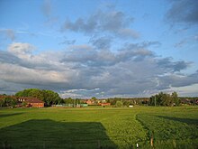
Todendorf
| coat of arms | Germany map | |
|---|---|---|

|
Coordinates: 53 ° 42 ' N , 10 ° 21' E |
|
| Basic data | ||
| State : | Schleswig-Holstein | |
| Circle : | Stormarn | |
| Office : | Bargteheide country | |
| Height : | 49 m above sea level NHN | |
| Area : | 12.81 km 2 | |
| Residents: | 1244 (Dec. 31, 2019) | |
| Population density : | 97 inhabitants per km 2 | |
| Postal code : | 22965 | |
| Area code : | 04534 | |
| License plate : | OD | |
| Community key : | 01 0 62 078 | |
| LOCODE : | DE TDF | |
| Office administration address: | Eckhorst 34 22941 Bargteheide |
|
| Website : | ||
| Mayor : | Philipp Lemke (AFWT) | |
| Location of the municipality of Todendorf in the Stormarn district | ||
Todendorf ( Low German Todendbod ) is a municipality in the Stormarn district in Schleswig-Holstein . The municipality includes the districts of Altenfelde ,iegenberg, Gölm, Kalkkuhle, Mannhagen, Niekoppel, Ochsenkoppel and Rönnbaum.
Geography and traffic
Todendorf is five kilometers northeast of Ahrensburg . The federal highway 1 and the federal highway 404 run through the municipality. The Gölmbach flows through the community. Parts of the Reinfeld and Trittau state forests, such as the Buchenwald and Ochsenkoppel forests. The Gölmer Moor is also in the area of the municipality of Todendorf.
history
The community was first mentioned in 1259. The name is probably derived from the proper name Todo . At that time the village was still called Todendorp, later Todendorpe. In 1263 the knight Gherbert sold the village for 150 marks with all rights to the Hamburg cathedral chapter. In 1294 the cathedral chapter gave the knight Otto v. Wackerbart Todendorf for 500 marks as a fief. In 1300 the cathedral chapter sold a piece to the knight Johann v. Homore (today's Hammoor). Before 1766 Todendorf was a Dominalgut.
politics
Municipal council and mayor
The AFWT electoral community won all eleven seats of the municipal council in the 2018 local elections. Mayor is Philipp Lemke (AFWT).
coat of arms
Blazon : "A silver cup in red, angled at the top by a silver hourglass, at the bottom by a silver swan ready to fight with a gold crown around its neck."
Culture and sights
Youth work
With the support of their parents, the pastor and the mayor, around 15 young people founded a youth club in 1974. The teenagers, who were 13 to 16 years old, met every two weeks to play cards, exercise, or dance. However, this youth work has not existed for a long time because no one is available for it.
Former church
After the people of Todendorf had held their church services in the local school for many years or visited the church in nearby Eichede, which is now part of the Steinburg parish, for this purpose , the Todendorf parish received its own church in 1967 , a pentagonal building with roof edges up to reached to the ground. As there was a pond on the building site in earlier times, the church was built in a modern pile construction due to the particularly soft soil. For this purpose, 17 reinforced concrete support pillars were used, which reached up to eight meters into the ground. As early as the 1980s , extensive renovations were necessary on the pillars, as the steel they contained corroded . Since further high renovation costs were expected in the future, the responsible parish of Eichede decided in October 2016 to give up the church building. On January 18, 2018, the last divine service took place in the church with the church deedication carried out by Bishop Kirsten Fehrs . The community of Todendorf, as the new owner of the property, wants to demolish the church in summer 2018 and build a fire station at this point .
Sports
The VfR Todendorf was founded in 1931 as the “Football Club Lawn Sports” and later renamed the “Club for Lawn Sports”. It goes back to the "Todendorfer Turnverein" from 1914, whose gymnastics equipment was sold after the First World War because gymnastics went out of fashion and the youth preferred to play football.
The club has a good 350 members and offers sport in the four areas of soccer, gymnastics, tennis and fitness.
Web links
Individual evidence
- ↑ North Statistics Office - Population of the municipalities in Schleswig-Holstein 4th quarter 2019 (XLSX file) (update based on the 2011 census) ( help on this ).
- ↑ Schleswig-Holstein topography. Vol. 10: Timmaspe - Ziethen . 1st edition Flying-Kiwi-Verl. Junge, Flensburg 2008, ISBN 978-3-926055-92-7 , p. 14 ( dnb.de [accessed on August 6, 2020]).
- ↑ a b Philipp Lemke is Todendorf's new mayor. Hamburger Abendblatt, June 26, 2018, accessed on October 14, 2018 .
- ↑ Schleswig-Holstein's municipal coat of arms
- ↑ Former church in Todendorf. Municipality of Todendorf, accessed on January 30, 2018 .
- ↑ The last service. Hamburger Abendblatt, January 20, 2018, accessed on January 20, 2018 .


