
Meddewade
| coat of arms | Germany map | |
|---|---|---|

|
Coordinates: 53 ° 49 ' N , 10 ° 26' E |
|
| Basic data | ||
| State : | Schleswig-Holstein | |
| Circle : | Stormarn | |
| Office : | Bad Oldesloe-Land | |
| Height : | 37 m above sea level NHN | |
| Area : | 3.1 km 2 | |
| Residents: | 920 (Dec. 31, 2019) | |
| Population density : | 297 inhabitants per km 2 | |
| Postal code : | 23847 | |
| Area code : | 04531 | |
| License plate : | OD | |
| Community key : | 01 0 62 046 | |
| Office administration address: | Louise-Zietz-Strasse 4 23843 Bad Oldesloe |
|
| Website : | ||
| Mayor : | Karsten Bauer (TEAM) | |
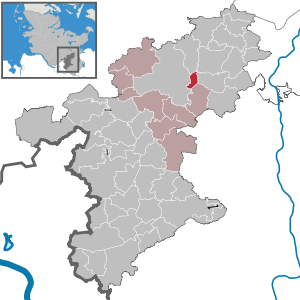
| Location of the municipality of Meddewade in the Stormarn district | ||
  |
||

Meddewade ( Low German Meddewaad ) is a municipality in the Stormarn district in Schleswig-Holstein .
geography
The village is 4 kilometers from Bad Oldesloe , 5 from Reinfeld , 15 from Lübeck and 47 from Hamburg . Meddewade lies in the heavily undulating hilly terrain of a terminal moraine landscape that was formed by the Vistula Ice Age and consists largely of permanent pastureland. Meddewade has had no forest since the end of the 18th century, the last trees were felled in 1787 to create fields. Its highest point is in the south 51.5 meters, its deepest in the north 2.8 meters above sea level .
In the north it is bounded by the Trave and in the south by the A1 . Meddewade borders on Bad Oldesloe, Rethwisch , Barnitz , Feldhorst and Reinfeld.
history
The meaning of the name Meddewade is not certain, there are different interpretations that lead it back to medwoda ("fresh water"), based on the river Trave , on which the village is located, or as "swampy meadow" ( mede from English meadow = meadow; wade = swamp) in reference to the often flooded traverse meadows. A widespread derivation of Midwalde ("Mittenwalde"), which is mentioned in a document from 1189, seems doubtful. Otto Stein uses the Slavic place name Medvedy and similar place names in Mecklenburg-Western Pomerania (Medwege), Poland and Russia on Madwädj (Slavic bear ) and suspects a town was founded by the Wends .
The area in which Meddewade is located was settled between 5,000 and 10,000 years ago. In the village itself, flint artifacts , remains of 14 Bronze Age barrows and Iron Age urn fields were found . Direct traces of settlement for the village area are only detectable from the 8th century, but it is not yet clear whether the settlers were Germanic or Slavic tribes.
The first mention of the name Midwalde in the founding document of the Reinfeld monastery from 1189 did not refer to the village, but to an unspecified piece of forest near the monastery, the name was only added to the document in the 14th century. The first secure documentary mention of the village is in the tithe register of the Lübeck bishop Schele from the year 1433. Meddewade belonged to the lands of the Reinfeld monastery until 1582, after which it fell together with Reinfeld to the duchy of Schleswig-Holstein-Sonderburg-Plön-Rethwisch . Two families are vouched for in the village for the years 1640/41.
In 1671, with the death of Duke Joachim Ernst from Plön, Meddewade fell to the newly founded Duchy of Holstein-Rethwisch and thus became the serfdom of Duke Joachim Ernst the Younger of Holstein-Rethwisch. During the serfdom Meddewade had to provide hauliers to pull the barges on the Trave, in the village there were only a few farms with land, but many cottages that did not include any land. After the death of Duke Friedrich Carl , who left no male heirs, the Danish King Friedrich the Good took over the duchy and with it the village in 1761 .
1773 Meddewade consisted of "6 half hoofs , hoofs 7/4, 3 Zwölftelhufen, 10 micro-Insten and 5 ownership Kätnern ." ( National Archives Schleswig, division 66 number 7543 )
When in 1774 the Vorwerk Rethwisch was dissolved due to a lack of income, serfdom for the residents of Meddewade also ended and the lands were distributed to the subjects.

In 1825 the size of the area of Meddewade was given as 456 tons , this corresponded to an area of 287.6 hectares. At that time the village consisted of six half-hooves, six quarter-hooves, three twelfth-hooves and 18 katen.
In 1877 the District Office of the Stormarn District in Wandsbek determined the name Meddewade for the place after 450 years of different spellings.
In 1887 a cooperative dairy was founded in Meddewade to make it easier for farmers to sell their milk. In the course of the nationalization in the Third Reich , the operation was stopped and the milk distribution was distributed to the surrounding larger dairies.
From 1889 Meddewade belonged to the district of Rethwisch.

After the end of the Second World War , the community took in 200 refugees from the east, in 1949 there were 16 farms in the village (one in 2003). Of the nine thatched-roof houses in 1949 , two still existed in 2003.
Meddewade has been part of the Bad Oldesloe-Land office since 1948 .

In autumn 1954, the Berlin entrepreneur Eberhard Paech took over the dairy building as a branch for his Paech-Brot GmbH and expanded it on a large scale. While ten employees worked on two stone ovens in the first year, six years later there were already 140. Between 1956 and 1980, the population of Meddewade rose from 268 by over 140 percent to 649. By 1967 the number of employees doubled again when the bakery became a business known throughout Schleswig-Holstein and supplied 1,800 customers from Meddewade. In 1985 the bakery had 380 employees, 22.6 percent of whom were Meddewaders.
As part of the construction of the bakery, Meddewade's infrastructure was also improved and expanded. From 1962 the municipal roads and the connecting roads to Bad Oldesloe and Steensrade were expanded. In 1962, after an urgent application, Meddewade was connected to the water supply of the Reinfeld-Land water supply association , and from 1972 to 1975 a full sewer system with its own sewage treatment plant was built. The Paech bakery contributed to the costs from 1972 to 1980 with a total of 480,000 German marks. In 1975 the village was connected to the natural gas pipeline from Bad Oldesloe to Reinfeld.
After the parent company's financial difficulties, the bakery was taken over at short notice in 1986 by Horst Schiesser and then by the Wendeln bakery . In 2000, the Kamps bakery took over the factory, 220 of which were once 380 jobs remained, of which only nine were occupied by Meddewaders. The bread factory was closed in 2003, the buildings were demolished in the summer of 2008, the property was divided into plots and prepared for sale to private buyers.

In October 2008, a memorial stone was inaugurated opposite the Peace Oak on the occasion of the 575th anniversary of the first documentary mention in 1433.
politics
Community council and mayor
Of the eleven seats in the municipal council, the electoral community TEAM has eight seats and the electoral community WGM three seats since the local elections in 2018.
Mayor is Karsten Bauer from the electoral community TEAM.
coat of arms

Blazon : “In green, a golden gopel filled with blue. In the upper right corners a golden oak leaf, on the left a golden ear of wheat, and below a silver wavy bar. "
The Göpel represents the center of Meddewade, from which the roads to Bad Oldesloe, Rethwisch and Benstaben start. The oak leaf stands for the peace oak planted in 1871, the ear of wheat for the agricultural origin of the village. The silver wave bar symbolizes the Trave.
Economy and Infrastructure

education
After the Meddewader and Sehmsdorfer students had attended the school in the neighboring town of Benstaben from 1731 to 1857, a new school was built in the more central Meddewade from 1857 to 1858. In 1915 there were 94 pupils, in 1949 there were 180 pupils from Meddewade, Benstaben and Sehmsdorf, who were taught by four teachers. At the end of the 1960s the school association of the three municipalities was dissolved; the students were dependent on schools in Bad Oldesloe until 1973.
Since then, the premises of the school have been used by the youth club, founded in 1975, and from 1985 to 1995 by the Meddewad kindergarten. Community activities are currently taking place there. Since 1999 the school has been refurbished, rebuilt and supplemented with shower and changing rooms for the sports club at community expense. For the 150th anniversary of the school in April 2008, the renovation work was completed.
Public facilities
The Meddewade Volunteer Fire Department was established in 1889. In 1966 she received a commemorative plaque from the city of Lübeck for her help during the Wakenitz flood in 1965 .
There is also the sports club SV Meddewade von 1977 founded in 1977. V. with gymnastics, table tennis and soccer teams and over 100 members (1980), the savings club and cultural association Edelweiß founded in 1912 , a skat club and others.
traffic
The county road 67 crosses the village, connects it with Bad Oldesloe and Benstaben and leads over the Trave to the federal road 75 .
In the village, the district road 68 branches off to the south, which connects it with Rethwischdorf and Steensrade .
Personalities
- Uwe Jannsen (* 1954), mathematician and university lecturer born in Meddewade
literature
- Doris and Eckhard Moßner and Hans-Werner Hillers (eds.): Meddewade; Chronicle of a village in the Stormarn district - Meddewade municipality ; 2004 Wachholtz Druck, Neumünster
- Gerhard Schulz, Hermann Leinius and Ernst Schneider (eds.): Bad Oldesloe-Land; the office and its communities - Bad Oldesloe-Land administration ; 1987 Wachholtz Druck, Neumünster
Web links
Individual evidence
- ↑ North Statistics Office - Population of the municipalities in Schleswig-Holstein 4th quarter 2019 (XLSX file) (update based on the 2011 census) ( help on this ).
- ↑ Schulz, Leinius, Schneider; P. 33
- ↑ "... that it was previously called Midwade . An old Reinsfelder Chronicle confirmed the same, adding that stupid name mean Mittenwalde [...] that vade never in forest and forest although in Wohld but never again in calf turns that you can not linguistically lighter l would have omitted. "( Ludwig Frahm : Oldesloer Landbote, August 25, 1896, quoted from D. Moßner, E. Moßner, Hillers; p. 28)
- ↑ Otto Stein, Die Heimat, 1940-43; P. 54
- ↑ D. Moßner, E. Moßner, Hillers; P. 17
- ^ Johansson 1895
- ↑ "Vresenbouch et Poggensee et Scraupendorpe et Sewenstorpe et Midwade et Benstouen, hey 6 ville dant decimam agrariam proposito Lubicensi." ( Cited by D. Mossner, E. Mossner, Hiller, P. 34 )
- ↑ quoted from D. Moßner, E. Moßner, Hillers; P. 52
- ^ Landesarchiv Schleswig, Department 400 I., Number 266; quoted from D. Moßner, E. Moßner, Hillers; P. 74
- ↑ Schulz, Leinius, Schneider; P. 34ff.
- ↑ Schleswig-Holstein's municipal coat of arms
Ahrensburg | Ammersbek | Bad Oldesloe | Badendorf | Bargfeld bridges | Bargteheide | Barnitz | Barsbüttel | Braak | Brunsbek | Delingsdorf | Elmenhorst | Feldhorst | Glinde | Grabau | Grande | Grönwohld | Großensee | Großhansdorf | Hamberge | Hamfelde | Hammoor | Heidekamp | Heilshoop | Hohenfelde | Hoisdorf | Jersbek | Klein Wesenberg | Koethel | Lasbek | Lütjensee | Meddewade | Mönkhagen | Neritz | Nienwohld | Oststeinbek | Pölitz | Rausdorf | Rehhorst | Reinbek | Reinfeld (Holstein) | Rethwisch | Lumber | Siek | Stacking field | Stone castle | Tangstedt | Todendorf | Travenbrück | Tremsbüttel | Trittau | Wesenberg | Westerau | Joke | Zarps