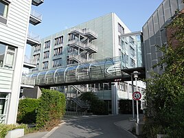
Bielingplatz (Nuremberg)
|
Bielingplatz
Statistical District 24 City of Nuremberg
Coordinates: 49 ° 27 '53 " N , 11 ° 3' 50" E
|
|
|---|---|
| Area : | 64.2 ha |
| Residents : | 5052 (December 31, 2015) |
| Population density : | 7,869 inhabitants / km² |
| Postal code : | 90419 |
| Area code : | 0911 |
|
Location of the statistical district 24 Bielingplatz
|
|
|
Nuremberg North Hospital
|
|
Bielingplatz is the northwestern part of St. Johannis (Nuremberg) and the name of the statistical district 24 in the northwest of the wider inner city belt . The district consists of the districts 240 Klinikum Nord, 241 Bielingplatz (Lerchenbühlstrasse) and 242 Bielingplatz (Kressenstrasse).
geography
Statistical District 24 is located between Nordwestring in the north, Bucherstrasse in the east, Kirchenweg in the south and Poppenreutherstrasse in the west.
| Neighboring statistical districts | |||||||||
|---|---|---|---|---|---|---|---|---|---|
|
Attractions
literature
- District data sheet Nuremberg - Statistical District 24 Bielingplatz , as of 2015 (PDF; approx. 120 kB)
Web links
Commons : Bielingplatz - collection of images, videos and audio files
Individual evidence
- ^ City of Nuremberg, Office for Urban Research and Statistics for Nuremberg and Fürth (ed.): Statistical Yearbook of the City of Nuremberg 2016 . December 2015, ISSN 0944-1514 , 18 Statistical City Districts and Districts, p. 244–245 , p. 244 ( nuernberg.de [PDF; 6.3 MB ; accessed on November 1, 2017]).
- ↑ Stadtplandienst Nürnberg District 24 Bieling Place


