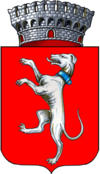
Campi Bisenzio
| Campi Bisenzio | ||
|---|---|---|

|
|
|
| Country | Italy | |
| region | Tuscany | |
| Metropolitan city | Florence (FI) | |
| Coordinates | 43 ° 50 ' N , 11 ° 8' E | |
| height | 38 m slm | |
| surface | 28.62 km² | |
| Residents | 47,343 (Dec. 31, 2019) | |
| Population density | 1,654 inhabitants / km² | |
| Post Code | 50013 | |
| prefix | 055 | |
| ISTAT number | 048006 | |
| Popular name | Campigiani | |
| Patron saint | Beata Teresa Maria della Croce (April 23) | |
| Website | Campi Bisenzio | |
Campi Bisenzio is an Italian municipality with 47,343 inhabitants (as of December 31, 2019) in the metropolitan city of Florence in the Tuscany region .
geography
The municipality is located twelve kilometers northwest of the provincial and regional capital Florence on the rivers Arno , Bisenzio , Marina and Ombrone Pistoiese .
The districts are Capalle, Il Rosi, La Villa, Le Miccine, Limite, San Cresci, San Donnino, San Giorgio a Colonica, San Piero a Ponti and Sant'Angelo a Lecore.
The neighboring municipalities are Calenzano , Florence , Poggio a Caiano ( PO ), Prato (PO), Scandicci , Sesto Fiorentino and Signa .
history
The first inhabitants of the area were probably the Ligurians , followed by the Etruscans . Traces of the Romans can be found up to the 1st century BC. Trace back to BC. These left the place with the street system and the place name (unchanged to this day). The place developed along the Bisenzio, shortly after the confluence with the river Marina, which already led to regular flood disasters in ancient times. The town began to grow around the year 1000, and districts such as San Piero a Ponti were founded. Through a donation from Otto I , the place came under the control of the Mazzinghi family, who equipped it with a castle (Castrum Mazzinghorum) and fortress (Rocca Strozzi, 12th century). It is possible that the conflict between Ghibellines and Guelphs originated here in 1215 or 1216 when the Florentine families of the Amidei and the Buondelmonti quarreled . Since 1170 the area was subordinate to the Sestiere di San Pancrazio of Florence, in 1292 it was assigned to the Quartiere di Santa Maria Novella . After the defeat of the Guelphs against the Ghibellines on September 4, 1260 in the Battle of Montaperti , the center was destroyed by the Ghibellines. The second destruction happened in 1364 when Pisa took the place during the war with Florence. After the reconquest, Florence reinforced the city walls again. However, further damage was caused by the Spanish troops during the siege of Florence in 1529. The municipality in its current form was created in 1774 (at that time still with Signa, Montemurlo and Calenzano) by a decree of Grand Duke Leopold I. During the occupation of Tuscany by Napoleon (1807-1814) Signa, Montemurlo and Calenzano were independent communities. The name addition Bisenzio was added to the place name Campi in 1862.
Attractions
- Pieve di Santo Stefano , Pieve from the 10th century . Contains the works Madonna con Bambino e Santi (approx. 1475) by Francesco Botticini and Annunciazione (approx. 1513) by Raffaellino del Garbo .
Community partnerships
The place maintains community partnerships with:
-
 Orly , France , since 1980
 -
 Tipitapa , Nicaragua , since 1987
 -
 North Lanarkshire , Scotland , UK , since 1988
 -
 Bir Lehlu , Western Sahara , since 1993
Daughters and sons of the church
- Teresa Manetti (1846–1910), religious sister
- Rolando Panerai (1924-2019), opera singer (baritone)
- Olimpia Carlisi (born 1946), actress
Web links
Individual evidence
- ↑ Statistiche demografiche ISTAT. Monthly population statistics of the Istituto Nazionale di Statistica , as of December 31 of 2019.
- ↑ a b c d Official website of the municipality of Campi Bisenzio , accessed on February 12, 2010 (Italian)
- ↑ Campibisenzio.com , accessed February 12, 2010 (Italian)
- ↑ a b Intoscana.it , accessed on October 24, 2016 (English)
- ↑ Enrico Faini: Annali di Storia di Firenze. University of Florence , 2006, pp. 11–12, accessed on February 12, 2010 (PDF; 1.8 MB) ( Memento from February 21, 2007 in the Internet Archive )
- ↑ Profilo storico on the website of the municipality of Campi Bisenzio, accessed on October 24, 2016 (Italian)
- ↑ Official website of the municipality of Campi Bisenzio on the municipality partnerships , accessed on February 12, 2010 (Italian)


