
Custer County, Idaho
| administration | |
|---|---|
| US state : | Idaho |
| Administrative headquarters : | Challis |
| Foundation : | January 8, 1881 |
| Demographics | |
| Residents : | 4368 (2010) |
| Population density : | 0.3 inhabitants / km 2 |
| geography | |
| Total area : | 12,786 km² |
| Water surface : | 29 km² |
| map | |
 |
|
| Website : www.co.custer.id.us | |
Custer County is a county in the state of Idaho in the United States . The county seat is Challis .
geography
Custer County covers an area of 12,786 square kilometers, of which approximately 29 square kilometers are water. The highest mountain in Idaho is Borah Peak at 3857 meters.
history
The county is named after the General Custer Mine on the Yankee Fork Salmon River , where gold was found in 1876. Today 37 structures and places in the county are listed on the National Register of Historic Places .
towns and places
Cities and towns in Custer County are Challis , Clayton , Lost River , Mackay, and Stanley .
| growth of population | |||
|---|---|---|---|
| Census | Residents | ± in% | |
| 1890 | 2176 | - | |
| 1900 | 2049 | -5.8% | |
| 1910 | 3001 | 46.5% | |
| 1920 | 3550 | 18.3% | |
| 1930 | 3162 | -10.9% | |
| 1940 | 3549 | 12.2% | |
| 1950 | 3318 | -6.5% | |
| 1960 | 2996 | -9.7% | |
| 1970 | 2967 | -1 % | |
| 1980 | 3385 | 14.1% | |
| 1990 | 4133 | 22.1% | |
| 2000 | 4342 | 5.1% | |
| 2010 | 4368 | 0.6% | |
| Before 1900
1900–1990 2000 + 2010 |
|||
Demographic data
The age structure in the county is as follows:
- under 18 years = 25.5%
- from 18-24 years = 4.8%
- from 25-44 years = 29.9%
- from 25-64 years = 29.3%
- over 65 years = 14.5% .
- The average age is 41 years .
- The median annual income for a family (2000) was approximately $ 39,500.
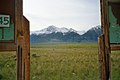
Mount Borah as seen from US Route 93

Leatherman Peak, the second highest point in Idaho


Places in the county
Individual evidence
- ↑ GNIS-ID: 399758. Retrieved on February 22, 2011 (English).
- ↑ Search mask database in the National Register Information System. National Park Service , accessed August 25, 2017.
- ↑ US Census Bureau - Census of Population and Housing . Retrieved March 15, 2011
- ↑ Extract from Census.gov . Retrieved February 14, 2011
- ↑ Extract from census.gov (2000 + 2010). Accessed April 2, 2012
Web links
- Custer County at idaho.gov (English)
List of counties in Idaho
Ada |
Adams |
Bannock |
Bear Lake |
Benewah |
Bingham |
Blaine |
Boise |
Bonn |
Bonneville |
Boundary |
Butte |
Camas |
Canyon |
Caribou |
Cassia |
Clark |
Clearwater |
Custer |
Elmore |
Franklin |
Fremont |
Gem |
Gooding |
Idaho |
Jefferson |
Jerome |
Kootenai |
Latah |
Lemhi |
Lewis |
Lincoln |
Madison |
Minidoka |
Nez Perce |
Oneida |
Owyhee |
Payette |
Power |
Shoshone |
Tetons |
Twin Falls |
Valley |
Washington
Coordinates: 44 ° 14 ′ N , 114 ° 17 ′ W