Glarus South
| Glarus South | |
|---|---|
| State : |
|
| Canton : |
|
| District : | No district division |
| BFS no. : | 1631 |
| Postal code : | 8756 Mitlödi 8762 Schwändi b. Schwanden 8762 Schwanden GL 8762 Sool 8765 Engi 8766 Matt 8767 Elm 8772 Nidfurn 8773 Haslen GL 8774 Leuggelbach 8775 Hätzingen 8775 Luchsingen 8777 Diesbach GL 8777 Betschwanden 8782 Rüti GL 8783 Linthal 8784 Braunwald |
| Coordinates : | 724 397 / 206 116 |
| Height : | 521 m above sea level M. |
| Height range : | 476–3610 m above sea level M. |
| Area : | 430.03 km² |
| Residents: | 9494 (December 31, 2018) |
| Population density : | 22 inhabitants per km² |
| Mayor : | Mathias Vögeli ( BDP ) |
| Website: | www.glarus-sued.ch |
|
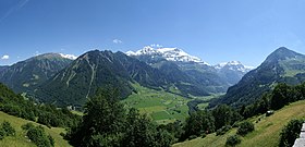
View from the Klausenpassstrasse |
|
| Location of the municipality | |
Glarus Süd has been a political municipality ( unitary municipality ) in the Swiss canton of Glarus since January 1, 2011 .
It was created as part of the Glarus community reform through the merger of the previous communities Betschwanden , Braunwald , Elm , Engi , Haslen , Linthal , Luchsingen , Matt , Mitlödi , Rüti (GL) , Schwanden (GL) , Schwändi and Sool .
geography
The municipality of Glarus Süd includes the rear Linthtal , also called Grosstal, and the entire Sernftal , also called Kleintal. With an area of 430 km² , it was the largest political municipality in Switzerland from the beginning of 2011 to the end of 2014, and from January 2015 the second largest after Scuol (439 km²). The community extends from a height of 504 m above sea level. M. in Mitlödi in the north up to the summit of Tödi with a height of 3614 m above sea level. M. in the south.
traffic
The community is accessed through the Klausenpassstrasse from Glarus to Altdorf UR . When the Klausen Pass is closed in the winter months, the valley can only be reached from the north via Glarus. The connection to public transport is provided by the railway line to Linthal, the bus services in Sernftal, as well as numerous bus and post bus lines and various cable cars.
Attractions
Personalities
- Fridolin Brunner (1498–1570), Protestant pastor and reformer 1532–1555 in Betschwanden
- Samuel Zopfy (1804–1890), doctor and pioneer of homeopathy , lived and worked in Schwanden
- Oswald Heer (1809–1883), Swiss palaeontologist, botanist and entomologist, living in Matt from 1817
- Caspar Schiesser (1812–1839), poet from Schwändi
- Hilarius Knobel (1830–1891), architect from Schwändi
- Gottfried Heer (1843–1921), Protestant Reformed pastor in Betschwanden 1866–1906, Council of States 1906–1914 and local historian
- Jacques Schiesser (* 1848 in Linthal; † August 18, 1913 in Bern), entrepreneur
- Jakob Hefti (1873–1951), politician and writer from Luchsingen
- Hans Comiotto (1906–1972), teacher and painter from Schwanden
- Emil Brunner (1908–1995), Swiss photographer, lived in Braunwald from 1948 to 1995
- Anton Stadler (1920–2016), politician (CVP) from Luchsingen
- Willi Aberer (1927–2007), Austrian politician from Mitlödi
- Jürgen Moser (1928–1999), German-American-Swiss mathematician, was buried in the air near Braunwald
- Kaspar Rhyner (* 1932), FDP politician, councilor and mayor of the Canton of Glarus from Elm
- Jakob Hefti (* 1947), a horn player and chamber musician from Schwanden
- Kurt Albert (* 1952), conductor of the country band Echo vom Tödi from Linthal
- Fritz Schiesser (* 1954), politician (FDP), President of the Council of States, President of the ETH Board from Haslen
- Hanspeter Hofmann (* 1960), painter from Mitlödi
- Vreni Schneider (* 1964), ski racer from Elm
- Rico Elmer (* 1969), ski mountaineer from Elm
- Jürg Grünenfelder (* 1974), ski racer from Elm
- Corina Grünenfelder (* 1975), ski racer from Elm
- Tobias Grünenfelder (* 1977), ski racer from Elm
- Markus Rhyner (* 1982), SP politician and court clerk from Elm
- Mathias Zopfi (* 1983), politician of the Greens and Council of States from Engi
- André Reithebuch (* 1986), Mister Switzerland 2009 from Linthal
Web links
Individual evidence
- ↑ Permanent and non-permanent resident population by year, canton, district, municipality, population type and gender (permanent resident population). In: bfs. admin.ch . Federal Statistical Office (FSO), August 31, 2019, accessed on December 22, 2019 .
- ↑ Numbers and facts , Glarus Süd website, accessed on June 8, 2011.


