
La Gomera
| La Gomera | ||
|---|---|---|
 |
||
| Waters | Atlantic Ocean | |
| Archipelago | Canary Islands | |
| Geographical location | 28 ° 7 ′ N , 17 ° 14 ′ W | |
|
||
| surface | 369.76 km² | |
| Highest elevation | Garajonay 1487 m |
|
| Residents | 21,503 (2019) 58 inhabitants / km² |
|
| main place | San Sebastian de La Gomera | |
 |
||


.jpg)


After El Hierro, La Gomera is the second smallest of the seven main islands of the Canary Archipelago in the Atlantic Ocean . It belongs to the Spanish province of Santa Cruz de Tenerife .
geography
The island of La Gomera is around 1300 kilometers from the Spanish mainland and 300 kilometers from the African mainland. The distance from the nearest ferry port Los Cristianos on Tenerife is 38 kilometers. With an area of 369.76 km², the island has a share of the total area of all Canaries of 4.94 percent. In 2013 La Gomera had 21,503 inhabitants, which corresponds to a population density of 58 inhabitants per km²
The highest point on the island is the 1,487 meter high Garajonay, which is located in the national park of the same name .
geology
La Gomera is of volcanic origin, about eleven million years old and consists largely of porous lava , yellow and red ash tuff and lapillite , older sloping basalts (seen on the coast in Los Organos) and younger horizontal basalts. The last volcanic eruption was about two million years ago. La Fortaleza is a phonolithic spring dome (cryptodome). Some volcanic vents are made of trachyte . Parts of the island are sunk and eroded by the sea or by water and wind. Notched valleys ( barrancos ) cut deep and flow into trough valleys ( valles ) with sedimentary soils . Weathering has progressed due to the humid climate; poorly soluble iron and aluminum oxides remain.
vegetation
La Gomera has several vegetation zones . Due to the differences in altitude, there are different types of microclimates . In the north of the island there are laurel forests and evergreen ferns from a height of 500 meters. Above a height of 1000 meters, they flow over into the Fayal-Brezal Formation, a mixed heather forest made up of gale tree ( faya ) and tree heather ( brezo ). In the rain-poor south of the island, the Phoenician juniper , thick-leaf plants of the genus Aeonium and the canary palm dominate in addition to various types of barren shrubs . Near the coast there are mainly plants that rely on the salty breeze from the sea, for example sea lavender , various milkweed plants , agaves and prickly pear cacti . In the middle of La Gomera lies the Garajonay National Park , which covers around 10 percent of the island's area. Its ecosystem has been protected by UNESCO as a World Heritage Site since 1986 . The forests in the park are laurel forests ( Laurisilva ), which still exist here due to the absence of the Ice Age . The heart of the national park consists of evergreen, subtropical cloud forest with ferns up to two meters high , long beard lichens hanging from the trees , branches covered with moss and streams with a few waterfalls.
Forest fires
- In 1984 there were large-scale forest fires, most of which were restricted to the Canary Islands pine , but the rapid spread resulted in over 20 fatalities.
- In August 2012 another major fire affected the island, aided by a very dry winter and spring, which destroyed around 40 km². Significant parts of the national park and the laurel forest were also affected.
climate
Climatically , the island is divided into the dry southern half and the fertile northern half, which is supplied with humid air by the trade winds . Rain and condensing water are collected in reservoirs and distributed to the residents to supply water to the fields laid out in terraces on the mountain slopes. In addition to potatoes , tomatoes and wine are also grown.
| Jan | Feb | Mar | Apr | May | Jun | Jul | Aug | Sep | Oct | Nov | Dec | |
|---|---|---|---|---|---|---|---|---|---|---|---|---|
| Average maximum temperature ( ° C ) | 21st | 21st | 22nd | 23 | 24 | 25th | 27 | 29 | 28 | 26th | 24 | 22nd |
| Average low temperature (° C) | 15th | 15th | 15th | 16 | 17th | 18th | 20th | 21st | 20th | 19th | 18th | 16 |
| Average rainfall (mm) | 18th | 24 | 14th | 7th | 2 | 0 | 0 | 0 | 10 | 13 | 18th | 27 |
| Average number of rainy days | 6th | 4th | 3 | 2 | 2 | 1 | 0 | 0 | 2 | 5 | 6th | 7th |
| Average water temperature (° C) | 19th | 18th | 18th | 18th | 19th | 20th | 21st | 22nd | 23 | 23 | 21st | 20th |
Natural symbols of the island
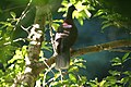
Natural symbols of the island of La Gomera are the laurel pigeon ( Columba junoniae ) and the Indian persea ( Persea indica ).
Laurel pigeon

Indian Persea


history
First settlement
The oldest find so far, which indicates that La Gomera was settled in the 1st century AD, comes from the site "El Lomito del Medio-1" (Casas Cáidas, San Sebastián de La Gomera ). In the Canary Islands of Lanzarote and Tenerife , the presence of humans has been around since the middle of the 10th century BC. Proven. At that time, only the Phoenicians had ships that met the technical requirements for a return trip from the Mediterranean region. The archaeological finds from Buenavista ( Teguise / Lanzarote) indicate Phoenician / Punic origin. The theory that enough inhabitants of the nearby African coast got to the islands by chance in a “Noah's Ark” is rejected by historians as very unlikely. To explain the settlement of the Canary Islands, the "hipótesis mediterránea" (Mediterranean hypothesis) has been formulated since the 1980s on the basis of archaeological finds. It says that Phoenician-Punic and later Roman seafarers probably settled on the islands at different times, people who came from the "Círculo del Estrecho". The “Círculo del Estrecho” ( English Circle of the straits ) is the name given to the extensive geopolitical zone that extends over the extreme south of the Iberian Peninsula and the western part of the North African coast at the transition from the Atlantic Ocean to the Mediterranean.
The establishment of colonies in the Canary Islands was interesting for the Punians for several reasons: It was strategically important areas that were rich in potentially usable resources. Controlling and using them favored the Carthaginian supremacy. They provided the opportunity to relocate excess population and avoid social tension. These were the reasons for the displacement of North Africans to the settlement colonies on the African Atlantic coast. With the expansion of Carthage , interest in the Canary Islands also seems to have increased. The travelogue of Hannos the Navigator from the 5th century BC BC describes the founding of Phoenician-Punic settlements on the west coast of Africa. The colonization of the Canary Islands is not reported, but it does not exclude that.
In the 1st century AD, the kingdom of Mauritania was established in northwest Africa under the auspices of Rome . King Juba II, who had been brought up in Rome, pursued a policy of establishing settlements. He had plants for the production of purple and for salting fish set up on the west coast of Morocco . Pliny reports that Juba II. After the year 25 BC. BC the Fortunatae insulae , as the Romans called the Canary Islands, explored. Finds from various islands dated to the turn of the century indicate a close economic connection between the Canary Islands and the Mediterranean. The intensive and long-lasting connection with the ancient Mediterranean world was ended by the Roman Empire crisis of the 3rd century . At this time, the Canary Islands became more and more isolated. This eventually led to the fact that the inhabitants of the islands, who had no knowledge of shipbuilding and nautical science, could not even maintain connections between the islands.
Time of isolated development
In the period between the 4th and 14th centuries, the indigenous people of all the Canary Islands each developed their own culture. The culture of the Gomeros had the same foundations as that of the old Canarians on the other islands. In about a thousand years peculiarities developed that require separate consideration of the cultures of the different islands.
At the beginning of the 15th century the island was divided into four domains. Despite this division, the Gomeros came together regularly for meetings and meetings, at which festivals were also celebrated. These meetings apparently took place between the inhabitants of two tribes. There was an agreement between the Hipalán and the Mulagua tribe that the Hipalán were only allowed to look for their spouses among the Mulagua and vice versa.
Rediscovery of the Canary Islands in the 14th century
The oldest mention of the name Gomera for this island is "Gommaria" on the map of Angelino Dulcert which was published in 1335 on the island of Mallorca .
In 1341 the Portuguese King Alfonso IV sent a three-ship expedition to explore and u. U. Conquest to the Canary Islands. The navigator of the expedition, the Genoese Niccoloso da Recco (1327-1367) reported that there were many streams with excellent water on La Gomera and that there were tasty pigeons and other birds in the forests. The expedition returned to Portugal without attempting to conquer the islands.
During the 14th century seamen and pirates came to La Gomera again and again. During their stay, they limited themselves to the supply of wood and resin or the catching of cattle and people in order to sell them as slaves. There are no reports of missionary efforts on La Gomera before the 15th century.
Developed under the rule of the Crown of Castile
- Jean de Béthencourt to Hernán Peraza
The kings of Castile successively granted different people the right to conquer the island in order to rule it as the king's feudal man . In order to preserve the right to rule, exaggerated information was given about the actual status of the subjugation of the Gomeros and about the status of their Christianization.
In 1402, the French nobles Jean de Béthencourt and Gadifer de La Salle began to establish trading posts and European settlements in the Canary Islands. When they found that their own resources were insufficient, Jean the Béthencourt submitted to King Henry III. of Castile, in whose name he was to subordinate the population of the islands to the rule of the Crown of Castile. The French visited Gomera twice, each time under the command of Gadifer de La Salles. The first time they wanted to replenish their water supplies. The Chronicle Le Canarien , in which two French clerics recorded the events of the French expedition, reports that as soon as the French had set foot on the island, they were attacked by the natives and had to retreat. The second time the island is described as having the shape of a shamrock with extraordinarily large and deep barrancos, inhabited by many people who use one of the strangest languages. This is certainly an allusion to the Silbo communication system that the Gomeros have received to this day. The French made no attempts to occupy or conquer La Gomera.
In December 1405, Jean den Béthencourt left the Canary Islands and returned to France. He left the administration of the conquered islands to his relative Maciot de Béthencourt. On November 15, 1418 Maciot de Béthencourt irrevocably transferred the right to conquer and rule over the Canary Islands in the name of Jean de Béthencours to Enrique de Guzmán, the Count of Niebla. Maciot de Béthencourt seems to have made an attempt to conquer La Gomera in 1420 as a representative of the Count of Niebla. Further details are not known.
In 1420, King John II gave Alfonso de las Casas all rights to the islands that had not yet been conquered. In addition to Gran Canaria, La Palma and Tenerife, this also included La Gomera.
- Peraza family
The occupation of the island took place in the course of 1445 to 1447 by Hernán Peraza the Elder. The politico-military history was limited to the legal fiction that La Gomera was an "Isla de Señorío" under the rule of the Crown of Castile. The Portuguese maintained good contacts with three tribes in the north of the island, while Hernán Peraza, who had the Torre de San Sebastián de La Gomera fortification built since 1447 , could count on the support of the indigenous people of the Hipalán tribe. According to international agreements of 1454, the Portuguese temporarily renounced control of the islands and vacated the bases they had established.
Hernán Peraza Martel (Hernán Peraza the Elder) died in 1452. His heiress Inés Peraza de las Casas was married to Diego García de Herrera y Ayala and had several children. Because of the insecurity of rule, she and her husband did not actually take control of the island until 1454, after moving from Seville to Lanzarote. In 1477 the rule of La Gomera was handed over to the second eldest son, Hernán Peraza (the younger), who settled on Gomera. On May 26, 1478, the Queen and King of Castile named Hernán Peraza in a letter as the masters of the island of La Gomera. He expanded the agreement with the Hipalán tribe to include the Mulagua tribe and then began to enslave the Gomeros of the other tribes "even though they were Christians, received the sacraments and paid tithes on crops and livestock." Indigenous uprisings on the island. At Hernán Peraza's request, Pedro de Vera came with a few hundred men in two caravels from Gran Canaria to San Sebastián de La Gomera in 1484 , further ships to reinforce came from Fuerteventura. Pedro de Vera found Hernán Peraza besieged by insurgent Gomeros. The soldiers of Pedro de Veras, experienced in the battle for the island of Gran Canaria, captured a large part of the insurgents after a short time. Pedro de Vera returned to Gran Canaria with more than two hundred Gomeros as slaves. The Bishop of the Canary Islands Juan de Frías protested against the violence. Pedro de Vera justified his action, probably in 1486, before a court in Seville. There was no more talk of the slaves of La Gomera.
- Murder of Hernán Peraza
In 1488, Hernán Peraza (the younger) was killed while he was with his lover Yballa, a native of Gomera. The death of the lord of the island was the prelude to an uprising that was not supported by all indigenous people. The Hipalán, on whose territory San Sebastián de La Gomera lay, did not join in and enabled the widow of the murdered man, who had fled with her children to the Torre del Conde in San Sebastian, to communicate with the Queen and King of Castile , with Inés Peraza, the mother of the murdered man on Lanzarote and Pedro de Vera, the governor of Gran Canaria, who had already intervened on La Gomera four years earlier. On March 4, 1489, the Queen and King of Castile ordered that Pedro de Vera should help the widow Beatriz de Bobadilla and her mother-in-law to punish the citizens who rose up against their master, Hernán Peraza, and murdered him. Pedro de Vera came to La Gomera in the spring of 1489 with 400 veteran soldiers on six ships. After a consultation between him and Beatriz de Bobadilla, all Gomeros were asked to attend a funeral service for the deceased Hernán Peraza in San Sebastián. There were many careless people. This showed that the Gomeros did not see each other as being at war together. Pedro de Vera announced that all members of the Orone and Agana tribes were responsible for the murder of their master and were sentenced to death as traitors. Thereupon the sentence was carried out and around 500 men were killed, some of them brutally. The women and children were brought to the other islands and Europe as slaves. The exact number of slaves sold is not known, it must have been around four hundred.
The sale of slaves in Europe did not go smoothly. Mossèn Çalba, the governor of the island of Mallorca, then ruled by the Crown of Aragon , opposed the sale of 91 prisoners from the ship Santa Maria de la Antigua. The reasons put forward by the governor were, on the one hand, the lack of express permission to do so and, on the other hand, a suspicion that they were Christians and were not caught in a "good war". The Bishop of the Canary Islands Miguel López de la Serna informed the Queen of Castile about the acts of violence against the Gomeros, their subjects, who were Christians and free like all Castilians. The Queen and King of Castile, after hearing the Royal Council, ordered the prisoners to be released. They appointed Pedro Díaz de Toledo y Ovalle the Bishop of Málaga and Miguel López de la Serna, the Bishop of the Canary Islands, as agents for enforcing this order. The repatriation of the enslaved Gomeros was very slow because their origins were mostly unknown at their whereabouts. Queen Isabella had the Royal Council open a lawsuit against Pedro de Vera and Beatriz de Bobadilla, and they were ordered to deposit half a million maravedíes each to compensate the bona fide buyers of the Gomeros who were wrongly sold as slaves. The processes themselves, however, came to nothing.
End of the rule of the Counts of Gomera
In 1837 the island was placed directly under the Spanish crown instead of the native count family . Most of the Gomeros remained poorly paid tenants or day laborers on the manorial plantations. In 1852 the Canary Islands were declared a free trade zone and thus interesting as an international trading center.
The cochineal whitefish living on the opuntia provided popular and highly traded red dyes. With the invention of synthetic dyes, the much more complex cochineal production collapsed a short time later. Against this background of economic hardship, the second wave of emigration came at the end of the 19th century, mainly to Cuba and Venezuela .
1974 saw the first regular ferry service between Los Cristianos on Tenerife and San Sebastián de la Gomera.
In 1975, after the death of the Spanish dictator Francisco Franco, there was democratization under the Spanish King Juan Carlos . The Canarios elected a regional parliament for the first time and received their own regional government. In 1982 the Canary Islands were granted autonomous status, divided into the provinces of Las Palmas and Santa Cruz de Tenerife , to which La Gomera belongs.
administration
La Gomera belongs to the Spanish province of Santa Cruz de Tenerife in the Spanish Autonomous Community of the Canary Islands, which has been in existence since 1982 , and has been part of the EU since 1986 . The capital of the island is San Sebastián de La Gomera, the national language is Spanish . La Gomera has its own island council, the Cabildo Insular , and is divided into the six municipalities of Agulo , Alajeró , Hermigua , San Sebastián de La Gomera, Valle Gran Rey and Vallehermoso . Casimiro Curbelo Curbelo has been President of the Island Council since 1991 (most recently re-elected in 2015).
General
At around eleven million years old, La Gomera is one of the older of the Canary Islands. Their volcanic origin is still very clearly visible. The history of its origins is described in detail in the article Canary Islands . In the middle of the island thrives the largest connected laurel forest on earth. With the closely spaced volcanic chimneys , it belongs to the Garajonay National Park, which is a UNESCO World Heritage Site . The highest point on the island is the Garajonay of the same name with a height of 1,487 meters.
One of the peculiarities of La Gomera is the whistling language of the Gomeros, El Silbo , which only exists here worldwide and is said to have been used by the indigenous people to communicate. It has the advantage of being heard over a great distance, which helped the Gomeros to communicate easily across their wide valleys ( Barrancos ). UNESCO put El Silbo on the list of world cultural assets to be protected in 1982 . In September 1999, the Canary Islands government introduced El Silbo as a compulsory subject at all primary schools on the island of La Gomera , before the whistling language was an optional subject.
In the famous Valley of the island, the Valle Gran Rey (Valley of the Great King), there were many years Hippie - communities that lived partly in caves on a beach, known as the Bay of Pigs. Today the Bay of Pigs is still used by some dropouts for an inexpensive vacation.
economy
In the flat areas of the coastal regions, banana plantations predominate, but their small, tasty fruits are not intended for export. Further agriculture was widespread, as in higher altitudes the frequent rains in the winter months could be used and harvested in the spring. Much of the cultivation areas are now fallow due to the rural exodus in the 1960s and 1970s . Some more remote villages are also deserted.
Traditional fishing became less important because of severe overfishing ; a large fish factory was closed in the 1970s.
When Spain joined the European Community in 1986, the Canary Islands were granted a special status with a sales guarantee for bananas, which expired at the end of 1995. Today agriculture for personal needs in the valleys and on a few of the terraces with citrus fruits, fruit, vegetables and wine still plays a role, but mostly the still gentle tourism, especially in the form of hiking tours, brings acceptable prosperity. Recently, more and more cruise ships have been calling at the island.
power supply


Most of the power supply on La Gomera comes from a diesel power station owned by the Spanish energy supply company Endesa . Eight gensets - two of which are mobile - deliver a total of 22.8 MW of electrical power. The power plant is located in the industrial area of San Sebastián de La Gomera. The oil tanks are close by on a mountain slope, and the diesel oil flows to the plant via pumps and pipes.
traffic

Road network
Until the 1960s, there were hardly any road connections between the towns, which are mostly located on the coast. All goods and people reached the island's capital only by ship. Since then, the road network has been expanded extensively. Since there are hardly any coastal roads, the connections between the places mostly lead inland.
Regular buses, called Guaguas in the Canary Islands , offer inexpensive connections between all major municipalities and the capital. As of 2018, there were a total of eight bus routes on the island, which connect the most important localities. Most buses run three times a day; There are limited timetables on Sundays and public holidays. In June 2018, seven new buses were put into operation, which are mainly used on the Valle Gran Rey - San Sebastian and Alajeró - San Sebastian routes. In addition, also in June 2018, a direct connection from Valle Gran Rey to Vallehermoso was created.
Ferries
La Gomera can be reached with the fast ferry of the shipping company Fred Olsen from Los Cristianos or a car ferry of the shipping company Naviera Armas .
From November 2008 to February 2009 the Garajonay Express shipping company operated a speedboat line between Los Cristianos and Vueltas in the Valle Gran Rey on La Gomera, with stops in San Sebastián de la Gomera and Playa Santiago in the south of the island. In March 2009 the shipping company took over Fred. Olsen this line. It has been discontinued since February 1, 2012.
In October 2017, new ferry connections to Valle Gran Rey were started by the shipping companies Fred Olsen and Naviera Armas. The Fred Olsen ferry, which runs from San Sebastian to Playa Santiago and then to Valle Gran Rey, has space for 250 people. It is not possible to transport vehicles, with the exception of smaller motorbikes or bicycles. You can also take the Armas shipping company’s large high-speed ferry from Los Cristianos directly to Valle Gran Rey. The almost 100 meter long ferry has space for 870 passengers and 220 cars.
Air traffic
La Gomera Airport, which only opened in 1999, is located near Playa Santiago in the municipality of Alajeró . The runway is too short for international charter planes , so the airport only serves regional traffic. The Canarian airline Binter Canarias offers regular connections to all other Canary Islands, but also to other destinations such as Marrakech, Madeira or Cape Verde.
Hiking trails
For hikers there is an extensive, mostly signposted network of hiking trails that connect all parts of the island - sometimes with considerable height differences.
literature
- Juan Francisco Navarro Mederos et al .: La Gomera - Entre bosques y taparuchas . Ed .: Julio Afonso-Carrillo. Instituto de Estudios Hispánicos de Canarias, Puerto de la Cruz 2016, ISBN 978-84-617-4752-8 (Spanish, PDF [accessed July 27, 2018]).
- Brigitte Kramer: La Gomera - The Olsen Gang . In: Mare . No. 80 , 2010 ( spiegel.de [accessed on February 8, 2020] on the economic situation).
Web links
- Administration of the island of La Gomera (Spanish)
- Images of geological structures and weathering forms
Individual evidence
- ↑ Población según indicadores. Municipios por islas de Canarias y años. In: gobiernodecanarias.org. Retrieved September 21, 2019 (Spanish).
- ↑ Geological forays into La Gomera. In: kanalmusik.de. September 18, 2013, accessed November 19, 2017 .
- ↑ Ley 7/1991, de 30 de April, de símbolos de la naturaleza para las Islas Canarias
- ↑ La Gomera retrasa la fecha de su primer poblamiento hasta la primera mitad del siglo I después de Cristo. Cabildo Insular de La Gomera, December 24, 2018, accessed January 22, 2019 (Spanish).
- ↑ Pablo Atoche Peña: Consideraciones en relación con la colonización protohistórica de las Islas Canarias . In: Anuario de estudios atlánticos . No. 59 , 2013, ISSN 0570-4065 , p. 525 (Spanish, [1] [accessed May 17, 2017]).
- ↑ Pablo Atoche Peña, María Ángeles Ramírez Rodriguez: C14 references and cultural sequence in the proto-history of Lanzarote (Canary Islands) . In: Juan A. Barceló, Igor Bogdanovic, Berta Morell (eds.): Cronometrías para la Historia de la Península Ibérica. Actas del Congreso de Cronometrías para la Historia de la Península Ibérica . 2017, ISSN 1613-0073 , p. 277 (English, [2] [accessed January 16, 2019]).
- ↑ Pablo Atoche Peña, María Ángeles Ramírez Rodriguez: C14 references and cultural sequence in the proto-history of Lanzarote (Canary Islands) . In: Juan A. Barceló, Igor Bogdanovic, Berta Morell (eds.): Cronometrías para la Historia de la Península Ibérica. Actas del Congreso de Cronometrías para la Historia de la Península Ibérica . 2017, ISSN 1613-0073 , p. 278 (Spanish, personales.ulpgc.es [accessed June 23, 2019]).
- ↑ Juan Álvarez Delgado: Primera conquista y cristianización de La Gomera . In: Anuario de estudios . No. 6 , 1960, ISSN 0570-4065 , p. 446 (Spanish, dialnet.unirioja.es [accessed September 20, 2019]).
- ↑ Hans-Joachim Ulbrich: The discovery of the Canaries from the 9th to the 14th century: Arabs, Genoese, Portuguese, Spaniards . In: Almogaren . No. 20 , 2006, ISSN 1695-2669 , pp. 85 ( dialnet.unirioja.es [accessed August 10, 2019]).
- ↑ Juan Álvarez Delgado: Primera conquista y cristianización de La Gomera . In: Anuario de estudios . No. 6 , 1960, ISSN 0570-4065 , p. 451 (Spanish, dialnet.unirioja.es [accessed August 25, 2017]).
- ↑ a b c Alejandro Cioranescu: Una amiga de Cristóbal Colón, Doña Beatriz de Bobadilla . Ed .: Servicio de publicaciones de la Caja General de Ahorros de Canarias. No. 135 . Confederación de Cajas de Ahorros, Santa Cruz de Tenerife 1989, ISBN 84-505-8354-3 , p. 64 (Spanish).
- ↑ Maximiano Trapero: La toponimia de Canarias en El Canaries . In: Eduardo Aznar, Dolores Corbella, Berta Pico, Antonio Tejera (eds.): Le Canarien: retrato de dos mundos (= Fontes Rerum Canarium ). tape XLIII . Instituto de Estudios Canarios, La Laguna 2006, ISBN 84-88366-59-0 , p. 298 (Spanish).
- ↑ Eduardo Aznar: Le Canarien: Retrato de dos mundos I. Textos . In: Eduardo Aznar, Dolores Corbella, Berta Pico, Antonio Tejera (eds.): Le Canarien: retrato de dos mundos (= Fontes Rerum Canarium ). tape XLII . Instituto de Estudios Canarios, La Laguna 2006, ISBN 84-88366-58-2 , p. 16 (Spanish). Eduardo Aznar: Le Canarien: Retrato de dos mundos I. Textos . In: Eduardo Aznar, Dolores Corbella, Berta Pico, Antonio Tejera (eds.): Le Canarien: retrato de dos mundos (= Fontes Rerum Canarium ). tape XLII . Instituto de Estudios Canarios, La Laguna 2006, ISBN 84-88366-58-2 , p. 16 (Spanish).
- ↑ Miguel Ángel Ladero Quesada: Jean de Béthencourt, Sevilla y Enrique III . In: Eduardo Aznar, Dolores Corbella, Berta Pico, Antonio Tejera (eds.): Le Canarien: retrato de dos mundos (= Fontes Rerum Canarium ). tape XLIII . Instituto de Estudios Canarios, La Laguna 2006, ISBN 84-88366-59-0 , p. 30th ff . (Spanish).
- ↑ Juan Álvarez Delgado: Primera conquista y cristianización de La Gomera . In: Anuario de estudios . No. 6 , 1960, ISSN 0570-4065 , p. 457 (Spanish, dialnet.unirioja.es [accessed August 25, 2017]).
- ↑ Miguel Ángel Ladero Quesada: Jean de Béthencourt, Sevilla y Enrique III . In: Eduardo Aznar, Dolores Corbella, Berta Pico, Antonio Tejera (eds.): Le Canarien: retrato de dos mundos (= Fontes Rerum Canarium ). tape XLIII . Instituto de Estudios Canarios, La Laguna 2006, ISBN 84-88366-59-0 , p. 34 (Spanish).
- ↑ Alejandro Cioranescu: Una amiga de Cristóbal Colón, Doña Beatriz de Bobadilla . Ed .: Servicio de publicaciones de la Caja General de Ahorros de Canarias. No. 135 . Confederación de Cajas de Ahorros, Santa Cruz de Tenerife 1989, ISBN 84-505-8354-3 , p. 62 (Spanish).
- ↑ Alejandro Cioranescu: Una amiga de Cristóbal Colón, Doña Beatriz de Bobadilla . Ed .: Servicio de publicaciones de la Caja General de Ahorros de Canarias. No. 135 . Confederación de Cajas de Ahorros, Santa Cruz de Tenerife 1989, ISBN 84-505-8354-3 , p. 67 (Spanish).
- ^ Alfredo Mederos Martín: Un enfrentamiento desigual - Baja demografía y difícil resistencia en la conquista de las Islas Canarias . In: Anuario de Estudios Atlánticos . No. 65 , 2018, ISSN 0570-4065 , p. 7 (Spanish, [3] [accessed February 21, 2019]).
- ↑ Alejandro Cioranescu: Una amiga de Cristóbal Colón, Doña Beatriz de Bobadilla . Ed .: Servicio de publicaciones de la Caja General de Ahorros de Canarias. No. 135 . Confederación de Cajas de Ahorros, Santa Cruz de Tenerife 1989, ISBN 84-505-8354-3 , p. 88 ff . (Spanish).
- ↑ Antonio Rumeu de Armas: La política indigenista de Isabel La Catolica . Instituto Isabel la Católica de Historia Eclesiástica, Valladolid 1969, p. 67 (Spanish, [4] [accessed March 28, 2016]).
- ↑ Alejandro Cioranescu: Una amiga de Cristóbal Colón, Doña Beatriz de Bobadilla . Ed .: Servicio de publicaciones de la Caja General de Ahorros de Canarias. No. 135 . Confederación de Cajas de Ahorros, Santa Cruz de Tenerife 1989, ISBN 84-505-8354-3 , p. 95 ff . (Spanish).
- ↑ Antonio Rumeu de Armas: La política indigenista de Isabel La Catolica . Instituto Isabel la Católica de Historia Eclesiástica, Valladolid 1969, p. 69 (Spanish, [5] [accessed March 28, 2016]).
- ↑ Antonio Rumeu de Armas: La política indigenista de Isabel La Catolica . Instituto Isabel la Católica de Historia Eclesiástica, Valladolid 1969, p. 68 ff . (Spanish, [6] [accessed March 28, 2016]).
Main islands: Fuerteventura | Gran Canaria | La Gomera | La Graciosa | El Hierro | Lanzarote | La Palma | Tenerife
Secondary islands: Lobos | Roque de Garachico | Chinijo Archipelago ( Alegranza | Montaña Clara | Roque del Este | Roque del Oeste )
Grazalema (1977) | Ordesa-Viñamala (1977) | Montseny (1978) | Doñana (1980) | Mancha Húmeda (1980) | La Palma (1983) | Marismas del Odiel (1983) | Sierras de Cazorla, Segura y Las Villas (1983) | Urdaibai (1984) | Sierra Nevada (1986) | Cuenca Alta del Río Manzanares (1992) | Lanzarote (1993) | Menorca (1993) | Sierra de las Nieves y su Entorno (1995) | Cape Gata-Nijar (1997) | Bardenas Reales (2000) | El Hierro Island (2000) | Muniellos (2000) | Somiedo (2000) | Redes (2001) | Sierra Morena pasture landscape (2002) | Terras do Miño (2002) | Valle de Laciana (2003) | Monfragüe (2003) | Picos de Europa (2003) | Valle de Jubera, Leza, Cidacos and Alhama (2003) | Babia (2004) | Alto de Bernesga (2005) | Área de Allariz (2005) | Gran Canaria (2005) | Los Argüellos (2005) | Los Valles de Omaña y Luna (2005) | Sierra del Rincon (2005) | Las Sierras de Béjar y Francia (2006) | Los Ancares Leoneses (2006) | Os Ancares Lucenses y Montes de Cervantes, Navia y Becerrea (2006) | Intercontinental Mediterranean Biosphere Reserve (2006) | Rio Eo, Oscos y Terras Buron (2007) | Fuerteventura (2009) | Xurés (2009) | La Gomera (2012) | Las Ubinas – La Mesa (2012) | Mariñas Coruñesas e Terras do Mande (2013) | Terres de l'Ebre (2013) | San Ildefonso – El Espinar (2013) | Meseta Iberica (2015) | Anaga Mountains (2015) | Tagus / Tejo (2016) | Ponga (2018) | Alto Turia (2019) | La Siberia (2019) | Valle del Cabriel (2019)