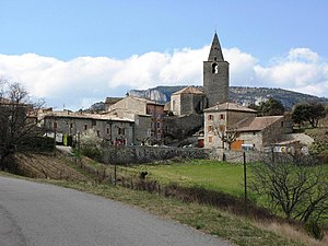
Grass (Ardèche)
| grass | ||
|---|---|---|
|
|
||
| region | Auvergne-Rhône-Alpes | |
| Department | Ardèche | |
| Arrondissement | Privas | |
| Canton | Bourg-Saint-Andéol | |
| Community association | Rhône aux Gorges de l'Ardèche | |
| Coordinates | 44 ° 27 ' N , 4 ° 32' E | |
| height | 120-732 m | |
| surface | 56.68 km 2 | |
| Residents | 635 (January 1, 2017) | |
| Population density | 11 inhabitants / km 2 | |
| Post Code | 07700 | |
| INSEE code | 07099 | |
| Website | www.gras.fr | |
 Chapel in the center of the village |
||
Gras is a French commune with 635 inhabitants (as of January 1, 2017) in the Ardèche department . The municipality is located on a high plateau between the towns of Viviers on the banks of the Rhone and Vallon-Pont-d'Arc on the Ardèche .
Gras is part of the Côtes du Vivarais wine-growing region .
Population development
| year | 1962 | 1968 | 1975 | 1982 | 1990 | 1999 | 2006 | 2016 |
|---|---|---|---|---|---|---|---|---|
| Residents | 225 | 260 | 234 | 250 | 317 | 381 | 482 | 625 |
Web links
Commons : grass - collection of pictures, videos and audio files
