
Saint-Laurent-du-Pape
|
Saint-Laurent-du-Pape Sant Laurent-du-Pape |
||
|---|---|---|
|
||
| region | Auvergne-Rhône-Alpes | |
| Department | Ardèche | |
| Arrondissement | Privas | |
| Canton | Rhône-Eyrieux | |
| Community association | Privas Center Ardèche | |
| Coordinates | 44 ° 49 ′ N , 4 ° 46 ′ E | |
| height | 106-535 m | |
| surface | 14.11 km 2 | |
| Residents | 1,566 (January 1, 2017) | |
| Population density | 111 inhabitants / km 2 | |
| Post Code | 07800 | |
| INSEE code | 07261 | |
| Website | http://www.saintlaurentdupape.fr/ | |
_mairie-%C3%A9cole.JPG) School and town hall of Saint-Laurent-du-Pape |
||

Saint-Laurent-du-Pape ( Occitan : Sant Laurent du Pape ) is a French municipality with 1566 inhabitants (as of January 1 2017) in the department of Ardèche in the Region Auvergne Rhône-Alpes . Saint-Laurent-du-Pape belongs to the Arrondissement Privas and the canton of Rhône-Eyrieux . The inhabitants are called Saint-Laurentais (es) .
geography
Saint-Laurent-du-Pape is located about 15 kilometers south-southwest of Valence on the Eyrieux , a tributary of the Rhône. Saint-Laurent-du-Pape is surrounded by the neighboring communities Gilhac-et-Bruzac in the north, Beauchastel in the east, La Voulte-sur-Rhône in the south and south-east, Rompon in the south, Saint-Cierge-la-Serre in the south-west and Saint -Fortunat-sur-Eyrieux to the west.
Population development
| 1962 | 1968 | 1975 | 1982 | 1990 | 1999 | 2006 | 2017 |
|---|---|---|---|---|---|---|---|
| 1237 | 1194 | 1159 | 1174 | 1206 | 1295 | 1469 | 1566 |
| Sources: Cassini and INSEE | |||||||
Attractions
- Catholic Church
- Evangelical Reformed Church
- Le Bousquet Castle, Monument historique
- Remains of a Roman bridge
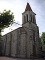
Catholic Church

Evangelical Reformed Church

Le Bousquet Castle
_%C3%A9glise_catholique.JPG)
_%C3%A9glise_r%C3%A9form%C3%A9e.JPG)
