
Provinces of Japan

Before the modern system of prefectures was introduced in Japan , Japan was divided into provinces ( 国 kuni , dt. "Countries").
history
As administrative units of the imperial court
The provinces were established in ancient times as both administrative units and geographical regions. Each province was further divided into gun (formerly kōri ).
The provinces were divided into Kinai (in the capital) and 7 or - with Hokkaidō , a modern addition - 8 dō ("routes, ways", less literally "large landscapes, imperial circles"; see Chinese Dao ). This division was called Gokishichidō . In this context, Dō did not yet correspond to early modern modern traffic routes ( Kaidō ) such as the Tōkaidō from Tōkyō to Kyōto or Kōbe .
The highest provincial officials including the governor were called Kokushi , older also kuni no tsukasa , and the capitals Kokufu .
As a geographical division of the country


In the late Muromachi period , their function as administrative units was gradually completely replaced by the lands of the Sengoku - daimyō . Under the rule of Toyotomi Hideyoshi , the provinces were finally replaced by the fiefs of the daimyo. The fiefs of the Edo period are subsequently referred to as Han . The provinces remained as a geographical region designation and the population often specified a certain place with the combination of province and Han.
In the Boshin War and during the Meiji Restoration , the shogunate territories and a few rebel (or shogunate loyalists) Han were replaced by Fu (urban prefectures) and Ken (rural prefectures) from 1868 and the remaining Han initially legitimized as administrative units, but all replaced by Ken in 1871 . As part of the address system, the provinces were not abolished, but played an even more important role. In 1871 there were 304 prefectures and 68 provinces (excluding Hokkaidō and Ryūkyū Province ). The many prefectures initially corresponded to their feudal predecessors with their complicated borders and numerous en- and exclaves, so their borders mostly did not correspond to those of the provinces. Exceptions were some large Han / prefectures, especially those of the powerful "outer" Tozama daimyo , who also ruled entire provinces under the Tokugawa. Subsequently, the prefectures were merged in several waves, divided and their borders shifted. By the end of the 1880s, this essentially formed today's 47 prefectures, the borders of which are in many places congruent with those of the provinces. Only after this consolidation of the prefectures could they largely replace the provinces as a geographical frame of reference.
To date, the provinces have not been abolished by law, but they are considered obsolete. However, their names are still often used as part of geographical names, company names, and trademarks. At the beginning of the 21st century , the governor of Nagano Prefecture proposed that his prefecture be renamed Shinshū (a name derived from Shinano Province ).
Provinces

Provinces around 701–702

Provinces in the Kamakura period up to 1868


Kinai
- Yamashiro Province (this province is Kyoto )
-
Yamato Province (then seat of the emperor)
- 716-738:
- Yamato Province
- Yoshino-gen
- 716-738:
- Kawachi Province
- Izumi Province (716 separated from Kawachi as Izumi-gen, 740 separated from Kawachi, 757 separated again)
- Settsu Province
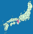
Kinai

Tōkaidō


Tōkaidō ( 東海 道 , dt. "Eastern Sea Route")
- Iga Province
- Ise Province
- Shima Province (separated from Ise in the 8th century)
- Owari Province
- Mikawa Province
- Tōtōmi Province
- Suruga Province
- Izu Province
- Kai Province
- Sagami Province
- Musashi Province (before 771 in Tōsandō Region)
- Awa Province (718 separated from Kazusa, 741 separated from Kazusa, 757 separated again)
- Kazusa Province (part of the ancient Fusa Province )
- Shimousa Province (part of the ancient Fusa Province)
- Hitachi Province
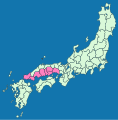
Tōsandō ( 東山 道 , German "Eastern Mountain Route")
- Ōmi Province
- Mino Province
- Hida Province
-
Shinano Province
- 721-731:
- Shinano Province
- Suwa Province
- 721-731:
- Kōzuke Province (part of the ancient Kenu Province )
- Shimotsuke Province (part of the ancient Kenu Province)
- Musashi Province (771 to the Tōkaidō region)
-
Dewa Province
- from 1869:
-
Mutsu Province
- at 718:
- Mutsu Province
- Iwaki Province
- Iwase Province
- from 1869:
- Rikuō (Mutsu) Province
- Rikuchu Province
- Rikuzen Province
- Iwaki Province
- Iwashiro Province
- at 718:

Tōsandō

Hokurikudō


Hokurikudō ( 北 陸 道 , Eng. "Northern Land Route")
- Wakasa Province
- Echizen Province (part of the ancient Koshi Province )
- Kaga Province (separated from Echizen in 823)
- Noto province (718 separated from Echizen, 741 to Etchū, 757 separated again)
- Etchu Province (part of the ancient Koshi Province)
- Echigo Province (part of the ancient Koshi Province)
- Sado Province
San'indō ( 山 陰道 , German "mountain ridge route")
- Tamba Province
- Tango Province (separated from Tamba in 713)
- Tajima Province
- Inaba Province
- Hōki Province
- Izumo Province
- Iwami Province
- Oki Province

San'indō
San'yōdō


San'yōdō ( 山陽 道 , German "Mountain Front Route")
- Harima Province
- Bizen Province (part of the ancient Kibi Province )
- Bitchū Province (part of the ancient Kibi Province)
- Province of Bingo (part of the ancient Kibi Province)
- Mimasaka Province (separated from Bizen in 713)
- Aki Province
- Suō Province
- Nagato Province
Nankaidō ( 南海 道 , German "Southern Lake Route")

Nankaidō
Saikaidō (excluding the Ryūkyū Islands)


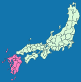
Saikaidō ( 西海 道 , Eng . "Western Sea Route")
- Buzen Province (part of the old Toyo Province )
- Bungo Province (part of the ancient Toyo Province)
- Chikuzen Province (part of the ancient Tsukushi Province )
- Chikugo Province (part of the ancient Tsukushi Province)
- Hizen Province (part of the old Hi Province )
- Higo Province (part of the old Hi Province)
- Hyūga Province
-
Ōsumi Province (separated from Hyūga in 713)
- 702-824:
- Ōsumi Province
- Tane Province
- 702-824:
- Satsuma Province (separated from Hyūga in 702)
- Iki Province
- Tsushima Province
- Ryūkyū Province (Until the Meiji Restoration, it was a vassal state of the Japanese fiefdom Satsuma . In 1871 it was absorbed into Kagoshima Prefecture . After World War II , it was ruled by the USA. In 1972 it was returned to Japan as a province and shortly afterwards the Okinawa Prefecture .)
Hokkaidō ( 北海道 , German "Northern Sea Route")
- Oshima Province
- Shiribeshi Province
- Iburi Province
- Ishikari Province
- Teshio Province
- Kitami Province
- Hidaka Province
- Tokachi Province
- Kushiro Province
- Nemuro Province
- Chishima Province
Web links
Detailed maps of the provinces at different times can be found on: