
Kniprodestrasse (Berlin)
| Kniprodestrasse | |
|---|---|
|
|
|
 |
|
| North of Danziger Strasse | |
| Basic data | |
| place | Berlin |
| District | Prenzlauer Berg |
| Hist. Names |
Lost Way , Artur-Becker-Strasse |
| Name received | February 13, 1901 November 1, 1995 |
| Connecting roads | Am Friedrichshain (S) Michelangelostraße (N) |
| Cross streets |
O: Virchowstraße |
| Numbering system | Horseshoe numbering |
| use | |
| User groups | Residents , cyclists , car traffic , bus routes |
| Technical specifications | |
| Street length | 1996 meters |
The Kniprodestraße is a 2,000-meter long transport route in the Berlin district of Prenzlauer Berg of Pankow . It bears this name since 1901 on an old Wegtrasse . The traffic route lies between the north of the Volkspark Friedrichshain and Michelangelostraße (around the Jewish cemetery ).
The article also gives an overview of the immediate vicinity in order to characterize the street that has existed since 1901.
Origin of name
The early route of the Lost Way lay from the Bernauer Tor (since 1810: Königstor) to the northeast and led along Friedrichshain, planned in 1840 and completed in 1848, into the Feldmark with an undefined destination ( Lost Way was created because it "lost" itself in the soft area ). The section at the park was named as the laid-out street 'Am Friedrichshain' by the municipal authorities on October 28, 1880 . The further guidance to the Weichbild boundary was named after Winrich von Kniprode (around 1310-1382) in 1901 . The choice of name corresponded to the theme of several streets in the district with reference to East Prussia (some are also named after outstanding doctors). The last place of work Winrich von Kniprode was Marienburg in East Prussia. There he held the office of Grand Master of the Teutonic Order from 1351 to 1382.
Kniprodestrasse was renamed on September 4, 1974 with neighboring streets. Resistance fighters were given names , and Kniprodestrasse was named after Artur Becker (1905–1938). He was a functionary of the Communist Youth Association of Germany , a member of the Reichstag and a Spain fighter . Since November 1st, 1995, after the political change , Artur-Becker-Straße has been carrying its traditional (city-historical) name to Kniprode again.
Location in the road network
course
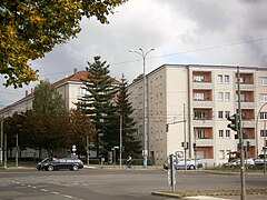
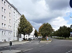
The traffic train is between Am Friedrichshain and the (turning) Michelangelostraße. The counting of the properties (in the south) from and to the intersection of Virchowstrasse and Hufelandstrasse is provided with horseshoe numbering . The street named ends as a 200-meter-long dead end at the Jewish cemetery, which is the border with Weissensee. The horseshoe numbering starts with number 1 on Virchowstraße and goes to 62 on the east side. The further count on the west side runs back north-south. Past the corner of Anton-Saefkow-Straße with 97 is the residential building 122 with the highest number on the corner of Hufelandstraße. Kniprodestrasse crosses the B 96a on Danziger Strasse . The traffic connection between Storkower Straße and Michelangelo- / Ostseestraße is important as a replacement for the city ring between Lichtenberg and Pankow and Reinickendorf . It is not possible to bypass the Weißensee Center (south-north on Berliner Allee) through the Jewish cemetery (return of the street corridor to the Jewish community). The continuation of the C-route of the road ring (tangent) in west / east traffic is suspended or excluded due to the protection of allotments at the Volkspark Prenzlauer Berg in between .
Statistical data
Kniprodestrasse belongs with number 5738 in the Berlin street directory in full length to Prenzlauer Berg. In the road development plan , the 1,406 meters between Danziger and Michelangelostraße are entered as a superordinate road connection (category II), the further 385 meters to the south are a regional road connection ( category III ). The tethered to the Michelangelostraße another 205 meters are dead end as far as the Jewish cemetery, "other city street" than with Category V . With OKSTRA class "G", the Berlin road administration is responsible for Kniprodestrasse, primarily the road and green area office (road and surface office) in the Pankow district office. Equipment regulations for a (public) route according to RBS class "STRA" apply.
urban planning
A city planning division of Berlin are statistical areas. According to these, the development on Kniprodestrasse was assigned to three of them. The “statistical area 111” includes house numbers 1–15 and 112–122 ( Bötzowviertel ) south of Danziger Strasse. To the north of Danziger Strasse, Kniprodestrasse divides the "statistical area 108" (land 16a-62 with commercial and small settlement to the east) and area 109 of house numbers 64-111a (Mühlenviertel and Green City ) on the west side. For traffic planning, traffic cells were derived from the statistical areas. The following applies to traffic allocation according to statistical areas
- "111 Greifswalder Strasse-Süd" → traffic cell 1112 "Greifswalder Strasse / Am Friedrichshain" → traffic sub-cell "11122 Greifswalder Strasse / Pasteurstrasse"
- “108 Greifswalder Straße-Nord” to the traffic cells
- "1081 Greifswalder Strasse / Danziger Strasse" → sub-cell "10812 Danziger Strasse / Kniprodestrasse"
- "1082 Ostseeplatz" → sub-cell "10821 Kniprodestraße / Michelangelostraße"
Younger is the socio-spatial division according to lifeworld-oriented spaces (LOR). This structure divides the street environment of Kniprodestrasse into smaller parts. The district in the Pankow district (number 03) is divided into forecast areas, district regions and planning areas. The differences and house and property divisions are detailed in the section on the development on the street . Danziger Strasse divides Kniprode into two forecast rooms:
- “0307 Südlicher Prenzlauer Berg” to the region “16 Prenzlauer Berg Süd” with the planning area “39 Bötzowstraße” (corresponding to 03071639), 3,924,600 m².
- "0306 Nördlicher Prenzlauer Berg" with the district region "14 Prenzlauer Berg Ost" distributed over four planning rooms
- West side of Kniprodestrasse
- south of the railway "34 Anton-Saefkow-Park" ( Green City , 03061434, 550.881 m²)
- north of the railway "29 Greifswalder Straße" (better than: Mühlenviertel, 03061429, 853.478 m²)
- East side of Kniprodestrasse
- south of the railway "35 Conrad-Blenkle-Straße" (also as "Paul-Heyse-Kiez", 03061435, 552,082 m²)
- north of the railway "30 Volkspark Prenzlauer Berg " (03061430, 1,211,184 m²)
- West side of Kniprodestrasse
In the planning area “Greifswalder Strasse” ( Mühlenviertel ) the Senate is planning an urban renewal with the help of subsidies. The area represents part of the Berlin funding framework “Urban Redevelopment”. On July 4, 2017, the district office decided on the ISEK ( Integrated Urban Development Concept ). To the north of the S-Bahn line (Kniprodenstrasse bridge), Kniprodestrasse divides the two LOR planning areas "Greifswalder Strasse" and "Volkspark Prenzlauer Berg".
District structure
It should be noted that the district with the formation of Greater Berlin on October 1, 1920 belonged to the Prenzlauer Berg administrative district (District 4) (see general information on the structure of Berlin ). This structure remained in the post-war period. This means that Kniprodestrasse was in the "city district" during East Berlin times and in the "district" of Prenzlauer Berg after the political change. This old district came in 2001 with the administrative reform (district area reform ) as a part of the (greater) district of Pankow. The affiliation of the entire length of Kniprodestrasse to Prenzlauer Berg has not changed since the name was given.
As city districts before the formation of Greater Berlin were in the area of Prenzlauer Berg
- for Kniprodestrasse 1–15 and 113–122 (south of Elbinger Strasse ): city district 189f
- from Elbinger Straße to Thorner Straße and Ringbahn: city district 190d
- between the Ringbahn and the Weichbild boundary: district 191.
Another older assignment of Kniprodestrasse was the registry office district 8 and the police station 113. According to the division of June 1, 1906, the part south of the Ringbahn belonged to the district court Berlin-Mitte, north to the district court Berlin-Weißensee. In the 1890s the police station 80 (Weißensee) was responsible for the lost way, which in turn formed the eastern border of the police station to the police station 51 (Landsberger Allee) with Am Friedrichshain.
Zoning plan
For the use of the areas along the street, the land use plan (FNP) is decisive as a working basis for urban planning. The use of Kniprodestrasse is again divided into different sections. The street itself is included as the higher-level main road between Danziger and Michelangelostraße.
- south of Danziger Strasse
- before: green area / park
- West side (Bötzowviertel) as residential area W2 (GFZ up to 1.5)
- East side to the Friedrichshain district border: common areas with a high proportion of greenery, school
- Danziger Strasse to Bahn
- West side
- Green city: residential area W2 (GFZ up to 1.5)
- Anton-Saefkow-Park along the railway: green area / park
- East side: follow north
- Residential building area W2 (GFZ up to 1.5)
- Depot (train and bus)
- Common area with a high proportion of greenery, school
- West side
- Railway area (under the Kniprodestrasse bridge)
- Train to Michelangelostraße (it crosses as the superordinate main road also entered in the allotment gardens)
- East Side
- Housing area W3 (GFZ up to 0.8)
- Mixed construction area M
- West side
- Common area (between Bahn and Storkower Straße)
- Housing area W4 (GFZ up to 0.4)
- Green area / allotment garden
- East Side
- Dead-end street to the cemetery wall
- West: residential area W3 (GFZ up to 0.8)
- East: Area with a commercial character / waste (sewage)
- Completion: green space / cemetery
Postal districts
The zip code of Kniprodestraße is 10407 Berlin. In 1900 the predecessor known as Verlorener Weg was assigned to Kniprodestrasse Berlin NO. By regulation from 1862 Kniprodestrasse belonged to the postal district NO 18. The associated post office, the old " Post-Expedition 18", was located at Landsberger Strasse 89, it later moved to Waßmannstrasse and then to Lichtenberger Strasse 19. The numbering of the postal district was valid until 1965, when four-digit postcodes were introduced in the GDR . The offices that used to carry numbers kept them and were prefixed with a 10 so that the postal district “Berlin NO 18” became the postcode “1018”. With the reorganization of the post offices (self-collection, main offices, distribution), the postal delivery districts were adjusted, Kniprodestrasse belonged to postcode “1055 Berlin” (at the latest) from January 1, 1969. In 1993, after the political change, five-digit postcodes were introduced nationwide , resulting in “10407 Berlin” for Kniprodestrasse.
Cross streets
.jpg)
.jpg)
.JPG)
.jpg)
.jpg)
Current situation
In addition to the road crossings and junctions, the ring line is crossed on the " Kniprodestrasse Bridge". This has its own number 08538 in the Berlin street directory. It has existed since Kniprodestrasse was created, but in a different status. According to the LOR statistics, it is assigned to 03061434 (06 Nördlicher Prenzlauer Berg / 14 Prenzlauer Berg Ost / 34 Anton-Saefkow-Park).
.jpg)
.jpg)
- Virchowstraße ( Lage , 43415): It opens from the east (opposite Hufelandstraße) at the beginning of the plot of land on Kniprodestraße. It was named on March 17, 1891 (Straße 32, Abt. XIII / 2).
- Hufelandstrasse ( Lage , 41384): It opens from the west (opposite Virchowstrasse) at the end of the plot of land on Kniprodestrasse. It was named on June 4, 1904 (Straße 2, Abt. XIII / 1).
- Lieselotte-Hermann-Straße ( Lage , 40049): It opens from the west under the residential building complex 119 / 119a. It was named on September 17, 1905 as Allensteiner Strasse (Strasse 2b, Section XIII / 1) and on September 4, 1974, it received the existing name of resistance fighter against the Nazi regime Lieselotte Hermann .
- Pasteurstrasse ( Lage , 42210): It flows from the west between the recessed residential buildings Pasteurstrasse 51/53 and 50/52 (in Front Kniprodestrasse 117 / 116a and 118 / 118a. It was named on July 4, 1904 (Strasse 4, Section XIII /1).
- Danziger Straße ( Lage , 5750): With a width of 55 m, it crosses two directional lanes and a double-track tram line in the middle. The tram track (turning loop) from the northern Kniprodestrasse has a connection to this in both directions. Since the beginning of the 19th century the road location was called Communicationsweg (also Gürtelstraße ). On February 23, 1874, it was officially named Danziger Strasse and on January 5, 1950, with the beginning of the reconstruction along the street, it was named Dimitroffstrasse . As with many historic streets, the renaming took place after the political change , here on November 1, 1995. The federal highway 96a is on Danziger Strasse .
- Heinz-Kapelle-Straße ( Lage , 41040): It flows from the west under the residential building complex 110 / 110a. It was named on November 9, 1911 as Goldaper Strasse (Strasse 7e, Section XIII / 1) and on September 4, 1974, it received the existing name after the resistance fighter against the Nazi regime Heinz Kapelle .
- John-Schehr-Straße ( Lage , 41681): It flows out from the west and connects the tram turning loop to the tracks of Kniprodestraße. It was named on November 9, 1911 as Kurische Strasse (Strasse 7, Section XIII / 1) and on September 4, 1974, it received the existing name after the resistance fighter against the Nazi regime, John Schehr .
- Conrad-Blenkle-Straße ( location ): It flows from the east. It was named on March 17, 1891 as Thorner Strasse (Strasse 30, Abbot XIII / 1) and on September 4, 1974, it received the existing name after the resistance fighter against the Nazi regime, Conrad Blenkle . In the Berlin street directory under 43309 it is listed in StEP Class III as a supplementary street.
- Rudolf-Schwarz-Straße ( Lage , 40757): It joins as a footpath from the west and is located behind residential building 103 and the low-rise building at 102 (“Zum Schluckspecht” bistro, bus stop). It was named on March 29, 1939 as Ermländische Strasse ( Planstrasse 63 ) and on September 4, 1974, the existing name was given after the resistance fighter against the Nazi regime Rudolf Schwarz .
- Anton-Saefkow-Straße ( Lage , 40201): It ends as a one-way street from the west at “Volkspark Anton Saefkow” at the corner of residential building 97. It was named on March 29, 1939 as Gumbinner Straße and on September 29, 1955, it was named after Resistance fighter against the Nazi regime Anton Saefkow . The Gumbinner Straße had a transverse position as plan road No. 61 , the existing course resulted from the first development.
- (Ringbahn): Kniprodestrasse bridge ( location ). The railway has existed here since the 1870s. A bridge crossing was included in the planning at an early stage. The railway crosses under with two S-Bahn and two long-distance railway tracks, the tracks from the freight rail connection continue as a single track under the bridge for another 300 m as a butt track to the buffer stop .
- Storkower Straße ( Lage , 42794): It crosses two lanes. At the northeast corner there is an administrative high-rise (Storkower Strasse 97) rising from ten to twelve storeys, in the southwest the 18- / 21-storey high-rise apartment building Storkower Strasse 108. Both are set back 50 m from the street corners. On the west side, the four-storey corner house Storkower Strasse 93/95 closes to the north and to the south the street corner is also open to the residential line Storkower Strasse 90-82 (straight), along Kniprodestrasse 50 meters to the residential line 94-96 (continuous). It was named on May 12, 1910 (Straße 12, Section XII / 1) from the west to Kniprodestraße. On August 9, 1929, it was continued up to Landsberger Allee.
- Einsteinstrasse (40697): It lies with the residential lines Einsteinstrasse (15b–) 15d and 16a – 16d behind a (almost) 20 m wide green area parallel to the west side of Kniprodestrasse and opens into Hans-Eisler-Strasse. There are two footpaths, one of which leads to the street sign on Kniprodestrasse from the west ( Lage ), the other leads to the bus stop ( Lage ). The street was redesigned with a new development area with Q3A buildings from the mid-1960s in the north on Storkower Straße and named on February 14, 1964. Before the WBS.Block 15a-15d - was built, Einsteinstraße ended directly at Kniprodestraße.
- Stedinger Weg ( Lage , 42767): It flows from the east, across from Hanns-Eisler Straße. It was named ( Strasse 41 ) on February 27, 1936.
- Hanns-Eisler-Straße ( Lage , 43810): It flows out from the west, across from Stedinger Weg. It delimits the large WBS70 / 11 settlement (Mühlenkiez, 10,000 inhabitants) that was built in the mid-1970s to the west and north and lies between Thomas-Mann- and Kniprodestrasse. It was named after the Austrian composer Hanns Eisler .
- Altenescher Weg ( Lage , 40061): It flows from the east. The 360 meter long Planstraße 37 got its name on the northern edge of the single-family housing estate on February 27, 1936. The street number is.
- Michelangelostraße ( Lage , 41961): Michelangelostraße is the main road leading to the west. A plan envisages the extension to the east between the commercial area and the allotment garden in the direction of Lichtenberg.
- Gürtelstrasse ( location ): The Gürtelstrasse runs along the district boundary to Weißensee and through it on the (south) wall to the Jewish cemetery. there is the Gürtelstraße up to the Kniprodestraße as a footpath. There is a footpath from house 25 (a daycare center) between the three horizontal rows of the Q3A residential development on Michelangelostraße (101–107, 109–115, 117–123, each uneven) and the tree line by the cemetery wall. In the Berlin street directory, the Gürtelstrasse is number 41140 and is RBS class "STRA" throughout, of which 470 meters belong to the Weissensee district from Berliner Allee. Kniprodestrasse is 840 meters away in Prenzlauer Berg, 180 meters of which are assigned as a district road, 80 meters belong to Okstra class "N", other users / responsible persons. The remaining length of Kniprodestrasse is included in the official plan as a 25 meter wide green strip: strips of trees and the footpath.
Former streets
The following cross streets have been closed or "closed down".
- Schönlanker Straße ( location ): Straße 31a, Section XIII / 1 of the development plan was named on August 23, 1905. It ended roughly opposite Goldaper Strasse (since 1974 Heinz-Kapelle-Strasse). On September 4, 1974, the remaining section was named Ernst-Fürstenberg-Straße. The route originally leading to Kniprodestrasse with gardening office and fire station was planned in the mid-1950s with the site at Kniprodestrasse 21 and shortened by building land with the residential row Kniprodestrasse 17-23. From the end on Erich-Boltze-Straße (formerly Gnesener Straße ) there is a gap between the two apartment blocks 12/14 to 15/17 (continuous) to the green / fallow area in the inner block, but especially the garage. It was named after the (now Polish) town of Schönlanke .
- Bardelebenstrasse ( location ): Planstrasse 31, Section XIII / 1 of the development plan was named on September 1, 1897. It ran opposite Pasteurstrasse between Kniprodestrasse 6 and 8 eastwards 115 m to Werneuchener Strasse (November 5, 1993: Margarete-Sommer-Strasse) on the Friedrichshain district border. It was drawn in around 1964 when planning inner-city construction work. It was named after the surgeon Bardeleben , director of the Charité surgical clinic.
- Friedeberger Strasse : It was a parallel street between Danziger and Pasteurstrasse. It was built over with the apartment block in the 1950s, but there is still a spur road that opens onto Arnswalder Platz.
- Meubrinkstrasse : As an extension of Carmen-Sylva-Strasse (since 1954 Erich-Weinert-Strasse), Planstrasse 13, Section XIII, was laid out between Greifswalder and Kniprodestrasse and was named on November 9, 1911 after the Berlin local politician Friedrich Meubrink (1844-1908) named. Meubrinkstrasse ended on Kniprodestrasse from the east opposite between von Altenescher and Stedinger Weg. The residential development was no longer continued due to the structural development between 1932 and 1934. It is only 100 meters as a street on the map, the route to Kniprodestrasse as route "No. 58 ”. It is recorded in the address book as "undeveloped", during and after the war there was an arbor colony / allotment garden on the planned street and the street name was lost.
- Lycker Strasse : Opposite Thorner Strasse (since 1974 Conrad-Blenkle-Strasse), Planstrasse 9 (Section XIII / 1) was laid out and on November 9, 1911, along with other surrounding streets, it was named Lycker Strasse . In the first plan it ran from the corner of Kniprodestrasse to the northwest to Greifswalder Strasse near Gumbinner Strasse (since 1955 Anton-Saefkow-Strasse). The street was cleared during the first development in the "Green City" and the streets were laid at right angles.
- Pregelstrasse : According to the street picture in the address book, it was specified from Kniprode to Greifswalder Strasse and was parallel between Gumbinner Strasse and Ringbahn. After the initial planning, probably parallel to Kniprodestrasse. The name was given on March 29, 1939 after the East Prussian River Pregel . In its current location as Werner-Kube-Straße, Pregelstraße was fixed during the first development.
Straub plan from 1910
Kniprodestrasse is included on the Straub plan from 1910 with the plans for the side streets before the First World War . Some of these planned routes have been implemented. On the west side there are buildings up to Danziger Strasse (then Elbinger Strasse ) and east to the “street station” (at height no. 25). All the streets mentioned belonged to Division XIII. Since then, the routes of the planned streets 7e (Heinz-Kapelle-Straße), 7b (John-Schehr-Straße) and 7d (Anton-Saefkow-Straße) have been implemented. The street 9a , which is a continuation of Thorner (since 1974 Conrad-Blenkle-) Straße , was named but ultimately built over. Also Straße 9 ( situation ) would have been parallel to the ring road was not built on and would be in Volkspark Anton Saefkow, parallel to Anton Saefkow road, parallel to the circle line continued to the east is also forgotten.
To the north of the Ringbahn, the planned routes and the use of the area as arbor colonies have been changed more strongly when new plans have been made. The Storkower Straße can be found in the route of Straße 12 (west) and Straße 28 (southeast). Michelangelostraße is also planned as 40a street , and if it continued to the east, the place C II would be 100 wide and 200 long. The plan was to cross street 15a in the Weißensee district (Jewish burial site) , which is partly laid out as a belt street. Note the existing Alte Weg ( location ), which became the Birkenstrasse of the KGA “Neues Heim”. For 1910, a private road is drawn in the approximate location of Pieskower Weg , which reached to Kniprodestrasse ( Lage ). Street 13 ( Meubrinkstraße , Lage ) is planned parallel to this , which now begins in the large estate as Thomas-Mann-Straße, but would have run to Kniprodestraße. The location here would correspond to the confluence of Hanns-Eisler-Strasse. Continued as Planstraße 24 , but following the "Ringbahnknick". The road 14a (to west corresponding to Hanns-Eisler-Straße 56-68, position ) and street 23a were planned parallel thereto. The triangular square K II would have been Kniprodestrasse, Strasse 24a and a (wider) Strasse 22a Lage leading directly to the east . The road 23a has a still comprehensible realization: its southern edge would have become the boundary of the industrial area Storkower Straße to the KGA "Neu-Berlin". From this it can be seen that before the new planning of the 1970s, these (planned) routes, which are over a hundred years old, were also used as plant routes for arbor colonies and allotments. In addition to the planned cross roads to Kniprodestrasse, there were parallel or inclined routes on the arable and colony areas between Greifswalder Strasse and to the east (to Oderbruch - partly Landsberger Strasse).
Green and open spaces
Several green spaces, allotments and parks border on Kniprodestrasse.
- Volkspark Friedrichshain: It is located in the south along Virchowstraße and Am Friedrichshain.
- Instead of the war-torn apartment buildings at Kniprodestrasse 1–15, there is a green open space of three hectares in the square of Kniprodestrasse, Danziger, Margarete-Sommerstrasse and Virchowstrasse right up to the Friedrichshain park area.
- Anton-Saefkow-Park : it lies to the east on the railway between the former freight yard and Anton-Saefkow-Straße. It is an area of 7.5 hectares on which rubble from the ruins of the city center was deposited around 1950.
- On the eastern side of the road there is a green area (0.4 ha) facing Einsteinstrasse.
- On Kniprodestrasse, north of the Storkower Strasse intersection, in front of the “Storkower Strasse industrial estate”, there is 0.9 hectares of green bush zone, which also includes the parking spaces in front of the two commercial buildings at Storkower Strasse 99 and 101.
- To the east of Kniprodestrasse, the KGA “Neu Berlin” begins behind the residential buildings on Stedingerweg. Their parcels border on the “Storkower Strasse industrial estate”, which until the 1960s also belonged to the “Unite Farmers from the Mountains” allotment garden.
- The "Siedlung Stedingerweg" from the east side of Kniprodestrasse between Altenescher and Stedingerweg covers almost 10 hectares, further east the Volkspark Prenzlauer Berg .
- In the arch to Michelangelostraße there is the “Sportplatz Hans-Eisler-Straße” on the west side behind a narrow green strip with bushes.
- “KGA Neues Heim”: It is located (with the plant's own private paths on Birkenstrasse and Rosenstrasse) in the course of a possible extension of the north-east bypass of the road ring on the “main path” according to the zoning plan. The latter leads to the east between the allotment gardens and the commercial area (formerly the recycling yard and the gardening office). The KGA was founded in 1908.
- Along the cemetery wall from the Weissensee district is a strip of green in the extension of Gürtelstrasse from Kniprodestrasse to the west.
.jpg)
Of the 20 main green routes in Berlin, two meet on Kniprodestrasse.
- Inner Parkring : It crosses Kniprodestrasse from Conrad-Blenkle-Strasse leading into “Volkspark Anton Saefkow”. The 52-kilometer circular route surrounds downtown Berlin and connects large and small parks with green niches.
- Hönower Weg : It starts at the Märchenbrunnen and leads over Arnswalder Platz and Bötzowstraße into Anton-Saefkow-Park to Kniprodestraße or alternatively along Kniprodestraße. The bridge leads him over the Ringbahn to Storkower Straße and through Einsteinpark to Michelangelostraße, where he crosses over Kniprodestraße to Volkspark Prenzlauer Berg . The end point of Hauptweg 7 is in Hellersdorf at the Hönow underground station .
History of the road
_in_12_Bl%C3%A4ttern_VI_Berlin_(cropped).jpg)
In 1913 (before the First World War and the inflation) the route can be seen in the development phases:
- Am Friedrichshain: named in 1880, along between the park and the Swiss garden
- From the park to the Ringbahn: built with Wilhelminian style houses (Bötzowviertel) and development still on schedule (Green City)
- Ringbahn and Gürtelstraße, arbor area: undeveloped and planning still open
- Weißensee territory: Jewish cemetery and connection to the Chaussee, only from 1920 in planning sovereignty for Greater Berlin.
The Brockhaus map from 1894 shows a route for Weißensee on the other side of the cemetery. The route to the cemetery in (old) Berlin is fixed and the road is laid out. Aerial photos from 1928 show the development to the south and north near Danziger Straße, from Kurische Straße and the tram station towards the land there are allotment gardens and arbor colonies. The corridor through the Jewish cemetery also stands out clearly.
The street Am Friedrichshain, as a connection to Kniprodestrasse, became the Abth from streets 25, 2 and 32. XVIII I of the development plan according to the Allerhöchster Cabinett Ordre of September 6, 1880 because of its location on Friedrichshain, which was laid out in 1845.
Lost way
.jpg)
_um_1840_(Bernauer_Tor_nach_Wei%C3%9Fensee).jpg)
A dirt road from the Bernauer Tor to the 'surrounding area' between Bernauer and Landsberger Chaussee already existed in the 18th century. Outside the excise wall, it led east of Greifswalder Straße from Königstor (previously Bernauer Tor) to the northeast to the fields of the arable citizens and in particular the Bötzow family, the path safely crossed Weißensee-Lichtenberger Chaussee. Until the abandonment of the excise wall in the 1860s, this path provided (probably above all) the only access to the Friedrichshain park, which was completed in 1848. On the Schroppschen “Latest development plan of Berlin with the immediate vicinity” from 1863, the “lost way” is shown up to the soft picture border on the edge to Weißensee. On the general development plan ( Hobrecht plan ), the (lost) path - along Friedrichshain - continues to the connection with Weißensee – Lichtenberger Chaussee. The wide route of Straße 25, Section XIII / 1, complements this route between the north corner of Friedrichshain ( Straße 2 , since 1904 Hufelandstraße and Straße 22 , since 1891 Virchowstraße) and an unmarked outer boundary road , the Chausseehaus on the other side of the road from Weißensee 15 .
At the latest when the "Friedrichs Hains" was laid out in the 1840s, the trail came to the western side of the parkland. Across from Friedrichshain , the beer and coffee garden ( Schweizergarten ) could develop from the beer garden of the Aktien-Brauerei Friedrichshain (wheat beer brewery, Lipp's brewery) or the Sharivari Theater on Greifswalder Straße. The early development of this southern section of the Lost Way was documented when it was named Am Friedrichshain in 1880. Part of the Lost Way thus had a name given by the magistrate on October 28, 1880. The further street section (Virchowstraße / Am Friedrichshain to Elbingerstraße ) was named Kniprodestraße in 1901. In the address book for 1900: "NO Verlorener Weg (suggested: Kniprodestr.)"
Street 25 (Section XIII / 1)

At the latest with the removal of the excise wall in the 1860s, the area around Berlin became urban land up to the border of the Weichbild. In the general development plan drawn up in 1862, the route of the "lost path" was extended towards the Weißenseer Flur. Registered by City Planning Director Hobrecht as Straße 25, Section XII / 1 in the development plan, it opened up the area between the Chaussee to Weißensee ( Greifswalder Straße ) and Landsberger Straße from Friedrichshain . In the 1900 address book, Verlorener Weg is still listed and suggested: Kniprodestrasse. The street picture shows the lost way between Virchowstraße (East) / Am Friedrichshain (West), going east to BardelebenStraße, crossing Elbinger Straße, going east to Thornerstraße , Ringbahn. Kniprodestrasse in the 1902 address book, on the other hand, was specified between on Virchowstrasse (east) / Am Friedrichshain (west) and Elbinger Strasse . Number 1 and Virchowstraße 10 together with the eight-party house. Barleben-Straße ran from the east , and street 4a was offset from the west.
In 1905 the Kniprodestrasse was initially developed south of Elbinger Strasse while building land was recorded in the address book as far as Weißenseer Feldmark. The house was owned by ten master masons, two master carpenters, a building contractor, a building plumber, a master painter, a town planning engineer, two manufacturers, three rentiers, a pensioner, a milk dealer, a carter, two merchants, a veterinarian, i.e. 16 out of 27 from the construction industry. In 1910 the tenement houses Kniprodestrasse 16-20 and in the inner block a fire station (on Schönlanker Strasse ) were completed, the 272nd community school and the municipal road station (north of Thorner Strasse ) with siding from Elbinger Strasse . The width of the carriageway was 15 meters and the width of the street between the property boundaries was 35 meters, the bridge was 45 meters long and 15 meters wide with sidewalks. Beyond the railway there were extensive routes for planned roads.
During the Allied air raids , the buildings along Kniprodestrasse were badly hit in the 1910s. Both the Bötzowviertel and houses in the Green City were affected. The resulting landscape of ruins on the edge of Friedrichshain was called the "Dead City". After the rubble had been cleared, a new residential development was created in the 1950s.
The one-family housing estate (between Steengravenweg and Süderbrokweg) was largely built by 1930. On the route of the current Michelangelostraße, the Golpa high-voltage line was pulled in the 1920s through the undeveloped area between Prenzlauer Berg and Weißensee, which was laid down in the 1950s. The initially free area north of the Ringbahn was built around Einsteinstrasse in the 1960s. Without reaching as far as Kniprodestrasse, the large housing estate (Mühlenkiez) followed in the 1970s on the previous allotment garden. The “Storkower Strasse industrial estate” with the standard buildings was built between 1970 and the mid-1970s.
Extended Kniprodestrasse
.jpg)
.jpg)
The lost way can be found on old maps beyond the Berlin Weichbild boundary, it connects to the Chaussee between Weißensee and Lichtenberg. Along this route, the Berlin Jewish community acquired land on Weißenseer Feldmark around 1870 , and from 1880 the largest preserved Jewish cemetery in Europe was laid out. The Jewish cemetery delimited the (probably already noted by) Hobrecht additional route for Kniprodestrasse on Berlin's Gürtelstrasse. The corridor through the cemetery was kept free of burials. With the formation of Greater Berlin in 1920, planning sovereignty passed from the municipality of Weißensee to the city of Berlin . The Berlin – Schwedt – Stettin ( B 2 ) road ran through the center of Weißensee since 1828 and the art road from Berlin to Werneuchen since 1806 . There was a "wish" to create a bypass road for the expected traffic . For this street 90 the extension of the Kniprodestrasse was obvious. The Kniprodeallee was in 1930 east of Weissensee north of Lichtenberger street from the Hohenschönhauser road (by Buschallee replaced) initially created as a dead-end road. On Schwarz's post-war city map, the Kniprodeallee is included as a plan through the Jewish cemetery and further along the Lost Way, Lichtenberger Strasse, past the Resurrection Cemetery , further through allotment gardens to Place 30 (Buschallee and Hohenschönhauser Strasse) between Giersstrasse and the children's and infant hospital Connection to Falkenberger Straße is marked. In 1987 (with plans for the 750th anniversary celebration in the divided city), another 'extended' Artur-Becker-Straße was taken on the tour through or via the cemetery in AngmapId = k_luftbild1928 @ senstadtriff. After preparatory work, the construction was canceled. The follow-up building on Hansastraße ends from the north on Indira-Gandhi-Straße (formerly Lichtenberger Straße).
For building on the street
- New beginning after 1945

Construction site and ruins

Kniprodestrasse (1955)

Kniprode- / Hufelandstrasse

Kniprodestrasse 12–27 / Hufelandstrasse ( 2017 )

Houses 109-111a


.jpg)

- Kniprodestrasse (2017)

Beach volleyball (numbers 1–15)

To the south via Danziger Straße

Corner at the industrial area Storkower Straße

Main traffic Kniprodestrasse

Northern section: dead end

End of the cemetery wall
.jpg)
.jpg)
.jpg)
.jpg)
.jpg)
.jpg)
The description of the construction sections of Kniprodestrasse follows the counting of the plots in horseshoe numbering. Kniprodestrasse 28–40, 43, 47–58, 63, 65–89 are missing from the house numbers currently recorded, but there are eleven on shared properties.
East Side
In 1936 the tenement houses 1-19 stood up to Schönlanker Strasse , followed by the school barracks, addressed at Schönlanker Strasse 11. On the corner of Thorner Strasse was the building plot Kniprodestrasse 23, the train station of the Berliner Verkehrs AG (No. 24) and on 25 the innkeeper Steger (house owned by the market hall administration Berlin-Rohhaus). The following construction sites are called Ringbahn, Storkower Straße, Stedingerweg, Altenescher Weg, Weißenseer Feldmark.
Am Friedrichshain / Virchowstraße - Danziger Straße
Plots 1–15 (continuous) are located at a depth of 40–45 m on the square Kniprode- / Danziger- / Margarete-Sommer- / Virchow-Straße. After the remaining partially damaged houses and the ruins of the war-torn buildings were demolished by the early 1960s, this fallow green space appears as a unit. Around 1970 the gas station was built on the northeast corner (Margarete-Sommer-Straße 2-6). These undeveloped areas are included in the property register as “statistical area 111029”. It was used for various additional activities in the park ( Karl Friedrich Friesen swimming stadium ) in the Friedrichshain district : beach volleyball , bouncy castles , there was previously an air dome . For the conversion of the nearby REWE department store, the provisional replacement store was located in the south of the area. These vacant lots form the statistical block 111029.
In the medium term (not before 2022), the construction of a new professional fire station for Prenzlauer Berg on the corner of Danziger and Kniprodestrasse is planned. The construction is estimated at 10.8 million euros, the funds are planned. The monument protection prohibits changes to the street-side gates on the previous building at Oderberger Straße 24.
Danziger Strasse to Conrad-Blenkle-Strasse
As "Paul-Heyse-Kiez", the quarter is run east of Kniprodestrasse along Danziger Strasse. The residential buildings Kniprodestrasse 17-24 and 16a, 16b belong to it. Residential development took place at the early Kniprodestrasse 16-20 and was badly destroyed in air raids. On the other side of Schönlanker Strasse, the buildings of the 272nd community school were connected, which had been used by the Prenzlauer Berg garden department since the 1930s. The fire station located here should also be noted. On the totally destroyed areas in the square east of Kniprodestrasse, including the gardening office and the tram station, free construction areas were created after the rubble had been cleared. In the later 1950s, the apartment block Kniprodestrasse 17-24 was built into Conrad-Blenkle-Strasse 41. The connection from house 17 was connected to the apartment block Kniprodestraße 16a / 16b / Danziger Straße 183, 185 (odd) / Erich-Boltze-Straße 18/19. The house entrances are connected from the courtyard side. Behind the houses there are green spaces with playgrounds in the square. There is access through the entrances at Kniprodestrasse 21 and at connection 17 / 16a. The block of flats on Danziger Strasse stands out due to its simpler facade design, and house entrances 16a and 16b are lower and face the street.
- Kniprodestraße 16b to 24
North-east corner over Danziger Straße

Courtyard side of the corner

Passage between Kniprodestrasse 17 and 16a

Frame design 16a, 16b and below

Street front 17–24

Passage Kniprodestrasse 21
.jpg)
.jpg)
.jpg)
.jpg)
.jpg)
.jpg)
Conrad-Blenkle-Strasse - Storkower Strasse
.jpg)

.jpg)
There is primarily commercial space between the two streets.
- Track storage: The track system on Kniprodestrasse north of the loop leads to the track storage facility in Kniprodestrasse. From 1908 to 1923 there was a depot of the SSB (trams of the city of Berlin). Due to merging of lines within the framework of the union of the Berlin tram companies, it became the track construction yard of the Berlin tramway (BST) in 1923, from 1929 BVG (after the union). During the Second World War, the site was partially damaged, there was no renovation, and little remained of the actual depot. The site is used as a track storage facility and depot for the utility vehicles used there. The 1.5 hectare BVG site is marked Conrad-Blenkle-Straße 37 and the department store at the corner of Erich-Boltze-Straße, now used as a discount supermarket ( Netto ) with the address , has stood on the area of the tram depot since the 1970s Conrad-Blenkle-Strasse 36.
- Gas station: the property at Kniprodestrasse 25 has always been in front of the tram area. After the Kniprodestrasse bridge was restored in 1979, with increasing traffic in the 1980s, a gas station was opened on this corner.
- Supermarket: In the course of the 1990s, instead of disused GDR department stores, a supermarket with a spacious parking lot was built on the main road to supply the residents on the Kniprodestrasse 26 property.
- Sports hall: In 2015/2016, a school sports hall was built on the Senate property at Kniprodestrasse 27, which previously belonged to Coubertin-Gymnasium. This new building was necessary for two upper school centers (OSZ), as these had been put into operation without sports facilities and there was no space in the immediate vicinity of the school locations. The "OSZ Office Management and Services" (Elinor-Ostrom-Schule, Mandelstrasse 6–8, also sports clerks) held temporary physical education in the Max-Schmeling-Halle and from the OSZ Sozialwesen II (Jane-Addams-Schule, Straßmannstrasse 14-16) in the Velodrom as well as in the halls on Darßer Straße and at the Georg Weerth School. The tender took place in 2013. The funds of ten million euros were released in January 2014, the shell was in October 2015. The two sports halls were also designed for club sports. The building is 57 m long, 64 m wide and 10 m high and accommodates a triple hall with a grandstand for 199 spectators and a double hall, an inserted two-storey part for the social area. The structure on the sloping terrain in a north-south direction was designed from precast concrete parts and partly has a clinker facing shell. The architects were Ingrid Hentschel and Axel Oestreich. There are separate changing, washing, shower and sanitary rooms, and a strength training room, a youth room and a multi-purpose room were created in the larger hall. The halls were opened at the beginning of the 2016/2017 school year. When there was a lack of venues for leisure and club sports, the sports halls were opened for them and also for inclusive sports . The construction offers and still offered difficulties in the completion of a handicapped-accessible inclusive sport.
In the square behind Kniprodestraße 25-27 between Conrad-Blenkle-Straße and the railway system is the Berlin School and Competitive Sports Center with the Coubertin Gymnasium (Conrad-Blenkle-Straße 34) and further 900 meters to the east along the Paul-Heyse- Street followed to Landsberger Allee by the Velodrom (until 1992 :: Werner-Seelenbinder-Halle ) and the jumping and swimming pool (Europa-Sport-Park). The activation of local sports buildings resulted from the application to hold the 2000 Olympics in Berlin , the award was not made to Berlin at the time. The Berlin sports buildings were renamed accordingly. - Ringbahn: Under the bridge are two S-Bahn tracks, two long-distance tracks and a stub track from the (former) freight station. To the east, the railway facilities lie between the commercial buildings on the north side and the school and sports buildings on the south side up to the Landsberger train station . To the west are the rows of living quarters standing across from Storkower Straße and on the south side the railway system, which has been expanded to 13 tracks and sidings, and the commercial space that has emerged from the "Weissensee freight yard". The latter is shielded from the residential area by Anton Saefkow Park . The S-Bahn station remains within sight at 700 meters.
- High-rise residential building Storkower Straße: At the green southeast corner of the Kniprode- / Storkower Straße intersection, the residential high-rise Storkower Straße 108 is owned by the municipal construction company Gewobag , on which there is a low-rise building that was used as a restaurant and has a commercial facility. A playground belongs to the property. Behind it there are commercial buildings up to Landsberger Allee. The approximately 70 meter high skyscraper has eight apartments on 18 floors, was completed in 1987 and dominates the street corner. The building was renovated in 2012-2014 with a gross floor area of 9000 m² for 2.29 million euros in the technical equipment.
Storkower Strasse - Michelangelostrasse
- Industrial area Storkower Straße: The entrance building is formed by the nine to eleven storey office building (Storkower Straße 97) on the northeast corner of the street. The building was built for the foreign trade company "heimelectric" (electrical household appliances) after 1975. In 1992 this AHB was dissolved and then various companies were based in the house, after the renovation and restoration the district office moved in. This office building was built on the land that was left free from the “Storkower Straße industrial estate”. That is in the direction of Landsberger Allee at a width of 250 meters and a length of around 800 meters to the Syringenweg and was laid out in the mid-1960s to 1967 on a former allotment garden. The following 50 meter deep green space is the property on Kniprodestrasse, the visible front of the next two 75 meter long office buildings (before 1966: Storkower Strasse 99 and 101) closes off the industrial area to the west. In the northeastern house there is primarily the police station and police administration.
- KGA "Neu-Berlin": The counting of properties is based on the dominant Storkower Straße. But the allotment garden is also addressed with Stedinger Weg 2 after the side street. The cause is (probably) the order in which the property is used. The "Neu-Berlin" allotment garden is part of the large arbor area that existed on Storkower Straße until 1960 and extends to the Am Weingarten, which was renamed in 2015, with a 260 m long path . The garden plots border primarily on the buildings in the commercial area.
- To the north there is a ten-hectare residential estate. Directly on Kniprodestrasse, this includes their properties 44, 45, 46, the corner properties Stedinger Weg 1 and Altenescher Weg 2. It was built in the 1930s on the east of Kniprodestrasse. The parcelling and the alignment took place in 1932/1933 and the residential building development began in 1934, the naming took place on February 27, 1936. on ten hectares of the area of surrounding arboric colonies. The establishment of (owner-occupied) settlements north of Storkower Strasse began at the end of the 1920s with the “Syringen settlement” around Syringenplatz (resident-style as the “flower quarter”). The street names of the settlement streets 37, 39, 41, 42, 43 were assigned in 1936 when the land was already built on. The name was given to parts of the Wesermarschen community Lemwerder : Altenesch, Ochtum, Süderbrook. and were related to the Stedinger Land . Further roads in the east and south in the 1930s point to the fact that land for residential property is still planned . However, with the beginning of the Second World War , such planning ceased to exist .
- Allotment gardens: The area of the existing colony "Neues Heim" was spared from the arbor area of the 1940s, when rubble from the bomb damage caused by the air raids from the inner city (primarily from Friedrichshain) was piled up east of Kniprodestrasse. The allotment garden association addresses as Kniprodestrasse 59, the colony has (currently still limited) grandfathering. until at least, the extension of Michelangelostraße to the east (“Tangente”) continues to be marked along the “Hauptweg” according to the land use plan . Traffic-related parcels could still be closed in the future by construction work and the route.
Dead end to the cemetery wall
The traffic-significant Michelangelostraße, which crosses here according to the zoning plan, turns with the main street to the west. On the east side of the street is the allotment garden “Neues Heim” (Kniprodestraße 59), the building trade with Kniprodestraße 60 and the BSR property as Kniprodestraße 62. The (garden) plant path between Kniprodestraße 59 and 60 together with the access road is the “main path” The street layout of the city ring road (C-route) marks the direction of the commercial park (still on the plan). This ring road plan includes an eastward extension of Michelangelostraße over the Pankow – Lichtenberg district border (further on about Stellerweg and via road 106) to Weißenseer Weg. However, this planning is blocked by the protection conditions specified in the KGA expansion plan.
The three properties cover large areas east of Kniprodestrasse:
- KGA Neues Heim at number 59: The allotment garden on 2.9 hectares has five system paths (Lilac, Rose, Birkenstrasse and, across it, Flower and Garden Street) and there are 79 plots. It has existed as a registered association since 1991 and is directly adjacent to the "settlement" to the south. The depth of the property is 270 meters from Kniprodestrasse to the east to Volkspark Prenzlauer Berg, which is a designed rubble mountain (Oderbruchkippe) from inner city rubble caused by bomb damage, followed by KGA Greenland (Süderbrockweg 30, 10407 Berlin, 5 ha, 112 parcels), KGA "Am Volkspark Prenzlauer Berg e. V. “(Hohenschönhauser Strasse 80 / am Volkspark Prenzlauer Berg, 10439 Berlin). The KGA Langes Höhe in the Lichtenberg district is still on the Ring's Plantrasse.
- Building trade yard at number 60: It is located behind the BSR premises and can be reached via its 390 meter long access road. There are several buildings on the 3.4 hectare property with commercial companies and a recycling center .
- BSR building, BSR company premises and garden and surface office of the district office Pankow at number 62: The area formerly used as a recycling yard and by the (disintegrated) district office as a depot is directly adjacent to the Jewish cemetery. The property is 3.34 hectares.
- Kniprodestrasse 59-62

KGA under No. 59

KGA access

Main path instead of a tangent

signpost

Access No. 60

BSR new building (62)
.jpg)
.jpg)
.jpg)
.jpg)
.jpg)
.jpg)
West side
On the western side of the street, the area is described based on the plot of land from north to south. In 1936, the west side from Weißenseer Feldmark via Storkower Straße to Ringbahn was listed in the address book as a “construction site” (parceled building land, without land register entries). The properties up to Kurischen Straße are numbered from 92/93 (Hamburger Holzkontor), followed by storage areas, construction sites, 98 and 107 hauliers. Residential development follows from Kurische Strasse: Two residential buildings with 20 tenants are on Goldaper Strasse (109 and 110), two more on Elbinger Strasse (111, 112). To the south of Hufelandstrasse are twelve apartment buildings up to number 122, with 12 to 50 tenants.
Gürtelstrasse to Ringbahn
.jpg)
The end of the street is at the cemetery wall, along which the (extension of) Gürtelstraße is a footpath ( OKSTRA : "N") to the west. A department store was built to supply the allotment gardeners and the 1960s buildings on Michelangelostraße . Refurbished after the turnaround by a low-rise building with a supermarket, hairdresser and a bistro (snack bar) with green electricity, block 108013. The Q3A residential rows to the west and the WBS-70 residential high-rise in the block are addressed to Michelangelostraße. The connection to Kniprodestrasse is via an arch from and to Michelangelostrasse. This low building is marked with Kniprodestrasse 64 on map K5, the bistro is called Kniprodestrasse 63. There is a darts room (sports TV, party room, terrace).
Further south, on Kniprodestrasse, behind 300 m of green space with a bush border, is the "Sportplatz Hanns-Eisler-Strasse" and the property designation Hanns-Eisler-Strasse 91, at the mouth there is the former GDR department store , which is still used as a flea market for the residents of Einsteinstrasse and Hanns-Eisler-Strasse West. The Hanns-Eisler-Straße confluence is also the connection to Einsteinstraße, which opens up the 1960s residential area, with a WBS-70/11 block parallel to Kniprodestraße as Einsteinstraße 16a-16d. The residential line Kniprodestrasse 90-93 (owned by WBG Zentrum) is addressed parallel to Storkower Strasse. A corner house (Storkower Straße 93/95) is at the northwest corner of the intersection. The residential buildings south of Storkower Straße to Ringbahn were built (also in the 1960s) as a type of construction. The Q3A block, set back parallel to the street and belonging to the municipal housing association, is addressed to Kniprodestrasse 94-96. On the S-Bahn line, a 25-meter-wide green strip with parking spaces separates the railway area and residential buildings.
Ringbahn to Danziger Straße
.JPG)
Immediately next to the railway system (formerly also the Weißensee freight yard, since then the industrial area Greifswalder Straße 80a-80e) is the “Volkspark Anton Saefkow” at 190 meters on the road. This "park landscape" was created on top of the rubble, which was created around 1950 from the ruins of the inner city ruins. In addition, the residential buildings of the "Green City" are from Anton-Saefkow-Straße across from the park with residential blocks. The residential building front 97-108 is separated from the breakthrough in Rudolf-Schwarz-Straße at the bus stop. An exit was made through two low-rise buildings with commercial use at 102 and 103 each. These houses had been badly damaged in the war, but could still be rebuilt. The unadorned facades correspond to the building before the effects of the war. In front of the houses, which were restored in the 1950s, there is a row of street trees on the sidewalk, the house entrances are on the courtyard side. The following block of flats between John-Schehr-Strasse and Danziger Strasse was rebuilt as a post-war building on the ruins of the square that was destroyed by air raids until 1960. The ideas for the construction of the Green City were adapted. So with more facade elements an impression of similarity was created. The block of flats comprises Kniprodestrasse 109–111a, the corner houses are John-Schehr-Strasse 70 and Danziger Strasse 179. In the square behind it, Wilhelminian-style houses (Danziger Strasse 165, 167; Heinz-Kapelle-Strasse 6) that have been preserved after minor destruction are included . The houses in this square on Kniprodestrasse have the entrance from the street side. Access to the courtyard-like interior of Heinz-Kapelle-Straße consists of a three-meter-wide, ground-floor-high pedestrian passage. Without any essential distinction, all of these residential buildings belong to the lifeworld-oriented area “34 Anton-Saefkow-Park”, but have been assigned to different “statistical blocks”. The statistical blocks mark for the residential block within the Green City:
- Block 108041: Kniprodestraße 97-102, and also Rudolf-Schwarz-, Werner-Kube-, Anton-Saefkow-Straße
- Block 108044: Kniprodestraße 103-108, and also John-Schehr-, Werner-Kube-, Rudolf-Schwarz-Straße
- Block 108044 with Kniprodestrasse 109–110, plus Heinz-Kapelle-, Hans-Otto-, John-Schehr-Strasse
- Block 108607 with Kniprodestrasse 110a-111a, and also Danziger, Hans-Otto-, John-Schehr-Strasse.
Danziger Straße to Hufelandstraße (Am Friedrichshain)
The Wilhelminian style and Art Nouveau houses in the perimeter block development of the Bötzowviertel were built for medium-sized businesses. The edge of the Bötzowviertel marked the street front of Kniprodestrasse. between Elbinger and Friedeberger Straße , to Pasteurstraße, to Allensteiner Straße and to Hufelandstraße with the respective corner houses. These were "irredeemably" destroyed by bombs in 1943/1944. They were residential blocks with side wings and transverse buildings. Due to the location and the possible complete evacuation of the ruins, as well as the "building planning Friedrichshain", a new construction with a structured street front to Kniprodestrasse took place from 1950. Some (rebuildable) old buildings in the four squares were included. These 1950s residential buildings were left to their own devices until 1990, so the necessary renovations have been carried out since the 1990s. Compared to the pre-war buildings in blocks, the post-war buildings stand in a square around green inner areas. The five-storey houses 112 to 117 in the statistical block 111025 are 170 meters between Danziger and Pasteurstrasse, Pasteurstrasse 51 and 53 also belong to the block. The house entrances are on the street side, the ground floors are visually set off from the upper floors by a ledge-like edge and between 113a and 115, as well as 121 and 122, a loosening, vertical structure of French windows is inserted, set off with the rosette pattern . The (more northerly) residential buildings are set back ten meters from the edge of the sidewalk behind front gardens with hedge. For this purpose 116a and 117 are set back by 30 meters (with the corner in Pasteurstrasse), so with the mirror-symmetrical facade and location on both sides of Pasteurstrasse there is a square-like extension at the confluence of Pasteurstrasse and Kniprodestrasse. Friedberger Strasse , which formerly ran through Arnswalder Platz, has been built over with the new buildings. The symmetry on Pasteurstrasse is also taken up by Kniprodestrasse 118, 118a and Pasteurstrasse 50 and 52 accordingly. The house entrances on the 180-meter-long section are on the sidewalk without a front garden. This is followed by six houses on Kniprodestrasse in block development up to 122. At the chamfered corner of the house on Hufelandstrasse 51-45 (odd), these also belong to the old buildings up to the block from the 1950s. The eight houses on Kniprodestrasse belong to the statistical block 111601. A passage to Lieselotte-Hermann-Strasse (formerly: Allensteiner Strasse ) is located between 119 and 119a at ground level and three meters wide.
- Southern Kniprodestrasse (west side)

Facade structure
(113a and 114)
Northwest corner to Pasteurstrasse: 116a, 117

Southwest corner to Pasteurstrasse: 118, 118a

Passage 119, 119a Lieselotte-Hermann-Straße

House entrance 122
West side of Kniprodestrasse north of 122
.jpg)
.jpg)
.jpg)
.jpg)
.jpg)
.jpg)
traffic
,_a_Hufelandstrasse_fel%C3%A9_n%C3%A9zve._Fortepan_60035.jpg)
.jpg)
Tram and bus
.jpg)
The full length of Kniprodestrasse is used by bus line 200 . The 156 bus also runs between Storkower and Michelangelostraße. There are five bus stops on the street.
On Danziger Strasse, tram line M 10 crosses Kniprodestrasse, get off at Kniprodestrasse / Danziger Strasse. The Hans-Otto- / John-Schehr-Straße / Kniprodestraße track loop leads from this route. This loop is only used in the event of diversion measures or construction work. There are also tracks on Kniprodestraße as access to the BVG track warehouse (Conrad-Blenkle-Straße 37) on the west corner of Kniprode- / Conrad-Blenkle-Straße. This approach is single-track, 90 meters are double-track for the turning loop.
Until April 1945, this track system had a double-track connection south of Danziger Strasse via Am Friedrichshain on the one hand to Friedenstrasse and on the other hand to the railway to Weißensee on Neue Königs- / Greifswalder Strasse. To the north of Danziger Strasse was the terminus of the tram lines and the entrance to the tram station on Kniprodestrasse (since 1993 only track storage). From 1907 the line Q of the Berlin-Charlottenburg tram (Kniprode- / Elbinger Str. ↔ Halensee Ringbahnhof, through the street Prenzlauer Berg) and the line 74 of the Große Berliner Straßenbahn (Kniprode- / Elbinger Straße ↔ Ebersstraße Bahnhof) ran through Kniprodestrasse the Neue Königstrasse). From 1922 line Q became line 144, which was discontinued in 1923, line 74 ran “Kniprode- / Elbinger Straße ↔ Lichterfelde, Handelplatz”. From 1927 the line 43 ran the route "Kniprodestr./ Elbinger Str. ↔ Dahlem, Königin-Luise-Strasse" and from 1928 the 74 "Kniprode- / Elbinger Strasse ↔ Lichterfelde, Zehlendorfer Strasse (state educational institution)". From 1930, line 174 (Kniprode- / Elbinger Straße ↔ Steglitz, Birkbusch- / Siemensstraße) was added to the 74. Line 74 ran from January 25, 1945 on Greifswalder Strasse to Weißensee, Rennbahnstrasse. The lines were removed from Kniprodestrasse. Both lines were closed in April 1945 at the latest. From 1951 the turning loop for line 69E (Dimitroffstrasse ↔ Oberschöneweide, Parkstrasse → Kniprodestrasse ↔ Parkstrasse, during rush hour as a cover line) was activated. From 1970 the 69E became the full-time line 17 (Kniprodestrasse ↔ Johannisthal, Haeckelstrasse). Lines 14, 15, 19 came to the Wendeschleife Kniprodestrasse (Artur-Becker-Strasse) in 1975.In addition, the lines crossed on Danziger Strasse (then Dimitroffstrasse ), including lines 4 and 13 and, from 1971, the 21.
From 1957 the bus line A57 (Kniprodestrasse ↔ Robert-Koch-Platz) was used on the (dismantled) track route, further on Am Friedrichshain – Neue Königstrasse – Alexanderplatz. In addition, from 1958 a trolleybus , the Ostring “O30”, drove on Kniprodestrasse between Kurische Strasse (since 1974 John-Schehr-Strasse) and Thorner Strasse (since 1974 Conrad-Blenkle-Strasse). From 1964 the Kniprodestrasse continued on the trolleybus line (O30: Gruner / Klosterstrasse ↔ Koppenstrasse / Ostbahnhof) on this route. From 1967 the (extending) bus line A54 (Ostseestr. ↔ Dimitroffstraße) was added. From 1978 on there were bus routes 43, 54, 56 and 57 / 57E on Artur-Becker-Straße with the end point on Kniprodestraße (then Artur-Becker-Straße). In November 1959, line 56 was extended on both sides and 43 was again designated as 30. Line 56 drove Michelangelo to Storkower Strasse through Artur-Becker-Strasse , the 57 through the entire length of the street and with the bus turning point Artur-Beckerstrasse / Michelangelostrasse this became the final stop.
.jpg)
After the political change and the merging of the East and West Networks, a Berlin-wide line designation was introduced in 1991 and 1993. The tram lines 20 and 21 drove on Danziger Straße and with the numbering of the buses 56 became 156 and 57 became 157 and 257. Since the network was last renumbered on December 12, 2004, the current public transport around the Kniprodestrasse from the following means of transport:
- Bus 156 on Storkower Straße – Kniprodestraße – Michelangelostraße.
- Bus 200 since 2007 on Kniprodestraße between Am Friedrichshain – Kniprodestraße – Michelangelostraße.
- Metro-Tram M10 since May 2006 on Danziger Strasse - crossing Kniprodestrasse.
The resumption of tram traffic on Kniprodestraße on the Königstor – Am Friedrichshain – Kniprodestraße – Michelangelostraße – Ostseestraße route (to the corner of Prenzlauer Allee) instead of the 200 bus line was discussed.
Road traffic
.JPG)
.jpg)
The importance for motor traffic (see location in the road network ) as a superordinate, partially regional road connection and the historical design (with tram in the middle) is the road width 33.9 m. The street was already laid out in this width around 1900, due to the use of the surroundings, this width north of the Ringbahn was not implemented until the 1970s. The bridge over the Ringbahn that has existed since then was 15 m wide. This was blown up by specialists from the German Wehrmacht at the beginning of 1945 in order to make it more difficult for the units of the Soviet army advancing from the northern outskirts to reach the inner city of Berlin. After the war a three meter wide temporary bridge was built. It was not until the plans to continue to Weißensee (in the course of Artur-Becker-Strasse ) and the construction of the Michelangelo- / Greifswalder Strasse settlement were made that it was replaced in 1979 by a new building with pre-stressed concrete beams. Since then, this bridge has continued to run on two lanes, each two lanes wide, plus a bus lane. The bridge was recently renovated at the beginning of the 2000s. For the reconstruction of the bridge (2003-2006) 1.1 million euros were made available. In 2017, during construction work on the bridge, the former parking lane became unparkable due to "traffic mushrooms".
Private motor vehicle traffic currently uses the section between Storkower Strasse and Michelangelostrasse in particular. Ultimately, this is the replacement for the missing central ring between Greifswalder Straße and Landsberger Allee. The traffic jams, primarily for cars during rush hour , should be noted: as a left turn from Kniprode to Storkower Straße and in oncoming traffic from Michelangelostraße via or into Greifswalder Straße. Separate lanes with green median strips (mostly with a row of trees) continue across Danziger Straße, which crosses with a tram in its own central position. Due to the number of lanes, the median (with lanes to turn off to the Kaufhalle) is narrower, but the lanes remain separate as far as Michelangelostraße. The intersections of Danziger Straße, Storkower Straße and the combination of John-Schehr- / Conrad-Blenkle-Straße are regulated by traffic lights .
Kniprodestrasse is used by bicycle traffic between Weißensee (Chopinstrasse) and Friedenstrasse (to compensate through Friedrichshain) . In particular, the Kniprodestrasse brings together different routes. From Am Friedrichshain there is a seven-meter-wide median between the directional lanes. Out of town with a driving lane and the bus lane (bicycles allowed), in the direction of town there is a bike path and parking bags as well as the sidewalks next to the lane. For example, in 2014 the Senate Department provided 235,000 euros for the “Kniprodestrasse cycle lane” north of Storkower Strasse. The Kniprodestrasse protective strip south of Danziger Strasse was also designed in the 2010s. The plans for a cycle path further in the Storkower Straße according to the regulations are suspended because the financial means for the overall necessary redesign in the district are not available.
Others
Streets in Celle , Cologne , Wilhelmshaven and Wuppertal are named after Grand Master Kniprode of the Teutonic Order . There was a Kniprodestrasse in Königsberg / Prussia, for example .
Web links
- Kniprodestrasse. In: Street name lexicon of the Luisenstädtischer Bildungsverein (near Kaupert )
- Further information on the surrounding streets
Individual evidence
- ↑ The Lost Way is marked on a city map of Berlin from 1770
- ↑ The designation "Lost Way" was given to roads that led to the edge of a populated area with no actual final destination.
- ↑ Up until 1901, the Lost Way is shown in contemporary city maps .
-
↑ Lost Way . In: Address book for Berlin and its suburbs , 1901, III. Theil, p. 654. “NO. Lost way. ( Suggested : Kn ie prodestr.) “(The associated street picture shows ← Virchowstr. / Am Friedrichshain → ← ⇓ Bardeleben-Str. → ← Elbinger Str →). as well as
NO. Kniprodestr. In: Address book for Berlin and its suburbs , 1902, III. Theil, S. 316. "House 1–" (Street picture: ← Virchowstr. / Am Friedrichshain → ⇓Bardeleben-Str. → ⇑Str.4a → ← Elbinger Str → // House numbers: 1–13 // 13, 15–… ). and also
NO.18 Kniprodestr. In: Berlin address book , 1903, III. Theil, p. 327. “'Lost path' is no longer in the directory” (street picture: ← Virchowstr. / Am Friedrichshain → ⇓ Bardeleben-Str. → ⇑ Friedeberger Str. → ← Elbinger Str. → ⇓ Thorner Str. → ← (Ringbahn ) → ← Weißenseer Feldmark → // House numbers 1–… //… –122). - ↑ The interspersing of corresponding personal names in the topic of a "quarter" (Danziger or East Prussia district between Danziger / Marienburger / Elbinger / Thorner> Chodowieckistraße) was common around the turn of the century, as was also the case in the north-west bordering Nordic Quarter (Wisbyer / Thule / Bornholmer / Korsörer / Osloer Straße with: Tegner, Andersen, Björnson, Ibsen, Nordenskjöld.)
- ↑ Map of Berlin 1: 5000 (K5 color edition) : Kniprode- / Virchowstraße / Am Friedrichshain / Hufelandstraße
- ^ Map of Berlin 1: 5000 (K5 - color edition) : Kniprode- / Michelangelostraße
- ↑ Kniprodestrasse on the K5 map, building age 1992/93 . Color legend at the time of construction: blue: until 1869 / purple: 1870–1899 / red: 1900–1918 / blue-green: 1919–1932 / yellow-green: 1933–1945 / deep brown: 1946–1961 / beige: 1962–1974 / yellow: after 1975 ( ... 1993)
- ^ Building damage in 1945 on Kniprodestrasse. fbinter.stadt-berlin.de
- ↑ Map of Berlin 1: 5000 (K5 color edition): Kniprodestrasse between Volkspark Friedrichshain and the Jewish cemetery
- ↑ Superordinate road network planning 2025. (PDF) Berlin.de
- ↑ City knowledge and data : “In 2006, the planning specialist administrations of the Senate, the districts and the Office for Statistics Berlin-Brandenburg agreed on the basis of the social spaces already defined by the youth welfare service, 'lifeworld oriented spaces' (LOR). The living-world-oriented rooms were determined on August 1, 2006 by a 'Senate resolution as a new spatial basis for planning, forecasting and monitoring demographic and social developments in Berlin'. "
- ↑ Lifeworld oriented spaces (LOR)
- ↑ Lifeworld oriented rooms (LOR) - planning rooms: along Kniprodestrasse
- ↑ Data portal: residents according to planning areas : "The small-scale data are offered within the framework of the Open Data Initiative without license conditions restricting use in order to support innovations, transparency and the participation of citizens."
- ↑ Kiezatlas to 03071639
- ↑ Kiezatlas to 03061434
- ↑ Kiezatlas to 03061429
- ↑ Kiezatlas to 03061435
- ↑ Kiezatlas to 03061430
- ↑ ISEK for the large housing estate Greifswalder Straße ( memento of the original from September 29, 2017 in the Internet Archive ) Info: The archive link was inserted automatically and has not yet been checked. Please check the original and archive link according to the instructions and then remove this notice.
- ^ Directory of all streets . In: Berliner Adreßbuch , 1918, II., P. 151.
- ^ Special plan of Berlin. Processed according to official material. Printed and published by Hans Müncheberg.
- ↑ Police headquarters and police sections . Directorate 1: Pankow / Reinickendorf: Section 16 and contact areas (as of 2017)
- ↑ a b zoning plan drawing
- ↑ The FNP Berlin serves the preparatory master plan according to the type of land use in the main as planning goals. Only areas over three hectares are considered and it does not contain any property-related statements.
- ↑ The FNP also restricts itself to the basics of planning when depicting facilities for traffic. In the case of roads, the plan focuses on the network of the higher-level main roads. [...] The supplementary network of local roads is specified in the urban development plan for traffic.
- ↑ The information in the legend has been added as a note in extracts for better understanding. A more detailed description of the details on Kniprodestrasse is given for the properties .
- ↑ As open spaces, the FNP represents green spaces (with specification of the intended purpose) […]. […] Green spaces, which also include allotment gardens, cemeteries and large sports facilities, are networked by a system of green connections, the existing structures such as the edges of water, but also Use intensively greened street spaces.
- ↑ In the zoning plan u. a. most of the large housing estates of the inter and post-war period are shown. This also includes the predominantly 3–4-storey residential rows […] With a generous green area, the following utilization figures are achieved: GFZ 1.0; GRZ 0.3; 110 WE / ha; 180 inhabitants / ha.
- ↑ The common areas include existing and planned facilities for common needs such as universities and cultural sites, hospitals, schools and sports facilities, public administration facilities [...] School sites are shown in the FNP if they have a supra-local catchment area (as a symbol) ...
- ↑ The FNP represents supply and disposal systems of overriding importance. This includes [...] the depots of the transport companies.
- ↑ The residential areas W3 are characterized by groups of small multi-family houses (city villas), terraced houses, older multi-family villas and other forms of compact, single-family-like, open space-related development. But many older residential areas in the outer urban area also achieve comparable density values: GFZ 0.8; GRZ 0.3; 70 WE / ha; 160 inhabitants / ha.
- ↑ The mixed building areas M2 encompass a broad spectrum of building areas in which a mixture of different functions (trade, trade, services, residential) is intended. […] GFZ 4.0; GRZ 0.7; 320 inhabitants / ha; 400 jobs / ha.
- ↑ The extensive single-family house areas of the urban periphery are shown as residential building area W4 in the FNP. Especially in the eastern districts ... these open-plan areas can often be denser by building additional single and semi-detached houses on areas that have previously been vacant. […] GFZ 0.25; GRZ 0.15; 15 WE / ha; 40 inhabitants / ha.
- ↑ postal district 10407
- ↑ Post Offices / Post-expeditions . In: Allgemeiner Wohnungs-Anzeiger together with address and business manual for Berlin , 1863, (IV. Evidence of all authorities ...), p. 34.
- ↑ Jörg Laborenz: The sender indicia of the central courier service of the GDR: manual and catalog . Pp. 118/134. limited preview
- ↑ Berlin post offices : 1018 Berlin 18 (delivery post distribution office)
- ↑ a b Berliner Verkehrsbetriebe (BVG) . In: Official telephone book for Berlin , 1950, p. 37 (b) Eastern sector, railway maintenance Bz. III NO 18, Kniprodestraße 24, * 51 58 87). Berliner Verkehrsbetriebe (BVG) . In: Telephone book for the capital of the GDR , 1967, p. 43. "Betriebshof Kniprodestrasse, Berlin 55, Kniprodestrasse 24, telephone: 53 23 51". In 1965 the entry was: Berlin 18, Kniprodestraße 24 // 1984, p. 270: Kombinat Berliner Verkehrsbetriebe VEB (K), Bahnanlagenunterhaltung 1055 Berlin, Artur-Becker-Straße 24.
- ^ Deutsche Post Central Office for Advertising 108 Berlin: Street directory with delivery post office and zip code, Berlin capital of the GDR . Post offices: 1018 Berlin 18 Lichtenberger Straße 19: with additional note: “° Will be relocated for structural reasons. * Postal address only for collectors, locker owners and poste restante items “// 1055 Berlin 55 Marienburger Straße 18–19 // Kniprodestraße, delivery post office 55, zip code 1055; / including / Kniprodeallee, delivery post office Weißensee 1, postcode 112
- ↑ ZIP 10407 . kauperts.de
- ↑ Representation on map of Berlin 1: 5000 (K5 - color edition)
- ^ Danziger Strasse. In: Street names lexicon of the Luisenstädtischer Bildungsverein (near Kaupert ) Zionsweg: In 1872 the magistrate suggested this name because of the nearby Zionskapelle, but the name was not approved.
- ↑ On April 2, 1975, the newly created section followed from Leninallee (since 1992 Landsberger Allee) along the S-Bahn to Möllendorffstraße, also named Storkower Straße.
- ↑ In February 1936, several streets in the district in Prenzlauer Berg were named after the landscapes and places of the Stedinger Land in memory of the uprising of the Stedinger farmers .
- ↑ Street picture Kniprodestrasse . In: Berliner Adreßbuch , 1937, IV., P. 413.
- ↑ a b c Street picture Kniprodestrasse . In: Berliner Adreßbuch , 1937, IV., P. 413.
- ↑ Meubrinkstrasse . In: Street name lexicon of the Luisenstädtischer Bildungsverein
- ↑ Meybrinkstrasse . In: Berliner Adreßbuch , 1937, IV., P. 573.
- ^ Lycker Strasse . In: Street name lexicon of the Luisenstädtischer Bildungsverein See also Lyck in East Prussia
- ^ Lycker Straße: Street scene . In: Berliner Adreßbuch , 1939, IV., P. 561.
- ^ Pregelstrasse . In: Berliner Adreßbuch , 1939, IV., P. 692.
- ↑ Straubeplan. Sheet I G, I H, I M, I N ( Memento of the original dated November 9, 2015 in the Internet Archive ) Info: The archive link was inserted automatically and has not yet been checked. Please check the original and archive link according to the instructions and then remove this notice.
- ↑ a b aerial photographs 1928, scale 1: 4,000: Kniprodestrasse
- ↑ a b kleingarten-prenzlberg.de founded in 1901, 24 parcels on an area of 8,737 m².
- ↑ a b c allotment garden association Neues Heim e. V. ( Memento of the original from September 17, 2017 in the Internet Archive ) Info: The archive link was inserted automatically and has not yet been checked. Please check the original and archive link according to the instructions and then remove this notice.
- ^ Hermann Vogt: Writings of the Association for the History of Berlin . Booklet XXII, The Street Names of Berlin, Berlin 1885, Verlag des Verein für die Geschichte Berlins, Ernst Siegfried Mittler and Son, p. 24
- ↑ A field path behind the Vorwerk at Schönhauser Thor, founded in 1709, was also named Verlorener Weg (since 1862 Schwedter Straße). Lost way . In: Street name lexicon of the Luisenstädtischer Bildungsverein
- ↑ The wider field path was already in the train of the streets Am Friedrichshain and Kniprodestraße. The course of Danziger Strasse was then called Gürtelstrasse and today's Gürtelstrasse was street 15 (the Hobrecht count) between place D (Schleipfuhl) on the Chaussee to Weißensee and Bernau and place E on street 17 , since 1911 Oderbruchstrasse.
- ↑ The village of Weißensee and the estate were at that time east of the Weißensee just under two kilometers north. According to the map, the confluence of this lost path was roughly the corner of Indira-Gandhi- / Orankestrasse
- ↑ At the Swiss Garden. In: Street name lexicon of the Luisenstädtischer Bildungsverein (near Kaupert )
- ^ Lost Way (NE) at Friedrichshain . In: Berliner Adreßbuch , 1879, II.Th., p. 364. "Left page (west): Schweizergarten von Rentier Wiganckow (Dorotheenstrasse 50), restaurateur widow Strewe // Friedrichshain brewery: Owner of the Friedrichshain share brewery: Braumeister Banjécki, Operational Dir. Siegmann, Restaurateur Tritt, Inspector Wende // Construction sites // Bötzowsches house owned by the landowner Bötzow (whft. In front of Prenzlauer Thor, Bötzowsches Haus), manager pens. Official judge, resident trimmer Börner ”.
- ↑ Lost Way (NO) . In: Berliner Adreßbuch , 1881, II.T., p. 385. “(Location) on Friedrichshain → Bötzow's house from landowner Bötzow” (this was the only building along the route). and in addition Am Friedrichshain (NO) . In: Berliner Adreßbuch , 1881, II.T., p. 101. “← Friedenstraße → Schweizergarten, Friedrichshain Brewery” (The buildings on the west side are included, the park was to the right to the east).
- ↑ Utrechtstrasse. … Vetranenstr. In: Address book for Berlin and its suburbs , 1901, III, p. 654.
- ↑ At this time, Virchowstrasse, named from 1891, ran along the northeast of the park to the hospital opposite the Friedrichshöhe Patzenhofers beer brewery. The existing park extension from Friedrichshainer Flur to Danziger Straße was built on at the beginning of the 1860s with two crossing undeveloped plan streets, on the Chaussee to Alt-Landsberg with the Friedrichshof on the east corner and two buildings on the south corner. This part of the park was created around 1870 with the construction of the municipal hospital in Friedrichshain .
- ↑ NO Lost Way . In: Address book for Berlin and its suburbs , 1900, III., P. 629. “Right: ← Virchowstrasse → Construction sites Goldschmidtsche Erben ← Bardelebenstrasse → Arndtsche's house goes to Werneuchener Strasse 9, Construction sites Goldschmidtsche Erben ← Elbingerstrasse → Left: Construction sites Bötzowsche Erben , Bötzowsches Haus: Owner: Landowner Hermann Bötzow, Oberleutnant a. D. (N Prenzlauer Allee 248 pt, there owner) and administrator is the municipal supervisor O. Meicke, as well as six tenants (three post conductors, supervisors, gilders, telephone workers), Bötzow heirs' construction sites ”(1900/180: Bötzow in the population register, still In 1890/1963 only the Bötzow house with furrier and administrator was noted.).
- ↑ NO Kniprodestrasse . In: Address book for Berlin and its suburbs , 1902, III., P. 316. “← Virchowstraße → Haus 1 s. a. Virchowstraße 10: Owners are master mason Böhmert and Maurer Fuhrmann, eight tenants, including innkeeper A. Fiebig // New building 2 by master builder Radel // 3–6: Goldschmidtsche Erben construction sites ← Bardelebenstraße → Apartment building 7 by owner Kaufmann Bahr with 20 tenants, including Goldhäutchenschlägerfabrik // Apartment building 8 owned by the owner Kaufmann Topp with 24 tenants from a sophisticated clientele, including innkeepers, factory owners, telegraph and post assistants, railway officials // Apartment building 9 owned by Zimmermeister Trinkhaus with seven tenants (four shoemakers) and managed by the baker Hoffmann // 10–12 : Construction sites from Banquier Frenkel (Unter den Linden 53) // New building 13 from the Lentz construction business // ← Elbinger Strasse → and back on the opposite side // Construction sites Bötzowsche Erben ← Strasse 4a → Bötzowsche Haus, construction sites Bötzowsche Erben, new building from Architect Böhnert ( Fichtestrasse 3) ".
- ↑ on the plot of land with the front building, side wing, transverse building and rear courtyard, compare: Straubeplan I G from 1910 ( memento of the original from November 9, 2015 in the Internet Archive ) Info: The archive link was inserted automatically and has not yet been checked. Please check the original and archive link according to the instructions and then remove this notice. X = 27375, Y = 22660 or keyword Kniprodestraße and then house number 117.
- ↑ Kniprodestrasse . In: Berliner Adreßbuch , 1905, III., P. 349. “← Virchowstrasse → Mietshaus 1 s. a. Virchowstraße 10, three residential buildings 1a – 3 with 3, 30 and 28 tenants, new buildings 4 and 4a, 5 tenement houses with 13 parties, house 6 see. a. Bardelebenstrasse 4 with 8 tenants ← Bardelebenstrasse → House 7 with 23 tenants, House 7 with 21 tenants, House 9 with 20 tenants, new building 10, new building 11/12, 13 storage space of an old iron shop, 14/15 s. a. Elbingerstraße 96 with 17 tenants ← Elbingerstraße → building sites ← Thornerstraße → building sites ← Ringbahn → building sites // Weißenseer Feldmark // building sites ← Ringbahn → building sites ← Elbingerstraße → house 113 p. a. Elbingerstraße 95 with 20 tenants, house 114 s. a. Friedeberger Straße 10 with 10 tenants ← Friedebergerstraße → House 115 s. a. Friedeberger Strasse 9 with 15 tenants, new building 116, house 117 with 24 tenants ← Pasteurstrasse → 30-party apartment building 118, new building 118a and 118b, residential building 119 with 38 tenants ← Strasse 2b → 120: residential building with 19 tenants, residential building 121 with 24 Tenants and residential building 122 s. a. Hufelandstrasse 24 with 19 tenants ← Hufelandstrasse → “.
- ↑ In the square Kniprode-, Schönlanker , Gnesener and Elbinger Straße
- ↑ Fisbroker building damage 1945: along the Kniprodestraße
- ↑ The high-voltage line “Golpa – Berlin” continued east of Kniprodestrasse over open areas around Lichtenberg and Friedrichsfelde.
- ↑ Fisbroker: Building age 1992/93
- ↑ Aerial photos 1928, scale 1: 4,000 - Kniprodestrasse between allotments and the corridor of the Jewish burial grounds
- ↑ In a contract dated August 18, 1915, the Jewish community in Berlin had to hand over land to the community in Weißensee and undertake to keep this area free from being occupied by corpses . For this, the city took over the expansion of the Lothringenstrasse as a western entrance to the cemetery. On September 26, 1921, the magistrate of Greater Berlin was entered in the land register for the strip. ( Der Friedhof: Straße ( Memento of the original from October 22, 2016 in the Internet Archive ) Info: The archive link has been inserted automatically and has not yet been checked. Please check the original and archive link according to the instructions and then remove this notice. ).
- ↑ As Reichsstrasse 158 it led to Lauenburg in Western Pomerania . The solution for the B 158 came about by relocating the Marzahn body. The B 2 still runs through Berliner Allee in Weißensee.
- ↑ Overview plan Berlin-Weißensee . In: Berliner Adreßbuch , 1914, Part V., p. 471.
- ↑ Street 90 . In: Berliner Adreßbuch , 1923, IV., P. 1861. On this also 1925/6665. 1923/5247: NO18 Kniprodestraße, as well as Kniprodeallee . In: Berliner Adreßbuch , 1934, IV., P. 2152., as well as Kniprodeallee . In: Berliner Adreßbuch , 1943, Part IV, p. 2363.
- ↑ [eld zlb-bsk-13684224DS1 Schwarz.pdf Schwarz city map of Berlin 1: 25,000] (PDF) Print by Bogdan Gesevius, November 1947, published by Richard Schwarz.
- ↑ Digitized version of: How do I drive? Signature of the digitized copy in the Berlin Central and State Library: B 900 / 107.Holz, Berlin 1936: On the 1936 city map, Kniprodestrasse follows the "Projected Kniprodestrasse" (through the cemetery) from the Weißensee border, and then the "Extended Kniprodestrasse" (to Lichtenberger Straße), then the “Projektierte Kniprodeallee” (across the Orankeweg) and finally the created “Kniprodeallee” with about 400 m in front of the Buschallee and 600 m behind it and without a confluence with the Falkenberger Straße.
- ↑ The Kniprodeallee still existed: for example Grall, Bruno . In: Telephone book for the capital of the GDR , 1979, p. 188. "112, Kniprodeallee 130, 5 66 07 72" 3 66 07 72 "".
- ↑ The planning of the elevated road on the (by definition) funeral-free cemetery strip had taken place and was available. A pillar of the (new) elevated road above Indira-Gandhi-Strasse was already completed between the relocated tram tracks but was torn down again without comment.
- ↑ In 1988 the corridor reserved for the planned extended Kniprodestrasse was returned to the Jewish community for “permanent use for cemetery purposes”. This measure was initiated by an article in the US -based German-language Jewish newspaper Aufbau . This had the statement: "The communists in East Berlin want to build a road across the Jewish cemetery". The return made it possible to set up new burial fields. (According to Die ungebauten Strasse . ( Memento of the original from October 22, 2016 in the Internet Archive ) Info: The archive link was automatically inserted and not yet checked. Please check the original and archive link according to the instructions and then remove this notice. Juedischer-Friedhof-berlin -weissensee.de) On October 25, 1990, the first burial took place on this cemetery strip. This prevents any new attempt to resume the "old" road planning.
- ↑ “During the GDR era, a road should be built here. But Heinz Galinski , the chairman of the Jewish community at the time, prevented that. He wrote a letter to Erich Honecker , in which he recalled the shared experiences of the Nazi persecution and boldly claimed that persecuted Jews were anonymously buried here. No remains were found there, but the road was never built. ” Unesco World Heritage: A stroll through the Jewish cemetery . In: Berliner Zeitung Online , August 1, 2012.
- ↑ Illus Martin 9/12/51 Berlin is building! The Dead City in Greifswalder, Kurischen, and Kniprodestrasse in Berlin is now being rebuilt. Shown here: view of a construction site. Location shown Berlin Date September 12, 1951
- ↑ Zentralbild Weiß: March 30, 1955: Berlin Housing Construction View from the rubble mountain “Mont Klamott” in Friedrichshain onto the Kniprodestrasse residential block.
- ↑ Central picture Sturm 3 motifs June 4, 1955 The new Berlin View from Friedrichshain to the new apartment blocks in Kniprodestrasse. (Taken on June 1, 1955)
- ↑ Zentralbild Zühlsdorf February 7, 1956 Successes of the first five-year plan New apartments in the Prenzlauer Berg district of Berlin: In Braunsberger-Strasse and Kniprode-Strasse in the Prenzlauer Berg district, where just a few years ago huge piles of rubble testify to the fascist destruction of our capital After the completion of the first five-year plan, beautiful new homes will be built. Under the leadership of the party of the working class - the Socialist Unity Party of Germany - the Berliners began in 1952 to free their capital from the traces of war and made space for new residential buildings. It was hard and hard work, but it was rewarding and the successes are visible to all the world. Shown here: In the first five-year plan, this new block of flats was built in Kniprode-Strasse with 113 comfortable apartments. In 1945 this part of the street was completely destroyed by SS bandits with flamethrowers.
- ↑ To the location of the house numbers on Kniprodestrasse
- ↑ House numbers on "shared" properties: 6a, 16a, 16b, 109a, 110a, 111a, 113a, 114a, 116a, 118a, 118b, 119a
- ↑ Kniprodestrasse 1 to Feldmark . In: Berliner Adreßbuch , 1937, IV., P. 414.
- ↑ Landesarchiv Berlin: Building damage 1945 (here still between Artur-Becker- and Werneuchener Straße)
- ↑ City Beach Berlin: Beach volleyball for everyone ( Memento from October 16, 2017 in the Internet Archive )
- ↑ Temporary REWE store ( page no longer available , search in web archives ) Info: The link was automatically marked as defective. Please check the link according to the instructions and then remove this notice.
- ↑ New fire station planned at the Volkspark . ( Memento of the original from May 4, 2017 in the Internet Archive ) Info: The archive link was inserted automatically and has not yet been checked. Please check the original and archive link according to the instructions and then remove this notice. In Berliner Abendblatt , August 11, 2015.
- ^ Square: Schönlanker , Kniprode-, Thorner , Gnesener Straße . Correspondingly built-up part of Ernst-Fürstenberg-, Kniprode-, Conrad-Blenkle-, Erich-Boltze-Straße.
- ↑ Damage to the building 1945: Kniprodestrasse to Hans-Bartsch-Strasse
- ↑ Aerial photos 1953, scale 1:22,000
- ↑ Gleislager Kniprodestrasse ( Memento of the original from May 20, 2016 in the Internet Archive ) Info: The archive link was inserted automatically and has not yet been checked. Please check the original and archive link according to the instructions and then remove this notice.
- ↑ Lidl supermarket , Kniprodestrasse
- ↑ Project: berlin-construction field clearance : “The Senate Department for Urban Development, as the owner of the property, commissioned REA GmbH to clear the construction field. This included the clearing of the site, the demolition, the clearing of the Teifen, backfilling and disposal of all materials. Scope of work: Complete clearing of the 8000 sqm construction site. "
- ↑ Two sports halls are being built on Kniprodestrasse . In: Berliner Woche , January 2, 2015
- ↑ New construction of 2 sports halls in Kniprodestrasse , August 1st, 2013. In the text also construction goals.
- ↑ Two new sports halls . In: Prenzlauer Berg Nachrichten , January 13, 2015.
- ↑ pichleringenieure.de: gymnasiums Kniprodestraße
- ↑ Two new sports halls . In: Pankower Allgemeine Zeitung , January 15, 2015
- ↑ Two new sports halls will be built on Kniprodestrasse by autumn 2016 . In: Berliner Woche , September 28, 2015.
- ↑ New Pfeffersport hall at Kniprodestrasse 27
- ↑ What happens if inclusion building projects are planned bypassing the users? In: taz , December 2, 2016
- ^ Website from Coubertin-Gymnasium, Conrad-Blenkle-Str. 34, 10407 Berlin
- ^ Residential high-rise Storkower Strasse
- ↑ Altenescher Weg. In: Street name lexicon of the Luisenstädtischer Bildungsverein (near Kaupert ). Ochtumweg with Luise. Stedingerweg with Luise. Steengravenweg near Luise. Süderbrokweg near Luise
-
↑ Strasse 37… 43 . In: Berliner Adreßbuch , 1935, IV., P. 827. “On the number streets without house numbers: Street 37: three houses / Street 39: eight houses / Street 41: eight houses / Street 42: four houses / Street 43: number 3 and 5 and three unnumbered. “Construction site” is noted in the address book for parceled property, but without an entry in the land register. “(Still in 1935/4326: Kniprodestraße: the crossing Storkower Straße is followed by the information: Weißenseer Feldmark // In 1933 -Adressbuch 1934/4583 - there was no suitable entry for street 37… 43).
+ Street 37… 43 . In: Berliner Adreßbuch , 1936, IV., P. 840. “Number of developed properties: Street 37: four / Street 39: ten residential buildings and one new building / Street 41: nine residential buildings and two new buildings / Street 42: four residential buildings / street 43: six houses ".
+ Street 37… 43 . In: Berliner Adreßbuch , 1937, IV., P. 847. "NO 18: Strasse 37 see Altenescher Weg, Strasse 39 see Ochtumweg, Strasse 41 see Stedingerweg, Strasse 42 see Steegravenweg, Strasse 43 see Süderbrokweg". - ↑ Since the beginning of the 20th century, between Landsberger Strasse and Greifswalder Strasse, north to Weissensee (Jewish cemetery) and south partly via the Ringbahn, there were areas of arable land and market gardens that were increasingly being used or leased as arboreal colonies on parceled land.
- ^ Parallel to Oderbruchstrasse: Schneeglöckenstrasse, Syringenweg; across it: Chrysanthemum, oleander, lily of the valley Sigridstrasse.
-
↑ Altenescher Weg . In: Berliner Adreßbuch , 1937, IV., P. 22. "← Kniprodestrasse → Left page: Construction sites ← Steegravenweg → Construction sites, 17: Widow Kabelitz, construction sites, 23: Wähnelt trucking business, construction sites // Right page: 8: Postman Klein, Construction sites ← Steegravenweg → 16: Lasarezyk machine setter, 18: Gardener König, construction sites, 30: Auditor Albrecht, construction sites ← Südersbrokweg → “(quote from 1938/4224 added).
+ Ochtumweg . In: Berliner Adreßbuch , 1937, IV., P. 615. “House owner: Left page: ← Steengravenweg → 1, 3: Construction sites, 5: Post assistant Lehmann, 7: Oberwachtmeister of the protection police, 9: Technical employee Wiezorek, 11: Drechsler Burwick , 13: Worker Grundey, 15: Merchant Valenthin, 17: Pensioner Hofmann, 19: Carpentry Rose, 21: Reich servant Turwin, 23: Koch Vogelsang // Right page: 2 to Steengravenweg 8, 4: Construction site, 6: Merchant Vesper, 8 : Ms. Ottow, 10, 12: construction sites, 14: owner “anonymous”, 16: butcher Wiezoreck - linen rental, 18/20: plumber judge, 22: carpenter Krumm, 24: driver Clemens, 26: mechanic Heckeler ← Süderbrokweg → “.
+ Stedingerweg . In: Berliner Adreßbuch , 1937, IV., P. 22. "← Kniprodestrasse → Left page: Construction sites ← Steegravenweg → Construction sites, 17: Widow Kabelitz, construction sites, 23: Wähnelt trucking business, construction sites // Right page: 8: Postman Klein, Construction sites ← Steegravenweg → 16: Lasarezyk machine setter, 18: Gardener König, construction sites, 30: Auditor Albrecht, construction sites ← Südersbrokweg → “(quote from 1938/4224 added).
+ Steegravenweg . In: Berliner Adreßbuch , 1937, IV., P. 829. "House owner: Left page: ← Stedingerweg → 1–5: construction sites, 7: cleaning worker Markus, 9: bank clerk Bernsee, 11: owner Gasenzer, 13: driver Schröder, 15 : Kellner Löhrke, 17: Construction site // Right page: 2: Driver Behrens, 4–6: Construction sites, 8: Radio dealer Arnsdorf ← A chtumweg → 10–16: Construction sites ← O ltenescher Weg → “.
+ Süderbrokweg . In: Berliner Adreßbuch , 1937, IV., P. 855. "← Stedingerweg → Left page: 1: construction site, 3: does not exist, 5: money lifter Müller, 7: construction site, 9 to Ochtumweg 26, 11 and 13 do not exist, 15 to Ochtumweg 23, ← Ochtumweg → 17–25: Construction sites, ← Altenescher Weg → 27: Buchdrucker Bidschun, 29: Construction technician Kohler, 31–35: Construction sites // Right page 2–6: Construction sites, 8: Mrs. Bogs, 10, 12: Construction sites, 14: Pensioner Hamann, 16–34: Construction sites ← Street 40a → “. - ↑ Straße 41 joined the Syringensiedlung (since 1936 Stedingerweg) / Straße 39 (since 1936 Ochtumweg) / Straße 37 (since 1936) Altenescher Weg / Straße 42 (since 1936 Steengravenweg) / Straße 43 (since 1936 Süderbrokweg).
- ↑ The names were (probably) assigned to the peasant republic of the 13th century.
- ↑ To the south of Storkower Strasse were Strasse 51 and Strasse 52 , across from them Strasse 50 : this is where the “Storkower Strasse industrial estate” was built in the 1970s on allotment grounds. To the east of the (extended) Oderbruchstrasse (currently on the Lichtenberg district boundary as Strasse 106 ), Strasse 46 to Strasse 49 and along with it Strasse 38 and Strasse 36 were projected. At the end of the 1940s and the beginning of the 1950s, the rubble hill was built on this planning land, which was designed as the Prenzlauer Berg Volkspark after 1970 . In the initial planning, settlement areas were separated from one another by 50 meters wide untracked and unpatched strips of land. Compare Histomap : Plans 4227 and 4228 from 1928 to 1940
- ↑ Bundesverband Deutscher Gartenfreunde e. V .: Land use and development plans - their significance for allotment gardens . Berlin 2016, ISSN 0936-6083
- ↑ Development plan protection for allotment gardens against displacement . In: Berliner Zeitung , February 13, 2014
- ↑ Allotment garden development plan Berlin, update 2014 : State-owned allotment gardens or sub-areas * that are protected until 2020.
- ↑ 1940: Hochspannungstrasse, 1950: Koloniestrasse, 1960/1980: "Extended Ostseestrasse"
- ↑ a b Map of Berlin 1: 5000 (K5 color edition): Kniprodestrasse 59–64
- ↑ Recycling centers: BSR is closing four collection points on August 1st . In: Der Tagesspiegel , July 28, 2000.
- ↑ Kniprodestraße from Weißenseer Feldmark to House 122 . In: Berliner Adreßbuch , 1937, IV., P. 414. “← Ringbahn → 92/93 Hamburger Holzkontor, 94: Fuhrunternehmen Messinger storage area, 95: Bötzowsche Erben storage area, 96: Roofing shop storage area, 97: Construction site, 98: Haulage company Behm with Driver, hairdresser and a tailor as tenant, 99–101: construction sites, 102: storage space owned by Gilka-Bötzow (manor owner near Glogau), 103: roofer Gregor, 104: storage space owned by Handelsmann Sydow, 105–106: construction site, 107: Haulage company, 108: Construction site ← Kurischer Straße → Tenement 109 is corner house to Kurische Straße 24. “.
- ↑ Norma Kniprodestrasse
- ↑ User self-declaration: "Daniels-Bistro Kniprodestrasse 63 10407 Berlin"
- ↑ Between the Q3A residential line Einsteinstrasse 17–20 (continuous) and the 1930s residential buildings at Storkower Strasse 81–95, the residential line Kniprodestrasse is in the architecture of the Einsteinstrasse district (statistical block).
- ↑ Straubeplan 1910, sheet I G ( Memento of the original dated November 9, 2015 in the Internet Archive ) Info: The archive link was inserted automatically and has not yet been checked. Please check the original and archive link according to the instructions and then remove this notice. X = 27350, Y = 22670 / also city map 4228 from 1940
- ↑ Kniprodestrasse 113 to 122 . In: Berliner Adreßbuch , 1943, IV., P. 421 f .. "← Elbinger Strasse → No. 113 with Elbinger Strasse 83, 114 with Friedberger Strasse 10 ← Friedberger Strasse → no. 115 with Friedberger Strasse 9, no. 116, No. 117 with Pasteurstraße 27 ← Pasteurstraße → No. 118 with Pasteurstraße 26, No. 118a, No. 118b, No. 119 with Allensteiner Straße 21 ← Allensteiner Straße → No. 120 with Allensteiner Straße 20, No. 121, No. 122 with Hufelandstrasse 125 ← Hufelandstrasse → “.
- ↑ Damage to buildings 1945: southern part of Kniprodestrasse
- ↑ Aerial photos 1953, scale 1:22,000 - southern Kniprodestrasse
- ^ Building age 1992/1993 . violet: early days, brown: 1950–1962
- ^ Repeal of the renovation statute for the Bötzowviertel . March 1, 2011
- ↑ Also: The Bötzowviertel has reason to celebrate . In: “Tagesspiegel”, August 28, 2013.
- ↑ There are nine houses for one individual: 112, 113a, 113b, 114, 114a, 115, 116, 116a, 117.
- ↑ This rose window is located on residential buildings on Stalinallee and other post-war buildings in Friedrichshain from the 1950s.
- ↑ Bus 200 (PDF): S + U Zoologischer Garten ↔ Prenzlauer Berg, Michelangelostraße
- ↑ Bus 156 (PDF): S Storkower Straße ↔ Prenzlauer Berg, Michelangelostraße ↔ S Prenzlauer Allee ↔ Stadion Buschallee / Hansastraße
- ↑ Am Friedrichshain / Hufelandstraße, Kniprodestraße / Hufelandstraße, Kniprodestraße / Danziger Straße, Conrad-Blenkle Straße, Kniprodestraße / Storkower Straße, Stedingerweg. The 156 bus also stops at the last two stops mentioned.
- ↑ Line chronicle 1908
- ↑ Timetable after inflation - line overview for Berlin 1923
- ↑ From 1932 in the leadership of Kniprode- / Elbinger Str. ↔ Lichterfelde, Finckensteinallee
- ^ Heinz Jung, Wolfgang Kramer: Line chronicle of the Berlin tram 1902–1945. 48th episode . In: Berliner Verkehrsblätter . No. 4 , 1968, p. 64 .
- ^ Heinz Jung, Wolfgang Kramer: Line chronicle of the Berlin tram 1902–1945. 49th episode . In: Berliner Verkehrsblätter . No. 6 , 1968, p. 91-94 .
- ^ Line directory 1953 as of April 1, 1953
- ↑ 15: Bf. Lichtenberg ↔ Hackescher Markt "or" Artur-Becker-Str., In addition during rush hour: 14: Hohenschönhausen, Degnerstr. ↔ Artur-Becker-Str. / 19: Artur-Becker-Str. ↔ Köpenick, hospital.
- ↑ Routing: Ostseestraße – Michelangelostraße – Kniprodestraße – Storkower Straße – Leninallee – Dimitroffstraße (back: Cotheniusstraße– Thorner Straße –Leninallee) / From 1968 the number sequence of the bus routes was changed: 54 → 56, A57 → 57 and O30 to 30.
- ↑ 43: S-Bf. Nöldnerplatz ↔ Artur-Becker-Str.
- ↑ 54: Artur-Becker-Str. ↔ Bf. Lichtenberg
- ↑ 56: Artur-Becker-Str. ↔ Weißensee, Nüßlerstr.
- ↑ 57: Artur-Becker-Str. ↔ Scharnhorststr.
- ↑ 20: Prenzlauer Berg, Eberswalder Str. ↔ S Warschauer Str., From May 2000: Prenzlauer Berg, Eberswalder Str. ↔ S + U Warschauer Str./ 21 (until 1994): Prenzlauer Berg, Eberswalder Str. ↔ S Schöneweide DR
- ↑ 157: Prenzlauer Berg, Michelangelostr. ↔ Mitte, Scharnhorststr. and 257: S Unter den Linden ↔ S Storkower Str.
- ↑ List of lines - as of December 13, 2015
- ↑ From December 21, 1997 (S Storkower Str. ↔ Prenzlauer Berg, Michelangelostr. ↔) S Prenzlauer Allee ↔ Weißensee, Pasedagplatz (↔ Stadion Buschallee / Hansastr.)
- ↑ S + U Zoological Garden ↔ Prenzlauer Berg, Michelangelostraße
- ^ S Nordbahnhof ↔ S + U Warschauer Str.
- ↑ The Left in the House of Representatives: More trams in Berlin! (Status: February 2016)
- ↑ City map of Berlin 1946. Richard Schwarz, Landkartenhandlung u. Geogr. Verlag, Berlin W.35
- ^ News from Berlin: New Bridges for Berlin , August 29, 2001
- ^ Gerhard Hoya: Traffic planning in the historical center . Lecture May 18, 2010
- ^ Bicycle traffic concept of the AK Verkehrs Prenzlauer Berg - March 2000 - to supplement the traffic policy goals of the Prenzlauer Berg district
- ↑ Anja Mia Neumann: Off to the streets . In: Prenzlauer Berg Nachrichten, January 19, 2015
- ↑ Printed matter 17 / 15.087, written question from MP Andreas Baum (Piraten) dated December 2, 2014 and answer
- ↑ The cycle path remains bumpy: Storkower Straße could get a cycle lane . In: Berliner Woche , September 17, 2017
( Location )