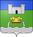
La Barben
| La Barben | ||
|---|---|---|

|
|
|
| region | Provence-Alpes-Cote d'Azur | |
| Department | Bouches-du-Rhône | |
| Arrondissement | Aix-en-Provence | |
| Canton | Pélissanne | |
| Community association | Métropole d'Aix-Marseille-Provence | |
| Coordinates | 43 ° 38 ' N , 5 ° 11' E | |
| height | 87-204 m | |
| surface | 22.85 km 2 | |
| Residents | 845 (January 1, 2017) | |
| Population density | 37 inhabitants / km 2 | |
| Post Code | 13330 | |
| INSEE code | 13009 | |
 La Barben Castle |
||
La Barben is a French municipality with 845 inhabitants (at January 1, 2017) in the department of Bouches-du-Rhône in the region of Provence-Alpes-Cote d'Azur .
geography
The municipality is located eight kilometers east of Salon-de-Provence and 24 kilometers northwest of Aix-en-Provence . In the west, the community goes over to the neighboring town of Pélissanne .
Neighboring municipalities are Lambesc in the north and east, Saint-Cannat and Éguilles (point of contact) in the south-east, Lançon-Provence in the south and Pélissanne in the west and north-west.
Attractions
- La Barben Castle
Economy and Infrastructure
The community is connected via Salon-de-Provence via the A7 to Marseille and Avignon , the A54 connects it with Arles .
The La Barben zoo is located in the municipality .
Population development
| year | 1962 | 1968 | 1975 | 1982 | 1990 | 1999 | 2008 | 2017 |
| Residents | 259 | 315 | 350 | 420 | 500 | 555 | 703 | 845 |
Web links
Commons : La Barben - Collection of images, videos and audio files
