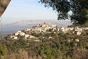
Mimet
| Mimet | ||
|---|---|---|

|
|
|
| region | Provence-Alpes-Cote d'Azur | |
| Department | Bouches-du-Rhône | |
| Arrondissement | Aix-en-Provence | |
| Canton | Gardanne | |
| Community association | Métropole d'Aix-Marseille-Provence | |
| Coordinates | 43 ° 25 ′ N , 5 ° 30 ′ E | |
| height | 269-779 m | |
| surface | 21.75 km 2 | |
| Residents | 4,482 (January 1, 2017) | |
| Population density | 206 inhabitants / km 2 | |
| Post Code | 13105 | |
| INSEE code | 13062 | |
 Mimet |
||
Mimet is a French municipality with 4482 inhabitants (at January 1, 2017) in the department of Bouches-du-Rhône in the region of Provence-Alpes-Cote d'Azur .
geography
Mimet is located thirty kilometers northeast of Marseille , between Roquevaire and Gardanne . Other neighboring towns are Gréasque , Saint-Savournin , Simiane-Collongue , Allauch and Septèmes-les-Vallons . Aix-en-Provence is 21 kilometers away. Mimet is the highest village in the Bouches-du-Rhône department.
Attractions
- Church of the Transfiguration of the Lord ( Église de la Transfiguration-du-Seigneur )
- Chapel of Santo Giovanni Calabria in the district of Les Moulières
- Ruins of the chapel of the former Notre-Dame-des-Anges priory
- Remains of the Paradise Chapel
traffic
The community is located between the A51 and A52 motorways .
Town twinning
The municipality has a partnership with Pergine Valdarno in Tuscany , Italy .
Personalities
- Patrick Revelli , French football player and coach, born in Mimet
Demographics
Population development
| year | 1962 | 1968 | 1975 | 1982 | 1990 | 1999 | 2008 | 2016 |
| Residents | 1291 | 1360 | 1476 | 2374 | 3464 | 4151 | 4479 | 4617 |
age structure
27 percent of the population are 19 years old or younger. Only three percent of the population are 75 years of age or older. This means that the average age is below the French average.
