Bouc-Bel-Air
| Bouc-Bel-Air | ||
|---|---|---|

|
|
|
| region | Provence-Alpes-Cote d'Azur | |
| Department | Bouches-du-Rhône | |
| Arrondissement | Aix-en-Provence | |
| Canton | Vitrolles | |
| Community association | Métropole d'Aix-Marseille-Provence | |
| Coordinates | 43 ° 27 ' N , 5 ° 25' E | |
| height | 153-330 m | |
| surface | 21.75 km 2 | |
| Residents | 14,654 (January 1, 2017) | |
| Population density | 674 inhabitants / km 2 | |
| Post Code | 13320 | |
| INSEE code | 13015 | |
| Website | www.boucbelair.com | |
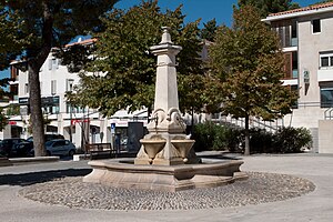
 Fountain in Bouc-Bel-Air |
||
Bouc-Bel-Air is a French municipality with 14,654 inhabitants (at January 1, 2017) in the department of Bouches-du-Rhône in the region of Provence-Alpes-Cote d'Azur .
geography
Bouc-Bel-Air is 13 kilometers south of Aix-en-Provence .
etymology
After the revolution, the community was initially called Bouc . Between 1814 and 1831 it was called Albertas . After that it was called Bouc again, in 1907 the name was given the addition Bel-Air .
history
6000 years ago, settlers settled for the first time near today's location. The Salluvians settled here around 600 BC , they had an important oppidum here . The municipality was strategically important as it was the passage from Marseille to the Val d'Arc. However, in 124 BC the site was burned down by the Romans. For the next few centuries there were only a few houses along trade routes. In the early eighth century the village was in an area where battles between Arabs and Franks often took place. The first castle in town dates from this time. In 1589 the place was the scene of the Huguenot Wars . On September 3, 1589, the castle was defended. Around 1700 about 700 people live in the village. It flourished, mostly through trade and crafts. In 1767 the place became the property of Jean-Baptiste d'Albertas. In 1754, construction began on the magnificent gardens that are now named after Albertas. However, the aristocratic family was driven out of the place in the course of the revolution. Later Adolphe Thiers , later French President, studied in Bouc. From 1850 the rural population moved to the cities. The population fell from around 1300 around 1850 to 800 inhabitants in 1900. In 1907 the place was named Bouc-Bel-Air (previously Bouc) to avoid confusion with the port of Port-de-Bouc . Until the 1950s, the place was only connected to the other places via dirt roads. From 1960 the place changed completely: The population increased from around 2000 to over 13000 in 2007, the farms disappeared.
Attractions
- Parish Church of Saint André
- Notre Dame de l'Espérance chapel from the 12th century
- 18th century Albertas Gardens
traffic
At Bouc-Bel-Air there is a motorway triangle, there the A517 leads to the A51 . This motorway connects the place with Marseille and Aix-en-Provence.
Population development
| year | 1962 | 1968 | 1975 | 1982 | 1990 | 1999 | 2008 | 2016 |
| Residents | 2.158 | 3.210 | 4,533 | 8,714 | 11,512 | 12,297 | 13,437 | 14,477 |
Web links
Individual evidence
- ↑ The community on CommunesGenWeb
- ↑ History of the place ( Memento of the original from April 7, 2011 in the Internet Archive ) Info: The archive link was inserted automatically and has not yet been checked. Please check the original and archive link according to the instructions and then remove this notice.
