List of bridges over the Reuss
The list of bridges over the Reuss contains the bridges and other crossings from the confluence of the Furkareuss and Gotthardreuss at Hospental to the confluence with the Aare at Windisch .
List of bridges
Urserental
9 bridges span the river in Hospental and Andermatt.
| image | Surname | place | function | location | Length (m) | Remarks |
|---|---|---|---|---|---|---|

|
Old Gotthardstrasse bridge | Hospental | Single-lane road bridge with pipelines below the roadway | cards | 32 | Concrete girder bridge
Top speed 50 km / h Mountainbikeland Route 65 Gottardo Bike (Stage 1 Andermatt – Airolo) Wanderland Route 2 Trans Swiss Trail (Section 23 Andermatt – Passo del S. Gottardo), Route 7 Via Gottardo (Section 10 Andermatt – Gotthard Pass) and Route 55 Via Suworow (Section 2 Gotthard Pass – Andermatt) Snowshoeing route 877 Hospental Trail (Hospental – Hospental) |
|
Gotthard road tunnel (crossing under the river) |
Hospental |
|
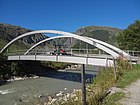
cards | Built 1970–1980
Top speed 80 km / h The Reuss is here exactly above the road tunnel , which is about 340 m lower |
||
|
Marcht Bridge | Andermatt | Single lane road bridge | cards | 30th | Reinforced concrete arch bridge
Winter hiking route 512 Urserntal-Weg (Andermatt – Realp) trail |

|
Russen Bridge | Andermatt | Former road bridge, today only serves pedestrians | cards | 28 | Concrete girder bridge
With the construction of the Andermatt golf course, the road to this bridge has been removed |

|
Andermatt Bridge golf course | Andermatt | Two-lane road bridge | cards | 36 | Concrete girder bridge
Top speed 40 km / h Access to the Andermatt Swiss Alps golf course (The Swiss House Clubhouse and parking spaces) |

|
Bazweg Bridge | Andermatt | Pedestrian bridge with metal bollards | cards | 24 | Concrete girder bridge, built in 1999 |

|
Eibodenstrasse bridge | Andermatt | Single lane road bridge with sidewalk | cards | 30th | Concrete beam bridge, built in 2000
Top speed 30 km / h Mountainbikeland Route 65 Gottardo Bike (Stage 1 Andermatt – Airolo) and Route 410 Witenwasseren Bike (Andermatt – Andermatt) Wanderland Route 2 Trans Swiss Trail (Section 23 Andermatt – Passo del S. Gottardo), Route 7 Via Gottardo (Section 10 Andermatt – Gotthard Pass), Route 51 Furka-Höhenweg (Section 2 Furkapass – Andermatt) and Route 55 Via Suworow (Section 2 Gotthard Pass – Andermatt) Cross-country skiing Route 470 Urserntal-Loipe (Andermatt, Giessen – Hospental – Zumdorf – Realp – Andermatt, Giessen) Winter hiking route 512 Urserntal-Weg (Andermatt – Realp) |

|
FOEN measuring station footbridge | Andermatt | Private footbridge | cards | 30th | Metal truss bridge with lockable gate
Federal Office for the Environment : Hydrometric measuring station No. 2087 |
| Gotthard summit tunnel (crossing under the river) |
Andermatt | Double-track railway tunnel | cards | Built 1872–1882
Top speed 120 km / h The Reuss is here exactly above the railway tunnel , which is about 280 m lower |
||

|
Bielstrasse bridge | Andermatt | Private single lane road bridge with pipeline on the bridge side | cards | 44 | Concrete girder bridge with barrier and light signal
The former artillery plant now serves as the army's logistics base Access road to Fort Bühl |

|
Fort Bühl Bridge | Andermatt | Private single lane road bridge | cards | 34 | Concrete beam bridge with a lockable entrance gate |
| Gotthard summit tunnel (crossing under the river) |
Andermatt - Urnerloch | Double-track railway tunnel | cards | Built 1872–1882
Top speed 120 km / h The Reuss is here exactly above the railway tunnel , which is about 270 m lower |
Upper Urner Reuss Valley
35 bridges and footbridges span the river from the Schöllenen to Gurtnellen.
| image | Surname | place | function | location | Length (m) | Remarks |
|---|---|---|---|---|---|---|

|
Schöllenen Bridge | Schöllenen | Single lane road bridge | cards | 22nd | Stone arch bridge
Schöllenen circular route |

|
Obere Schöllenenbahn Bridge (Devil's Bridge) |
Schöllenen | Single-track railway bridge | cards | 55 | Stone arch bridge, opened in 1917 |
| Gotthard summit tunnel (crossing under the river) |
Schöllenen | Double-track railway tunnel | cards | Built 1872–1882
Top speed 120 km / h The Reuss is here exactly above the railway tunnel , which is about 220 m lower |
||
|
Second Devil's Bridge (Old Devil's Bridge) |
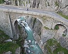
Schöllenen | The old Gotthard road bridge is only used by pedestrians and cyclists today | cards | 50 | Stone arch bridge worth protecting, built 1820–1830
Mountainbikeland Route 1 Alpine Bike (stage 10 Andermatt – Meiringen) and Route 406 Oberland Bike (Amsteg – Amsteg) Veloland Route 3 North-South Route (Stage 4 Flüelen – Andermatt) Wanderland Route 2 Trans Swiss Trail (Section 22 Wassen – Andermatt), Route 7 Via Gottardo (Section 9 Wassen – Andermatt) and Route 55 Via Suworow (Section 3 Andermatt – Wassen) Schöllenen circular route |

|
First Devil's Bridge ("Stiebender Steg") |
Schöllenen | Former Gotthard road bridge | cards | Stone arch bridge, used 1585-1830, in 1888 it collapsed
The foundations are still visible on the left bank of the river |
|

|
Third Devil's Bridge (New Devil's Bridge) |
Schöllenen |
|
cards | 90 | The arch bridge, which is worthy of protection, built in 1957/58, leads with a wide segment arch over the river and with a small segment arch over the old street
Top speed 60 km / h Mountainbikeland Route 1 Alpine Bike (stage 10 Andermatt – Meiringen) and Route 406 Oberland Bike (Amsteg – Amsteg) Veloland Route 3 North-South Route (Stage 4 Flüelen – Andermatt) |
| Gotthard summit tunnel (crossing under the river) |
Göschenen | Double-track railway tunnel | cards | Built 1872–1882
Top speed 120 km / h The Reuss is here exactly above the railway tunnel , which is about 170 m lower |
||
|
Gotthard road tunnel (crossing under the river) |
Göschenen |
|
cards | Built 1970–1980
Top speed 80 km / h The Reuss is here exactly above the road tunnel , which is about 170 m lower |
||
|
Spränggi Bridge (Gotthardstrasse) |
Göschenen |
|
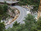
cards | 24 | Stone arch bridge, renovated in 2016
Top speed 60 km / h Mountainbikeland Route 1 Alpine Bike (stage 10 Andermatt – Meiringen) and Route 406 Oberland Bike (Amsteg – Amsteg) Veloland Route 3 North-South Route (Stage 4 Flüelen – Andermatt) |

|
Häderlis Bridge (Sprenggi Bridge) | Göschenen | Footbridge | cards | 40 | Historic three-arch stone arch bridge, built in 1649 instead of an older footbridge, destroyed by floods in 1987, faithfully rebuilt in 1991
Wanderland Route 2 Trans Swiss Trail (Section 22 Wassen – Andermatt), Route 7 Via Gottardo (Section 9 Wassen – Andermatt) and Route 55 Via Suworow (Section 3 Andermatt – Wassen) |
|
Middle Schöllenenbahn Bridge (Mättelibrücke) |
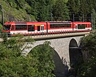
Göschenen | Single-track railway bridge | cards | 62 | The stone arch bridge, opened in 1917, renovated in 2004/05, leads with a large segment arch over the river and with a small arch over the mule track. |

|
Schöllenenmätteli Bridge (Gotthardstrasse) |
Göschenen | Two-lane road bridge with sidewalk | cards | 50 | Stone arch bridge
Top speed 60 km / h Mountainbikeland Route 1 Alpine Bike (stage 10 Andermatt – Meiringen) and Route 406 Oberland Bike (Amsteg – Amsteg) Veloland Route 3 North-South Route (Stage 4 Flüelen – Andermatt) Wanderland Route 2 Trans Swiss Trail (Section 22 Wassen – Andermatt), Route 7 Via Gottardo (Section 9 Wassen – Andermatt) and Route 55 Via Suworow (Section 3 Andermatt – Wassen) |

|
Lower Schöllenenbahn Bridge (Reuss Bridge) |
Göschenen | Single-track railway bridge | cards | 100 | Stone arch bridge, opened in 1917, renovated in 2004/05 |

|
SBB bridge | Göschenen | Five-track railway bridge | cards | 100 | Brook passage
Top speed 80 km / h Access to the Gotthard summit tunnel north portal |
|
Gotthard road tunnel (crossing under the river) |
Göschenen |
|
cards | Built 1970–1980
Top speed 80 km / h The Reuss is here exactly above the road tunnel , which is only a few meters lower |
||

|
Steglaui Bridge (bypass road) |
Göschenen |
|
cards | 80 | Concrete arch bridge
Top speed 60 km / h |
|
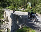
Schönibrücke (Gotthardstrasse) |
Water |
|
cards | 60 | Single-span stone arch bridge worth protecting, consisting of two assembled natural stone arches from different construction periods (1830/1931), renovated in 2007
Top speed 80 km / h Veloland Route 3 North-South Route (Stage 4 Flüelen – Andermatt) |
|
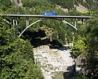
Naxberg Bridge | Water |
|
cards | 225 | Reinforced concrete arch bridge, completed in 1980
Top speed: 60 km / h (direction Gotthard), 80 km / h (direction Lucerne) |

|
Upper Wattinger Bridge | Water | Double track railway bridge | cards | 43 | Concrete arch bridge
Top speed 80 km / h |

|
Wattingersteg | Water | Footbridge | cards | 13 | Wooden girder bridge |

|
Reuss Bridge Wattingen (Gotthardstrasse) |
Water |
|
cards | 187 | Protective girder bridge, built in 1977, renovated in 2014
With a length of 187 m and a width of 9 m, it is the largest bridge in Uri's cantonal road network Top speed 80 km / h |

|
Reuss Bridge Wattingen (A2 motorway) |
Water |
|
cards | 100 | Box-girder prestressed concrete bridge, built 1975–1978
Top speed: 80 km / h (direction Gotthard), 120 km / h (direction Lucerne) |

|
Lower Wattinger Bridge | Water | Double track railway bridge | cards | 38 | Concrete arch bridge, built in 1954
Top speed 80 km / h |

|
Canyon bridge (floor) |
Water | Footbridge | cards | 20th | Stone arch bridge with lockable gate on the right side of the river |

|
Reuss Bridge Wassen (A2 motorway) |
Water |
|
cards | 100 | Box-girder girder bridge, completed in 1972, reconstructed in 1987/88 after extreme flood damage
Top speed 120 km / h |

|
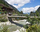
Dieden Bridge | Water | Single lane road bridge | cards | 46 | Steel cable-stayed bridge with mixed system, completed in 1994
The bridge board is suspended from four hook-shaped pylons at the ends of the bridge
Maximum weight 6 t Mountainbikeland Route 406 Oberland Bike (Amsteg – Amsteg) Wanderland Route 2 Trans Swiss Trail (Section 21 Erstfeld – Wassen), Route 7 Via Gottardo (Section 8 Altdorf – Wassen) and Route 55 Via Suworow (Section 4 Wassen – Altdorf) |
|
Sawmill Bridge | Water | Single lane road bridge | cards | 40 | Concrete girder bridge
Mountainbikeland Route 406 Oberland Bike (Amsteg – Amsteg) |

|
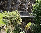
Pfaffensprung weir footbridge | Water | Private works bridge | cards | 6th | Concrete girder bridge |
|
Pfaffensprung footbridge | Water | Footbridge | cards | 8th | Concrete girder bridge |

|
Pfaffensprungbrücke (Gotthardstrasse) |
Water |
|
cards | 32 | Stone arch bridge
Top speed 60 km / h Veloland Route 3 North-South Route (Stage 4 Flüelen – Andermatt) Wanderland Route 2 Trans Swiss Trail (Section 21 Erstfeld – Wassen), Route 7 Via Gottardo (Section 8 Altdorf – Wassen) and Route 55 Via Suworow (Section 4 Wassen – Altdorf) |

|
Wilerbrücke (Dorfstrasse) |
Belt fasteners | Two-lane road bridge | cards | 30th | The stone arch bridge of medieval origin, which is worth protecting, was widened in 1925 and was reconstructed after the storm in 1987
Top speed 50 km / h Mountainbikeland Route 407 Arni Bike (Amsteg – Amsteg) trail |

|
Geisssticki Bridge | Belt fasteners | Pedestrian bridge with water pipes on the sides of the bridge | cards | 48 | Steel arch bridge with grating floor |

|
Güetli footbridge | Belt fasteners | Footbridge | cards | 32 | Metal girder bridge with central pillar made of natural stone
Wanderland Route 2 Trans Swiss Trail (Section 21 Erstfeld – Wassen), Route 7 Via Gottardo (Section 8 Altdorf – Wassen) and Route 55 Via Suworow (Section 4 Wassen – Altdorf) |

|
Magnificent footbridge | Belt fasteners | Footbridge | cards | 15th | Wooden girder bridge
Wanderland Route 2 Trans Swiss Trail (Section 21 Erstfeld – Wassen), Route 7 Via Gottardo (Section 8 Altdorf – Wassen) and Route 55 Via Suworow (Section 4 Wassen – Altdorf) |

|
Reuss bridge Felli Süd (A2 motorway) |
Belt fasteners |
|
cards | 70 | Prestressed concrete bridge
Top speed 120 km / h |

|
Felli-Steg (Fellital suspension bridge) |
Belt fasteners | Footbridge | cards | 36 | Wooden suspension bridge, built in 2005
Wanderland Route 2 Trans Swiss Trail (Section 21 Erstfeld – Wassen), Route 7 Via Gottardo (Section 8 Altdorf – Wassen) and Route 55 Via Suworow (Section 4 Wassen – Altdorf) |

|
Reuss bridge Felli Nord (A2 motorway) |
Belt fasteners |
|
cards | 70 | Prestressed concrete bridge
Top speed 120 km / h |

|
Meitschligen Bridge (Gotthardstrasse) |
Belt fasteners |
|
cards | 60 | Historic stone arch bridge, renovated in 2016/17
Top speed 80 km / h Mountainbikeland Route 406 Oberland Bike (Amsteg – Amsteg) Veloland Route 3 North-South Route (Stage 4 Flüelen – Andermatt) trail |

|
Reuss bridge Intschi (A2 motorway) |
Silenen-Ried - Gurtnellen |
|
cards | 150 | Box-girder prestressed concrete bridge
Top speed 80 km / h |

|
Intschireussbrücke (Intschitobelbrücke) | Silenen-Ried - Gurtnellen | Double-track railway bridge with a footpath below the carriageway | cards | 121 | The bridge, newly built in 1975, consists of two single-track concrete hollow boxes, each supported by two supports. A walk-on grating runs between the hollow boxes, which allows a vertical view downwards
Top speed 80 km / h |
Lower Urner Reuss Valley
16 bridges and footbridges span the river between the Silenen and the Reuss delta near Flüelen and Seedorf.
| image | Surname | place | function | location | Length (m) | Remarks |
|---|---|---|---|---|---|---|

|
Plattibrücke (Gotthardstrasse) |
Amsteg - Gurtnellen |
|
cards | 80 | Natural stone arch bridge worthy of protection, built in 1830, expanded in the 1940s, renovated 2007–2009
Top speed 80 km / h Mountainbikeland Route 402 Talboden Bike (Altdorf (train station) –Altdorf (train station)) and Route 407 Arni Bike (Amsteg – Amsteg) Veloland Route 3 North-South Route (Stage 4 Flüelen – Andermatt) |

|
Plattischachen Bridge | Amsteg - Gurtnellen | Two-lane road bridge with pedestrian crossing | cards | 55 | Concrete girder bridge
Top speed 50 km / h Connection to the motorway connection A2 «38 Amsteg» |

|
Butzen Bridge | Amsteg - Gurtnellen | Single-lane road bridge with sidewalks, today mainly used for slow traffic | cards | 50 | Metal suspension bridge
Maximum weight 3.5 t Metal bollards serve as a barrier Veloland Route 3 North-South Route (Stage 4 Flüelen – Andermatt) trail |

|
Reuss Bridge Amsteg (A2 motorway) |
Amsteg - Gurtnellen |
|
cards | 250 | Concrete girder bridge
Top speed: 80 km / h (direction Gotthard), 120 km / h (direction Lucerne) |

|
Reuss Bridge Silenen (A2 motorway) |
Silenen - belt nelles |
|
cards | 150 | Concrete girder bridge
Top speed 120 km / h |

|
Blüemlismatt Bridge | Silenen - belt nelles | Two-lane road bridge with sidewalk | cards | 140 | Concrete girder bridge
Top speed 60 km / h |

|
Reuss bridge Erstfeld (model 1936) |
Erstfeld | Military railway bridge, has been used for non-motorized traffic since 2013 | cards | 134 | Steel truss bridge with wooden deck
The military emergency bridge, built in 1936, was erected over the Reuss in 1993 and served to remove the excavated material from the new underground power plant and the intermediate attack on the Gotthard base tunnel near Amsteg |

|
Schlossberg Bridge | Erstfeld | Two-lane road bridge with sidewalks | cards | 52 | Built in 1998/99, replaced bridge from 1951
Top speed 30 km / h Mountainbikeland Route 402 Talboden Bike (Altdorf (train station) –Altdorf (train station)) and Route 405 Erstfeldertal Bike (Erstfeld – Erstfeld) Veloland Route 3 North-South Route (Stage 4 Flüelen – Andermatt) Wanderland Route 2 Trans Swiss Trail (Section 20 Seelisberg – Erstfeld), Route 7 Via Gottardo (Section 8 Altdorf – Wassen) and Route 55 Via Suworow (Section 4 Wassen – Altdorf) |

|
Reuss bridge Erstfeld (A2 motorway) |
Erstfeld |
|
cards | 300 | Concrete girder bridge
Top speed 120 km / h |

|
Ripshausen Bridge (Niederhofenstrasse) | Erstfeld | Two-lane road bridge with a separated sidewalk | cards | 50 | Concrete girder bridge
Top speed 60 km / h Access to the Uri heavy traffic center trail |

|
Ryyssboogebrugg (Gottardo hiking trail) |
Erstfeld | Footbridge | cards | 54 | Tension band bridge, designed by bridge engineer Jürg Conzett , built in 2020
Connects the Gotthard motorway service station with the Hochweg opposite Gottardo hiking trail |

|
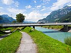
Attinghauser Bridge | Altdorf - Attinghausen | Two-lane road bridge with sidewalks | cards | 48 | Concrete girder bridge
Top speed 50 km / h Bus stop "Attinghausen Post" Mountainbikeland Route 401 Unterland Bike, Route 403 Isenthal Bike and Route 404 Gitschital Bike (Altdorf (train station) –Altdorf (train station)) Veloland Route 3 North-South Route (Stage 4 Flüelen – Andermatt) Wanderland Route 1 Via Alpina (Section 7 Altdorf (UR) –Engelberg), Route 7 Via Gottardo (Section 8 Altdorf – Wassen) and Route 55 Via Suworow (Section 4 Wassen – Altdorf) |
|
Seedorfer Bridge | Altdorf - Seedorf | Two-lane road bridge with sidewalks | cards | 140 | Concrete girder bridge
Top speed 60 km / h |

|
Reuss bridge Altdorf (A2 motorway) |
Altdorf - Seedorf |
|
cards | 240 | Concrete girder bridge |

|
Reussbrücke Wyerstrasse (A2 motorway access) |
Altdorf - Seedorf | Single-lane road bridge with a separated sidewalk | cards | 80 | Concrete girder bridge
Top speed 100 km / h Mountainbikeland Route 401 Unterland Bike, Route 403 Isenthal Bike and Route 404 Gitschital Bike (Altdorf (train station) –Altdorf (train station)) Veloland Route 3 North-South Route (Stage 4 Flüelen – Andermatt) |

|
Reusssteg | Flüelen - Seedorf | Pedestrian and bicycle bridge | cards | 40 | Imposing glued laminated timber arch bridge, built in 1990
Wanderland Route 99 Swiss Path (stage 2 Seelisberg – Flüelen) and Route 603 Urnersee-Uferweg Hiking trail “ Weg der Schweiz ” with the boundary stone “Basel Stadt / Basel Land” in the middle of the bridge |
The Reuss flows through Lake Lucerne , from its confluence in the Reuss delta at Flüelen and Seedorf to the outlet at Lucerne , the air distance is 28 km.
Canton lucerne
29 bridges and footbridges span the river from the city of Lucerne to Gisikon.
| image | Surname | place | function | location | Length (m) | Remarks |
|---|---|---|---|---|---|---|

|
Pier (Janus Bridge) |
Lucerne |
|
cards | 157 | Double-web T-beam bridge at the transition from the lake basin to the Reuss, built 1994–1996, replaced reinforced concrete bridge from 1936, the first pier was built in 1869/70
The pier, which connects the old town and new town, is one of the busiest roads in Switzerland Top speed 50 km / h Veloland Route 38 Lucerne Hinterland – Rigi (Stage 3 Lucerne – Brunnen) Wanderland route 3 Alpenpanorama-Weg (stage 10 Zug – Luzern), route 98 Waldstätterweg (stage 3 Küssnacht – Luzern) and route 560 Lucerne lake shore path (Lucerne – Luzern, Seeburg) |

|
Chapel Bridge with Water Tower | Lucerne | Footbridge | cards | 205 | Historic covered wooden bridge, built in the 14th century, is considered the oldest covered wooden bridge in Europe
The bridge is listed ( national cultural asset, KGS No. 3729 ) |

|
Rathaussteg | Lucerne | Footbridge | cards | 90 | Concrete beam bridge with wrought iron railing and stairs, built 1961, renovated in 2014
Transition is not handicapped accessible |
|
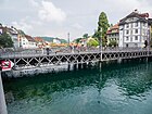
Reuss Bridge (Schnyder Bridge ) |
Lucerne | Former road bridge, now only used by pedestrians and cyclists | cards | 50 | Truss bridge with wrought iron railing and fourteen benches is worth preserving
The stone Reuss Bridge was first mentioned in 1168, it is the oldest bridge in the city of Lucerne and it is also the oldest bridge over the Reuss The bridge is listed ( cantonal monument register ) Mountainbikeland Route 77 Napf Bike (Section 3 Napf (Stächelegg) –Luzern) Skatingland Route 66 Central Switzerland Skate (Stage 1 Zug – Luzern) Veloland route 3 north-south route (stage 2 Aarau – Luzern), route 9 lakes route (stage 6 Sarnen – Zug), route 24 Emmental – Entlebuch (stage 3 Escholzmatt – Luzern), route 38 Lucerne hinterland – Rigi (stage 2 Willisau – Luzern), Route 56 Seetal – Bözberg (Stage 1 Lucerne – Lenzburg) and Route 67 Wynental Route (Lucerne – Aarau) |

|
Reuss needle weir footbridge | Lucerne | Private works bridge | cards | 110 | Metal beam bridge with grating floor (90 m) and wooden beam bridge (20 m)
The historic needle weir , built 1858–1861, renovated in 2009–2011, serves to regulate the outflow of Lake Lucerne and to feed the Mühleplatz power station The Mühlesporne Nadelwehr is a listed building ( national cultural asset, KGS No. 10102 ) |

|
Mühlenplatz power station Wehrsteg | Lucerne | Private works bridge | cards | 12 | Metal girder bridge
The canal power station , built in 1888/89, rebuilt in 1998 The small hydropower plant is listed ( cantonal monument register, ID 193c ) |

|
Chaff bridge | Lucerne | Footbridge | cards | 110 | Historic covered wooden bridge, completed in 1408, torn away from the Reuss in 1566 and rebuilt
The bridge is listed ( national cultural asset, KGS No. 3738 ) |

|
Geissmattbrücke (Reussbrücke Gütschstrasse) |
Lucerne | Three-lane road bridge with sidewalks, pedestrian and bicycle lanes, two-lane driving direction Bramberg-St. Karli and single-lane driving in the direction of Luzern-Zentrum | cards | 60 | Concrete girder bridge
Top speed 50 km / h Skatingland Route 66 Central Switzerland Skate (Stage 1 Zug – Luzern) |

|
SBB Geissmatt Bridge | Lucerne | Single-track railway bridge | cards | 130 | Concrete girder bridge
Top speed 80 km / h Lucerne – Immensee railway line , opened in 1897 |

|
Reuss Bridge Lucerne (A2 motorway) |
Lucerne |
|
cards | 120 | Concrete girder bridge
Maximum speed 80 km / h, entry lane 60 km / h |

|
Reussbrücke exit 26 Luzern-Zentrum (A2 motorway) |
Lucerne |
|
cards | 90 | Concrete girder bridge
Top speed 80 km / h |

|
St. Karli Bridge | Lucerne | Two-lane road bridge with sidewalks and bicycle lanes | cards | 55 | Box-girder prestressed concrete bridge, built in 2000/01, replaced arch bridge
Top speed 50 km / h Veloland route 3 north-south route (stage 2 Aarau – Luzern), route 9 lakes route (stage 6 Sarnen – Zug), route 24 Emmental – Entlebuch (stage 3 Escholzmatt – Luzern), route 38 Lucerne hinterland – Rigi (stage 2 Willisau – Luzern), Route 56 Seetal – Bözberg (Stage 1 Lucerne – Lenzburg) and Route 67 Wynental Route (Lucerne – Aarau) trail |

|
SBB Bridge Fluhmühle | Lucerne- Reussbühl | Single-track railway bridge | cards | 142 | Iron truss bridge
Top speed 90 km / h Lucerne – Zug – Zurich railway line , opened in 1864 |

|
Ibachbrücke (Reusseggstrasse) |
Lucerne -Ibach - Emmenbrücke | Three-lane road bridge with sidewalk, two-lane driving in the direction of Lucerne-Ibach with a branch to the A2 motorway (in the direction of Lucerne) | cards | 228 | Concrete beam bridge, opened in 1969, renovated in 2008/09
Top speed 60 km / h Bridge also crosses the Kleine Emme and A2 Autobahn |

|
Sädelbrücke (Grüeblischachenbrücke) |
Emmenbrücke | Pedestrian and bicycle bridge with pipelines on the side of the bridge and below the road | cards | 70 | Iron truss bridge |

|
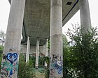
Reussbrücke junction Rotsee (A2 motorway) |
Ebikon - Emmen |
|
cards | 300 | Concrete girder bridge
Top speed 100 km / h, entry lane 40 km / h (direction Basel) Maximum speed 80 km / h, exit lane 60 km / h (direction Lucerne) |
|
Reussegg Bridge | Ebikon - Emmen | Three-lane road bridge, two-lane driving towards Ebikon and one-lane driving towards Emmen | cards | 450 | Concrete girder bridge
Top speed 60 km / h |

|
Rathausen weir footbridge | Rathausen - Emmen | Private works bridge | cards | 60 | Metal truss bridge with grating floor and stairs |

|
Reuss Bridge Rathausen | Emmen | Two-lane road bridge with sidewalk | cards | 74 | Steel girder composite bridge, built in 2013/14, replaced steel bridge from 1914
Top speed 30 km / h trail |

|
Rathausenstrasse Bridge (Upper Water Canal) |
Rathausen - Emmen | Two-lane road bridge with sidewalk | cards | 15th | Concrete girder bridge
Top speed 30 km / h trail |

|
Rathausen -Steg power plant (upper water canal) |
Rathausen - Emmen | Private works bridge | cards | 15th | Metal truss bridge with grating floor |

|
Reussbrücke Buchrain (A14 motorway) |
Buchrain |
|
cards | 250 | Concrete girder bridge
Top speed 120 km / h |
|
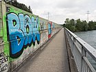
Motorway Altwegbrücke | Buchrain | Footbridge | cards | 200 | Concrete girder bridge
The footpath runs on the eastern side of the A14 motorway trail |
|
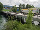
Reuss Bridge Buchrain | Buchrain | 367 Four-lane road bridge | cards | 100 | Concrete girder bridge
Top speed 60 km / h |

|
Buchrain bridge for slow traffic | Buchrain | Footbridge | cards | 110 | Concrete girder bridge
Skatingland Route 66 Central Switzerland Skate (Stage 1 Zug – Luzern) trail |

|
Pearl weir footbridge | Buchrain | Private works bridge | cards | 60 | Metal truss bridge with stairs |

|
Rooter Bridge ("Little Golden Gate") |
Root | Single lane road bridge | cards | 80 | Concrete arch bridge, built in 1989
Veloland Route 9 Lakes Route (Stage 6 Sarnen – Zug) trail |

|
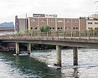
Reuss Bridge Gisikon | Gisikon - Inwil | 296 Four-lane road bridge with sidewalks and pipelines below the carriageway | cards | 90 | Concrete beam bridge, opened in 1974
Top speed 60 km / h Access to the A14 motorway, junction "4 Gisikon Root" |
|
Gisiker Bridge | Gisikon - Inwil | Two-lane road bridge with sidewalks | cards | 72 | Reinforced concrete bridge, built 1933/34, replaced the covered wooden bridge from 1854
Top speed 60 km / h trail |
Cantons of Aargau, Zug and Zurich
31 bridges and footbridges span the river between Rotkreuz and Windisch.
| image | Surname | place | function | location | Length (m) | Remarks |
|---|---|---|---|---|---|---|

|
Reuss bridge Rotkreuz – Dietwil (A14 motorway) |
Rotkreuz - Dietwil |
|
cards | 300 | Concrete girder bridge
The Reuss Bridge is the second highest bridge in the canton of Zug. Top speed 120 km / h |

|
SBB bridge | Hünenberg - Oberrüti | Double-track railway bridge with footpath | cards | 150 | Concrete girder bridge
Top speed 115 km / h Railway line Olten – Aarau – Rotkreuz Veloland Route 99 Herzroute (Section 7 Willisau – Zug) trail |

|
Zollweid Bridge | Hünenberg - Sins |
|
cards | 160 | Concrete girder bridge, built 1993–1996
Top speed 80 km / h |

|
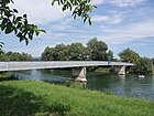
Reuss bridge Sins – Hünenberg | Hünenberg - Sins | Single lane road bridge with footpath | cards | 80 | Historic covered wooden bridge, built 1640/41, rebuilt in 1852, covered footpath created in 1945, roadway paved in 1948
The bridge is protected as a historical monument ( Regional Cultural Property, KGS No. 9895 (Canton Aargau) and KGS No. 7268 (Canton Zug) )
Maximum weight 20 t Veloland Route 94 L'Areuse – Emme – Sihl (Stage 5 Hochdorf (Urswil) –Zürich) trail |
|
Mühlau Reuss Bridge | Hünenberg - Mühlau | Single-lane road bridge with narrow sidewalks | cards | 80 | Concrete beam bridge, built by Wartmann & Co. , opened in 1940
Maximum speed 80 km / h, maximum weight 8 t Veloland Route 77 Rigi – Reuss – Klettgau (Stage 2 Rotkreuz – Brugg) trail |

|
Reuss Bridge Obfelden | Obfelden - Merenschwand | Two-lane road bridge with sidewalks | cards | 85 | Concrete bridge, built 1971, replaced steel truss bridge from 1876 and covered wooden bridge from 1864
Top speed 80 km / h Veloland Route 84 Mittelländer Hill Route (Stage 4 Muri AG – Zurich) trail |

|
Reuss Bridge Ottenbach (Muristrasse) |
Ottenbach - Merenschwand | 299 Two-lane road bridge with sidewalks | cards | 80 |
Concrete girder bridge , built 1954/55, replaced the iron truss bridge from 1864, which was the only fixed crossing between Bremgarten and Sins
Top speed 60 km / h Wanderland Route 526 Reuss-Uferweg (Ottenbach – Rottenschwil) |

|
Reuss Bridge Werd | Rottenschwil-Werd | Single lane road bridge | cards | 90 | Concrete beam bridge, opened in 1958, replaced iron footbridge from 1913
Top speed 80 km / h trail |
|
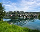
Rottenschwil bridge over the Reuss | Unterlunkhofen - Rottenschwil | 358 single-lane road bridge | cards | 90 | Protected arched iron bridge, built in 1907, renovated in 2003/04
The bridge is listed ( building and usage regulations of the municipality, ID 909 )
Top speed 50 km / h |

|
Reusssteg Rottenschwil | Unterlunkhofen - Rottenschwil | Pedestrian and bicycle bridge | cards | 90 | Concrete girder bridge, built in 2003/04
trail |

|
Dominilochsteg | Zufikon - Hermetschwil | Pedestrian and bicycle bridge | cards | 92 | Covered wooden bridge at Hermetschwil Monastery , built in 1988, replaced the open wooden walkway from 1979, which was destroyed by floods in 1984
The Dominolochstäg is one of the longest covered wooden bridges in Switzerland (92.4 m) trail |
|
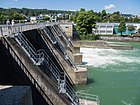
Kraftwerk Zufikon dam bridge | Zufikon - Bremgarten | Pedestrian crossing on the weir crown | cards | 155 | Concrete dam with pedestrian passage, built 1971–1975
Wanderland Route 42 Aargauer Weg (Stage 6 Bremgarten (AG) –Muri (AG)) |

|
Isenlaufbrücke (Badisteg) |
Bremgarten | Footbridge | cards | 93 | Steel truss bridge, built in 2003 by Losinger Construction AG , previous bridges from 1972 and 1990 destroyed by floods |
|
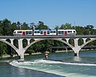
Bremgarten railway bridge | Bremgarten | Single-track railway bridge | cards | 156 | Three-span concrete arch bridge worth protecting, built 1911–1920, renovated in 2011
The bridge is listed ( building and usage regulations of the municipality, ID 902 ) Top speed 60 km / h Railway line Wohlen – Bremgarten – Dietikon |

|
Bremgarten Reuss Bridge | Bremgarten | Single lane road bridge with sidewalks | cards | 100 | Covered wooden bridge worthy of protection, built 1544–1549, demolished and rebuilt with a wider prestressed concrete deck 1953–1957
The bridge is a listed building ( regional cultural property, KGS no.73 )
Top speed 20 km / h Veloland Route 77 Rigi – Reuss – Klettgau (Stage 2 Rotkreuz – Brugg) trail |

|
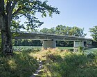
Bruggmühle-Steg power plant | Bremgarten | Footbridge with metal bollards | cards | 25th | Concrete girder bridge
Access to the Reuss Island and the Bruggmühle Museum Power Plant |
|
Military bridge (Friedhofstrasse) |
Bremgarten | Two-lane road bridge with separated sidewalks and utility lines in the box girder | cards | 85 | Concrete beam bridge, built 1963/64, renovated in 2012, replaced wooden bridge from 1952, a little further up the river
Top speed 50 km / h The only access to the lower town of Bremgarten Veloland Route 77 Rigi – Reuss – Klettgau (Stage 2 Rotkreuz – Brugg) |

|
Risibrücke (ARA bridge) |
Bremgarten | Pedestrian and pipe bridge with two sewer pipes below the pedestrian level | cards | 84 | Steel cable-stayed bridge with wooden floor, built 1975/76, renovated in 2018
The wastewater from the municipalities of Berikon, Widen, Zufikon and Bremgarten is directed to the sewage treatment plant in the boiler via the green ARA bridge trail |

|
Reuss Bridge Struss (Bremgarten bypass road) |
Eggenwil - Bremgarten |
|
cards | 205 | Five-span reinforced concrete bridge, opened in 1994
Top speed 80 km / h |

|
Uferweg footbridge (Eggenwiler Sporen) |
Bremgarten | Footbridge | cards | 32 | Steel truss bridge with grating floor and metal barriers
Transition leads to an island that used to be a dam. The dam, once continuously accessible, was torn open in 2007 and has become an island. |

|
Old Reuss Bridge Gnadenthal | Stetten - Niederwil | Former single-lane road bridge with sidewalk | cards | 70 | Steel truss bridge built in 1909, completely dismantled in 2016 after the opening of the new bridge with the exception of the bridgehead |

|
Reuss Bridge Gnadenthal | Stetten - Niederwil | 413 Two-lane road bridge with footpath and bicycle path | cards | 100 | A steel-concrete composite bridge built in 2015/16 is located downstream of the old bridge
Top speed 80 km / h |

|
Städtlisteg (Soldatebrugg) |
Mellingen | Pedestrian and bicycle bridge | cards | 58 | Wooden beam bridge, built in 1999, replaced the soldier's bridge from 1993 |

|
Reuss Bridge Mellingen | Mellingen | 279 268 Two-lane road bridge with sidewalks | cards | 55 | Steel bridge with concrete deck, built in 1928, replaced the covered wooden bridge from 1794
The Reuss Gate by the bridge is a listed building ( building and usage regulations of the municipality, ID 5.0.7 ) Top speed 50 km / h trail |

|
Gruemet footbridge | Mellingen - Wohlenschwil | Pedestrian and bicycle bridge with pipelines below the road | cards | 90 | Metal girder bridge with grating floor, built in 1975
On the underside, the pipes were installed in which the wastewater from Mägenwil, Wohlenschwil, Tägerig, Birrhard and the left-hand municipality of Mellingens is pumped into the WWTP on the right-hand side of the Reuss Veloland Route 34 Alter Bernerweg (Stage 4 Zofingen (Oftringen) –Baden) |

|
Mellingen railway bridge | Mellingen - Wohlenschwil | Double track railway bridge | cards | 193 | Reinforced concrete composite bridge, opened in 1877, renovated in 1932 and 1972/73
With a height of around 50 meters above water, it is still the highest railway bridge in Aargau today Top speed 140 km / h Railway lines Zurich – Heitersberg – Lenzburg and Wettingen – Lenzburg |

|
Reussbrücke Birmenstorf (A1 / A3 motorway) |
Birmenstorf - Mülligen |
|
cards | 260 | Box-girder prestressed concrete bridge, built in 1968
Top speed 100 km / h |

|
Birmenstorf Bridge | Birmenstorf - Mülligen | 420 Single-lane road bridge with sidewalk and pipeline below the roadway | cards | 70 | Concrete girder bridge, built in 1949, replaced wooden bridge built by a pontooner battalion in place of a ferry in 1940
Top speed 80 km / h Veloland Route 5 Mittelland Route (Stage 3 Kloten – Aarau) trail |

|
Reuss Bridge Windisch –habenstorf (customs bridge) |
Gibstorf - Windisch |
|
cards | 70 | Prestressed concrete bridge, built in 1982, replaced the three-arched stone bridge from 1834
Top speed 60 km / h The toll bridge is the bronze sculpture "The Flösser" of Eduard Spörri decorated |

|
Windisch power station, weir footbridge | Windisch | Private works bridge | cards | 190 | Two metal girder bridges (150 m and 40 m) with stairs |

|
Reusssteg Windisch – Gibstorf (Spinnereisteg) |
Gibstorf - Windisch | Pedestrian and bicycle bridge | cards | 90 | Concrete girder bridge, built in 1916, stabilized in 2019, new construction planned
Skatingland Route 3 Mittelland Skate (Stage 5 Kloten (Airport) –Brugg) Wanderland Route 5 Jurahöhenweg (Stage 1 Dielsdorf – Brugg) |

|
SBB-Reussbrücke Turgi (railway bridge Windisch – Gibstorf) |
Gibstorf - Windisch | Double-track railway bridge with footpath and bike path | cards | 93 | Natural stone arch bridge, built 1855/56
Top speed 110 km / h Railway line Zurich – Baden – Brugg – Aarau Wanderland Route 42 Aargauer Weg (Stage 4 Brugg – Mellingen) Industrial culture trail Limmat – Wasserschloss (stage 5 industrial buildings in the Brugg – Windisch region) |
Web links
References and comments
- ↑ a b The year of construction is visible on the outer side of the bridge
- ↑ Hydrometric measuring station No. 2087. Federal Office for the Environment FOEN, accessed on March 6, 2019 .
- ↑ a b Schöllenen circular route. Andermatt-Urserntal Tourismus GmbH, accessed on August 13, 2020 .
- ↑ a b Andermatt inventory list. (PDF) Canton Uri: Cantonal protection inventory, accessed on March 9, 2019 .
- ↑ Route UR 1.2.7 First Devil's Bridge, Stiebender Steg. (PDF) Federal inventory of historical traffic routes in Switzerland (IVS), accessed on October 17, 2019 .
- ↑ a b Route UR 1.3.1 Kunststrasse 1830, Göschenen - Bruggwald. (PDF) Federal inventory of historical traffic routes in Switzerland (IVS), accessed on October 17, 2019 .
- ↑ Route UR 1.2.4 Häderlis Bridge - Spränggi. (PDF) Federal inventory of historical traffic routes in Switzerland (IVS), accessed on October 17, 2019 .
- ↑ Häderlis Bridge. Structurae, October 18, 2002, accessed March 18, 2019 .
- ↑ a b Extensive renovation of the Reuss bridges. Urner Wochenblatt, September 20, 2005, accessed on March 11, 2019 .
- ↑ Route UR 3.4.10 Artificial Road Àgensteinwald - Schöni. (PDF) Federal inventory of historical traffic routes in Switzerland (IVS), accessed on October 17, 2019 .
- ^ Rehabilitation of the Reuss Bridge at Schöni, Wassen. Synaxis AG, accessed on March 11, 2019 .
- ↑ Naxberg Bridge. Structurae, July 27, 2020, accessed August 14, 2020 .
- ↑ Upper Wattinger Bridge. Structurae, October 21, 2004, accessed August 14, 2020 .
- ↑ Wattingersteg. SWISS TIMBER BRIDGES - The Swiss wooden bridges by Werner Minder, accessed on March 12, 2019 .
- ↑ a b c Our reference projects. Conzeptra GmbH, Aarau, accessed on March 19, 2019 .
- ↑ Wattingen Reuss Bridge. Structurae, October 21, 2004, accessed March 13, 2019 .
- ↑ Lower Wattinger Bridge. Structurae, October 21, 2004, accessed August 14, 2020 .
- ↑ Reuss Bridge Wassen. Structurae, October 19, 2004, accessed March 13, 2019 .
- ^ Reussbrücke Wassen reconstruction 1987/88. (PDF) Bauamt Uri, engineering structures department, accessed on August 14, 2020 .
- ↑ Diedensteg. Structurae, October 16, 2002, accessed March 13, 2019 .
- ↑ Footbridges and footbridges in Switzerland. Karl Gotsch, accessed on August 14, 2020 .
- ↑ Route 3.4.6 Artificial Road Surüti - Höhi. (PDF) Federal inventory of historical traffic routes in Switzerland (IVS), accessed on October 17, 2019 .
- ↑ track UR Gurtnellen 3.2.9 / Heimigen - Wiler. (PDF) Federal inventory of historical traffic routes in Switzerland (IVS), accessed on October 17, 2019 .
- ↑ At the Fellibachtobel. SWISS TIMBER BRIDGES - The Swiss wooden bridges by Werner Minder, accessed on March 15, 2019 .
- ↑ track UR 3.4.5 engineered road Meitschligen - Surüti. (PDF) Federal inventory of historical traffic routes in Switzerland (IVS), accessed on October 17, 2019 .
- ↑ Route UR 3.4.3 Kunststrasse Amsteg - Intschi. (PDF) Federal inventory of historical traffic routes in Switzerland (IVS), accessed on October 17, 2019 .
- ↑ Repair of the Plattibrücke Amsteg, 2007–2009. (PDF) Henauer Gugler AG, accessed on March 19, 2019 .
- ↑ Military emergency bridges for works track. (PDF) Swiss Engineer and Architect Year 1994 No. 32, August 4, 1994, accessed on March 17, 2019 .
- ^ Schlossbergbrücke, Erstfeld. Synaxis AG, accessed on August 16, 2020 .
- ↑ The opening year "1999" is visible on the outside of the bridge
- ↑ Start of construction Ryyssboogäbriggä. www.lokalhelden.ch, accessed on March 19, 2019 .
- ↑ Ryyssboogebrugg Gottardo hiking trail. Gottardo hiking trail, accessed August 16, 2020 .
- ^ Reuss Bridge, Flüelen Seedorf. SWISS TIMBER BRIDGES - The Swiss wooden bridges by Werner Minder, accessed on March 18, 2019 .
- ↑ Swiss Path, “Basel Stadt / Basel Land” boundary stone. Wikimedia Commons, accessed August 17, 2020 .
- ↑ New pier. Structurae, April 18, 2003, accessed August 17, 2020 .
- ↑ Lucerne pier. In: www.e-periodica.ch. Swiss Engineer and Architect, Volume 115 (1997), accessed April 7, 2019 .
- ↑ Renovation of the Rathaussteg. (PDF) City of Lucerne, September 17, 2014, accessed on August 17, 2020 .
- ↑ The Reuss Bridge - the first bridge over the Reuss. Pilatus Today, July 7, 2015, accessed on August 18, 2020 .
- ↑ The Reuss weir. Lucerne Tourism, accessed on August 18, 2020 .
- ↑ St. Karli Bridge. Structurae, accessed May 3, 2019 .
- ↑ EMMEN: The Ibachbrücke is now completed. Luzerner Zeitung, October 26, 2009, accessed on August 18, 2020 .
- ↑ REUSSBRÜCKE TOWN HALLS. (PDF) Anliker AG Bauunternehmung, accessed on August 19, 2020 .
- ↑ The Rooter «Little Golden Gate». Luzerner Rundschau, October 2, 2014, accessed on August 19, 2020 .
- ^ History of the municipality of Gisikon. Municipality of Gisikon, accessed on August 19, 2020 .
- ^ Route LU 21 Gisikon - Sins. (PDF) Federal inventory of historical traffic routes in Switzerland (IVS), accessed on October 17, 2019 .
- ↑ Reuss Bridge Sins. SWISS TIMBER BRIDGES - The Swiss wooden bridges by Werner Minder, accessed on April 29, 2019 .
- ↑ haul AG 24.2.3 Sins; Ferry and bridge. (PDF) Federal inventory of historical traffic routes in Switzerland (IVS), accessed on October 17, 2019 .
- ↑ History and coat of arms. Website of the municipality of Mühlau, accessed on August 20, 2020 .
- ^ Route AG 970 Merenschwand - Obfelden. (PDF) Federal inventory of historical traffic routes in Switzerland (IVS), accessed on August 20, 2020 .
- ^ Reuss bridge Obfelden Merenschwand (AG / ZH). SWISS TIMBER BRIDGES - The Swiss wooden bridges by Werner Minder, accessed on August 20, 2020 .
- ^ Line ZH 1110 Ottenbach - Muri / Tümpelen. (PDF) Federal inventory of historical traffic routes in Switzerland (IVS), accessed on August 20, 2020 .
- ↑ a b c 101 years of the Reuss Bridge Rottenschwil-Unterlunkhofen. Festival guide to the bridge festival on 30./31. August 2008, Rottenschwil municipal office
- ^ Route AG 54.3 Oberfeld - Rottenschwil - Unterlunkhofen. (PDF) Federal inventory of historical traffic routes in Switzerland (IVS), accessed on October 17, 2019 .
- ↑ This bridge lasts five times longer than the old one. Aargauer Zeitung, May 30, 2015, accessed on August 20, 2020 .
- ↑ Dominilochstäg. SWISS TIMBER BRIDGES - The Swiss wooden bridges by Werner Minder, accessed on April 30, 2019 .
- ↑ Bremgarten-Zufikon dam. Structurae, March 1, 2003, accessed August 22, 2020 .
- ↑ A construction badge with the year of construction "2003" is attached to the bridge. Wikimedia Commons, accessed August 20, 2020 .
- ↑ a b c Bremgarten City Museum, exhibition "Over seven bridges. Bridges in Bremgarten and their stories", 2013–2015
- ↑ Bremgarten Reuss Bridge. SWISS TIMBER BRIDGES - The Swiss wooden bridges by Werner Minder, accessed on April 30, 2019 .
- ↑ haul AG 27.1.1 Old Bremgartenstrasse, Reuss transition. (PDF) Federal inventory of historical traffic routes in Switzerland (IVS), accessed on October 17, 2019 .
- ↑ Army has Reuss Bridge renovated for 650,000 francs. Aargauer Zeitung, June 28, 2012, accessed on August 21, 2020 .
- ↑ Reuss strollers watch out: The Risi Bridge will be closed until June. Aargauer Zeitung, April 18, 2018, accessed on August 21, 2020 .
- ^ Reuss bridge Struss, Bremgarten bypass, Bremgarten. (PDF) MWV Bauingenieure AG, accessed on August 21, 2020 .
- ↑ Bremgarten: 5 kilometers of road for 81 million francs. Aargauer Zeitung, March 22, 2013, accessed on August 21, 2020 .
- ^ River meanders in the lower Reuss valley. (PDF) Auenschutzpark Aargau, accessed on August 21, 2020 .
- ↑ haul AG 682 Busslignen - Stetten - Gnadental - Niederwil. (PDF) Federal inventory of historical traffic routes in Switzerland (IVS), accessed on October 17, 2019 .
- ↑ REPLACEMENT REUSSBRÜCKE, GNADENTHAL. (PDF) Bänziger Partner AG, accessed on August 21, 2020 .
- ↑ New bridge in operation - the bottleneck in Gnadenthal has been eliminated. Aargauer Zeitung, June 13, 2016, accessed on August 21, 2020 .
- ↑ Städtli-Steg. SWISS TIMBER BRIDGES - The Swiss wooden bridges by Werner Minder, accessed on May 2, 2019 .
- ↑ Emergency Bridge-Soldiers Bridge-Städtlisteg. Photo archive Mellingen, accessed on August 21, 2020 .
- ↑ a b Bridges - all Reuss crossings. Photo archive Mellingen, accessed on August 21, 2020 .
- ^ Reuss Bridge Mellingen (AG). SWISS TIMBER BRIDGES - The Swiss wooden bridges by Werner Minder, accessed on August 21, 2020 .
- ↑ Railway Reuss Bridge. Photo archive Mellingen, accessed on August 21, 2020 .
- ↑ Information boards with the year of construction "1949" are attached to both sides of the bridge. Wikimedia Commons, accessed August 21, 2020 .
- ^ Felix Müller (Brugg): Mülligen. Historical Lexicons of Switzerland (HLS), June 25, 2007, accessed on August 21, 2020 .
- ↑ Route AG 3.4 Early modern route between Gibstorf and Windisch. (PDF) Federal inventory of historical traffic routes in Switzerland (IVS), accessed on August 22, 2020 .
- ↑ Zollbrücke Gibstorf: bronze sculpture "Der Flösser". Wikimedia Commons, accessed August 22, 2020 .
- ↑ Risk of collapse in the event of flooding: The Reuss Bridge must be replaced. Aargauer Zeitung, December 28, 2019, accessed on August 22, 2020 .