List of Ruhr bridges
The list of Ruhr bridges names the bridges over the Ruhr from the Ruhr spring in Winterberg to the confluence with the Rhine in Duisburg . The Ruhr crossings also include fords, ferries and tunnels, which are also listed here.
bridges
| designation | local community | Coordinates | Remarks | Illustration |
|---|---|---|---|---|
| Ruhrsteg | Winterberg | 51 ° 12 '50.9 " N , 8 ° 33' 31.8" E | Overpass of the Rothaarsteig , about 120 m northeast of the Ruhr spring . | |
| Road bridge |
|
|||
| Road bridge |
|
|||
| Road bridge |
|
|||
| Commercial road bridge | ||||
| Ruhr Bridge | ||||
| Company access | ||||
| Ruhrstrasse Bridge | ||||
| footbridge | ||||
| footbridge | ||||
| Rimbergweg bridge | ||||
| Steinkamp Bridge | ||||
| Mühlengasse bridge | ||||
| Ruhrstrasse Bridge | ||||
| Pedestrian bridge in the trunk corner | ||||
| Bridge in the stone | ||||
| footbridge | ||||
| footbridge | ||||
| Company driveway | ||||
| Bridge on Winterberger Strasse | ||||
| footbridge | ||||
| Pedestrian bridge Zur Lieth | ||||
| Ibergstrasse bridge | ||||
| footbridge | ||||
| footbridge | ||||
| Bridge Grimmestrasse | ||||
| Ruhr Bridge K47 | ||||
| Bridge under Enschede | ||||
| Commercial road bridge | ||||
| Bridge at Olsberger Strasse | ||||
| Kleinbahnbrücke | ||||
| footbridge | ||||
| Weir bridge | ||||
| Ruhrstrasse bridge | ||||
| Pedestrian bridge Kurpark | ||||
| Pedestrian bridge Kurpark | ||||
| Manette Bridge | ||||
| Stehestrasse bridge | ||||
| footbridge | ||||
| Bridge Stadionstrasse | ||||
| Railway bridge | ||||
| Steinkleffstrasse Bridge | ||||
| Bridge L743 | ||||
| footbridge | ||||
| Commercial road bridge | ||||
| Alfert Bridge | Bestwig |
|
||
| Railway bridge | Bestwig | upper Ruhr Valley Railway | ||
| footbridge | Bestwig | |||
| Commercial road bridge | Bestwig | |||
| Commercial road bridge | Bestwig | |||
| Canal Street Bridge | Bestwig | |||
| Ruhr valley bridge Velmede | Bestwig | Access to AS Bestwig der |
||
| Undermine the bridge | Meschede | Road to the power plant | ||
| Bridge at the train station | Meschede | at the former Eversberg train station | ||
| Wehrstapel railway bridge | Meschede Wehrstapel | Ruhr Valley Railway | ||
| Footbridge under the light | Meschede | |||
| Company bridge | Meschede | Access by M. Busch GmbH, Meschede plant | ||
| Drüerbrücke | Meschede | In the west courtyard | ||
| Honsel footbridge | Meschede | Pedestrian bridge over the Ruhr to Honselwerk Tor 4. | ||
| footbridge | Meschede | |||
| Johannes Bridge | Meschede | New construction of the Johannesbrücke between Mühlenweg and Kolpingstraße . | ||
| Fritz-Honsel-Strasse bridge and development | Meschede | 51 ° 20 ′ 54.4 " N , 8 ° 17 ′ 10.5" E | Road bridge and fire station building over the Mühlengraben at its confluence with the main arm of the Ruhr. The mill ditch is used to generate hydropower in the area of the Honselwerke. | |
| Sidewalk bridge | Meschede | connecting the town hall (and formerly Karstadt) and the right Ruhruferweg. | ||
| Ruhr Bridge | Meschede | Road bridge with three arches. | ||
| Sidewalk bridge | Meschede | Bridge above Coventry Bridge connects the walkway on the left bank of the river with Brückenstrasse | ||
| Coventry Bridge | Meschede | Connects the Brückenstraße with the Arnsberger Straße | ||
| Anthony Bridge | Meschede |
|
||
| Sidewalk bridge | Meschede | Sidewalk bridge, connecting the parking lot on Arnsberger Str. With the indoor swimming pool and the leisure facilities on the right bank of the Ruhr | ||
| Arnsberger Strasse bridge | Meschede | Road bridge over the Ruhr dammed by the weir near Laer | ||
| Chain Bridge Castle Laer | Meschede | Pedestrian bridge built in 1839, monument | ||
| Greitenbergerstrasse bridge | ||||
| footbridge | ||||
| Railway bridge | ||||
| Wennemen Ruhr Valley Bridge | ||||
| Bridge Freienohler Strasse | ||||
| Railway bridge | ||||
| footbridge | ||||
| Bridge wide way | ||||
| Langel Bridge | ||||
| New Langel Bridge | ||||
| footbridge | ||||
| Wildshausener Strasse bridge | ||||
| Dinscheder Bridge | ||||
| Dinschede footbridge | ||||
| Bridge Oeventroper Strasse | ||||
| Kaiser Wilhelm Bridge | Arnsberg | |||
| Commercial road bridge | ||||
| Prym bridge | ||||
| Railway bridge | ||||
| Ruhr valley bridge Rumbeck | ||||
| Railway bridge | ||||
| Schloßberg Bridge | ||||
| Marienbrücke | Arnsberg | |||
| Monastery bridge | Arnsberg | |||
| Bacillus Bridge | Arnsberg | |||
| Round gym bridge | Arnsberg | |||
| Camel bridge | Arnsberg | |||
| Twietebrücke | Arnsberg | |||
| Hunter Bridge | Arnsberg | A bridge has existed on or near the site since the Middle Ages. In the course of the renaturation of the Ruhr, the remains of an old wooden bridge were found | ||
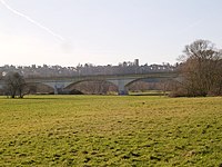
| Arnsberg viaduct | Arnsberg | Railway viaduct of the Upper Ruhr Valley Railway, built from 1868, damaged by bombs in 1945, then rebuilt | ||
| Railway bridge | ||||
| Hammerweidebrücke | ||||
| Herbremen Bridge | ||||
| Railway bridge | ||||
| Arnsberger Strasse bridge | ||||
| Viaduct B229n |
|
|||
| footbridge | ||||
| Oberausseler Bridge | ||||
| Pickenhain Bridge | ||||
| Denz Bridge | ||||
| Ruhr Bridge Im Ohl | ||||
| Ruhr Bridge B7 |
|
|||
| Ruhr Bridge House Füchten | Ense | K 26 | ||
| Railway bridge | Wickede (Ruhr) | Upper Ruhr Valley Railway , bridge over Obergraben and Ruhr | ||
| Pedestrian bridges | Wickede (Ruhr) | over the trench of the Echthausen power plant | ||
| Ruhr Bridge Wickede | Wickede (Ruhr) |
|
||
| Power station bridge | Fröndenberg / Ruhr | Bridge over the Obergraben at the Wickede power station | ||
| Fröndenberg Ruhr Bridge | Fröndenberg / Menden | L 679 Mendener Str. / Fröndenberger Str. | ||
| Railway bridge | Fröndenberg / Menden | Letmathe – Fröndenberg railway line | ||
| footbridge | Fröndenberg / Menden | |||
| Commercial road bridge | Fröndenberg / Menden | |||
| Ruhr Bridge Langschede | Fröndenberg- Langschede / Menden |
|
||
| Cow bridge | Fröndenberg / Iserlohn | Iserlohn footbridge (Dellwiger Weg, Fröndenberg, Ohlweg) | ||
| Ruhrstrasse bridge | Holzwickede / Iserlohn | |||
| Ruhr Bridge Geisecke | Schwerte / Iserlohn | L 677 | ||
| Peace Bridge | Swords | |||
| Pipe bridge | Swords | right next to the railway bridge | ||
| Railway bridge Wandhofen (and Ruhr flood bridge Ergste ) | Swords | almost 400 m apart bridges of the Ardey Railway ; The western bridge (western part in Schwerte-Wandhofen, eastern part in Schwerte-Ergste ) leads over the Ruhr, while the eastern bridge is "dry" in the Ergster Ruhraue and serves as an emergency flood bridge in case of strong floods (see photo); both under monument protection | ||
| Ruhr valley bridge Schwerte | Swords |
|
||
| Westhofen weir bridge | Swords | |||
| Ruhr Bridge Westhofen | Schwerte / Hagen | Hagener Straße ( L 673 ), road bridge over the Ruhr, Kluseninsel and Untergraben (the Ruhr); mostly located in Schwerte-Westhofen , southern part in Hagen-Garenfeld | ||
| Ruhr Valley Bridge (A 1) | Schwerte / Hagen |
|
||
| Railway bridge | Hagen | 51 ° 24 ′ 55.6 " N , 7 ° 29 ′ 31.4" E | at the Lenne estuary below the Hohensyburg east of Hagen-Bathey | |
| Ruhr Bridge Hengsteysee | Dortmund / Hagen | Road bridge ( L 704 ); Hengsteystraße in Syburg (northern part), Dortmunder Straße in Hagen (southern part) | ||
| Bridge Schiffswinkel | Hagen / Herdecke | multifunctional bridge at the Hengstey run-of-river power plant , built for the Koepchenwerk's railway traffic, for road vehicles and pedestrians; approved for pedestrian and bicycle traffic (pushing) | ||
| Herdecke Ruhr Bridge | Herdecke | Road bridge, Hagener Strasse ( B 54 ) | ||
| Herdecke railway viaduct | Herdecke / Hagen | 51 ° 23 '59.5 " N , 7 ° 25' 16.5" E | Monument; South part in Hagen-Vorhalle , north part in Herdecke | |
| Obergrabenbrücken | Weather (Ruhr) | parallel railway and road bridges in the transition from the Harkortsee to the Wetteraner Obergraben; Eastern parts of the bridges are on the Ruhr Island | ||
| Ruhrbrücken weather | Weather (Ruhr) | parallel railway and road bridges on the weir of the Harkortsee , east of the Obergrabenbrücken; Western parts of the bridges are on the Ruhr Island | ||
| Suspension bridge at the Kaltenborn | Weather (Ruhr) | 51 ° 22 '34.9 " N , 7 ° 23' 52.2" E | non-public footbridge on the premises of the Volmarstein community waterworks in Wetter (Ruhr) ; Monument, closed due to dilapidation | |
| Overweg Bridge | Weather (Ruhr) | Ruhrstrasse between Alt-Wetter (eastern part) and Volmarstein (western part); Cycle path ( RuhrtalRadweg ) attached | ||
| Ruhr Bridge Wetter (B 226 n) | Wetter (Ruhr) / Herdecke |
|
||
| Hohenstein hydropower bridge | Witten | Bridge to the power plant island over the Witten mill ditch | ||
| Witten Ruhr Viaduct | Witten | Erected from 1913 to 1916. At the end of the Second World War, railway workers prevented the demolition. | ||
| Ruhr Bridge Bommern | Witten | |||
| Nightingale Bridge | Witten | Pedestrian bridge near the Nachtigall colliery (Witten) | ||
| Mühlengrabenbrücke | Witten | Bridge over the Herbeder Mühlengraben | ||
| Lake Bridge | Witten | |||
| Herbede Ruhr Bridge | Witten | Bridge over the Ruhr and Herbeder Mühlengraben. | ||
| Ruhr bridge A43 | Witten |
|
||
| Kemnader Weir footbridge | Bochum / Hattingen | Located behind the weir of the Kemnader See . | ||
| Ruhrum flood bridge | Hattingen-Blankenstein | Bridge L551 on the Kemnade , in 12 arches over an oxbow lake of the Ruhr near Haus Kemnade. | ||
| Ruhrbrücke Kemnader Strasse | Bochum / Hattingen | Located at House Kemnade , to the north is Stiepel . | ||
| Blankenstein power station bridge | Bochum | Bridge over the power station ditch | ||
| Blankenstein lock bridge | Bochum | 51 ° 24 ′ 48 " N , 7 ° 13 ′ 11" E | Bridge at the Blankenstein lock , access to the power plant | |
| Koster Bridge | Bochum / Hattingen | 51 ° 25 ′ 9 ″ N , 7 ° 12 ′ 2 ″ E | The fifth bridge at this point, with four lanes for the L 705, is now completely oversized. | |
| Ruhr Bridge Hattingen | Hattingen |
L 651 , formerly |
||
| Hattingen railway bridge | Hattingen | The Ruhr Valley Railway , used by the S 3, crosses here . | ||
| Dahlhausen pontoon bridge | Bochum / Hattingen | 51 ° 25 '16 " N , 7 ° 8' 49" E | First built in 1899, rebuilt in 1959. Movable on pontoons due to the flood situation. Currently in acute disrepair. | |
| Old bridge | Bochum / Hattingen | 51 ° 25 ′ 24 " N , 7 ° 8 ′ 33" E | In Dahlhausen Alte Brücke , known as the Roman Bridge in Altendorf , it had two tracks for a horse-drawn railway from the Altendorf Tiefbau colliery . The bridge went into operation in 1863 and was demolished in 1912. | |
| Dahlhausen railway bridge | Bochum / Essen | 51 ° 25 '50.8 " N , 7 ° 7' 28.2" E | At the railway museum Dahlhausen Located bridge of Ruhrtalbahn which is closed in this section. | |
| Dahlhausen footbridge | Bochum / Essen | 51 ° 25 ′ 51 ″ N , 7 ° 7 ′ 28 ″ E | New construction of the foot / cycle bridge next to the railway bridge , built in 1988. | |
| Holtey floating bridge | eat | 51 ° 25 '45.5 " N , 7 ° 5' 51.5" E | First built in 1901, renewed in 1982. Floating bridge for pedestrians and cyclists. | |
| RhE bridge Steele | eat | This bridge for the Mülheim-Heißen-Altendorf (Ruhr) railway line was blown up on April 21, 1945 and not rebuilt. | ||
| Bridge Holteyer Harbor | eat | Arch bridge to the former Holteyer harbor, crossed by the towpath with original paving | ||
| Ruhr Bridge Steele | eat | Railway bridge for the Essen-Überruhr – Bochum-Langendreer railway line , used by the S 9 | ||
| Kurt Schumacher Bridge | eat | |||
| Obergrabenbrücke Spillenburg Weir | eat | Built in 1930 for double-track operation of the former Mülheim-Heißen-Altendorf (Ruhr) railway line, closed in 1980, converted into today's pedestrian and cycle path in 1986 | ||
| Untergrabenbrücke Spillenburger Weir | eat | Built in 1930 for double-track operation of the former Mülheim-Heißen-Altendorf (Ruhr) railway line, closed in 1980, converted into today's pedestrian and cycle path in 1986 | ||
| Konrad Adenauer Bridge | eat | L 925 | ||
| Theodor Heuss Bridge | eat |
|
||
| Kampmann Bridge | eat | dilapidated road bridge from Heisingen to Kupferdreh | ||
| Copper rotary railway bridge | eat | originally the Ruhr Valley Railway, now a footpath and bike path | ||
| Footbridge weir Baldeneysee | eat | |||
| Neukirchen lock bridge | eat | |||
| Brehminsel footbridge | eat | Access to the Brehminsel (peninsula) in Essen-Werden via an old Ruhr arm (underwater of the Neukirchen lock) | ||
| Gustav Heinemann Bridge | eat | 51 ° 23 '13.4 " N , 6 ° 59' 57.9" E |
|
|
| Paper mill lock bridge | eat | 51 ° 22 ′ 52.5 " N , 6 ° 59 ′ 43" E | ||
| Kettwig railway bridge | eat | Ruhrtalbahn on the upper (still preserved), the Untere Ruhrtalbahn on the lower bridge, which was destroyed in the war; used by the S 6 | ||
| Ruhr Bridge Kettwig | eat | Bridge over the weir of the Kettwig lake | ||
| Mühlengrabenbrücke | eat | Bridge over the Kettwiger Mühlengraben, an old arm of the Ruhr | ||
| Historic Ruhr Bridge Kettwig | eat | First mentioned in a document in 1282. Important for the Westphalian Hellweg . Dismantled in 1635. | ||
| Mintarder Bridge | Mülheim an der Ruhr |
|
||
| Menden bridge | Mülheim an der Ruhr |
|
||
| Kassenberger Weir Bridge | Mülheim an der Ruhr | Pedestrian bridges over the Kassenberg weir in the western arm of the Ruhr at the beginning of the Dohneinsel | ||
| Flora bridge | Mülheim an der Ruhr | Pedestrian bridge over the eastern arm of the Ruhr (Schleusenkanal) at the beginning of the Dohneinsel | ||
| Lock bridge | Mülheim an der Ruhr | Road access to the water station on the lock island at the Ruhr lock Mülheim | ||
| Kassenberg Bridge | Mülheim an der Ruhr | Pedestrian bridge from the Kahlenberg hydropower plant on the Dohneinsel over the western arm of the Ruhr to the Broicher Ufer | ||
| Gerbersteg | Mülheim an der Ruhr | Pedestrian footbridge from the Broicher end of the Schlossbrücke across to the Ruhrinsel and then over the western branch of the Ruhr back to the Broicher Ufer | ||
| Castle Bridge | Mülheim an der Ruhr | 51 ° 25 '36.3 " N , 6 ° 52' 34.5" E | Bridge at the Mülheimer Stadthalle , built 1957–1960. Predecessor building in the same place: Chain Bridge . | |
| City viaduct and Ruhr bridge Mülheim | Mülheim an der Ruhr | 51 ° 25 '46.7 " N , 6 ° 52' 34.6" E | Osterath – Dortmund Süd railway line | |
| Konrad Adenauer Bridge | Mülheim an der Ruhr |
|
||
| Styrum Bridge / "Blue Bridge" | Mülheim an der Ruhr | Originally the lower Ruhr Valley Railway , now a foot and bike path | ||
| Footbridge Ruhrwehr Raffelberg | Mülheim an der Ruhr | over the Ruhrschleife | ||
| Raffelberg Bridge | Mülheim an der Ruhr | L 140 over the Ruhr loop | ||
| Raffelberg Bridge | Mülheim an der Ruhr | L 140 via the Ruhr shipping canal at the Raffelberg power plant and the Raffelberg Ruhr lock . | ||
| New Raffelberg Bridge | Mülheim an der Ruhr |
|
||
| Highway bridge | Mülheim an der Ruhr | 51 ° 26 ′ 32 " N , 6 ° 49 ′ 8" E |
|
|
| Ruhr Bridge | Mülheim an der Ruhr | Railway from Duisburg to Mülheim over the Ruhr loop | ||
| Ruhr Bridge Alstaden | Mülheim an der Ruhr / Oberhausen | Railway from Duisburg to Oberhausen over the Ruhr loop | ||
| seven railway bridges Kaiserberg | Mülheim an der Ruhr / Duisburg | 51 ° 26 ′ 47.2 " N , 6 ° 48 ′ 30" E | in the unbundling area of the railway lines to Mülheim and Oberhausen, over the Ruhrschifffahrtskanal, belong to the Ruhraue bridge landscape | |
| Schwiesenkamp bridge | Duisburg | 51 ° 26 ′ 50.5 " N , 6 ° 48 ′ 22" E | across the canal, belongs to the Ruhraue bridge landscape | |
| A3 bridge | Duisburg | 51 ° 26 ′ 56 " N , 6 ° 47 ′ 55" E |
|
|
| Quakenbrücker railway bridge | Duisburg | 51 ° 26 ′ 56 " N , 6 ° 47 ′ 52" E | Convicted u. a. the Duisburg – Quakenbrück railway is part of the Ruhraue bridge landscape . | |
| Aaker ferry bridge | Duisburg | 51 ° 26 ′ 59 " N , 6 ° 47 ′ 31" E | Built for the first time in 1906, rebuilt in 1996, is part of the Ruhraue bridge landscape | |
| Connecting channel bridge | Duisburg | |||
| Berlin bridge | Duisburg | 51 ° 27 ′ 2 " N , 6 ° 46 ′ 44" E |
|
|
| Harbor Canal Bridge | Duisburg | |||
| Ruhrwehr pedestrian bridge | Duisburg | |||
| Lock bridge | Duisburg | |||
| Railway bridge | Duisburg | Built in 1908, demolished in 1997 | ||
| Karl Lehr Bridge | Duisburg | 51 ° 26 ′ 39 " N , 6 ° 44 ′ 44" E | Road bridge for Landesstraße 140 and tram line 901. First built in 1864, rebuilt in 1907 and 1949. |
Fords
| designation | local community | Coordinates | Remarks | Illustration |
|---|---|---|---|---|
| Cologne ford | Hattingen | former ford near the Isenburg | ||
| Ford at Dahlhausen | Bochum | Near the floating bridge. | ||
| Ford at Holtey | eat | Near the Holteyer footbridge. |
Ferries
Current and former ferry connections can be traced from the source to the mouth.
| designation | local community | Coordinates | Remarks | Illustration |
|---|---|---|---|---|
| Company ferry | Witten | Company ferry to the RWE island in Bommern (hand-operated cable ferry) | ||
| Hardenstein ferry | Witten | |||
| Ferry Stiepel | Bochum | |||
| To the food | Bochum / Hattingen | In the area of the Koster Bridge. | ||
| Fisherman's ferry | Bochum | Over several generations by the Fischer family. About 50 m from today's floating bridge upstream. The paving for the place where the ferry landed on the left can still be seen. The footpath to Linden on the right-hand side still bears the name "Fährweg" today. | ||
| Horst ferry | eat | Between Burgaltendorf and Horst in the 18th and 19th centuries run by the Haakmann family, leased by the owner of the Horst house . | ||
| Kettwig ferry | eat | Bonded the Bleach Island with the opposite bank at the level of the restaurant in front of the bridge. The "Ferry Fair" was awarded by the gentlemen at Hugenpoet Castle . In operation until 1865. | ||
| Alstaden ferry | Oberhausen | Association of Alstaden and Speldorf since the late Middle Ages until the 19th century. An important pilgrimage to Rome described by Albert von Stade led from Lippern to Duisburg via the Ruhr ferry. The last ferry owner in Alstaden was Matthias Schrör, who also ran the Matthes restaurant from the Ruhr ferry . The “Fährstraße” and “Speldorfer Straße” are still reminiscent of the Ruhr ferry today. |
Shipping on the Ruhr lakes also takes on a ferry function in parts, e.g. B. between Essen-Heisingen and Essen-Fischlaken and between hill and weir Werden , which is reflected in the ship tariff.
tunnel
| designation | local community | Coordinates | Remarks | Illustration |
|---|---|---|---|---|
| Ruhr tunnel of the Mülheim / Oberhausen tram | ||||
| Ruhr tunnel of the Duisburg light rail |
See also
literature
- Christoph Schmitz: The Ruhr bridges. From the source to the mouth between then and now. Ardey-Verlag , 2004, ISBN 978-3870233112
- Building bridges: Bridges over the middle Ruhr in the area between Schwerte and Herbede. Photo documentation of the historic and new Ruhr bridges; Exhibition catalog of the City Archives Wetter (Ruhr) / ed. by Dietrich Thier. In cooperation with the Heimat- und Geschichtsverein Bommern eV / Thier, Dietrich [Hrsg.] / 1995
- Johann Lichtblau: Ruhr bridges between Halingen and Langschede. 2000
- Martin Obertrifter: Ruhrbrücken - for 700 years. 2000
Web links
Commons : Ruhrbrücken - Collection of images, videos and audio files
- The bridges in the area of the federal waterway from Duisburg to Mülheim, WSA Duisburg-Meiderich
- Brueckenweb.de zu Ruhrbrücken, list of Ruhrbrücken according to Christof Schmitz's above book, in the web archive
Individual evidence
- ↑ https://www.waz.de/staedte/witten/damals-eine-arbeitsbruecke-heute-eine-freizeitbruecke-id214426205.html
- ↑ BAS 13020 Ruhr Bridge House Kemnade. Retrieved November 18, 2014 .
- ↑ In good shape. Retrieved November 18, 2014 .
- ↑ a b c d e Dieter Bonnekamp, Heimat- und Burgverein Essen-Burgaltendorf eV (Ed.): Fords, ferries, bridges. ( online )
- ↑ Notice board on the property
- ↑ a b Ruhrbrücken. Retrieved November 18, 2014 .
- ^ Official website of the city of Mülheim an der Ruhr
- ↑ BAS 13057 railway bridge. Retrieved November 18, 2014 .
- ↑ Historical Society Oberhausen: Origins and Developments of the City of Oberhausen , Volume 2.
- ^ Fares of the White Fleet Baldeney


