List of special natural monuments of Japan
The list of special natural monuments of Japan ( Japanese 特別 天然 記念 物 , Tokubetsu Tennen Kinenbutsu ) currently includes a total of 75 natural monuments of special value declared under the Cultural Property Protection Act , 71 of which are fauna, flora and geology. There are also four nature reserves designated as special natural monuments.
fauna
In the fauna category, 21 animal species are currently declared as special natural monuments. The year of appointment is also given.
- Japanese Serau , 1955
- Japanese otter ( Lutra lutra nippon ), 1965
- Iriomote cat , 1977
- Ryukyu rabbit , 1963
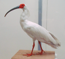
- Nipponibis , 1952
- Black-billed stork , 1956
- Red-crowned crane , 1967
- Short-tailed albatross , 1962
- Snake consecration
- Ptarmigan , 1955
- Okinawa woodpecker , 1977
- Bonin-eyeglass bird , 1977
- Japanese giant salamander , 1952
- Swans from Kominato in Aomori Prefecture , 1952
- Sea bream and its habitat ( Tai no ura ) in Chiba Prefecture , 1967
- Firefly squid of Toyama Prefecture , in 1952
- Japanese firefly and its habitat in Okayama, Shiga Prefecture , 1952
- Yashiro crane ( 八 代 の ツ ル ) and its habitat in Yamaguchi Prefecture , 1955
- Tosa - Onagadori in Kōchi Prefecture , 1952
- Kōchi butterfly Graphium doson and its habitat in Kōchi Prefecture , 1954
- Kagoshima crane and its habitat in Kagoshima Prefecture , 1952
flora
In the flora category, 30 plant species are currently declared as special natural monuments. The prefecture in which the plants are found and the year of the appointment are also given.
| Natural monument | Year of appointment |
Remarks | location | image |
|---|---|---|---|---|
| Alge Marimo ( 阿寒湖のマリモ ) in Lake Akan | 1952 |
Akan , Hokkaidō 43 ° 27 '1.5 " N , 144 ° 5' 57.9" E |

|
|
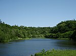
| Nopporo jungle ( 野 幌 原始 林 , Nopporo genshirin ) | 1952 |
Kitahiroshima , Hokkaidō 43 ° 3 ′ 12.5 ″ N , 141 ° 30 ′ 3.1 ″ E |
|
|
| High mountain plants of Mount Apoi ( ア ポ イ 岳 高山 植物群落 , Apoidake kōzanshokubutsu gunraku ) | 1952 |
Samani , Hokkaidō 42 ° 6 ′ 25.4 " N , 143 ° 1 ′ 41.9" E |
||
| Mount Hayachine and forest like high mountain zone of Mount Yakushi ( 早 池 峰山 お よ び 薬 師 岳 の 高山 帯 ・ 森林 植物群落 , Hayachinesan oyobi yakushidake no kōzantai shinrin shokubutsugunraku ) | Natural monument since 1928 |
Hanamaki , Tōno and Kawai , Iwate Prefecture 39 ° 31 ′ 53.7 ″ N , 141 ° 28 ′ 26.5 ″ E |
||
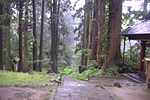
| 600 year old cedars of Mount Haguro ( 羽 黒 山 の ス ギ 並 木 , Hagurosan no suginamiki ) | 1955 |
Tsuruoka , Yamagata Prefecture 38 ° 42 ′ 13.9 ″ N , 139 ° 58 ′ 13.3 ″ E |
|
|
| Large Japanese zelkove in Higashine ( 東 根 の 大 ケ ヤ キ , Higashine no ōkeyaki ) | 1957 | With a diameter of 12 m, the largest zelkove in Japan, around 1000 years old |
Higashine , Yamagata Prefecture 38 ° 26 ′ 31.2 ″ N , 140 ° 24 ′ 6.3 ″ E |

|
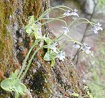
| Habitat of the Pinguicula ramosa ( コ ウ シ ン ソ ウ 自 生地 , Kōshinsō jiseichi ) | 1952 | belongs to the genus of fatty herbs that are native to the Nikkō National Park |
Nikkō , Tochigi Prefecture 36 ° 40 ′ 27.1 ″ N , 139 ° 21 ′ 42.9 ″ E |
|
| Cedar avenue to Nikkō including a stone monument ( 日光 杉 並 木 街道 附 並 木 寄 進 碑 , Nikkō suginamiki kaidō tsuketari namiki kishinhi ) | 1954 | Three avenues with a length of 37 km |
Nikkō , Imaichi and Kanuma , Tochigi Prefecture 36 ° 35 ′ 46.3 ″ N , 139 ° 49 ′ 16.9 ″ E |

|
| Habitat of Siebold's primroses in Tajimagahara ( 田島 ヶ 原 サ ク ラ ソ ウ 自 生地 , Tajimagahara sakurasō jiseichi ) | 1952 |
Saitama , Saitama Prefecture 35 ° 50 ′ 17.4 ″ N , 139 ° 36 ′ 56.7 ″ E |

|
|
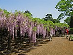
| Great wisteria of Ushijima ( 牛 島 の フ ジ , Ushijima no fuji ) | 1955 |
Kasukabe , Saitama Prefecture 35 ° 59 ′ 5.8 ″ N , 139 ° 46 ′ 24.1 ″ E |
|
|
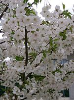
| Cherry tree ( Cerasus speciosa ) ( 大 島 の サ ク ラ 株 , Ōshima no sakurakabu ) | 1952 | 800 year old cherry tree with a circumference of 7.9 m |
Izu-Ōshima , Tokyo Prefecture 34 ° 45 ′ 49 ″ N , 139 ° 26 ′ 3.1 ″ E |
|
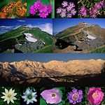
| High mountain plants of the ridge on Mount Shirouma ( 白馬 連山 高山 植物 帯 , Shiroumarenzan kōzanshokubutsutai ) | 1952 |
Asahi and Kurobe in Toyama Prefecture ; Hakuba in Nagano Prefecture ; Itoigawa in Niigata Prefecture 36 ° 38 ′ 56.9 ″ N , 137 ° 44 ′ 55.7 ″ E |
|
|
| Wild cherry Kariyado no kebazakura ( 狩 宿 の 下馬 ザ ク ラ , for example: cherry tree for the "rest stop at the hunting lodge") | 1952 | Oldest wild cherry in Japan |
Fujinomiya , Shizuoka Prefecture 35 ° 18 ′ 6.9 ″ N , 138 ° 35 ′ 19.6 ″ E |
|
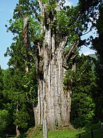
| Old cedar to Itoshiro (Mount Haku) ( 石 徹 白 の 大 杉 , Itoshiro no Ōsugi ) | 1957 | Circumference 14 m |
Gujō , Gifu Prefecture 36 ° 0 ′ 5.8 ″ N , 136 ° 46 ′ 18.5 ″ E |
|
| Jungle of Mount Kasuga ( 春日 山 原始 林 , Kasugayama genshirin ) | 1955 | Moreover, part of the UNESCO - World Heritage "Historic Nara" |
Nara , Nara Prefecture 34 ° 40 ′ 56.2 ″ N , 135 ° 51 ′ 46.1 ″ E |

|
| Forest with Japanese yew trees on Daisen Mountain ( 大 山 の ダ イ セ ン キ ャ ラ ボ ク 純 林 , Daisen no daisenkyaraboku junrin ) | 1952 |
Daisen , Tottori Prefecture 35 ° 29 ′ 0.9 ″ N , 133 ° 30 ′ 28.5 ″ E |
||
| Large camphor tree to Kamo ( 加 茂 の 大 ク ス , Kamo no ōkusu ) | 1956 |
Higashimiyoshi , Tokushima Prefecture 34 ° 2 ′ 27.4 ″ N , 133 ° 55 ′ 54.9 ″ E |

|
|
| Chinese juniper at Hōshōin ( 宝 生 院 の シ ン パ ク , Hōshōin no shinpaku ) | 1955 | Circumference: 15 m to 23 m |
Tonoshō , Kagawa Prefecture 34 ° 29 ′ 36.1 ″ N , 134 ° 11 ′ 49.9 ″ E |

|
| "Largest of all cedars" ( 杉 の 大 ス ギ , Sugi no ōsugi ) | 1952 | Sequoia with two trunks with a circumference of 16 m each |
Ōtoyo , Kochi Prefecture 33 ° 45 ′ 20.2 ″ N , 133 ° 39 ′ 47 ″ E |

|
| Boxwood forest on Mount Kosho ( 古 処 山 ツ ゲ 原始 , Koshosan tsuge genshirin ) | 1952 |
Asakura and Kama , Fukuoka Prefecture 33 ° 28 ′ 54.7 " N , 130 ° 43 ′ 29.8" E |

|
|
| Camphor forest on Mount Tachibana ( 立 花山 ク ス ノ キ 原始 林 , Tachibanayama kusunoki genshirin ) | 1956 |
Shingū and Hisayama , Fukuoka Prefecture 33 ° 40 ′ 45.7 ″ N , 130 ° 28 ′ 6.2 ″ E |

|
|
| Velvet beans ( Mucuna sempervirens ) in Aira ( 相 良 の ア イ ラ ト ビ カ ズ ラ , Aira no airatobikazura ) | 1952 |
Kikuka , Kumamoto Prefecture |
||
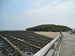
| Subtropical flora of the island of Aoshima ( 青島 亜 熱 帯 性 植物群落 , Aoshima anettai seishokubutsugunraku ) | 1954 |
Aoshima , Miyazaki , Miyazaki Prefecture 31 ° 48 '18.7 " N , 131 ° 28' 32.7" O |
|
|
| Habitat of the Japanese sago palm fern of the Toi headland ( 都 井 岬 ソ テ ツ 自 生地 , Toimisaki sotetsu jiseichi ) | 1952 |
Kushima , Miyazaki Prefecture 31 ° 21 ′ 54.8 " N , 131 ° 20 ′ 24" E |

|
|
| Mitrastemonaceae in Uchiumi ( 内海 の ヤ ッ コ ソ ウ 発 生地 , Uchiumi no yakkosō hasseichi ) | 1954 |
Miyazaki , Miyazaki Prefecture 31 ° 44 ′ 29 " N , 131 ° 28 ′ 3.8" E |
||
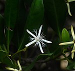
| Kandelia rheedii in Kiire ( 喜 入 の リ ュ ウ キ ュ ウ コ ウ ガ イ 産地 , Kiire no ryūkyōkōgai sanchi ) | 1952 |
Kagoshima , Kagoshima Prefecture 31 ° 22 ′ 29.3 ″ N , 130 ° 32 ′ 49.3 ″ E |
|
|
| Subtropical plant community of the uninhabited island Birō ( 枇 榔 島 亜 熱 帯 性 植物群落 , Birōjima anettai seishokubutsugunraku ) | 1956 |
Shibushi , Kagoshima Prefecture 31 ° 25 ′ 45.3 ″ N , 131 ° 7 ′ 1.9 ″ E |

|
|
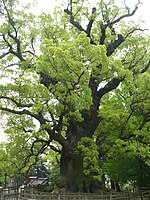
| Camphor trees to Kamo ( 蒲 生 の ク ス , Kamō no kesu ) | 1952 | Height: 30 m, circumference: 24 m |
Kamō , Kagoshima Prefecture 31 ° 45 ′ 44.4 " N , 130 ° 34 ′ 11.8" E |
|
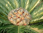
| Habitat of the Japanese sago palm fern in Kagoshima ( 鹿 児 島 県 の ソ テ ツ 自 生地 , Kagoshimaken no sotetsu jiseichi ) | 1952 |
Yamagawa , Bonotsu , Sata, and Uchinoura , Kagoshima Prefecture 31 ° 21 ′ 13.1 ″ N , 130 ° 42 ′ 15.6 ″ E |
|
|
| Cedar forest of Yakushima ( 屋 久 島 ス ギ 原始 林 , Yakushima sugi genshirin ) | 1954 | Together with the Jōmon Sugi, the oldest cedar trees in Japan |
Yakushima , Kagoshima Prefecture 30 ° 19 ′ 40.2 ″ N , 130 ° 31 ′ 23.1 ″ E |

|
Geology and minerals
In the geology category, 20 geological formations and minerals are currently declared as special natural monuments. The prefecture and the year of appointment are also given.
| Natural monument | Year of appointment |
Remarks | location | image |
|---|---|---|---|---|
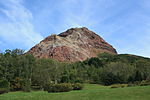
| Shōwa-shinzan ( 昭和 新 山 ) | 1957 |
Sōbetsu , Hokkaidō 42 ° 32 ′ 37.2 " N , 140 ° 51 ′ 51.8" E |
|
|
| Lime sinter at Getō- Onsen ( 夏 油 温泉 の 石灰 華 , Getō onsen no sekkaika ) | 1957 |
Kitakami , Iwate Prefecture 39 ° 12 ′ 36.6 ″ N , 140 ° 52 ′ 55.7 ″ E |
||
| Solidified lava flows ( 焼 走 り 熔岩 流 , Yakehashiri yōganryū ) | 1952 |
Nishine , Iwate Prefecture 39 ° 52 ′ 30.8 " N , 141 ° 2 ′ 51.2" E |
|
|
| Petrified trees Nesori ( 根 反 の 大 珪 化 木 , Nesori no daikeikaboku ) | 1952 | 15-20 million years old |
Ichinohe , Iwate Prefecture 40 ° 11 ′ 24.8 ″ N , 141 ° 20 ′ 4.4 ″ E |
|
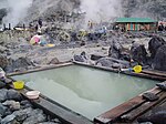
| Radioactive hakutolite at Tamagawa-Onsen ( 玉川 温泉 の 北投 石 , Tamagawa onsen no hokutōseki ) | Hokutolite is a radioactive barite . |
Semboku , Akita 39 ° 57 '42.6 " N , 140 ° 43' 42.2" E |
|
|
| Hot, periodic hot springs Megama and Ogama in Onikobe ( 鬼 首 の 雌 釜 お よ び 雄 釜 間歇 温泉 , Onikobe no megama oyobi ogama kanketsu onsen ) | 1952 |
Ōsaki , Miyagi Prefecture 38 ° 48 ′ 0.2 ″ N , 140 ° 38 ′ 52.8 ″ E |
||
| Tree-shaped lava of Mount Asama ( 浅 間 山 熔岩 樹型 , Asamayama yōganjukei ) | 1940 |
Tsumagoi , Gunma Prefecture 36 ° 26 ′ 53.6 ″ N , 138 ° 30 ′ 56.3 ″ E |
||
| Kagami-iwa rock in Kamikawa ( 御 岳 の 鏡 岩 , Ontake no kagamiiwa ) | 1956 |
Kamikawa , Saitama Prefecture 36 ° 10 ′ 45.9 ″ N , 139 ° 4 ′ 14.2 ″ E |

|
|
| Buried grove in Uozu ( 魚津 埋没 林 , Uozu maibutsurin ) | 1955 | Three tree stumps from a cedar forest that was partially buried 2000 years ago; the largest with a circumference of 12 m |
Shakadō, Uozu , Toyama Prefecture 36 ° 49 ′ 31.5 ″ N , 137 ° 24 ′ 23.5 ″ E |

|
| Kar of Yakushi Mountain ( 薬 師 岳 の 圏 谷 群 , Yakushidake no kenkokugun ) | 1952 |
Toyama , Toyama Prefecture 36 ° 28 ′ 5.6 " N , 137 ° 32" 38.5 " E |

|
|
| Tower-shaped limestone sinter between rocks ( 岩 間 の 噴泉 塔群 , Iwama no funsentōgun ) | 1957 |
Hakusan , Ishikawa Prefecture 36 ° 13 ′ 39.3 " N , 136 ° 46 ′ 11.7" E |

|
|
| Tree-shaped lava holes in Narusawa ( 鳴 沢 熔岩 樹型 , Narusawa yōgan jukei ) | 1952 |
Narusawa , Yamanashi Prefecture 35 ° 25 ′ 34.1 ″ N , 138 ° 42 ′ 3 ″ E |

|
|
| Limestone beads and stalagmites at the Shirahone Onsen ( 噴 湯 湯 と 球状 石灰石 , Shirahone onsen no funtōkyū to kyūjōsekkaiseki ) | 1922 |
Matsumoto , Nagano Prefecture 36 ° 8 ′ 51.7 ″ N , 137 ° 37 ′ 28.9 ″ E |
||
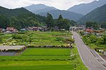
| Neodani fault ( 根 尾 谷 断層 , Neodani dansō ) | 1952 |
Motosu , Gifu Prefecture 35 ° 37 ′ 1.6 ″ N , 136 ° 37 ′ 15 ″ E |
|
|
| Chrysanthemum stones ( kikaseki ) by Neodani ( 根 尾 谷 の 菊花 石 , Neodani no kikaseki ) | 1952 | Gifu Prefecture | ||
| Wakutama Lake ( 湧 玉池 ) | 1952 |
Fujinomiya , Shizuoka Prefecture 35 ° 13 ′ 38.1 ″ N , 138 ° 36 ′ 41.1 ″ E |

|
|
| Lava tunnel on Daikon Island ( 大 根 島 の 熔岩 隧道 , Daikonjima no yōganzuidō ) | 1931 |
Matsue , Shimane Prefecture 35 ° 29 ′ 42.6 " N , 133 ° 10 ′ 34.4" E |
||
| Akiyoshi stalactite cave ( 秋芳 洞 , Akiyoshidō ) | 1922 | Largest cave in Japan with a length of 8.7 km |
Mine , Yamaguchi Prefecture 34 ° 13 ′ 40.2 ″ N , 131 ° 18 ′ 12.3 ″ E |

|
| Akiyoshi karst plateau ( 秋 吉 台 , Akiyoshidai ) | 1964 |
Mine , Yamaguchi Prefecture 34 ° 14 ′ 11.1 ″ N , 131 ° 17 ′ 26 ″ E |
|
|
| Pot-shaped rock holes Yakama ( 八 釜 の 甌 穴 群 , Yakama no ōketsugun ) |
Kumakōgen , Ehime Prefecture 33 ° 42 ′ 13.6 ″ N , 132 ° 57 ′ 38.4 ″ E |
Nature reserves
Four nature reserves are also declared as special natural monuments. The prefecture and the year of appointment are also given.
- Daisetsu-zan in Hokkaidō
- Marshland Oze , Fukushima Prefecture , Gunma Prefecture , Niigata Prefecture
- Kurobe Valley with Sarutobi Gorge and Mount Okukane ( 黒 部 峡谷 附 猿 飛 な ら び に 奥 鐘山 ) in Toyama Prefecture
- Kamikochi Highlands in Nagano Prefecture
Remarks
- ↑ The Nipponibis is declared a special natural monument both in Japan and in Korea.
- ↑ The name of the cherry tree comes from the fact that in 1193 Minamoto no Yoritomo dismounted and rested here during a hunt.
Individual evidence
- ↑ Nobuo Ishihara: 根 尾 谷 の 菊花 石 . 2014, Retrieved January 21, 2015 (Japanese, with many illustrations).
Web links
- Natural monuments of Japan - photos
- Japan Association for Techno-innovation in Agriculture, Forestry and Fisheries. 公益 社 団 法人 農林 水産 ・ 食品 産業 技術 振興 協会 , accessed January 17, 2015 (Japanese, lists most special natural monuments with a brief description and picture).
