
Kössen
|
Kössen
|
||
|---|---|---|
| coat of arms | Austria map | |
 |
|
|
| Basic data | ||
| Country: | Austria | |
| State : | Tyrol | |
| Political District : | Kitzbühel | |
| License plate : | KB | |
| Surface: | 69.29 km² | |
| Coordinates : | 47 ° 40 ′ N , 12 ° 24 ′ E | |
| Height : | 589 m above sea level A. | |
| Residents : | 4,426 (January 1, 2020) | |
| Postal code : | 6345 | |
| Area code : | 05375 | |
| Community code : | 7 04 12 | |
| NUTS region | AT335 | |
| UN / LOCODE | AT KOS | |
| Address of the municipal administration: |
Dorf 14 6345 Kössen |
|
| Website: | ||
| politics | ||
| Mayor : | Reinhold Flörl (We for everyone - a heart for Kössen) | |
|
Municipal Council : (2016) (17 members) |
||
| Location of Kössen in the Kitzbühel district | ||
  |
||
 Kössen with the parish church of St. Peter and St. Paul and Unterberghorn in the background. |
||
| Source: Municipal data from Statistics Austria | ||

Kössen (in the Bavarian and Tyrolean local dialect: Kessn ) is a municipality with 4426 inhabitants (as of January 1, 2020) in the Leukental in the Kitzbühel district in Tyrol ( Austria ). The community is located in the judicial district of Kitzbühel . Together with the towns of Walchsee, Schwendt and Rettenschöss, Kössen forms the Kaiserwinkl tourist region .
history
The place has been inhabited for about 5000 years and has been a trading center ever since . Over the Klobenstein valley pass , which is located in the north of the village, an important route was formed between the surrounding villages of Kössen and Aschau in Bavaria . The discovery of a rag ax from the Bronze Age proves the early use of this path. In a traditional note of Herrenchiemsee Abbey from the years 1180-1188 the name Kössen derived from the word "kezzin" and as much as means boiler 'is first documented as "Chessen" mentioned. The origins of the parish in church history go back to the 8th century. From the 10th century onwards, around 144 farms in what is now the municipality belonged to the Frauenchiemsee monastery .

Thanks to the pass road that ran along the town houses , inns were soon built. The "Gasthof Erzherzog Rainer", built in Gothic style in 1587, still exists today.
Ore mining was also significant in many regions of Tyrol. Lead and iron were mined in Kössen . In 1549 the “Kössentaler Berg- und Schmelzwerkhandel” was founded, which specialized in the processing of ores . Furthermore, a hut was operated in the Kössen district of "Hut". This ironworks was active until the 19th century. In addition, industrial wire was also manufactured , but production was discontinued around 1880. Thus Kössen became a purely agricultural community again.
After the Second World War , tourism developed mainly and is now one of the most important sources of income. Kössen gained special importance as a pioneer hang glider with the implementation of the 1st world championship in alpine hang gliding (1975) and in 1989 with the 1st world championship in paragliding . The 1st Austrian civil aviation school for hang gliders was officially approved here in 1976.
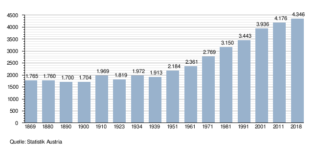
Population development
geography
The place is located in the northern Leukental in the Kaiserwinkl region in a wide basin between the Chiemgau Alps in the north and the Kaiser Mountains in the south, at the confluence of the Großache , the Kohlenbach and the Weißenbach. To the north, this basin is closed by the valley of the Entenlochklamm ("Antenloch"). An old smuggler path leads through the gorge via the pilgrimage church Klobenstein to Schleching . Due to its location on the Großache, which has a large catchment area , and the section of the gorge that adjoins it, Kössen fell victim to major floods several times , most recently in 2013. In geology , the location is eponymous for the Kössen formation .
structure
The community is made up of various hamlets and farms. The northern and eastern municipal boundaries also form the border with Bavaria .
Districts
Achenweg, Alleestraße, Am See, Auserkapelle, Bichlach, Blaik, Durchen, Dorf, Erlau, Erlengrund, Fritzing, Gundharting, Hut, Hüttfeldstraße, Kranebittau, Kaltenbach, Klobensteinerstraße, Kranzach, Loferberg, Leitwang, Lendgasse, Moosen, Mooslenz, Moserbachweg, , Mühlberg, Niederachen, Oberbichlach, Ried, Schinterwinkl, Schwandorf, Staffen, Steinbruchweg, Thurnbichl, Waidach, Wiesenweg
Neighboring communities
Neighboring communities are (alphabetically): Aschau im Chiemgau (Bavaria), Kirchdorf in Tirol , Reit im Winkl (BY), Schleching (BY), Schwendt , Unterwössen (BY), Waidring , Walchsee (district of Kufstein).
climate
Kössen is located in the snowiest region in Tyrol. For its altitude of around 600 m above sea level. A. This is where the most snow falls in the whole of the Alps. The average temperatures here are -3.3 ° C in January and 15.9 ° C in July. The annual rainfall is 1718 mm. Since it is very cold in winter and there is a lot of precipitation, snow depths of up to 1.50 m are possible.
|
Average monthly temperatures and precipitation for Kössen (600 m)
|
- Centennial flood 2013
After days of rain , there was massive flooding in large parts of Austria at the end of May and beginning of June 2013, which also affected the Tyrolean lowlands . The municipality of Kössen in the lower Leukental in the Kitzbühel district was particularly hard hit.
The Großache overflowed its banks on the night of June 1st and 2nd and caused enormous devastation. Water penetrated into the village center, where numerous cellars had to be pumped out. The district of Erlau was affected even more. Hundreds of houses were up to one and a half meters under water. A total of 300 people had to be evacuated, 80 of them even by helicopter and boats. The power grid and all telephone connections were interrupted until Monday morning. Hundreds of fire fighters and other volunteers worked continuously to prevent even worse damage. Significant contamination of the property and buildings in Kössen-Erlau occurred through hundreds of burst oil tanks. With the moisture, large amounts of fuel oil residues settled in the walls and floors. The acrid smell of oil remained in the air for days and penetrated into the neighboring community of Schleching, 5 kilometers away.
The record level of the flood in 2002 was exceeded by far. At noon on June 2, the Ache peaked at 357 cm.

The Kössen valley floor has been known as a flood plain for centuries. Over a hundred years ago, the development and the inadequate implementation of repair and security work were held responsible for the enormous damage.
traffic
At the turn of the century Kössen should have been connected to a local railway projected to Reit im Winkl from Kufstein via Ebbs and Walchsee . The eastern connection, the forest railway from Reit im Winkl to Ruhpolding was actually built later but only operated from 1923 to 1931. Parts of the German Alpine Road were later realized in this area. Today, as then, the place is an important junction due to its location between Kitzbühel and Rosenheim or Kufstein and Traunstein .
In October 1904, the project of a standard-gauge local railway leading from Kufstein to Kössen was withdrawn in consideration of the concerns and difficulties opposing the project, and instead the construction of a narrow-gauge local railway connecting Kössen with St. Johann in Tirol was sought.
Economy, tourism and sport


Kössen is the largest of the 4 towns in the Kaiserwinkl holiday region . The association is led by chairman Gerd Erharter. Summer tourism dominates with its 200 km of marked hiking trails and 180 km of cycle paths. In addition, the Kaiserwinkl is one of the largest golf regions in Austria. In winter, the Kaiserwinkl is one of the cross-country skiing centers in Tyrol and has the country's seal of approval. The total of 240.50 km of cross-country trails has a high standard of preparation, orientation, marking and safety precautions. The Kaiserwinkl is also a member of the "Tyrolean cross-country skiing specialists".
Kössen is economically dominated by tourism and is particularly known to paragliders and hang-gliders . Thanks to its local mountain, the Unterberghorn , Kössen is increasingly gaining the status of a winter sports and hiking area. The Fellhorn is also partly located in the municipality. This is also one of the namesake of the Hefferthorn-Fellhorn-Sonnenberg landscape conservation area , which is largely located in the municipality of Kössen. It extends from the Hefferthorn, the secondary summit of the Unterberg in the west, over the Hagertal to the border with Bavaria and the Salzburg region in the east.
The overnight stays show the tourism orientation of the place:
| year | Overnight stays |
|---|---|
| 1999 | 580,000 |
| 2000 | 539,000 |
| 2001 | 544,800 |
| 2002 | 592,800 |
| 2003 | 607,600 |
| 2004 | 589,651 |
| 2005 | 581,671 |
| 2006 | 561,492 |
| 2007 | 530.775 |
| 2008 | 539.479 |
| 2009 | 533,882 |
| 2010 | 510.804 |
| 2011 | 507.464 |
| 2012 | 506,552 |
| 2013 | 479.924 |
| 2014 | 486.733 |
| 2015 | 490.844 |
| 2016 | 508,580 |
| 2017 | 521.505 |
mayor
- until 2015 Stefan Mühlberger (progressive list of workers and mayors AAB Kössen)
- 2015 to 2017 Vinzenz Schlechter (Team Zukunft Kössen - Josef Hechenbichler)
- since 2017 Reinhard Flörl (ÖVP list)
Culture and sights


- The pilgrimage church Maria Klobenstein is located in the municipality of Kössen in Tyrol on the border with Bavaria (municipality of Schleching ). It belongs to the parish of Kössen, deanery St. Johann in Tirol in the Archdiocese of Salzburg.
- The Anna Chapel , built in 1725
Personalities
Sons and Daughters of the Church:
- Matthias Wißhofer (1752–1819), dean, freedom fighter, universal scholar and inventor
- Matthäus Hörfarter (1817-1896), theologian
- Johanna Fürstauer (1931–2018), writer
- Fritz Astl (1944–2000), principal school director and politician
- Josef Hechenbichler (* 1945), politician (ÖVP)
Women and men who live in the community:
- Stephanie Obermoser (* 1988), marksman
- Evi Sachsenbacher-Stehle (* 1980), biathlete
- Peter Schröcksnadel (* 1941), President ÖSV
Web links
- 70412 - Kössen. Community data, Statistics Austria .
- Kössen , in the history database ofthe association "fontes historiae - sources of history"
Individual evidence
- ↑ http://www.koessen.tirol.gv.at/Reinhold_Floerl
- ↑ Martin Bitschnau , Hannes Obermair : Tiroler Urkundenbuch, II. Department: The documents on the history of the Inn, Eisack and Pustertal valleys. Vol. 2: 1140-1200 . Universitätsverlag Wagner, Innsbruck 2012, ISBN 978-3-7030-0485-8 , p. 287-288, no.760 . - In the older literature, based on the Monumenta Boica , Volume 2, p. 336, No. 170, the document was erroneously dated to "1160".
- ^ Meyer's Large Conversational Lexicon . 6th edition. Bibliographisches Institut, Leipzig / Vienna 1909 ( zeno.org [accessed on October 8, 2019] Lexicon entry “Kössener layers”).
- ↑ Kössen is under water
- ↑ Tiroler Tageszeitung from August 29, 2013, Kitzbühel Lokal, p. 33
- ↑ Kössen Hut / Grossache - water level
- ↑ Tiroler Anzeiger, May 28, 1914, p. 6, No. 120 .
- ↑ Local railway project Kössen – St. Johann. In: Wiener Zeitung , No. 227/1904, October 4, 1904, p. 7, bottom center. (Online at ANNO ).
Aurach near Kitzbühel | Brixen im Thale | Fieberbrunn | Going at the Wilder Kaiser | Hochfilzen | Hopfgarten im Brixental | Itter | Jochberg | Kirchberg in Tirol | Kirchdorf in Tirol | Kitzbühel | Kössen | Oberndorf in Tirol | Reith near Kitzbühel | Schwendt | St. Jacob in House | St. Johann in Tirol | St. Ulrich am Pillersee | Waidring | Westendorf