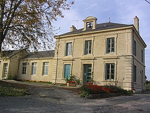
Neuville Day
| Neuville Day | ||
|---|---|---|
|
|
||
| region | Grand Est | |
| Department | Ardennes | |
| Arrondissement | Vouziers | |
| Canton | Attigny | |
| Community association | Crêtes Préardennaises | |
| Coordinates | 49 ° 30 ′ N , 4 ° 41 ′ E | |
| height | 95-191 m | |
| surface | 7.68 km 2 | |
| Residents | 158 (January 1, 2017) | |
| Population density | 21 inhabitants / km 2 | |
| Post Code | 08130 | |
| INSEE code | 08321 | |
 Local government |
||
Neuville-Day is a French commune with 158 inhabitants (as of January 1, 2017) in the Ardennes department in the Grand Est region in the canton of Attigny .
The Canal des Ardennes runs southeast of the village . Départementsstraße 25 runs through the local situation, where Départementsstraße 28 meets here. The village of Day, about one and a half kilometers northwest, belongs to the municipality . To the west of the village is the Bois du Vivier forest .
history
Both in the First and Second World War there was severe damage to the place. During a French offensive in World War I, the village was destroyed by French artillery fire in November 1918 and by fire in May 1940 when German troops advanced in World War II. The village was always rebuilt.
Population development
| year | 1962 | 1968 | 1975 | 1982 | 1990 | 1999 | 2010 | 2016 |
| Residents | 257 | 220 | 193 | 185 | 162 | 154 | 171 | 160 |
| Sources: Cassini and INSEE | ||||||||

