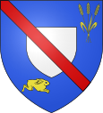
Saint-Etienne-à-Arnes
| Saint-Etienne-à-Arnes | ||
|---|---|---|

|
|
|
| region | Grand Est | |
| Department | Ardennes | |
| Arrondissement | Vouziers | |
| Canton | Attigny | |
| Community association | Argonne Ardennaise | |
| Coordinates | 49 ° 19 ′ N , 4 ° 30 ′ E | |
| height | 114-208 m | |
| surface | 29.56 km 2 | |
| Residents | 242 (January 1, 2017) | |
| Population density | 8 inhabitants / km 2 | |
| Post Code | 08310 | |
| INSEE code | 08379 | |
Saint-Étienne-à-Arnes is a French commune of the department of Ardennes in the region Grand Est . Administratively it is assigned to the canton of Attigny and the Arrondissement of Vouziers .
geography
The place with 242 inhabitants (as of January 1, 2017) is located in the foothills of the Ardennes on the Arnes, a small tributary of the Suippe .
Population development
| year | 1962 | 1968 | 1975 | 1982 | 1990 | 1999 | 2006 | 2016 |
| Residents | 257 | 237 | 227 | 202 | 198 | 166 | 193 | 243 |
| Sources: Cassini and INSEE | ||||||||
Military cemetery
In the area of the municipality there is a military cemetery from the time after the First World War with the graves of 12,541 dead, most of whom were German soldiers.
In the night from July 7th to 8th 2012, around 40 graves of soldiers were desecrated. This took place in the run-up to a meeting between French President François Hollande and German Chancellor Angela Merkel on July 8, 2012 in Reims . The meeting was reminiscent of a demonstratively friendly conclusion by Charles de Gaulle and Konrad Adenauer during a state visit from July 2-8, 1962 to France in Reims Cathedral 50 years ago.
Personalities
The French pilot Bernard Barny de Romanet (1894-1921) was born in the village.

