Duncan Islands
| Duncan Islands | |
|---|---|
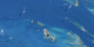
| Landsat image of the group | |
| Waters | Pacific Ocean |
| archipelago | Torres Strait Islands |
| Geographical location | 10 ° 14 ′ S , 142 ° 5 ′ E |
| Number of islands | approx. 15 |
| Total land area | 0.8 km² |
| Residents | uninhabited |
| Location of the Torres Strait Islands | |
The Duncan Islands are an Australian island group between Australia and New Guinea . They are located in the west of the Torres Strait Islands archipelago , about 14 km west of Moa Island .
There are some very small, flat rock islands; all islands are uninhabited.
The group includes the following islets:
![]() Map with all coordinates: OSM | WikiMap
Map with all coordinates: OSM | WikiMap
| Island name | Area (km²), approx. | Geographic coordinates |
|---|---|---|
| Ngurtai | 0.03 | 10 ° 13 ' S , 142 ° 3' E |
| Quoin Island | 0.06 | 10 ° 13 ′ S , 142 ° 4 ′ E |
| Meth Island | 0.04 | 10 ° 14 ' S , 142 ° 4' E |
| Wilson Island | 0.40 | 10 ° 14 ′ S , 142 ° 5 ′ E |
| Kanig Island | 0.26 | 10 ° 15 ′ S , 142 ° 5 ′ E |
Administratively, the Duncan Islands are part of the Western Islands , an island region in the Torres Shire county of Queensland .

