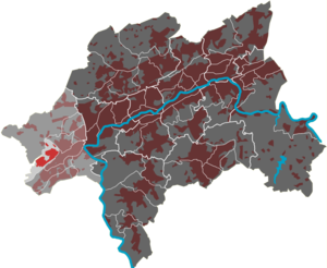
Osterholz (district)
|
Osterholz (31) district of Wuppertal |
|
|---|---|
| Coordinates | 51 ° 13 '52 " N , 7 ° 3' 20" E |
| surface | 1.96 km² |
| Residents | 3783 (Dec. 31, 2014) |
| Population density | 1930 inhabitants / km² |
| Proportion of foreigners | 10.9% (Dec. 31, 2014) |
| Post Code | 42327 |
| prefix | 0202 |
| Borough | Vohwinkel |
| Transport links | |
| Federal road |
|
| railroad | RB 48 RE 4 RE 13 |
| Train | S 8 S 9 S 68 |
| bus | 631 |
| Source: Wuppertal statistics - spatial data | |
The Osterholz residential area in Wuppertal is one of nine districts in the Vohwinkel district . It is named after the Osterholz forest area in the west of Wuppertal.
geography
The 1.96 km² residential area is sparsely populated and only has a closed development with single and multi-family houses in the east with the settlement on the street Zur Waldkampfbahn . Despite its name, the residential area is also rural. Only a very small part of the Osterholz forest area is in the residential area, a large part of which has been placed under protection in the Krutscheid sinkhole nature reserve. The most important body of water is the Krudtscheider Bach .
The residential area is bordered to the north by the residential district Schoeller Dornap , on the east by the railroad line Wuppertal-Vohwinkel-Essen-Ruhr , on the south by the railway line Dusseldorf-Elberfeld and to the west Gruiten (city Haan ).
In addition to the two main settlements, the Alt-Derken and Schrotzberg farms are part of the residential area. On the site of the old farm Simonshöfchen a commercial area and have been prison Simonshöfchen built.

