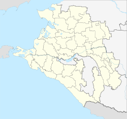
Temryuk
| city
Temryuk
Темрюк
|
||||||||||||||||||||||||||||||||||||||||
|
||||||||||||||||||||||||||||||||||||||||
|
||||||||||||||||||||||||||||||||||||||||
| List of cities in Russia | ||||||||||||||||||||||||||||||||||||||||
Temryuk ( Russian Темрюк ) is a city in the Krasnodar region ( Russia ) with 38,046 inhabitants (as of October 14, 2010).
geography
The city is located near the north coast of the Taman Peninsula about 130 km west of the regional capital Krasnodar on the right bank of the southwest arm of the Kuban not far from its confluence with the Sea of Azov .
Temryuk is the administrative center of the Rajon of the same name .
The city is the end of a railway line that branches off the Krymskaya - Kawkas line leading to the western tip of the Taman peninsula . Temryuk has a sea and fishing port five kilometers north of the city.
history
After the Mongols had conquered the Kuban region , they founded their first city in 1237 on the site of today's Temryuk.
As a result, control over the strategically favorable location at the mouth of the Kuban was sought after. In the 14th century, the Genoese trading colony Copa was located here .
In 1483, the colony was conquered by the Crimean Khanate and was known as (in Russian form) Tumnev under Crimean Tatar rule towards the end of the 15th / beginning of the 16th century .
In the 16th century, the Kabardian prince Temryuk Aidarovich conquered the Taman Peninsula with Russian support and built the fortress Novy Temryuk (New Temryuk) . In 1570 the Tatars recaptured the area and renamed the fortress and town Adis .
In the 17th and 18th centuries, the Taman Peninsula and Temryuk Fortress belonged to the Ottoman Empire . As a result of the Russo-Ottoman War from 1768 to 1774 , the area became part of the Russian Empire . In 1778 the first Russian fortification was built - the Starotemrjukskoje ukreplenije (Old Temryuk Fortification) . Cossacks were settled in 1793 , the settlement of which changed its status several times until it became Staniza in 1843 and in 1860 received city rights under its current name. From 1860 to 1910 Temryuk was the administrative center of a district of Kuban Oblast .
During the Second World War Temryuk was occupied by the German Wehrmacht on August 24, 1942 and recaptured on September 27, 1943 by troops of the North Caucasus Front of the Red Army with the support of the Black Sea Fleet as part of the Novorossiysk-Taman operation .
Population development
| year | Residents |
|---|---|
| 1897 | 14,734 |
| 1926 | 15,900 |
| 1939 | 23,226 |
| 1959 | 22,182 |
| 1970 | 23,172 |
| 1979 | 31,895 |
| 1989 | 33.163 |
| 2002 | 36,118 |
| 2010 | 38,046 |
Note: census data (1926 rounded)
Culture and sights
Temryuk has a historical and archaeological museum and an open-air museum for military technology ( Wojennaja gorka ).
In the area of the Rajon, on the Taman Peninsula, there are a number of archaeological sites in the place of ancient Greek colonies, such as Phanagoria and Hermonassa, and later Genoese and Russian settlements built in their place, e . B. Tmutorokan .
Among the natural attractions the marsh and part lagoon (here Limane called) of Cuba deltas and a number of mud volcanoes on the city and its surroundings.
economy
Temryuk is the center of fishing and fish processing and, as the center of an agricultural area, also the food industry. In addition, equipment manufacturing and building materials businesses.
The coast of the Sea of Azov, not far from the city, is a holiday area, and Stanitsa Golubitskaya is also a balneological spa based on bromine and iodine-containing healing mud.
sons and daughters of the town
- Pyotr Wetschny (1891–1957), Lieutenant General
- Dmitri Jurjewitsch Pirog (* 1980), boxer
See also
Individual evidence
- ↑ a b Itogi Vserossijskoj perepisi naselenija 2010 goda. Tom 1. Čislennostʹ i razmeščenie naselenija (Results of the All-Russian Census 2010. Volume 1. Number and distribution of the population). Tables 5 , pp. 12-209; 11 , pp. 312–979 (download from the website of the Federal Service for State Statistics of the Russian Federation)
- ↑ Вечный Петр Пантелеймонович , pamyat-naroda.ru (Russian)
Web links
- Rajon and City Administration website (Russian)


