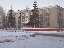
Worotynez
| Urban-type settlement
Worotynez
Воротынец
|
||||||||||||||||||||||||||||||
|
||||||||||||||||||||||||||||||
|
||||||||||||||||||||||||||||||
Worotynez ( Russian Вороты́нец ) is an urban-type settlement in the Nizhny Novgorod Oblast in Russia with 6451 inhabitants (as of October 14, 2010).
geography
The place is about 120 km as the crow flies east-southeast of the Nizhny Novgorod Oblast Administrative Center not far from the border with the republics of Mari El and Chuvashia . It is located on the Gremjatschka river, which flows a little northwest into the Tschugunka, and this in turn flows about 8 km northeast into the Cheboksarsk reservoir of the Volga , which includes the former lower reaches of the Sura there .
Worotynez is the administrative center of the Rajons Worotynski and seat and only town of the municipality (gorodskoje posselenije) Rabotchi possjolok Worotynez.
history
The place was first mentioned as a village in 1620 (according to other sources as early as 1552 in connection with the Moscow-Kazan wars ). His name is related to the Vorotynski family, which died out at the end of the 17th century. Worotynez belonged to the Ujesd Wassilsursk of the Nizhny Novgorod governorate from the 18th century , and from 1923 to the newly formed Ujesd Lyskowo .
With the dissolution of the Ujesde in 1929 Worotynez became the administrative seat of a rajon named after him. In November 1964, the place received urban-type settlement status.
Population development
| year | Residents |
|---|---|
| 1897 | 2509 |
| 1939 | 3969 |
| 1959 | 3476 |
| 1970 | 4140 |
| 1979 | 5231 |
| 1989 | 7006 |
| 2002 | 6719 |
| 2010 | 6451 |
Note: census data
traffic
On the southern edge of the settlement, the M7 Volga federal trunk road runs from Moscow via Nizhny Novgorod and Kazan to Ufa and Perm . To the south, the regional road 22K-0046 branches off into the district centers of Spasskoye and Sergach .
In Sergach , 60 km away, and in Pilna , a little further east and closer, there are also the nearest train stations on the Moscow - Kazan - Yekaterinburg route .
Web links
Individual evidence
- ↑ a b Itogi Vserossijskoj perepisi naselenija 2010 goda. Tom 1. Čislennostʹ i razmeščenie naselenija (Results of the All-Russian Census 2010. Volume 1. Number and distribution of the population). Tables 5 , pp. 12-209; 11 , pp. 312–979 (download from the website of the Federal Service for State Statistics of the Russian Federation)


