Anzême
| Anzême | ||
|---|---|---|
|
|
||
| region | Nouvelle-Aquitaine | |
| Department | Creuse | |
| Arrondissement | Guéret | |
| Canton | Saint-Vaury | |
| Community association | Grand Guéret | |
| Coordinates | 46 ° 17 ′ N , 1 ° 52 ′ E | |
| height | 254-441 m | |
| surface | 29.50 km 2 | |
| Residents | 578 (January 1, 2017) | |
| Population density | 20 inhabitants / km 2 | |
| Post Code | 23000 | |
| INSEE code | 23004 | |
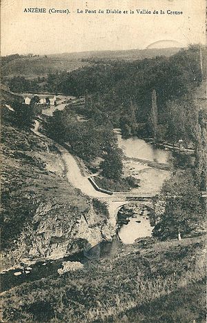
 Anzême with the Creuse on a postcard from the 1920s |
||
Anzême is a municipality in France . It belongs to the Nouvelle-Aquitaine region , the Creuse department , the Guéret arrondissement and the Saint-Vaury canton .
geography
Anzême is immediately to the left of the Creuse . The river largely forms the municipality boundary in the west and in the north. To the right of this are part of the municipal marker as well as Glénic and Jouillat in the west and Champsanglard and Le Bourg-d'Hem in the north. The other neighboring municipalities are Saint-Fiel in the southeast, Saint-Sulpice-le-Guérétois in the south, Bussière-Dunoise in the west and La Celle-Dunoise in the northwest.
Attractions
- Saint-Pierre-et-Saint-Paul church, a monument historique since 1982
Population development
| year | 1962 | 1968 | 1975 | 1982 | 1990 | 1999 | 2008 | 2012 |
|---|---|---|---|---|---|---|---|---|
| Residents | 808 | 707 | 601 | 508 | 519 | 535 | 561 | 553 |
Web links
Commons : Anzême - collection of images, videos and audio files
