Ars (Creuse)
| Ars | ||
|---|---|---|
|
|
||
| region | Nouvelle-Aquitaine | |
| Department | Creuse | |
| Arrondissement | Guéret | |
| Canton | Ahun | |
| Community association | Creuse Sud Ouest | |
| Coordinates | 46 ° 0 ′ N , 2 ° 5 ′ E | |
| height | 427-625 m | |
| surface | 21.69 km 2 | |
| Residents | 244 (January 1, 2017) | |
| Population density | 11 inhabitants / km 2 | |
| Post Code | 23480 | |
| INSEE code | 23007 | |
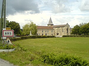
 Village entrance |
||
Ars is a municipality in the Massif Central in France . It belongs to the Nouvelle-Aquitaine region , the Creuse department , the Guéret arrondissement and the Ahun canton . The residents call themselves the Arsois or Arsoises.
geography
It is bordered by Fransèches to the north-west, Saint-Martial-le-Mont to the north, Saint-Médard-la-Rochette to the east, Blessac to the south, Saint-Sulpice-les-Champs to the south-west and Saint- Avit-le-Pauvre . The settlement area consists of the villages of Afeuille, La Besse, Le Breuil, Champeauvier, Châtelard, Le Cher / Cheix, Chemaud / Chermeaux, Couchas / Conchas, Couvaud, Grandessard, Le Liboulier, La Lizolle, Le Monteil, Moulin-de-La- Borne, Nizerolles, Peyrelades, Le Puy, Le Puy-de-Semenon, Quéraud, Sémenon, Troix, Tuilerie d'Ars, Valade / Vallade-Basse, Valade-d'Ars, Villeloube, Villesauveix, Voutouery, Védignat, L'Oiseau -Blanc and Les Farges.
Population development
| year | 1962 | 1968 | 1975 | 1982 | 1990 | 1999 | 2006 | 2008 | 2012 |
|---|---|---|---|---|---|---|---|---|---|
| Residents | 397 | 336 | 265 | 250 | 247 | 247 | 251 | 525 | 260 |

