
Bihor County


Bihor ( , Hungarian Bihar megye ) is a Romanian district (Județ) in the Kreischgebiet with the district town Oradea (Ger. Großwardein , Hungarian Nagyvárad ). Its common abbreviation and license plate number is BH.
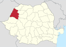
Bihor County borders on Satu Mare County to the north, Sălaj and Cluj County to the east, Alba and Arad County to the south, and Hungary to the west .
Demographics
In 2002 Bihor had 600,223 inhabitants and a population density of 80 inhabitants per km². There were 291,613 male and 308,610 female residents that year, as well as 969 foreigners (0.16% of the population).
In 2011, Bihor County had 575,398 inhabitants and a population density of 76 inhabitants per km².
Ethnic groups
According to the 2002 census, the population consisted of the following ethnic groups:
- Romanians : 404,537 (67.40%)
- Hungary : 155,554 (25.91%)
- Roma : 30,237 (5.00%)
- Slovaks : 7,361 (1.22%)
- Germans : 1,137 (0.19%)
- Jews : 242
- Ukrainians : 174
- Greeks : 71
- Russians : 63
- Bulgarians : 31
- Serbs : 31
- Poland : 21
- Turks : 15
- Czechs : 14
- Armenians : 11
- Croatians : 3
religion
The following religions were represented according to the 2002 census:
- Romanian Orthodox : 357,996 (59.6%)
- Reformed : 107,817 (18.0%)
- Roman Catholic Church : 55,555 (9.3%)
- Pentecostal Church : 34,460 (5.7%)
- Baptists : 22,366 (3.7%)
- Greek Catholic : 14,086 (2.3%)
- Seventh-day Adventists : 1,858 (0.3%)
- Atheists : 1,155 (0.2%)
- Jews : 210
- Muslims : 175
- Total number of Protestants : 166,501 (27.7%)
geography
The district has a total area of 7544 km², which corresponds to 3.16% of the area of Romania. It is located in the north-west of Romania and the historical region of Transylvania on the western border with Hungary. From a topographical point of view, Bihor still belongs to the Pannonian Plain , but for historical reasons it is part of Transylvania - more precisely to the so-called Partium - which, however, lies in the narrower sense only east of the Western Carpathians . Another description of the area in which the Bihor County is located is derived from the rivers that flow from the Western Carpathians through its area in an east-west direction, namely from the Rapid Kreisch (Roman: Crișul Repede ) and the Black Kreisch (Rum. Crișul Negru ), which is why the region (together with parts of the Arad district) is also called Kreischgebiet.
cities and communes
Status of the localities
Bihor County officially consists of 460 localities. 10 of them have the status of a city, 91 that of a municipality. The rest are administratively assigned to the cities and municipalities.
Biggest places
| City / municipality | Residents |
|---|---|
| Oradea ( German Great Oradine , Hungarian Nagyvárad , Sk. Veký Varadín ) | 196.367 |
| Salonta (German Großsalontha , Hungarian Nagyszalonta ) | 17,735 |
| Marghita (German Margarethen , Hungarian Margitta ) | 15,770 |
| Săcueni (German Zickelhid , Hungarian Székelyhíd ) | 11,526 |
| Beiuș (Hungarian Belényes ) | 10,667 |
| Aleșd (Hungarian Élesd ) | 10,066 |
| Valea lui Mihai (Hungarian Érmihályfalva ) | 9,902 |
| Sânmartin (Hungarian Váradszentmárton ) | 9,572 |
| Tinca (ung. Tenke ) | 7,793 |
| Popești (Hungarian Papfalva ) | 7,362 |
| Tileagd (Hungarian Mezőtelegd ) | 6,968 |
| Diosig (Hungarian Bihardiószeg ) | 6,816 |
| Ștei (Hungarian Vaskohsziklás ) | 6,529 |
| (As of October 20, 2011) | |
See also
Web links
Individual evidence
- ↑ a b 2011 census in Romania ( MS Excel ; 1.3 MB)
Alba | Arad | Argeș | Bacau | Bihor | Bistrița-Năsăud | Botoșani | Brăila | Brașov | Bucureşti | Buzău | Călărași | Caraș-Severin | Cluj | Constanța | Covasna | Dâmbovița | Dolj | Galați | Giurgiu | Gorj | Harghita | Hunedoara | Ialomița | Iași | Ilfov | Maramureș | Mehedinți | Mureș | Neamț | Olt | Prahova | Sălaj | Satu Mare | Sibiu | Suceava | Teleorman | Timiș | Tulcea | Vâlcea | Vaslui | Vrancea