Heřmanov
| Heřmanov | ||||
|---|---|---|---|---|
|
||||
| Basic data | ||||
| State : |
|
|||
| Region : | Ústecký kraj | |||
| District : | Děčín | |||
| Area : | 1769.7387 ha | |||
| Geographic location : | 50 ° 43 ' N , 14 ° 17' E | |||
| Height: | 274 m nm | |||
| Residents : | 500 (Jan. 1, 2019) | |||
| Postal code : | 405 02 | |||
| License plate : | U | |||
| traffic | ||||
| Street: | Benešov nad Ploučnicí - Těchlovice | |||
| structure | ||||
| Status: | local community | |||
| Districts: | 3 | |||
| administration | ||||
| Mayor : | František David (as of 2018) | |||
| Address: | Heřmanov 13 405 02 Děčín 2 |
|||
| Municipality number: | 562483 | |||
| Website : | www.hermanov.cz | |||
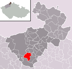
| Location of Heřmanov in the Děčín district | ||||

|
||||
Heřmanov (German Hermersdorf ) is a municipality in the Czech Republic . It is located eight kilometers southeast of Děčín and belongs to the Okres Děčín .
geography
Geographical location
The three kilometer long forest hoof village Heřmanov extends in the north of the Bohemian Central Uplands from the Ploučnice valley along the Fojtovický potok ( Erlenbach ) in a south-westerly direction to Fojtovice. To the north rises the Sokolský vrch (333 m), in the northeast the Ostrý (300 m), southeast the Kohout ( Krohberg , 589 m), in the south the Klobouk / Hadrový vrch (539 m), west the Jedlová (491 m) and in the northwest, beyond the Ploučnice, the Hlídka ( Hutberg , 480 m).
Community structure
The municipality Heřmanov consists of the districts Blankartice ( Blankersdorf ), Fojtovice ( Voitsdorf ) and Heřmanov ( Hermersdorf ), which also form cadastral districts.
Neighboring communities
Neighboring towns are Benešov nad Ploučnicí in the north, Mlatce, Bedřichov, Terezinske Údolí Františkov nad Ploučnicí in the east, Valkeřice the southeast, Blankartice in the south, Fojtovice, Babětín and Ptačí in the southwest, Lesná and Velká Veleň the west and Malá Veleň , Jedlka and Eliščino Údolí in the northwest.
history
The place, probably named after a locator Hermann , was first mentioned in a document in 1273 under the name Hermanesdorp . In 1409 the village was called Hermanni villa . In 1550, the settlement of Flütlhäusel was established in the small valley one kilometer to the west. Its founders are said to have been miners who dug for silver there. The Berní rula from 1654 shows 43 properties for the village. In 1691 Hermersdorf had 360 inhabitants. In 1833, 487 people lived in the 93 houses in Hermersdorf.
After the abolition of patrimonial Hermersdorf formed with the district Flietelhäusel, which was also known as Klein Hermersdorf, from 1850 a political municipality in the district authority of Tetschen . The residents lived mainly from agriculture and handicrafts. In 1890 the village had 785 inhabitants and in 1930 there were 760, mostly Germans.
After the Munich Agreement , the municipality was added to the German Reich in 1938 and until 1945 belonged to the Tetschen (-Bodenbach) district in the Sudetenland . In 1939 the community had 696 inhabitants. In 1945 Hermersdorf returned to Czechoslovakia and the German residents were expelled . The village was renamed Heřmanov in 1946 and settled with Czechs. The Flietelhäusel settlement remained abandoned and was demolished. In 1961 Blankartice and Fojtovice were incorporated.
Culture and sights
- Chapel in the town center
- Chapel on the Ploučnice
- Lookout tower and chapel on Sokolský vrch
- Mount Kohout with ruinous lookout tower
education
There is a primary school and a kindergarten in Heřmanov.
Individual evidence
- ↑ uir.cz
- ↑ Český statistický úřad - The population of the Czech municipalities as of January 1, 2019 (PDF; 7.4 MiB)
- ↑ uir.cz
- ↑ uir.cz
- ↑ portal.gov.cz ( page no longer available , search in web archives ) Info: The link was automatically marked as defective. Please check the link according to the instructions and then remove this notice.

