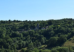
Issepts
|
Issepts Aissets |
||
|---|---|---|
|
|
||
| region | Occitania | |
| Department | Lot | |
| Arrondissement | Figeac | |
| Canton | Lacapelle-Marival | |
| Community association | Grand Figeac | |
| Coordinates | 44 ° 41 ′ N , 1 ° 56 ′ E | |
| height | 267-444 m | |
| surface | 9.15 km 2 | |
| Residents | 241 (January 1, 2017) | |
| Population density | 26 inhabitants / km 2 | |
| Post Code | 46320 | |
| INSEE code | 46133 | |
 Look at Issepts |
||
Issepts ( Occitan : Aissets ) is a French municipality with 241 inhabitants (at January 1, 2017) in the department of Lot in the Région Okzitanien (2015 Midi-Pyrenees ). It belongs to the arrondissement of Figeac and to the community association Grand-Figeac founded in 2016 . The inhabitants are called Isseptois .
geography
The municipality is located about 13 kilometers northwest of Figeac in the Regional Nature Park Causses du Quercy in the east of the Quercy landscape on the south-western foothills of the Massif Central . The calcareous soil allows only a few surface watercourses. The Ruisseau de la Dournelle has its source in Issepts , which runs underground in parts and flows southeast to the Drauzou . Neighboring communities are Le Bourg in the north, Le Bouyssou in the northeast, and east, Fons in the east, Reyrevignes in the south and Assier in the west. The largest districts of the municipality of Issepts are Mas de Bouzou, Mas de Pestel, Mas de Barry, Lavaur and Pech d'issepts .
Place name
The place name Issepts could go back to the Latin sepes for hedge or fence , or it could be derived from the Occitan word eissetz , which means something like excluded from sale .
Population development
| year | 1962 | 1968 | 1975 | 1982 | 1990 | 1999 | 2006 | 2014 |
| Residents | 198 | 184 | 200 | 183 | 145 | 158 | 176 | 219 |
| Sources: Cassini and INSEE | ||||||||
Attractions
- Saint Laurent Church
- Saint-Médard-Lagarénie chapel from the 11th century, historic monument
- Multiple floor cross
Economy and Infrastructure
There are 24 farms in the municipality of Issepts (cultivation of grain and vegetables, cultivation of aromatic, aromatic, medicinal and pharmaceutical plants, dairy farming, cheese production [ Bleu d'Auvergne ], goat, sheep and cattle breeding).
The D840 trunk road from Gramat to Figeac touches Issepts in the northeast. In Montfaucon , 35 kilometers to the west, there is a connection to the ( Autoroute A20 ). In Assier , six kilometers west of Issepts, there is a stop on the railway line from Brive-la-Gaillarde via Capdenac to Toulouse ( Ligne de Brive-la-Gaillarde à Toulouse-Matabiau via Capdenac ).
supporting documents
- ↑ Gaston Bazalgues: Les noms des communes du Parc, Les cahiers scientifiques du Parc naturel régional des Causses du Quercy (French)
- ↑ Issepts on cassini.ehess.fr
- ↑ Issepts on insee.fr
- ↑ Saint-Médard-Lagarénie chapel in the Mérimée base of the Ministry of Culture. Retrieved February 23, 2019 (French).
- ↑ Farmers in Issepts on annuaire-mairie.fr (French)

